All Activity
- Past hour
-
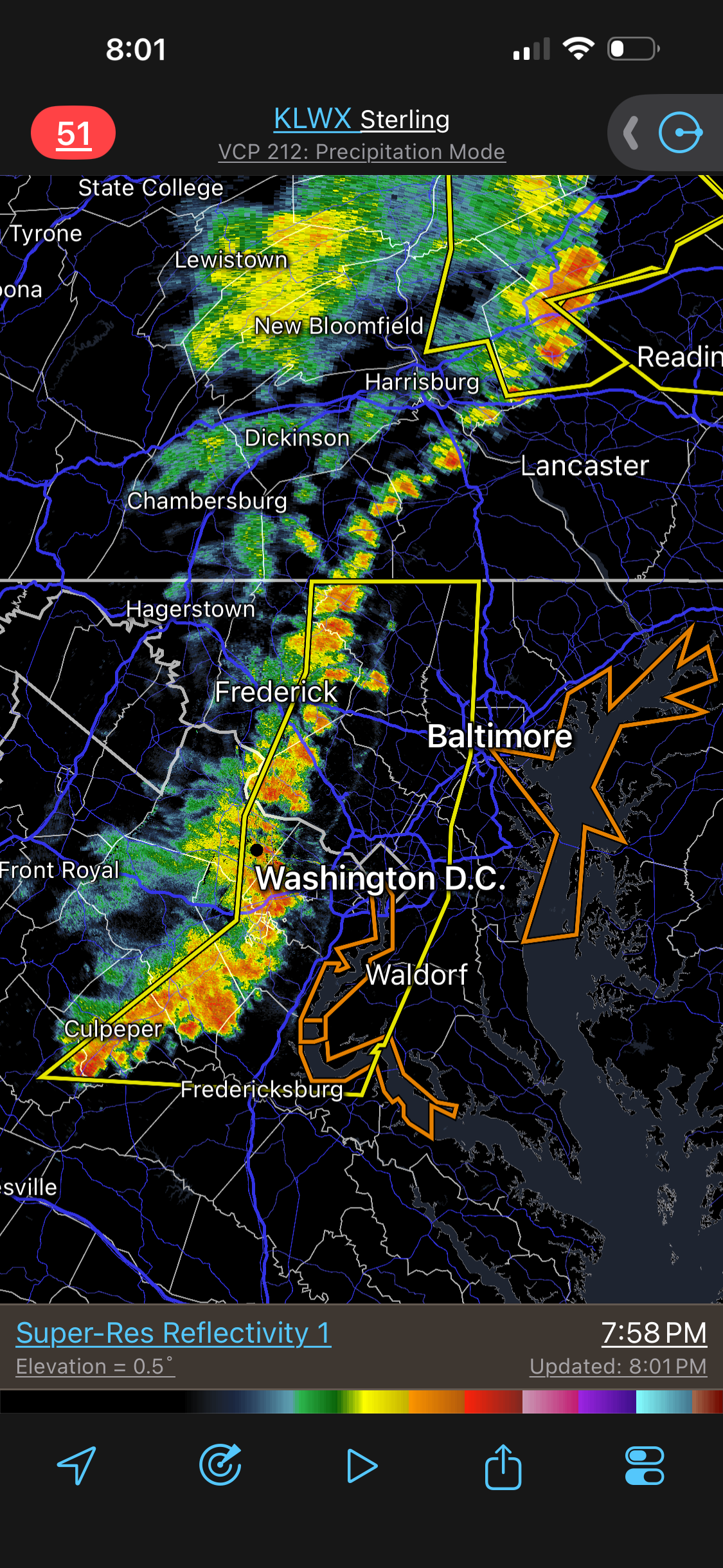
Actually even see a 75-76mph pixel on the LWX base reflectivity tilt.
-
Did LWX lose power? Not getting any updates from them and getting internal server errors on their webpage
-
Tornado warning and Tor otg near Gary IN
-

2026 Mid-Atlantic Severe Storm General Discussion
Eskimo Joe replied to Kmlwx's topic in Mid Atlantic
Wow healthy 60 kt core just south of DCA. -
DCA is going to get rocked in a sec. Wind core almost heading right for the airport/Arlington. I see 70+mph pixels on LWX
-
2026 Mid-Atlantic Severe Storm General Discussion
Eskimo Joe replied to Kmlwx's topic in Mid Atlantic
Agree 9/10 times. IMO, this is the 1 out of 10 times I'll differ given the numerous 250 Anniversary event from Baltimore to DC. In a situation like this, it's just easier to slap down a big polygon and say "it's coming everyone". -
it will be good.. I'll be in Atlantic City so something good will happen in SNE
-
Any reason that it seems to be more prominent this season than prior ones? Or is that just recency bias?
-
2026 Mid-Atlantic Severe Storm General Discussion
Eskimo Joe replied to Kmlwx's topic in Mid Atlantic
Two thoughts come to mind: 1.) These are machine learning/AI-influenced CAMS that don't yet have the "database" of events to properly articulate when these events die off. 2.) As we saw with April 2011 and the 2012 Derecho, mature MCS complexes persist longer than meso guidance if the downstream airmass is sufficiently unstable. However, the lack of an EML or good jet streak generally isn't enough to sustain the storms much past sunset. There is an eight part YouTube video from Rich Thompson (SPC met) speaking a Univ of Oklahoma and he talks about this extensively. I cannot find the YouTube series unfortunately.- 538 replies
-
- 2
-

-

-
- severe
- thunderstorms
- (and 7 more)
-
Our vantage point looks super similar - I could probably yell our "SNOWFAN" and you might hear it.
-
Wind is here!
-
It seems like LWX will warn a huge swath and then if an area of considerable or destructive nature shows itself they will put a warning inside of the warning. I can see it from both sides...I think they do it because of the metro corridor honestly.
-
Don’t even have a severe yet. The fuel source is a bit elevated for tornadoes near 1-96, but we have a warm boundary layer this side of the lake, so the initial gusts could get crazy as the bow / comma pushes inland. The bottom thee rows definitely need the tornado watch as that area has decent surface based instability.
-

2026 Mid-Atlantic Severe Storm General Discussion
wxmeddler replied to Kmlwx's topic in Mid Atlantic
Depth of the cold pool and surface inversions after the radiation flip over. I think the model cold pools are too shallow and/or the surface inversions are too deep.- 538 replies
-
- 2
-
-
- severe
- thunderstorms
- (and 7 more)
-

- 538 replies
-
- 1
-
-
- severe
- thunderstorms
- (and 7 more)
-
97 mi long? This kind of defeats the entire purpose of polygon *storm-based* warnings. We can do better than one giant "carpet bomb" SVR. There should be a limit to a size of a short-fused polygon warning. A large squall line is not necessarily "one-size fits all." And all that has to happened is one wind damage report anywhere in the polygon and it verifies. We should be fine-tuning and getting more detailed w/ warnings, not the other way around. There is real impact (economic and social) from over-warning.

- 538 replies
-
- 1
-
-
- severe
- thunderstorms
- (and 7 more)
-
It's interesting because anecdotally we have seen them bring through robust lines only for relative minimums to occur in swaths of our area. But yeah - this has been an interesting season of modeling.
-

2026 Mid-Atlantic Severe Storm General Discussion
MN Transplant replied to Kmlwx's topic in Mid Atlantic
The gust front was solid, definitely in the 40s. We’ll see what the next surge has in store. -

2026 Mid-Atlantic Severe Storm General Discussion
high risk replied to Kmlwx's topic in Mid Atlantic
Two straight events in which the cams incorrectly weakened a line approaching our area. Wondering if the lack of shear is causing the models to gust these lines out too quickly.- 538 replies
-
- 1
-
-
- severe
- thunderstorms
- (and 7 more)
-
Next Thursday looks really really good this far out.
-
mmmmm Lucky Corner! Peak gust 39mph .22" Nice for the garden.
-
Power keeps going off and on here
-
The shape of the velocity signature sort of makes me think there's a slight chance of a little kink or enhanced area that may be prone to spin briefly. But certainly not a strong tornado risk or anything - maybe more like a gustnado if that keeps up.
-
2026 Mid-Atlantic Severe Storm General Discussion
Eskimo Joe replied to Kmlwx's topic in Mid Atlantic
IAD gusted to 50 mph again. Impressive. Fairfax to DC about to get crushed.- 538 replies
-
- 1
-
-
- severe
- thunderstorms
- (and 7 more)
-

Central PA Summer 2026 Discussion/Obs Thread
canderson replied to Voyager's topic in Upstate New York/Pennsylvania
Loss of heating / sun and mountain uplift. Happens all the time.


.thumb.gif.f92b16c631a1d15d405ed77b33f0710d.gif)