poolz1
-
Posts
2,763 -
Joined
-
Last visited
About poolz1

Recent Profile Visitors
7,823 profile views


-
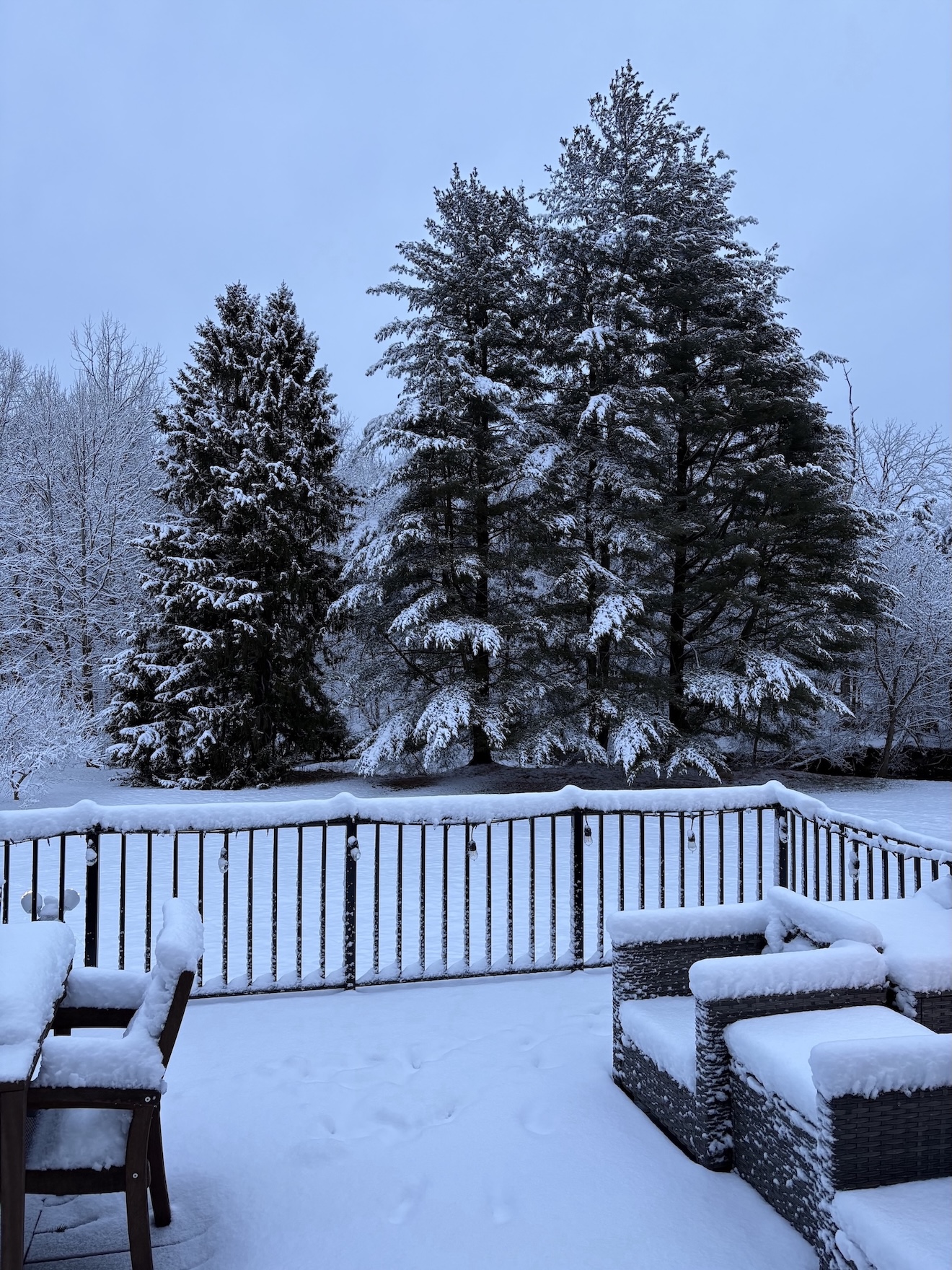
29/27. 5" otg with some light snow falling.
-
31/29 mod snow even under lighter returns. Measured 4" at 1045.
-
mod snow. just measured 1.5" on the board. Driveway and roads covered. 32.8/31
-
Our best shot at this thing. I hope we are puking dendrites for several hours tomorrow night.
-
Traffic cams show light snow falling just west of HGR.
-
Already some snow showers moving into the western areas. Temp at the house is 16 and cloudy. Should be no problem with road stickage
-
Thank you for posting this. I am sorry your daughter went through this BS. I have a daughter who is in her second year at UMD, working her butt off. I will be relaying this information to her and my wife. Never knew of or even imagined this method of scamming!
-
yea, but the real question is what is your 3 model average?
-
Euro has the front runner that knocks down heights. H5 looks like a decent passage south of us shortly after. Don't know what the surface looks like but a slight moral booster on today's runs.
-
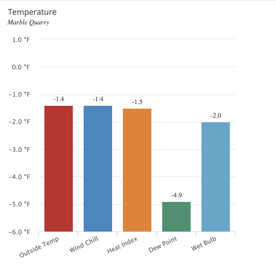
Perfect radiational cooling conditions right now especially in low lying areas. Currently 8 degrees
-
Still below 0 at 9am. Impressive.

-
I am about 2 miles SE of the -6 reading in Wash Co. Can confirm a -6 reading at the house this morning before leaving for work. .7 degrees shy of the record low imby of -6.7 in February 2014.
-
Temp has really fallen right before sunrise. 7 when I got up this morning at 530 and has fallen to 3 currently. Nose hair freezing cold!
-
Very similar. Just difficult to measure. Had around 6" snow and 2"-2.25" sleet. I was going to go with 8" total. Some of the worst stuff to shovel.
-
Didn't separate sleet from snow qpf just due to so much mixing. 1.58" total. 7" otg.