All Activity
- Past hour
-
Fortunately it’s been just below the threshold for flooding for us, although it’s been enough to take out of the the riverside trails on my property. But could have been much worse
-
And while the rain sucks, the mountains do look really pretty with the rain
-
Because when it’s nice it’s really nice. Also they do snow and severe better than us
-
Speaking to a observer in Madison NH, he has had 14.79" since 5/1. CoastalWx: "Why can't we get than here?!"
-
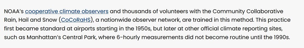
See here for the snowfall measuring issues pre-1990. https://news.ucar.edu/14009/snowfall-measurement-flaky-history
-
You don't see so much of the USA have cool weather in June anymore Toledo has had highs in the 70's since Monday
-
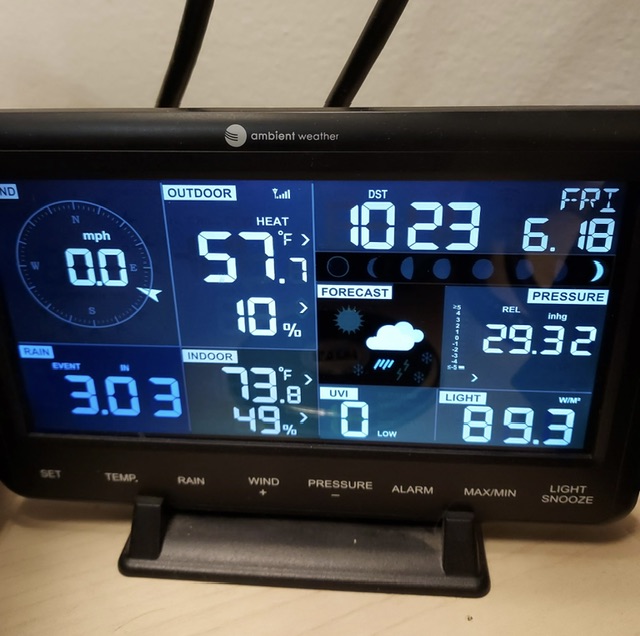
Yeah, I’ll be honest, when I looked at Cocorahs last night, it didn’t have yesterday’s rainfall added in. I hadn’t looked yet today but I’m sure another 1-2” was added everywhere up north. Up at Mansfield, our Mtn Operations station showed 3.03” from this recent “event.”
-
Exactly what I was thinking of! The rare moments of joy we had last year, lol
-
Noted Albany NH 8.90" and Debry Line VT 7.41" CoCoRaHS MTD.
- Today
-
Maybe we can super nino right from summer 26 to summer 27.
-
perfect summer week coming up!! 70s for highs 50s for lows... we take!
-
-
But if Weymouth does not get the absolute max pcpn for the event in SNE, it will be "MEH!"
-
You know, this is a New England forum, so all wx in the region is relevant. Maybe we should start a forum called: "5 SM Radius Weymouth - ACATT"
-
18z euro looks good. Let’s get another 7/29/2021 up here
-
Its ridiculous. I can't even bring the dog to his favorite swimming hole. The river is running so high the beach and the swimming hole are gone and the water is almost up to the top of the bank
-
Today's Highs: EWR: 85 BLM: 84 TEB: 84 New Brnswck: 84 JFK: 84 LGA: 84 ACY: 84 PHL: 84 TTN: 83 ISP: 82 NYC: 81 (despite the dryness the park has been well behind / below this year)
-

Stray Cat In My Backyard That I Feed
Coach McGuirk posted a topic in Outdoor and Weather Photography
He's like stop taking pictures of me, I want to eat. -
Long range models constantly had a 500mb trough over the Mid Atlantic, including the Euro. This held all Summer/Fall then in the Winter the long range Euro weeklies were constantly showing the same pattern, a trough over the Mid Atlantic. It didn't work out - 23-24 was the warmest winter on record for US.
-
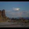
Hey Ji, did you do this graphic?

-
Men in suits type of day
- Yesterday
-
Idk I think whole county got at least 3/4” some up to 2”
-
That’s crazy, must’ve been localized. Looked on Cocorahs and most stations seemed similar 3-5” this month. Can’t imagine being at 8”+ lol. Now see those Bretton Woods stations at 7-9”, that’s wild. Beavers or not, that’s gotta be near flash flood in some of those inches.
-
My average 30-year annual precip via PRISM is 45.70", NOAA is 43.72" 2023: 41.99" 2024: 36.19" 2025: 38.62" And this year I'm about 5-6" down. It came after a series of wet years, but eventually that catches up.
-
This is what you guys do. I don’t know how people vacation there.