All Activity
- Past hour
-
Still south of where the NHC has it.. I still think atleast the cape could get brushed pretty good and the Carolina coast . When the 12z hurricane models come out they will be initialized with the further north position.. guessing track shifts west a bit at 18z or 0z

-
I like an above normal September then I’m ready for cooler weather at the end of the month.
-
In the 40s this morning. First August rain (0.28") yesterday afternoon between 4:20 and 5. Enough breeze to bring down some early leaves but no thunder.
-
48.7F. Heat kicked on overnight
-
Yeah cloud pike south but clearing moving in from north
-
Yeah cool down next week and then moderate a bit.
-
Cloudy? It’s full sun and blue skies in Greenfield.
-
Looks like maybe another cool down next week then hopefully Labor Day weekend is summer like.
-
might have to switch to jeans, this blows. cool and cloudy gross
-
 Mt. Holly nearly 5"
 -
We got down to 52° here. Maybe Valley did better than hilltops?
-

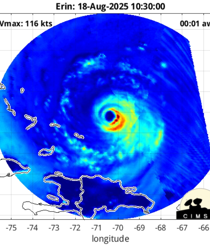
Hurricane Erin: 130 MPH - 942mb - NW @ 12
Boston Bulldog replied to BarryStantonGBP's topic in Tropical Headquarters
Yep, NHC noted another double wind maxima in the 5am discussion -

E PA/NJ/DE Summer 2025 Obs/Discussion
Kevin Reilly replied to Hurricane Agnes's topic in Philadelphia Region
What is this rain? zero percent chance of rain today? 66 light to moderate rain here currently. Humidity 85% dew point 59f I am guessing an upper air disturbance is developing overhead in conjunction to near by cold front. You can see the seeds of winter 2025-26 we would be getting mood flakes right now as colder air rushed in. -
 that wind is biting this morning....brrr 8 day heatwave will fall by the wayside
 -
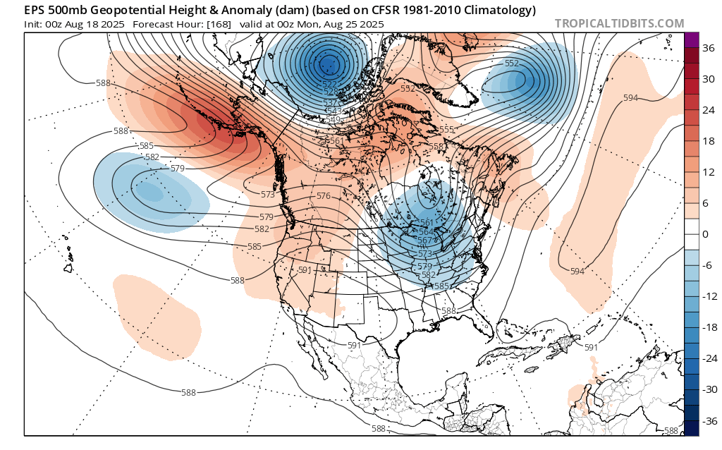
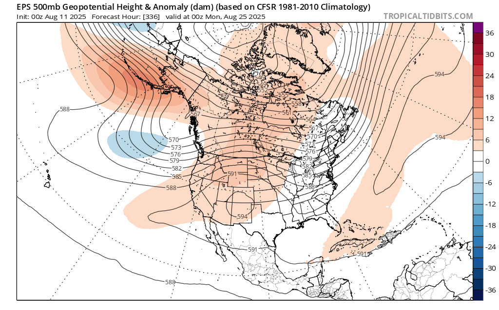
 Maybe the EPS shifting to a deeper trough and stronger cold front passage next Monday could actually give us some organized rainfall rather than the spotty convection of late leading to the developing dry pattern. New run Old run

-
Saturday looks warm for sure I think. Especially rt 2 north. I’d say general 84-90 most images. 80-87 and more humid Sunday with some tstms west. Good summer weekend.
-
Weekend also looking cooler than I was hoping for. Maybe 80-82 here
-
57 for a low here. Meh. But it won’t get warm for a bit.
-
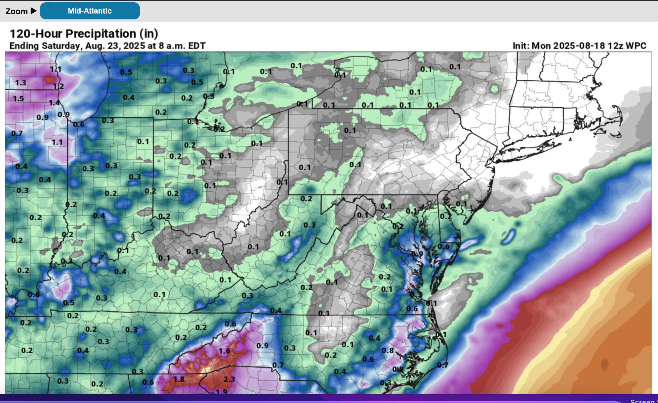
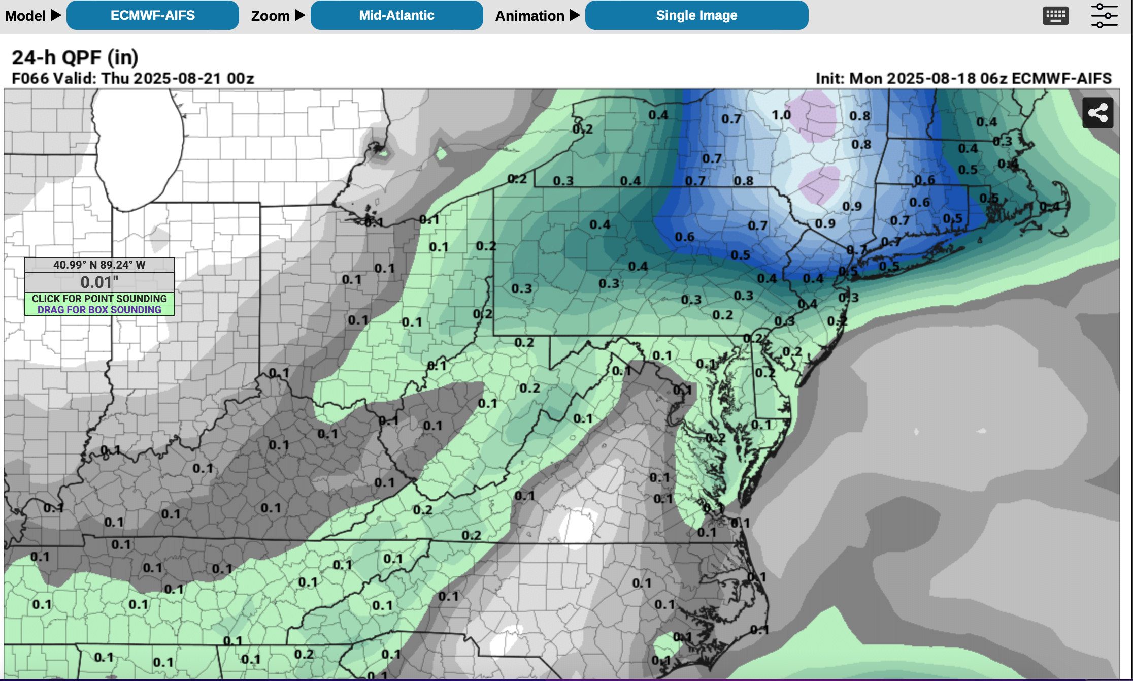
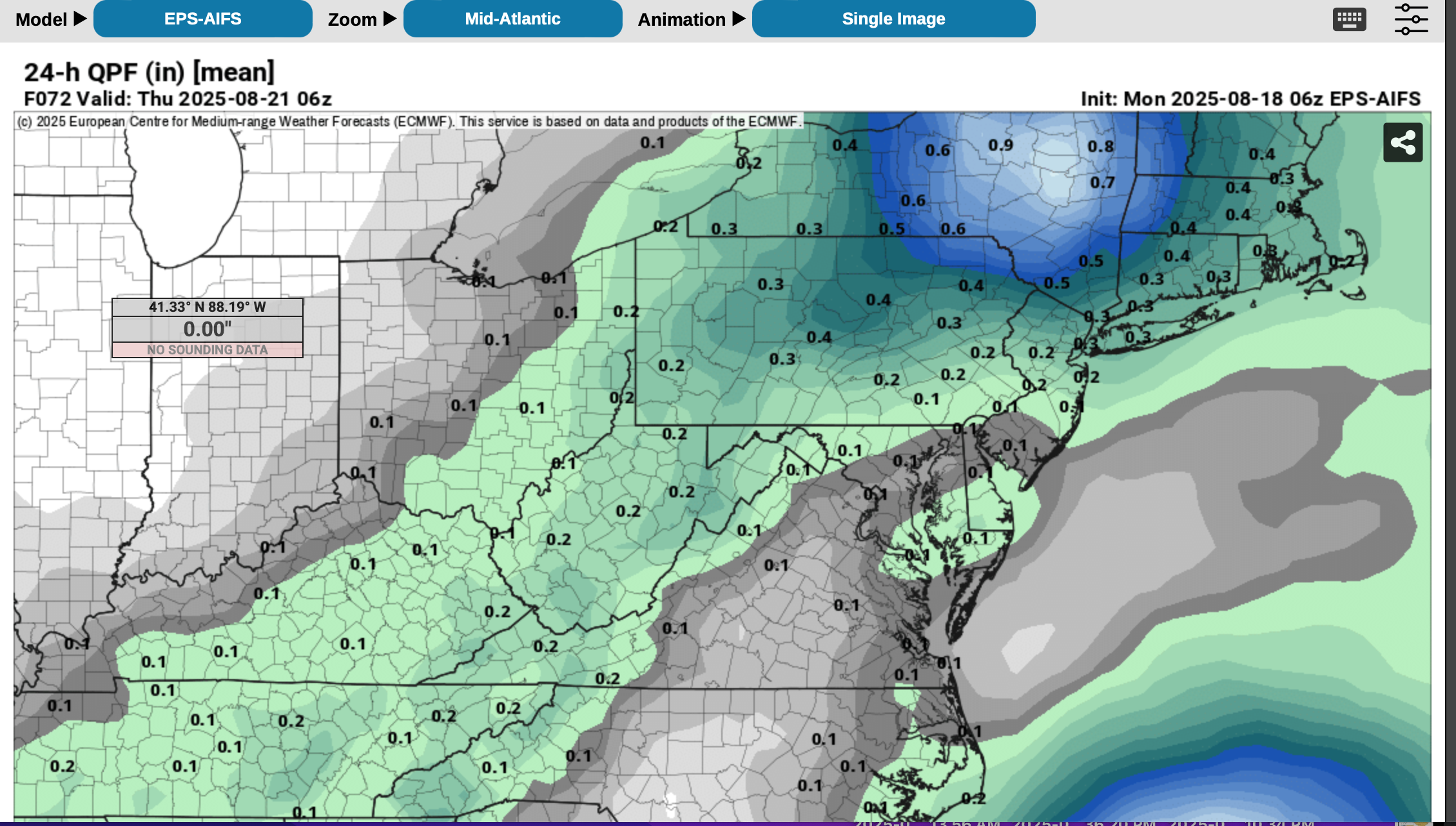
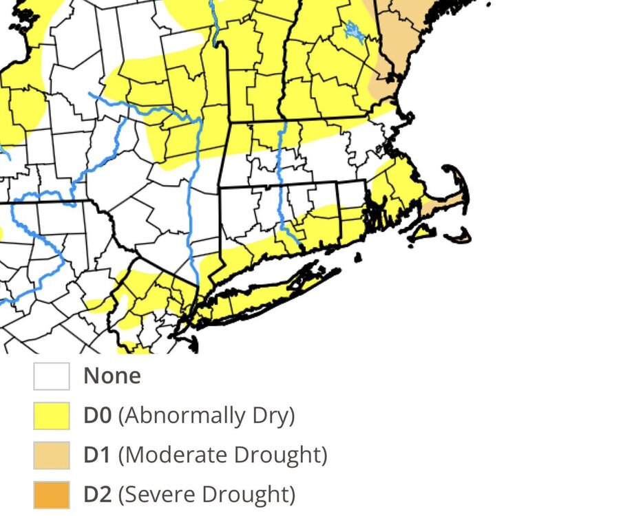
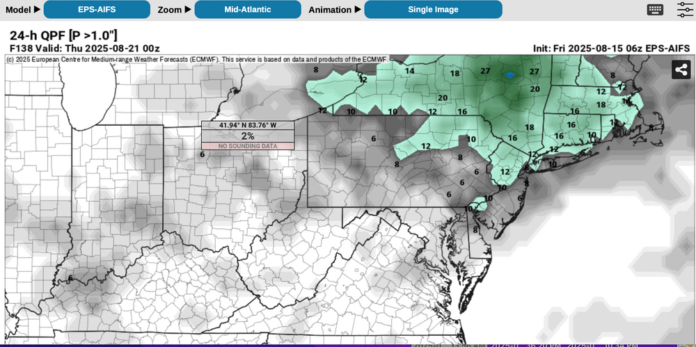
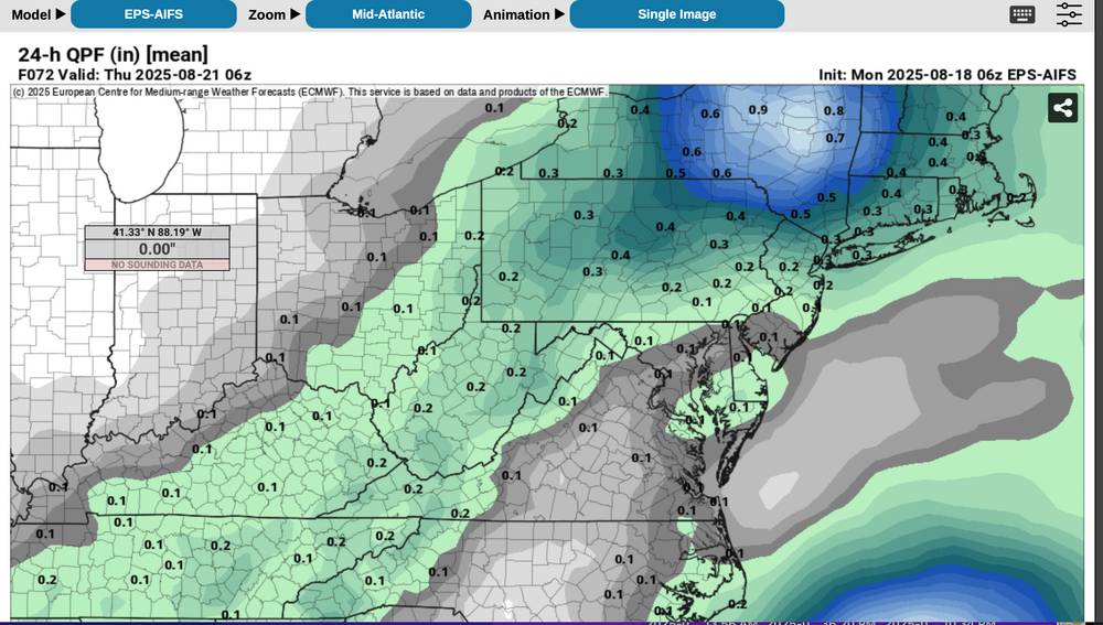
 Testing modeling: WPC seems strongly attached to the much drier GEFS/EPS per no qpf in our subform, this week as per attached 5 day qpf issued around Mon 8/18 10z. Please follow NWS/WPC/NHC. I'll continue to monitor for my own interest on whether the more benign GEFS prevails over the more vigorous EPS in our NYC subforum. This post continues from Saturday 410PM and prior posts last week and will be a lesson for me regarding EPS and EPS AI. IF the GEFS is to prevail, EPS and EPS AI will have to dry out soon. EPS suite is as yet the most intriguing for 1-2" 12 hour general rainfall sometime between 8/19-21 for NJ/CT/NYS/PA, in part due to nw flow UL short wave with associated RRQ UL jet in the Maritimes and some relatively shallow low level ese moisture inflow related to the position of the H near Nova Scotia and the L near Lake Erie, connecting a bit with ERIN? EPS PW steady since the past Saturday near 1.5" for 12z Wed at 40N. Lots of fairly deep vorticity NYS into the mid Atlantic states along the boundary this week into Thu AM. Atlantic Recurvature PRE composite has had my attention since late last week. ODDS for recent drought easing rainfall per multi modeling are very low. Yet, continues my attention on ultimate results for Tue-Wed-Thu AM this week. Just to see how erroneous the EC AI can be. Added WPC 5 day, the 06z ECAI and its 06z ensemble as well as the 00z/18 EPS AI 24 hour prob for 1" (very low prob except I90 in NYS). EC EPS is less vigorous than the EC AI suite.

-
looks like some more rain/storm chances this afternoon before we dry out for a bit again
-
0.22” here from last evening
-
0.09" from the Sunday evening T-storm. Looked stronger on radar.
-
41.3° for the low here.
-
Wow congrats guys!
-

Hurricane Erin: 130 MPH - 942mb - NW @ 12
olafminesaw replied to BarryStantonGBP's topic in Tropical Headquarters
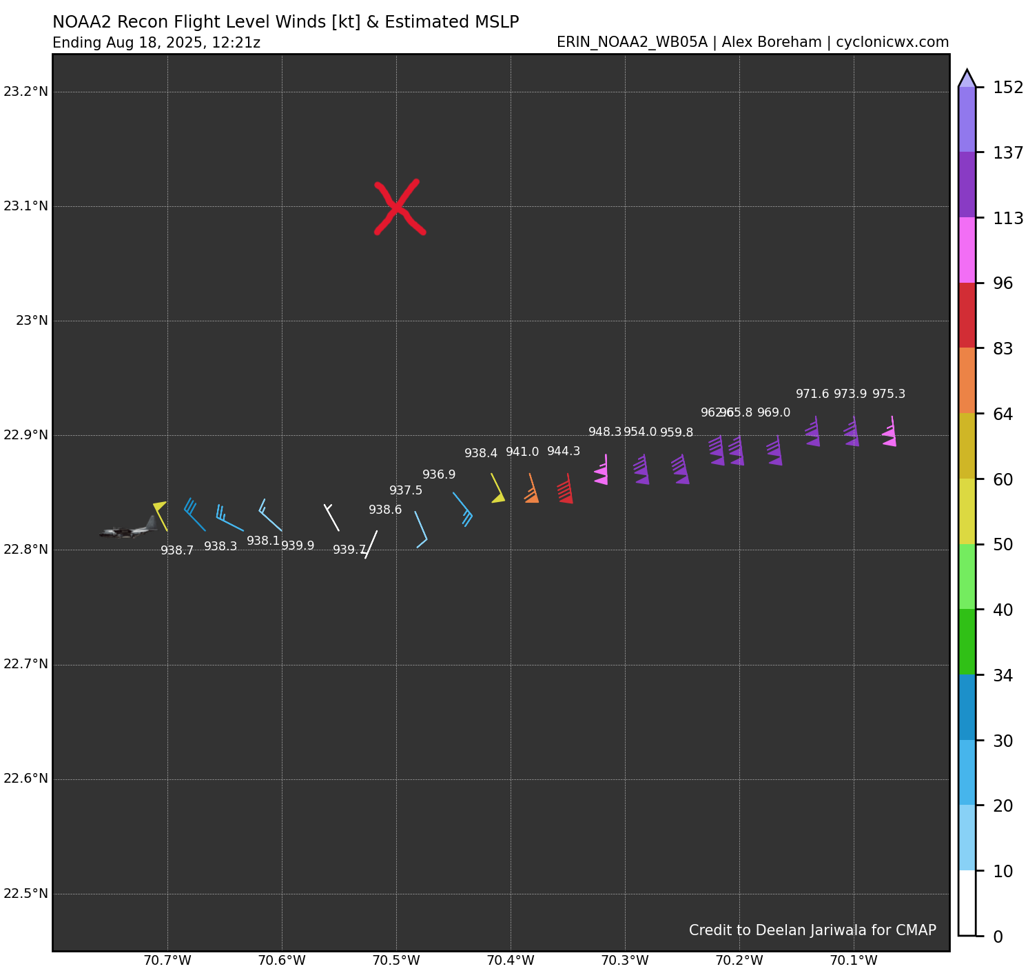
Hold up...do I spy another ERC?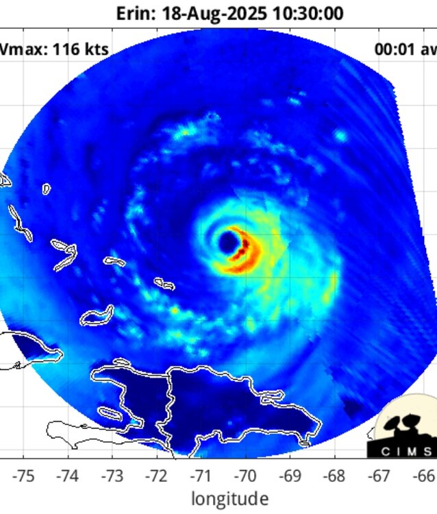

.thumb.png.4150b06c63a21f61052e47a612bf1818.png)