All Activity
- Past hour
-
Sun and some blue sky coming through here at Coppin at the moment
-
https://www.wpc.ncep.noaa.gov/metwatch/metwatch_mpd_multi.php?md=0652&yr=2026 Mesoscale Precipitation Discussion 0652 NWS Weather Prediction Center College Park MD 1215 PM EDT Thu Jul 09 2026 Areas affected...Central Appalachians through the Mid-Atlantic Concerning...Heavy rainfall...Flash flooding possible Valid 091613Z - 092200Z Summary...Showers and thunderstorms will rapidly increase in coverage this afternoon across the Mid-Atlantic. Rainfall rates of 2-3"/hr are likely at times, leading to 2-4" of rain with locally higher amounts. Flash flooding is possible. Discussion...The GOES-E Experimental Day-Cloud Phase RGB this morning features rapidly expanding coverage of Cu/TCu reflected by glaciation development within deeper cloud structures. This is occurring primarily within cloud breaks in the visible satellite imagery, and is leading to a quick uptick of elevated reflectivity with showers and thunderstorms spreading from eastern KY through southern PA. Forcing for ascent is steadily intensifying across the Mid-Atlantic, leading to a concurrent increase in the flash flood risk. A shortwave noted in WV imagery is lifting E/NE out of KY, working in tandem with the RRQ of a modest jet streak aloft to produce synoptic ascent. At the same time, modest 850mb inflow of 10-15 kts (locally accelerated in the vicinity of the northeast advancing shortwave) is isentropically ascending a stationary front to produce additional lift. Together, this overlapped ascent is acting upon robust thermodynamics reflected by PWs measured via the 12Z soundings that are above previous daily records (2.17" at IAD) and a ribbon of MLCAPE already reaching 1000+ J/kg (2000 J/kg within clearing sky conditions). Despite convection being fresh, MRMS hourly rainfall has been above 1 inch in some areas, indicative of the impressive environment in place. Convection should continue to rapidly expand and intensify during the next few hours as the shortwave lifts northeast. The high-res CAMs, although a bit slow to develop the ongoing activity, are in good agreement that thunderstorms will develop along any boundaries (terrain, differential heating, outflows) and become numerous with at least modest organization into clusters likely through bulk shear of 25-35 kts. This will intensify rain rates even further, and both the HREF and REFS depict a 30-40% chance of at least 2"/hr rates this aftn, with short-term rates of 3-4"/hr possible as reflected by the sub-hourly HRRR. The regional soundings and forecast 0-6km mean winds suggest storms will generally move steadily E/NE, but short-term training is likely as Corfidi vectors align parallel to the mean flow and storms repeatedly develop back into the higher instability. This region is naturally vulnerable to intense rain rates both due to sensitive terrain as well as urban areas. Additionally, 7-day rainfall that has been 400% of normal has led to 0-10cm RSM of 60-70% according to NASA SPoRT. This suggests the region has become even more compromised, so any repeating of these intense rain rates could cause flash flood impacts through the aftn. Weiss ATTN...WFO...AKQ...BGM...CTP...LWX...OKX...PBZ...PHI...RLX... RNK... ATTN...RFC...RHA...TAR...TIR...NWC... LAT...LON 41047622 41027511 40827395 40157384 39237458 38517578 38137745 38007867 38058006 38488095 39088145 39828135 40408045 40867806
-
 OK I'll give them that, but then the person showing this should probably not even show this at all. At least wait a week. This should be common sense, I'm sure the public comments have laugh emojis and condescending remarks since they are well aware of the copious amounts of rain SNE got overall. I can't tell you how many idiots out there claim this is govt manipulation and trying to control our water usage. This doesn't help.
 -

2026-2027 Super El Nino
LakePaste25 replied to Stormchaserchuck1's topic in Weather Forecasting and Discussion
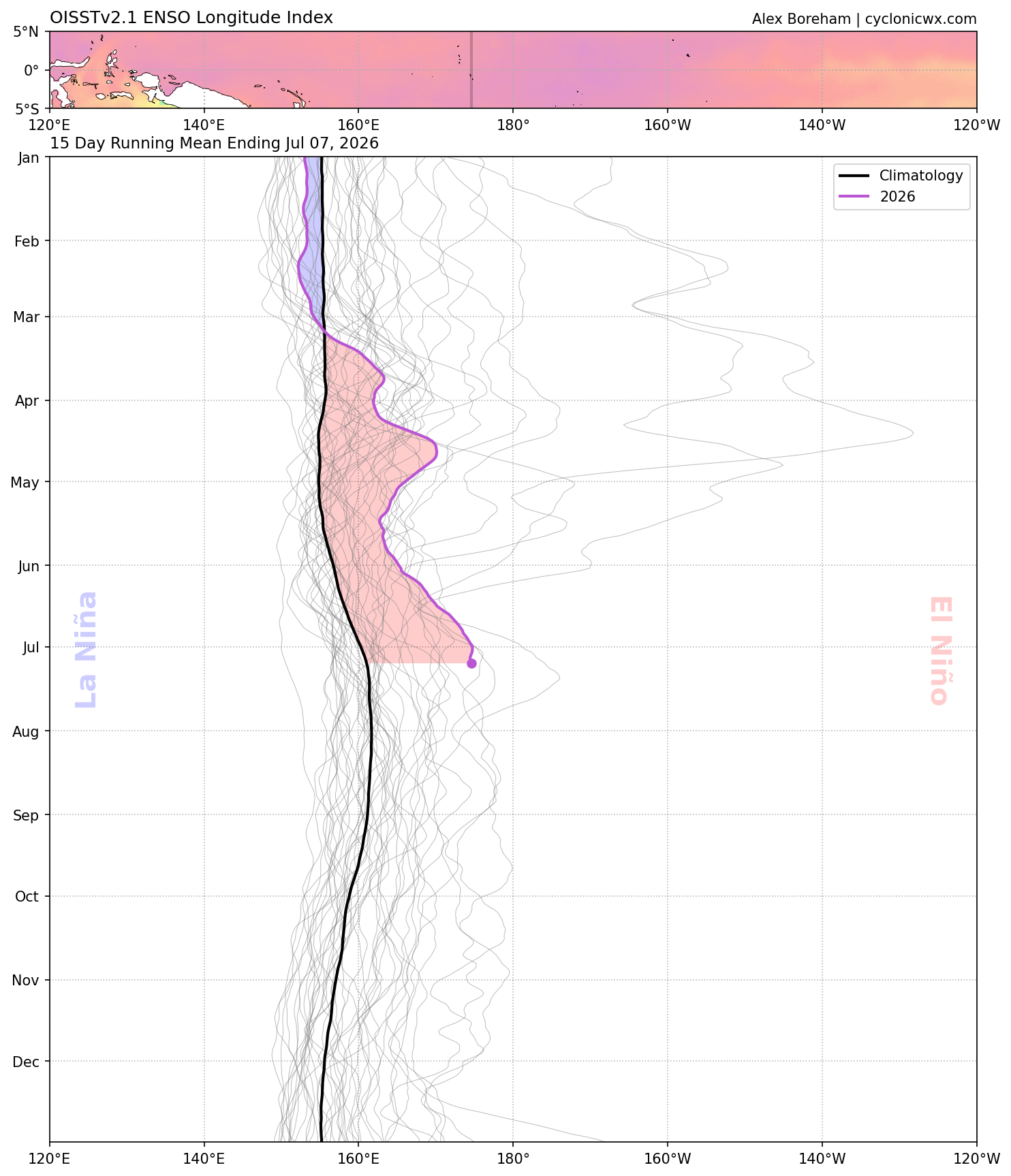
Enso longtidue index. It’s a fairly new index that’s used to calculate the longitude in the tropical pacific (between 5N and 5S) where it’s most supportive of deep tropical convection regardless of actual SSTA. Threshold for deep tropical convection is dynamic year-year as it incorporates mean tropics SST. https://agupubs.onlinelibrary.wiley.com/doi/full/10.1029/2018GL079203 There’s actually a page that calculates past events with it: https://ggweather.com/enso/eli.htm Looks like they assign the 97-98 event as the highest (note that the 220 peak is the same as 140W). -
I see Fredrick is already scoring and it's not even 1 yet lol. I wonder what time they make it into Glen Burnie later on. Super dry here. If we don't get some rain today it's going to get bad around here next week.
-
I thought you like it thick?
-
 I want a Met to incorporate the word “hellacious” when doing their forecast
 -
Hopefully it's us, i love when things are moist.
-
Alright just like that the cloud deck is breaking up. C'mon stir up that moisture!
-
It is soupy af out...thick
-
I saw talk of this earlier and this has got me thinking. Are we finally moving into a wetter pattern or is this yet another head fake?
-
Awesome! Thanks for letting me know. Will bookmark it now.
-
 I guess in their defense this is valid 8am Tuesday and there may not have been much river and stream response yet, but man...idk what they expect.
 -
NO change in drought where 3-6" of rain fell. Those maps should have been DOGE'd.
-

2026-2027 Super El Nino
40/70 Benchmark replied to Stormchaserchuck1's topic in Weather Forecasting and Discussion
What is ELI? -
Yeah looks more dumb than malintent.
-
 Surprised they didn't up the severity.
 -
I hope these meaningless sprinkles and overcast don't ruin our chances for showers later. Cloudy and 77/74
-
Jokes aside aren’t we staring down a likely east based strong to very strong El Niño? I take climatology in the fall but my base teleconnections knowledge say that it won’t snow much.
-
35 degree 5 inch rainstorm is gonna go so crazy.
-
Pretty good rainfall here. Mount Holly's forecast already verified in terms of rainfall totals. 1.33 from the slow moving morning storms, however, the highest probs were later in the day. Many folks were suprised by the heavy rains.
-
2026-2027 Super El Nino
LakePaste25 replied to Stormchaserchuck1's topic in Weather Forecasting and Discussion
ELI has already surpassed most of the historical events. i would expect this to go further east as that 30C isotherm moves east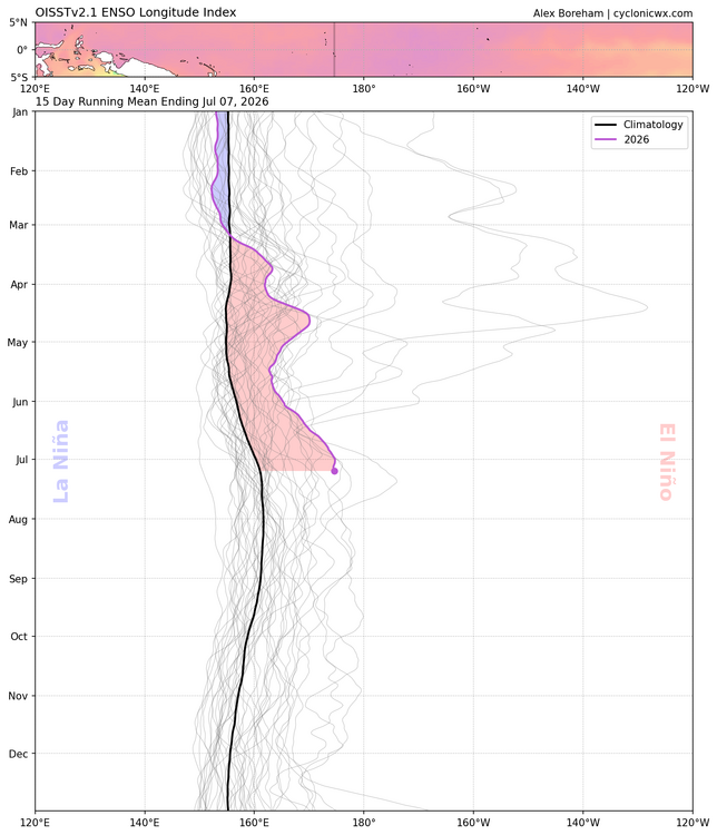
- Today
-

Mountain West Discussion
mayjawintastawm replied to mayjawintastawm's topic in Central/Western States
great- will keep fingers crossed for today. Just a trace here since 6/25. -
Yeah when I saw that graphic, I first thought something went wrong lol. I didn't think it was to hype something up or anything.
-
My get grazed by a little rain shortly