All Activity
- Past hour
-
I hope so too. We were lucky to go last year too and it was so much fun. Either way, you are going to love it! Looks like the rain might move out by game time!
-
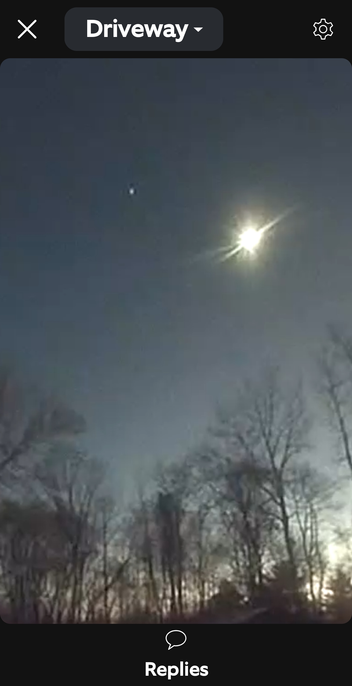
Tree benders here this afternoon. A bit unexpected to be as strong here as they are today.
-
Sticky here

-
So got a measly .2 of precip with the last "severe" outbreak here. Storms have been dodging us like crazy lately. Dust blowing everywhere today with the winds gusting upwards of 40-45. It's brutally dry locally. This incoming line looks to continue the trend.
-
No, the ground is too warm, and the sun angle is way too high now. Plus, Bobby Martrich's last Weather Weeklies was almost 2 months ago: https://x.com/epawawx/status/2038305484810092870
- Yesterday
-
Got down to 23.2 this AM...recovered up to 53.1 39.6
-
Models already backing down on amount of precip. I've seen this the last 6 mos. I got a bad feeling about this. I hope this doesn't just fizzle out again.
-
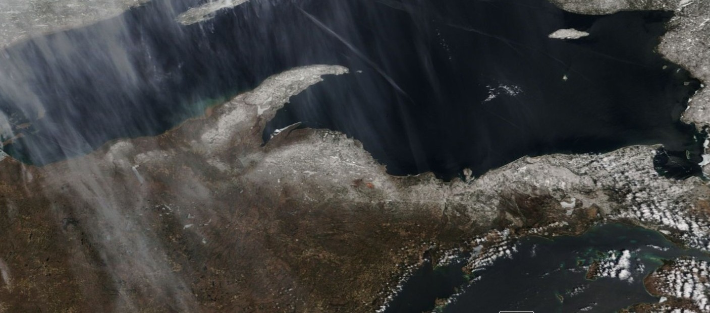
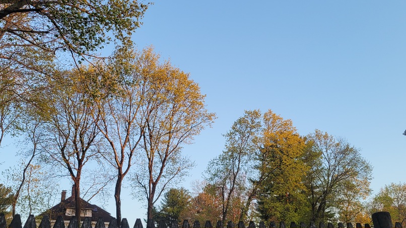
Beautiful sunny day in the mid 50's before the lake breeze hit, dropping temps down into the 40's. Cool sat shot today of the remaining snowpack.

-
Low of 50, winds kept up all night. High was a cool 67.
-
Dewy summer anyone?Why .. yes . yes it shall be.
-
Well I dont understand why you don’t like to give a nice , friendly , knowledgeable dude credit.. but that’s ok. Nice to see enjoy a deep spring landscape out there despite the cool
-
Black locust haven't.
-
Doubt I broke 50 around here but it was beautiful. Correction, 51.2 for a high.
-
I hate to give you any credit ever but... I did see some oak buds starting to pop today. Maples are coming on well. Gorgeous day and evening.
-

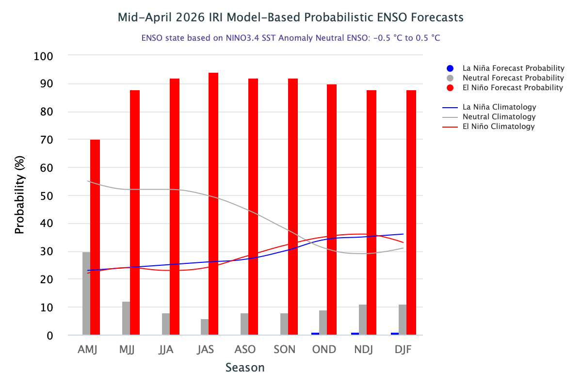
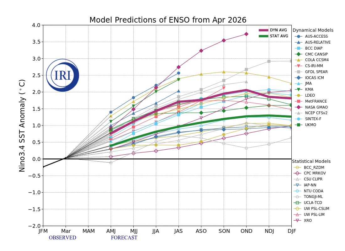
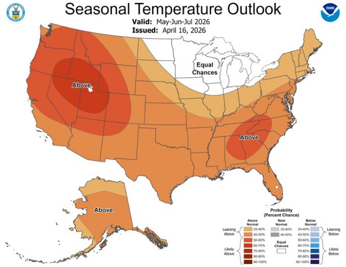
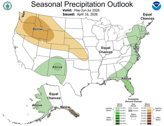
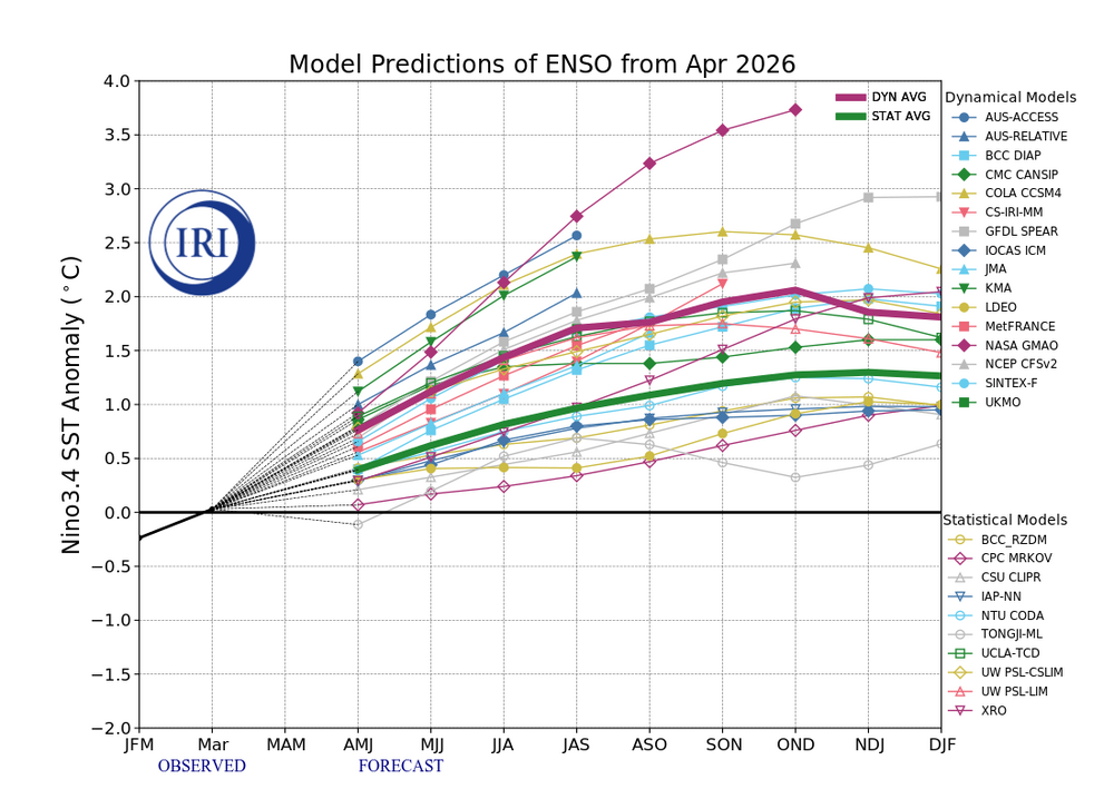
2026-2027 El Nino
PhiEaglesfan712 replied to Stormchaserchuck1's topic in Weather Forecasting and Discussion

-
any snow possible ?
- 770 replies
-
- 1
-

-
- april showers bring may..
- rain
- (and 2 more)
-
Nope . Not one species hasn’t popped
-
Every tree has tiny leaves. That is what leaf out is
-
That was a record low for IAD
-
Still stick season I se
-
More good boomers out this way. Classic spring storm. Lightning strike believed to be the cause of a fire at a furniture store in Mishawaka.
-
That doesn’t look to deep on the vegetation pal…
-
Near record and record cold covered the region this morning. Records included: Allentown: 24° (old record: 28°, 1925, 1956, and 2018) Hartford: 27° (tied record set in 1961) Poughkeepsie: 24° (old record: 26°, 2018) Scranton: 24° (old record: 26°, 1925) Westhampton: 22° (old record: 23°, 2014) White Plains: 27° (old record: 29°, 1981) The last time White Plains recorded a low in the 20s on or after April 21st was April 23, 1982. Tomorrow will be somewhat milder with highs returning to the upper 50s. The temperature could approach or reach 70° on Thursday before another cooling trend commences. No cold shots comparable to the current one are likely for the remainder of spring. No significant rainfall appears likely through the foreseeable future. Some showers are possible during the weekend. There remains some risk for a more meaningful rainfall given the lead time involved. The ENSO Region 1+2 anomaly was +1.8°C and the Region 3.4 anomaly was +0.5°C for the week centered around April 15. For the past six weeks, the ENSO Region 1+2 anomaly has averaged +1.43°C and the ENSO Region 3.4 anomaly has averaged +0.15°C. El Niño conditions will likely develop during late spring or early summer. The SOI was -5.34 today. The preliminary Arctic Oscillation (AO) was -0.507 today. Based on sensitivity analysis applied to the latest guidance, there is an implied near 84% probability that New York City will have a warmer than normal April (1991-2020 normal). April will likely finish with a mean temperature near 55.6° (1.9° above normal). Supplemental Information: The projected mean would be 2.6° above the 1981-2010 normal monthly value.
-
Where will we meet up now in Boston? https://www.boston.com/food/food-news/2026/04/21/clarkes-faneuil-hall-closed/?p1=hp_featurebox
-
Please tell me you aren’t calling that leaf out.