All Activity
- Past hour
-
Yup, got a soaking on my ride home from work. Even closed my windows and turned the heat on when I got home. Lotta wind and rain. Hopefully a harbinger to the winter.
-
Looks tropical to me. It probably does have a warm core, given the time of year and location.
-
word. thanks. not really much of a cfs user but ... I'd have thought that'd be more first half tendency
-
Nope, non-tropical. It’s still attached to a frontal boundary.
-
Is this not a tropical system... it looks like an eye on radar just off the coast of VA.
-
NW zones:
-

September 2025 OBS-Discussion centered NYC subforum
bluewave replied to wdrag's topic in New York City Metro
Whether we get .10 or .50 most people probably won’t notice since it will be rain. Many times models are off by around .5 or more especially during the warm season when convection is involved. But everyone notices the difference between 1” and 5” when snow is involved. -
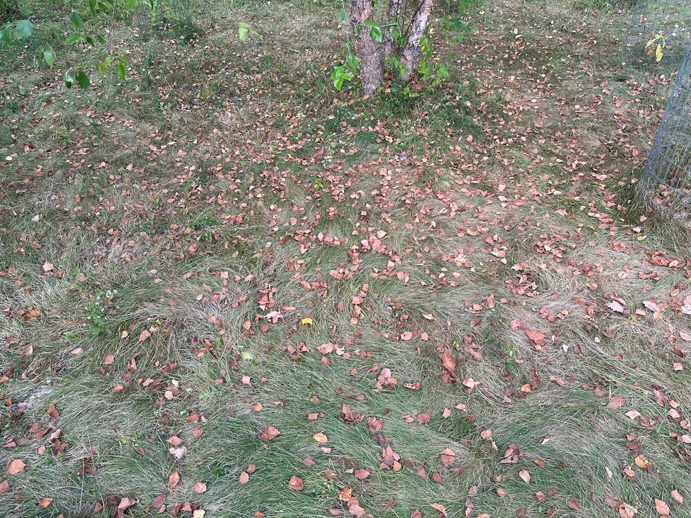
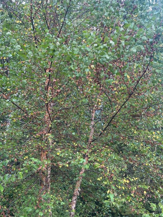
Lots of trees changing or just browning and defoliating. My pawpaws are mostly yellow and the river birch is half brown. At least the invasive buckthorn and oriental bittersweet are withering and dying.
-

Pittsburgh PA Fall 2025 Thread
Eskimo Joe replied to TheClimateChanger's topic in Upstate New York/Pennsylvania
-
-
Late season 90 achieved at MSP. The record of 94 appears to be safe but still a couple hours of warming to go.
-
Sorry, had to do a screenshot or this site drives me nuts over the size. CFS 2m temp anomaly forecast for JFM.
-
You're the tree guy, what's the deal?
-
What are we looking at here? (there's no headers on this image -) anyway, this also reflects higher latitude blocking.
-
It's prevalent on the cape according to reports. Been there since August.
-
Pouring in the lowlands. Nothing new here. I'm guessing 1-2 over the next several days here in my area. Hopefully this thing moves along and doesn't sit for days.
-
I waswn't talking about leaf-edge browning, I was talking about trees being half-dead and half green. May still be cicadas, I guess. Could just be dead stuff from last year. I'll take pictures tomorrow when I'm in SRI, they probably have same issue. It's only those short bushy oaks you see near the coast, I don't see it around here or anywhere inland with the larger ones.
-

2025-2026 ENSO
Stormchaserchuck1 replied to 40/70 Benchmark's topic in Weather Forecasting and Discussion
Long range 12z GEFS at 384 has a pretty strong ridge setting up for the first few days of October NAO is also turning negative this September after being positive every month since last January.. this same thing happened last year, where the +AO/+NAO that was present all Summer long broke in September. -

September 2025 OBS-Discussion centered NYC subforum
donsutherland1 replied to wdrag's topic in New York City Metro
So far, rainfall is running above the guidance in a number of locations through 18z.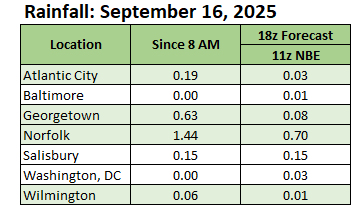
-
For the E MDR lemon from the 2PM TWO: 2. Eastern Tropical Atlantic: A tropical wave just offshore of the west coast of Africa is producing an area of disorganized showers and thunderstorms. Some slow development of this system is possible towards the latter part of this week as it moves westward at 15 to 20 mph, moving from the eastern to central portion of the tropical Atlantic. * Formation chance through 48 hours...low...near 0 percent. * Formation chance through 7 days...low...20 percent.
-

Invest 92L--90% two day, 90% five day odds
GaWx replied to WxWatcher007's topic in Tropical Headquarters
More 12Z runs: The models have switched in some cases. The GFS/CMC moved W to just SE of Bermuda whereas the Euro moved E to well E of Bermuda. Icon: still well to the SW of others with it much weaker SSW of Bermuda then recurving NWJMA: TS at Bermuda at 192 -
Definitely looks like at least some of it will reach you in the next 30 minutes or so. We've already had 2 nice bouts of rain down here at work.
-
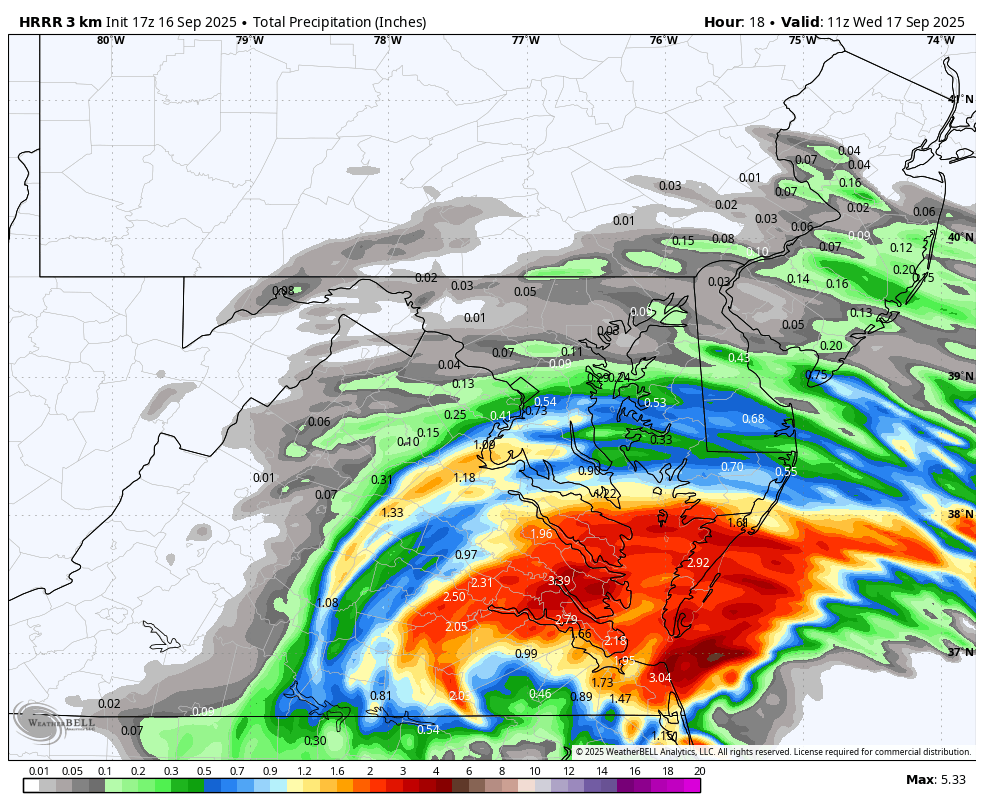
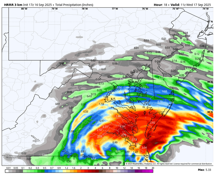
Track of storm looks like it takes it inland a little north of VA beach, which will not be far enough North for us in the NW zones, at least for today. Looking at the radar loop, HRRR looks like it might verify, keeping any steady rain south of DC through 7am. WB 17Z HRRR through 7am Wed.
-

September 2025 OBS-Discussion centered NYC subforum
steve392 replied to wdrag's topic in New York City Metro
74, overcast with a nice cool breeze. -
Will that slug of rain die before it reaches HBG? Or will it be pouring when I have to load the car to head to IAD, ha.