All Activity
- Past hour
-

Southern MD / Lower Eastern Shore weather discussion
SnowtoRain replied to PrinceFrederickWx's topic in Mid Atlantic
Yeah, 28.8 now, some nice icicles. -
Sleet bombs IMG_1148.mov
-

Southern Crippler - Get well soon Jimbo Storm Obs
BornAgain13 replied to BooneWX's topic in Southeastern States
Edit - Heavy Sleet -

January 25-26 Winter Storm Potential
Chadzachadam replied to Ralph Wiggum's topic in Philadelphia Region
Sleet line holding pretty strong to our south and west. Hope it stays that way and we never flip to ZR -

January 25-26 Winter Storm Potential
dizzy9479 replied to Ralph Wiggum's topic in Philadelphia Region
Getting some ZR mixed with the sleet in Williamstown now. 26F -
Me too. Should be done by 8.
-
I'd say its happening,that coastal is really helping things by nullifying the warm push. I doubt it moves north,better chances of it sagging south later.
-
 Yeah visibility has come back down. Haven’t seen sleet yet.
 -
January 24-26: Miracle or Mirage OBS Thread!
Another Field replied to Jebman's topic in Mid Atlantic
Lol you could infer that I’m measuring snow depth. Look at the Montebello and Towson Mesonet sites. I am in lock step with them. -
 The usual chocolate starfish that shows up with every storm. Should be going bye bye soon…. .
 -

Pittsburgh/Western PA WINTER ‘25/‘26
MikeB_01 replied to Burghblizz's topic in Upstate New York/Pennsylvania
I just think the ratios got to us down here. I know the dry air looms, but once the back side comes in, the ratios will be better. Still got a few inches on the table I think . -
I could see there being another 1-1.5” sleet/snow mix to come.
-
 Wanted to make a quick video before it’s dark. We’re in a lol with snow growth worse. But it’s still great. 79107073693__A99F067A-B1BD-4702-8CAF-C4AEE6241755.MOV
 -
Do you think it is going to get cranking?
-
 Looks like Sleet here now, about 1 mile north of 84 at 670'
-
Sussex to northern Fairfield is just pounding! Missed the big totals by about 20 miles here in central Morris. Still was a fabulous morning.
-
 Over 11” here still pounding away
 -
There are parts of the Bronx already at a foot, I know there aren't any official sites in the Bronx.
-
I wonder where this ranks on the NESIS scale. Apparently the number of counties under a winter storm warning was the highest ever recorded, at least, according to Wikipedia.
-

Pittsburgh/Western PA WINTER ‘25/‘26
Rd9108 replied to Burghblizz's topic in Upstate New York/Pennsylvania
Ehh didnt NWS have like 9-13 and around 13 expected? -
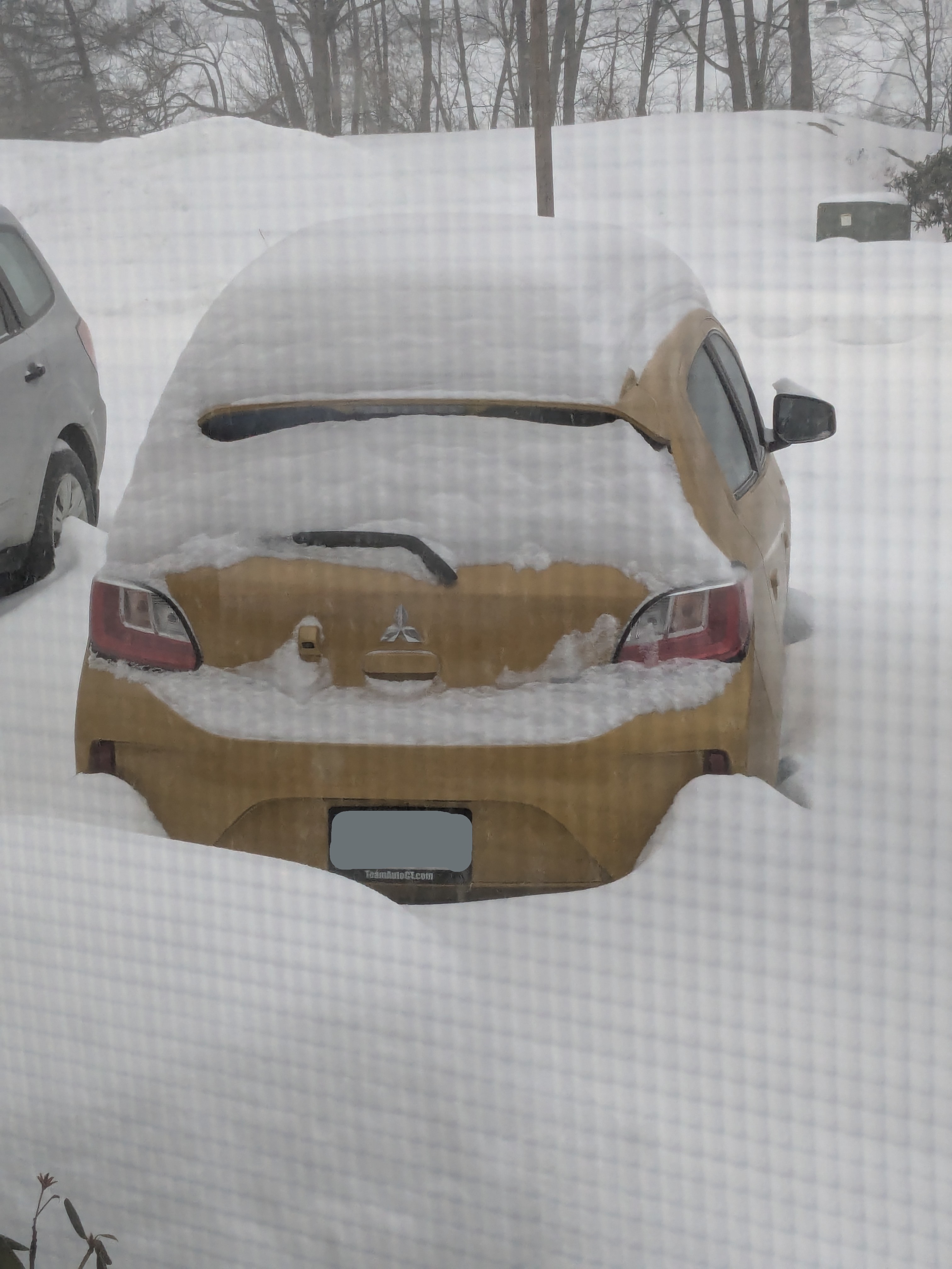
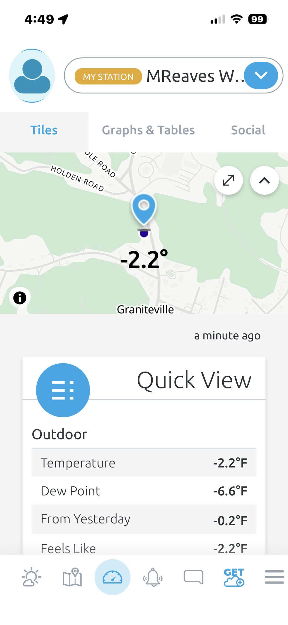
 Still comfortably below 0 here.
-
Yeah, it did. Scared the crap out of me. It was about 3/4's closed when it blew, so it exploded and dropped like a boulder. I unlocked it from the trolly, but then I found out for the first time how heavy garage doors really are. I wonder if it was temp related, or I just have bad luck timing wise.
-
 Groton report is like Central Park report! Never right and always low!
 -

January 25-26 Winter Storm Potential
PhilsFanDrew replied to Ralph Wiggum's topic in Philadelphia Region
4:50 - Whitehall, PA - Back to heavy sleet, little to no flakes. Have a feeling its going to be like this back and forth until the system pulls away. -
 Feels like heaviest rates of the day, can barely see houses on the street.