All Activity
- Past hour
-
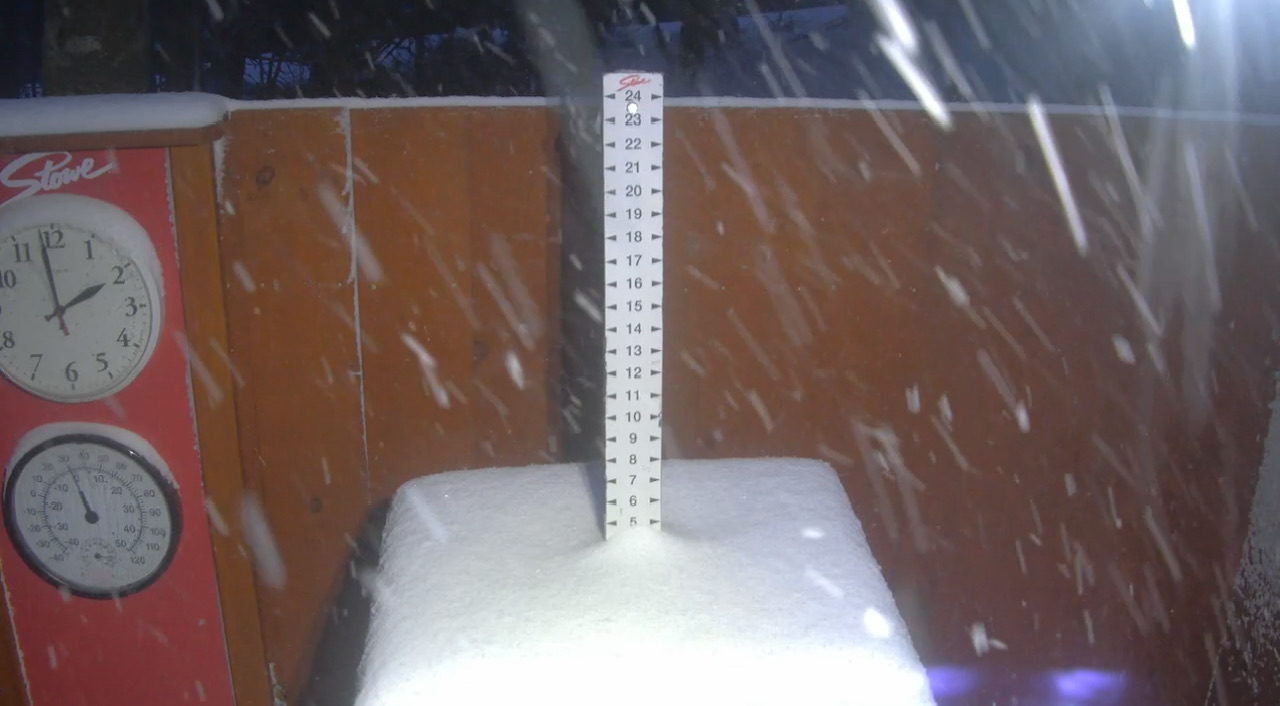
One last chance this season for it to look "VIOLENTLY BEAUTIFUL" out there!
-
SE MA OES in later April? "Unprecedented!" CoastalWx will be out during overnight shaving off every tenth of an inch for max total snow! NORLUN apparent. I like the -31 C at 500 and -10 at 850 and the axis of the 500 trough right overhead.
-
Tap tap… tap tap tap. Tap tap ?
-
Early May?
-
Instant PT?
-
From my contact in Woburn, 5 days w/ thunder this month now. 5 TS days is pretty good. That's what normal in July this area. CoastalWx still MEH though I bet!
-
-
31.7° and clear…glad I got the plants in early.
-
I was bit by a few mosquitoes the other day. They must be extra cold hardy up here. I’ve already had 3 ticks, but only one biting and it couldn’t have been on for that long.
-
LOL. Ticks will survive the coming nuclear/AI holocaust. Mosquitos fortunately haven't hatched yet, but the black flies are definitely out already. I always notice if we have a mid-April freeze down here that the black fly population is significantly less the rest of the year.
-
32.3° SKC Black ice GW
-
Almost 70F at the mountain yesterday, now this. Some good squalls topping it off this evening.

-
Yes, there are a few breweries in the area fyi
-
0.02 inch today! Is that a win? .
- Yesterday
-
Waiting for the rain today was like waiting for paint to dry. When it did finally get here it felt like I missed a spot as only .07" fell here.
-
We won't
-
Wouldn't mind bypassing the next 5 months lol
-

E PA/NJ/DE Spring 2026 Obs/Discussion
Albedoman replied to PhiEaglesfan712's topic in Philadelphia Region
sorry to burst your bubble or fail to melt the butter on your pocorn. I am still waiting for the major pattern change after May 15th where the sticky comes back and the gulf fetch kicks in. Until then, yes it wil be dry with moisture starved cold fronts passing though every 3 days. The eastern maritime flow is absolultey killing our chances of any significant t storm formation. Western PA has been hammered with nice rainfall the last few weeks with the absence of this flow reaching them. -
I don't agree that you don't want the El Nino Strong, as long as it stays west-based. Number of examples is too low, and Stronger La Nina's (opposite) correlate with big SE ridge in the Winter
-
It would be great if we can finally get some help from the PDO and get the warm bath water out of the western Pacific. That should tamp down the ridiculous Pacific jet but a super Nino will just flood the continent with mild air and overwhelm any other positive trend. We’d have to hope for one huge STJ driven event like Jan 2016 or Feb 1983.
-
A nuclear bomb wouldn’t kill them, mosquitoes, or ticks.
-
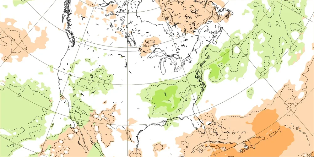
Today’s Euro Weeklies run is the wettest yet for the SE as a whole for Apr 27-May 3rd with ~1.25-1.75” over much of the area! And as an added bonus, the subsequent week (May 4-10) has a bit of a wetter signal than prior runs had:
-

2026-2027 El Nino
michsnowfreak replied to Stormchaserchuck1's topic in Weather Forecasting and Discussion
I dont really keep track of severe (other than my own daily weather obs), but what I do know is we've had a lot of pretty dull severe seasons, so we were overdue. -

2026-2027 El Nino
snowman19 replied to Stormchaserchuck1's topic in Weather Forecasting and Discussion
Yep good point we are warmer today. And AGW is increasing the frequency of super El Ninos -
Probably worse here because they’ll be north of a lot of moisture I think.


.thumb.gif.f92b16c631a1d15d405ed77b33f0710d.gif)