All Activity
- Past hour
-
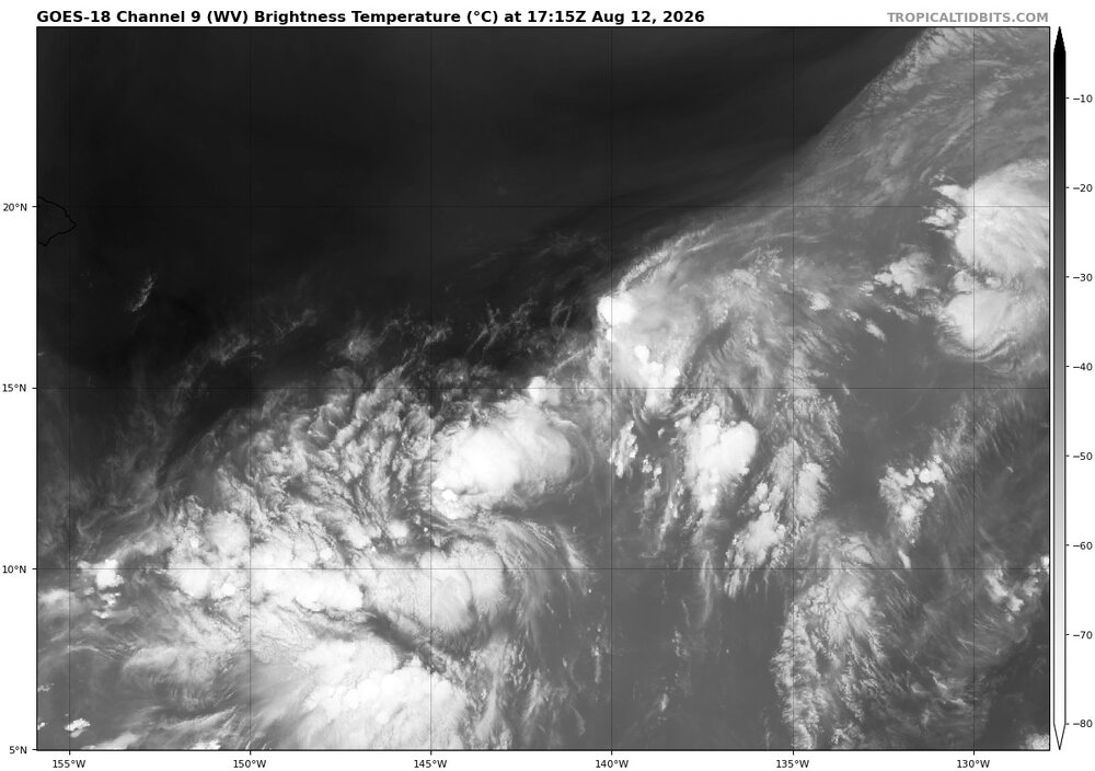
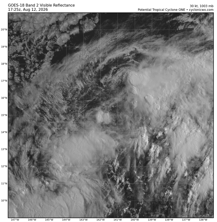
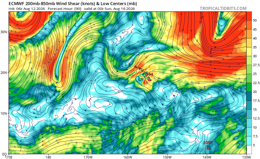
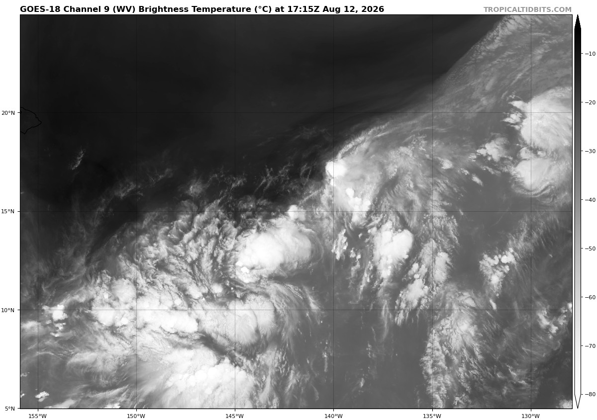
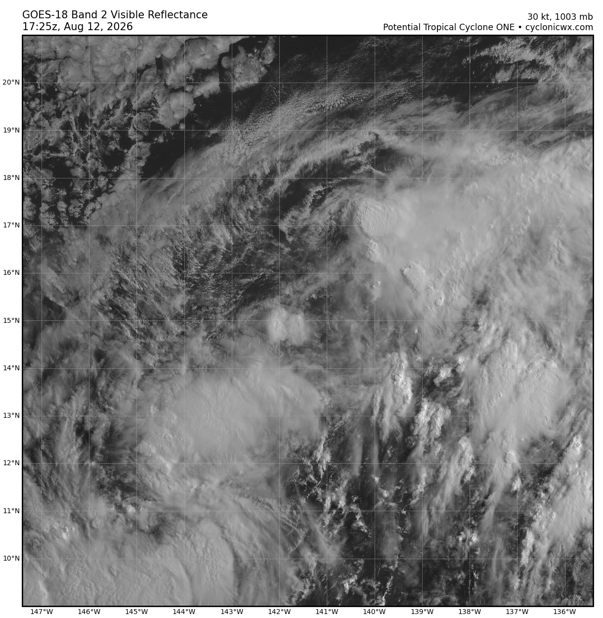
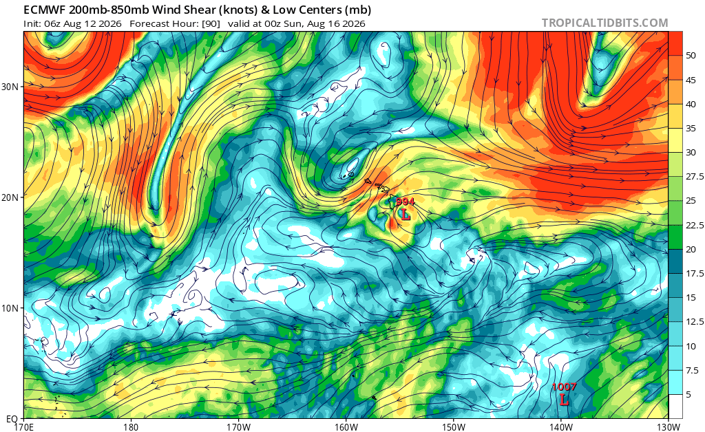
I am not impressed w/ this cntrl Pacific system (now PTC 01C). It is broad and monsoonal, and lots of dry air at mid-levels just to its NW over a large area along w/ stable stratocu present (see WV and VIS attached). A trough develops over HI as the system approaches the Big Island (see 850-200 shear attached at 90 hr), so another negating factor. Being a larger monsoonal type TC, this prevents it from becoming tight and solid RI phases. Also, long parcel trajectories around the system promote more dry air intrusions into the center. I think it will be no worse than a typical strong Kona low HI gets almost every winter. Significant impact yes, but one has to look beyond the media hype and the fact it has a name. That does not change actual wind, surf, or rain. 50 kt winds and 20" of rain is the same whether it comes from a TC or ET low. Even though direct TC strikes on HI are uncommon, they are used to such conditions (a strong TS) from Kona lows. That makes a big difference for preparations and overall less shock and awe. I like to look at the SHIPS output for TC as you can sum up things fairly quickly as to shear and dry air issues in the fcst. Here is the 12/12z run for 01C: https://hurricanes.ral.ucar.edu/realtime/plots/northcentralpacific/2026/cp932026/stext/26081212CP9326_ships.txt Look at the SHEAR (KT) and SHEAR DIR lines, You see it increases by 72 hr, not high, but look at the direction, out of the W, and w/ the TC moving to the W? That's a problem. And the 700-500 MB RH line. Environmental mid-level RH is key. Anything bellow 60% is not good and you can see it drops below 40% by 84 hr. The are many others items in the SHIPS output, but the shear and RH I find most useful. Now, there are caveats. When you have a large and strong TC, it can fight off modest shear and its inner core can remain isolated from dry air in the surrounding environment., Shear and RH values front he SHIPS did *not* work well at all for HU Ian in Sep 2022 leading up to the FL landfall. Shear was quite strong (over 30kt ) and RH below 60%, and it still intensifies to a Cat 5! But for nascent or weaker TCs, modest shear and dry air at mid-levels are typically a significant hindrance. When these factors are present, it's hard for any TC to get above Cat 2 strength. For 01C, I think 60 kt for a peak is a good fcst. Once it gets well beyond HI near the Dateline, it looks like it could become much stronger.
-

2026 C and E Pacific tropical activity
Wannabehippie replied to GaWx's topic in Tropical Headquarters
It is going to be interesting to see if One-C makes landfall in any of the Hawaiian islands. That doesn't happen too often. -
suicide wx... haven't crested 70W/m^2 of solar radiation the entire day, and it's just been drizzling for about 10 hours. 0nly 0.63" to show for it...
-
Skeeters are gonna suck next week, literally
-
 http://mapletrustrx.com/# Maple Trust Rx
 -

Augdewst 2026: Summer's Last Stand
jlauderdal replied to Prismshine Productions's topic in New England
Dew lovers are united and unhappy. -
That rain may not survive the mountains this afternoon. They keep shredding any showers with which they interact. Outside is a rather weird filtered sunshine through very high level clouds here in Hickory.
-
Or pitch against them
-
Final 90 degrees last year was 8/17.
-
classic germantown stuff
-
Partial eclipse at 1:54pm!
- Today
-
https://mexisaferx.com/# best online mexican pharmacy
-
mexican online pharmacy wegovy or the purple pharmacy mexico mexican pharma http://traditionsalive.wsiefusion.net/redirect.aspx?destination=http://mexisaferx.shop online mexican pharmacyor http://la-maison-des-amis.com/user/suoivhzify/ order from mexico [url=https://nxu.biz/smart_intelligence_engine/?q=http://mexisaferx.shop]best online mexican pharmacy[/url] buy drugs onlineand [url=https://www.17610.cn/home.php?mod=space&uid=715006]pharmacies in mexico[/url] mail order pharmacies
-
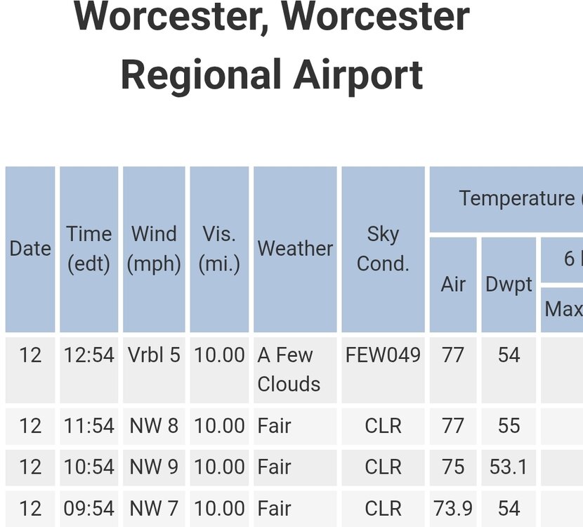
Summer doesn't get much better than today.
-
SPC has marginal for majority of tn for 5% damaging winds https://www.spc.noaa.gov/products/outlook/day1otlk.html .
-
.thumb.gif.f92b16c631a1d15d405ed77b33f0710d.gif)
Augdewst 2026: Summer's Last Stand
Torch Tiger replied to Prismshine Productions's topic in New England
done
-
Still at 66 as of 1pm. Highest we got was 68 at 7am. The record low maximum temperature is 65 in 1964. With that superMCS going on, may very well be stuck in the mid to upper 60s the entire day today.
-
Very unreal superMCS
-

2026-2027 Record-breaking El Nino
LakePaste25 replied to Stormchaserchuck1's topic in Weather Forecasting and Discussion
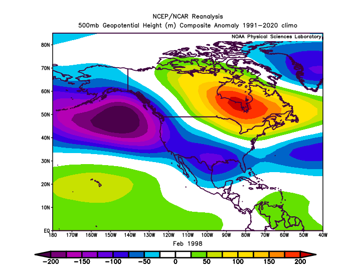
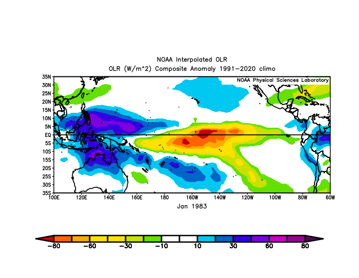
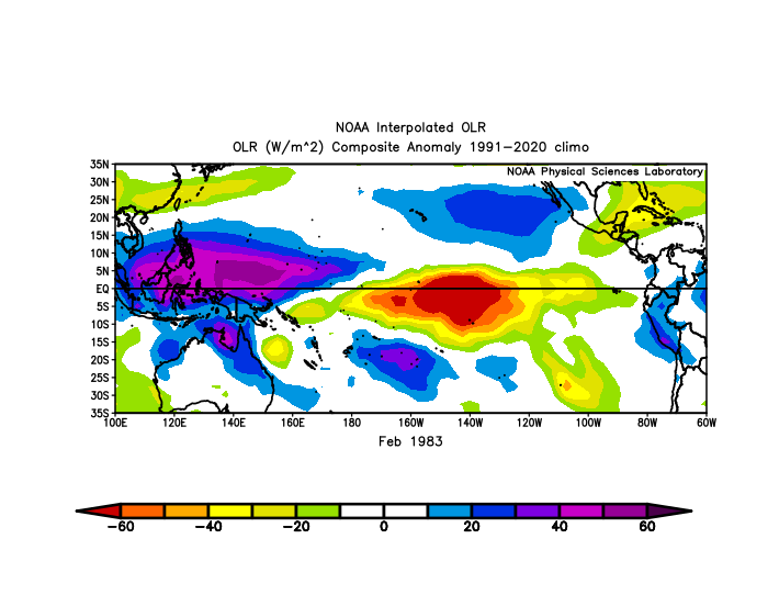
Very subtle but you can see how more dateline forcing shifts the Aleutian Low away from the PNA domain and more equatorward in 1983. Keep in mind it was a colder climate period despite showing a *weaker* low. Obviously the -NAO is a major help here.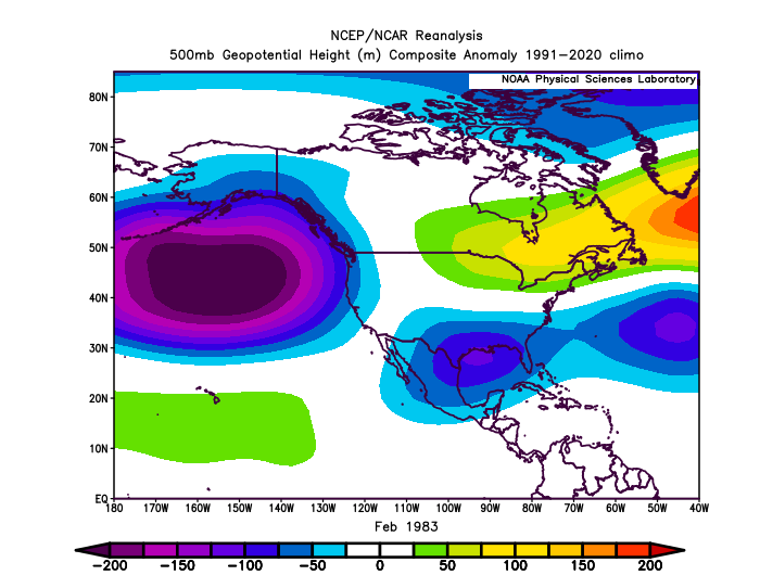
-
Im really curious to see what the some of the 3 day totals will be in Indiana
-
I only know pain
-
2026-2027 Record-breaking El Nino
LakePaste25 replied to Stormchaserchuck1's topic in Weather Forecasting and Discussion
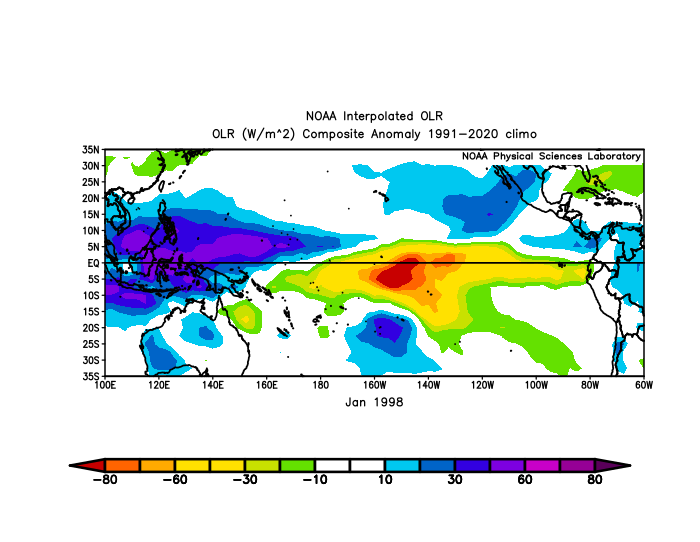
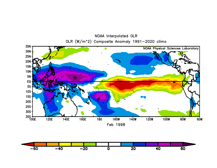
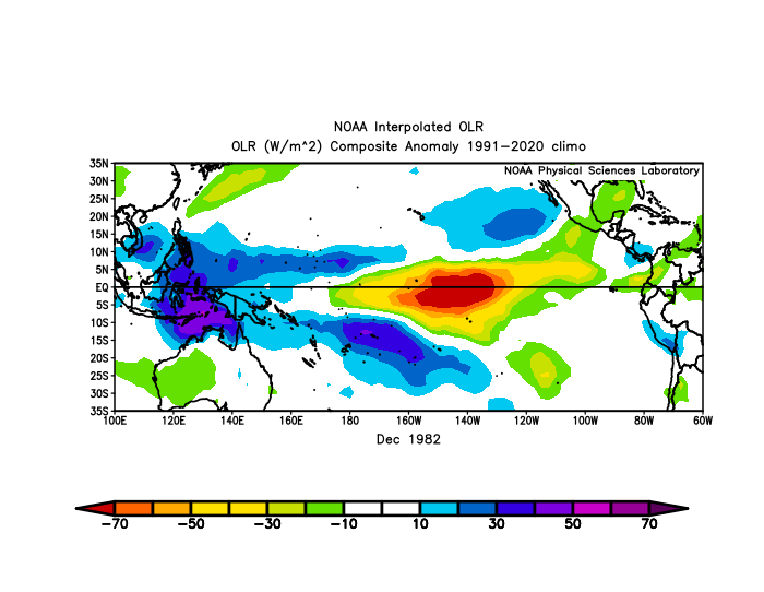
The forcing was similar but Feb 1983 was more confined to the dateline vs the EPac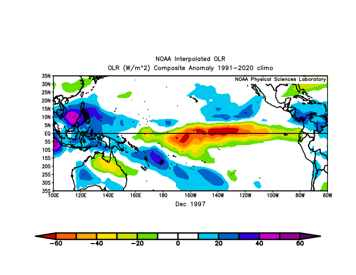
-
Amazing drive into work this morning. Went from dense fog to dark as night driving right into the incoming line. Couldn't see a shelf cause of the fog. Then hit a wall of torrential rains and 60mph winds. Was worrying a bit about some of the trees whipping around on the west side of the highway. Another great soaker with over an inch at home looks like.
-
Everyone becomes Cy Young when they leave the Orioles.
-
I have my long johns on.

.thumb.jpg.ad3a2e31d30aff035044689b311a0540.jpg)