All Activity
- Past hour
-
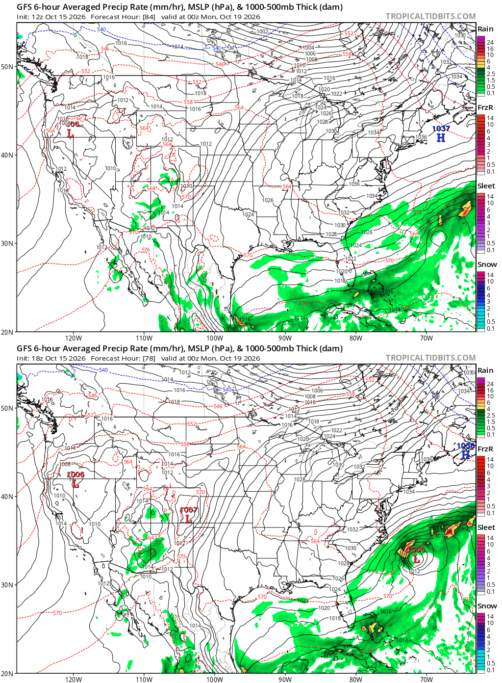
Whatever forms off the east coast next week…better not drift closer to coast, for the sake of that forecast.
-
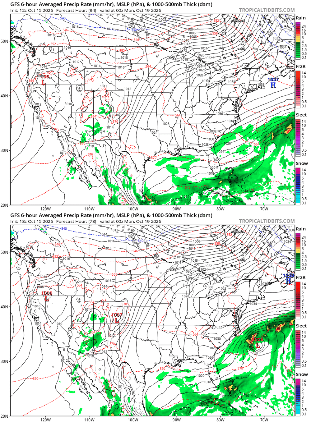
18Z GFS is the most threatening GFS yet to the E coast by far with it only 200 miles ESE of Hatteras as its closest! Also, the 18Z Icon has come back W a bit from the 12Z, which itself was less threatening than its 0Z that was coming into the SE.
-
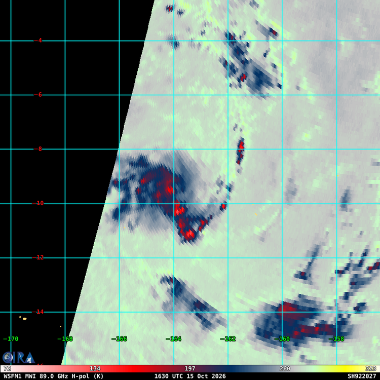
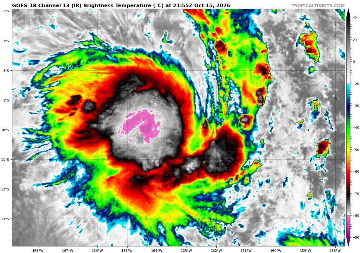
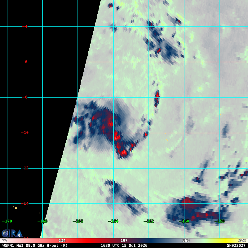
 SPAC starting already and well E of the Dateline. TCs well E of the Dateline are common in very strong El Nino years. 92P is easily a TS now from Dvorak classification. That kind of cold nascent CDO over a well-defined LLCC? The microwave from 1630z clearly show good banding and a small core. But not declared by JTWC yet, and only a TD from Fiji. They wait too long in the part of the world for developing TCs I have observed over a long time. Just one example of how it not easy to compare stats basin to basin due to different standards and practices.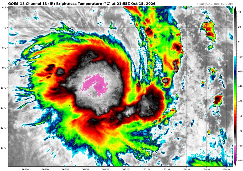
-
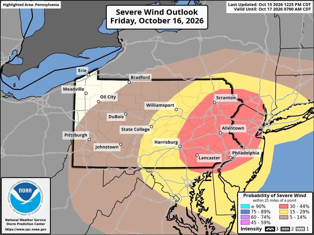
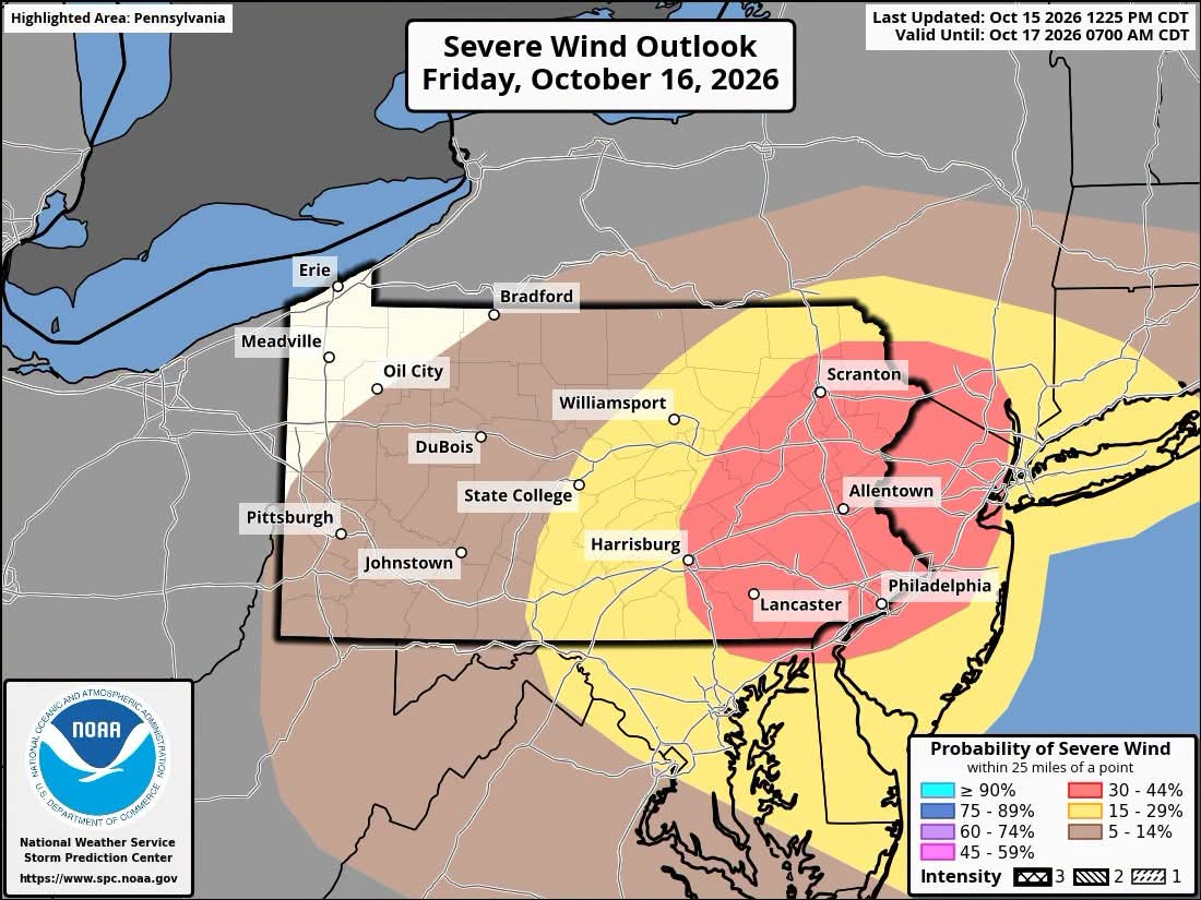
OKX AFD afternoon package: Showers and thunderstorm move through late tonight into early Friday morning in association with an approaching warm front. Thereafter, the region will be warm sectored with an approaching cold front to the west, deepening low pressure over northern New England/southeastern Canada, and a positively tilted upper level trough approaching from the west. After the passage of the warm front and ahead of the approaching cold front, winds shift to the SW and increase somewhat during the afternoon, bringing a surge of low level moisture, with dew points rising well into the 60s. Low level convergence along the cold front will allow for the development of low topped showers and thunderstorms that approach the western portion of the forecast area as a well defined squall line (as per most meso scale models) by late afternoon and early evening hours (anywhere from 5 pm to 7 pm, give or take an hour). With ample moisture in place, increasing low level convergence, and MLCAPE in the 500 to 1000 J/kg range, strong to potentially severe thunderstorms are possible, mainly for western portions of the area (NE NJ and Lower Hudson Valley). As the line approaches the coast, weakening is expected. However, even in these locations an isolated strong to severe thunderstorm cannot be ruled out. The Storm Prediction Center has placed much of the forecast area in a slight risk for severe thunderstorms. The cold front and weakening squall line should push offshore between 9 pm and 11 pm, but post frontal rain looks to develop thereafter, keeping the chance for showers in the forecast for Long Island and southern CT through most of Friday night, with lesser chances as you head N and W.
-
18z GFS starting to figure out that there will be a storm off the Carolinas
-
It's like we gotta treat it almost JV level at this point, right? Not to the degree of it can't be right but just not being able to take it seriously until a certain range?
-
Gfs (hardly usable at this point) looks like it’s caving towards the euro twins.
-
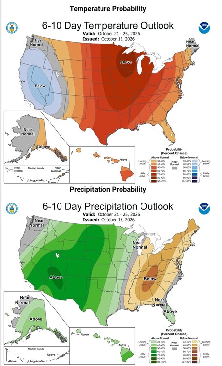
I'll take it.
-
Looks like after the line of storm goes through tomorrow night... there might be some back building of precipitation for the early morning hours.
-
-

2026 Atlantic Hurricane Season
LongBeachSurfFreak replied to Stormchaserchuck1's topic in Tropical Headquarters
A fetch that large, with duration that long would create long period energetic swells. Periods over 14 seconds are rare on the east coast (usually only associated with major hurricanes) They can cause major beach erosion in comparison to more typical mid period (10-13) second swells we typically see during east coast coastal storms. So if this comes to fruition it could have major coastal impacts. Especially on the outer banks where several areas are already in trouble. . -
 purple pharmacy online: MexGet Rx - mexico pharmacy order online prescription
 -
Get used to it this winter unfortunately
-
cheap prescription drugs india and indian pharmacy reviews buy medicines from india online https://maps.google.lu/url?q=https://indigetrx.com medications from india or http://www.1gmoli.com/home.php?mod=space&uid=1183597 order medicine online in india [url=https://clients1.google.sm/url?q=https://indigetrx.com]1mg medicine india[/url] rx india or [url=http://www.orangepi.org/orangepibbsen/home.php?mod=space&uid=7095845]pharmacy online india[/url] online medicine sites in india
-
Both HRRR and NAM show first snows for the mountains this Saturday morning. Considering a hike out there but the soundings seem fishy. Would there even be enough of a layer for precipitation to occur? If so, would any snowflakes even form or would I get to hike in cloudy drizzle? Don't know the answers would love some help from our mets @WxUSAF @MillvilleWx @Eskimo Joe I plan to head out and try and hike early Saturday morning at the Cheat Mountain range at 4200-4400 feet and would love to make sure I don't drive 3 hours to hike in a cold, windy, freezing rain fog.
-
cheap prescription drugs india and indian pharmacy reviews buy medicines from india online https://maps.google.lu/url?q=https://indigetrx.com medications from india or http://www.1gmoli.com/home.php?mod=space&uid=1183597 order medicine online in india [url=https://clients1.google.sm/url?q=https://indigetrx.com]1mg medicine india[/url] rx india or [url=http://www.orangepi.org/orangepibbsen/home.php?mod=space&uid=7095845]pharmacy online india[/url] online medicine sites in india
-
88 for a high yesterday and 65 peak afternoon high today
-
Let's see the reservoirs are low enough that susquehanna water has to be mixed into the supply. DCA is still at a ~6" YTD deficit. We're going to need every drop we can get in order to recharge the ground water or else we'll be in trouble in 6 months. The fact that we avoided real water restrictions this year is nothing short of a miracle.
-

Winter 2026-2027 Speculation
Prismshine Productions replied to 40/70 Benchmark's topic in New England
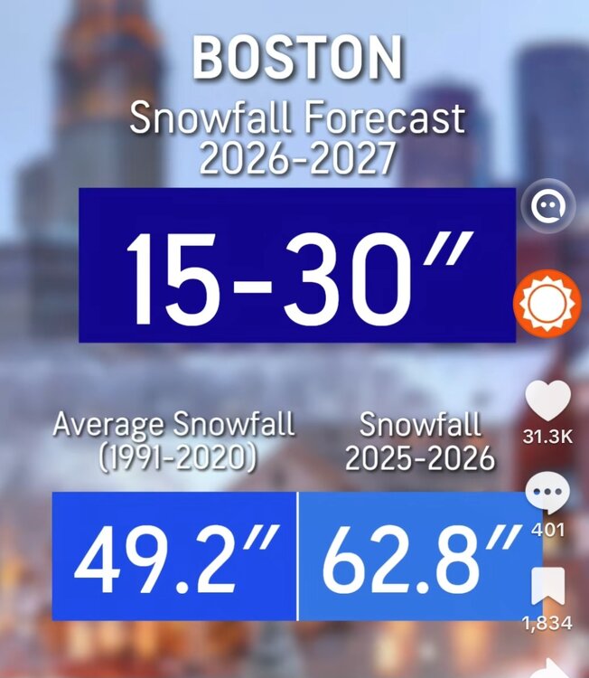
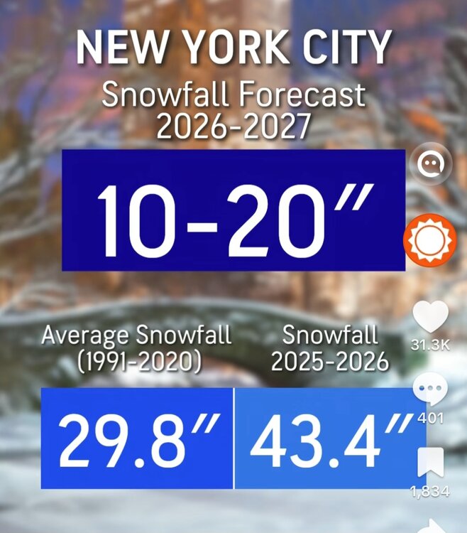
Fuck Inaccuweather Sent from my SM-S176V using Tapatalk -
.thumb.png.e8bfac47f0cf0e9ea4e5c6d6f00448eb.png)
-
It’ll be close I think for you.
-
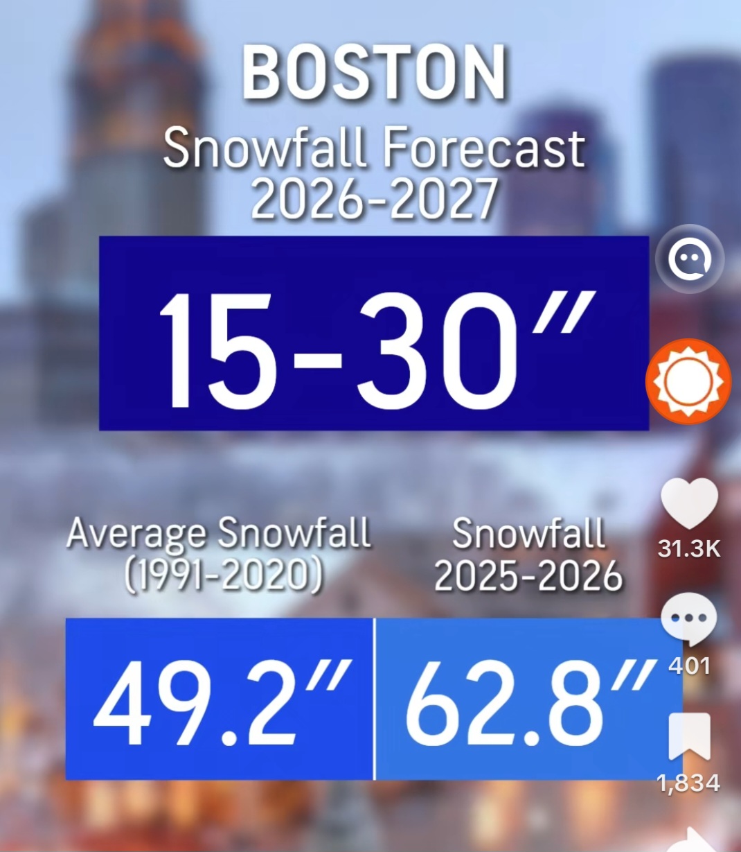
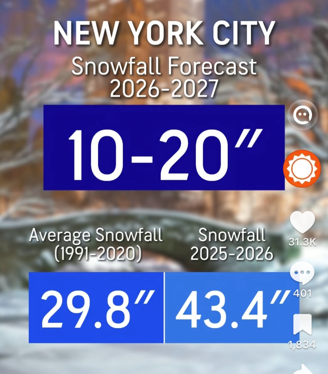
Accuweathers snowfall predictions
-
Very unlikely here . Need strong CAA at night this time of year
- Today
-
You could frost/freeze Sunday morning bro…just saying. Wouldn’t that be a hoot.
-
Yup…all clickbait BS.
















.png.8e11390883c055851e31ff28ad596b8c.png)