All Activity
- Past hour
-

December 2025 regional war/obs/disco thread
Sey-Mour Snow replied to Torch Tiger's topic in New England
I agree.. only a special storm for me will keep me up for euro -
WB 6Z GEFS. No support for operational run in the 5 day storm,

-

December 2025 regional war/obs/disco thread
Kitz Craver replied to Torch Tiger's topic in New England
Just LOL -

Central PA Winter 25/26 Discussion and Obs
mahantango#1 replied to MAG5035's topic in Upstate New York/Pennsylvania
Forum seems to be fairly quiet lately. It seems disappointment has set in. -

December 2025 regional war/obs/disco thread
40/70 Benchmark replied to Torch Tiger's topic in New England
It takes a special set of circumstances for me to be up for the EURO on weeknights these days, at 45 with 4 little ones..... -
December 2025 regional war/obs/disco thread
Sey-Mour Snow replied to Torch Tiger's topic in New England
? -
Central PA Winter 25/26 Discussion and Obs
mahantango#1 replied to MAG5035's topic in Upstate New York/Pennsylvania
Hazardous Weather Outlook Hazardous Weather Outlook National Weather Service State College PA 313 AM EST Mon Dec 22 2025 PAZ004>006-010>012-017>019-024>028-033-034-037-041-042-045-046- 049>053-058-230815- Warren-McKean-Potter-Elk-Cameron-Northern Clinton-Clearfield- Northern Centre-Southern Centre-Cambria-Blair-Huntingdon-Mifflin- Juniata-Somerset-Bedford-Tioga-Northern Lycoming-Sullivan- Southern Clinton-Southern Lycoming-Union-Snyder-Montour- Northumberland-Columbia-Schuylkill- 313 AM EST Mon Dec 22 2025 This Hazardous Weather Outlook is for central Pennsylvania. .DAY ONE...Today and tonight. Light snow is expected before turning to a mix of precipitation later tonight. A thin coating of ice is possible on top of a light accumulation of snow. .DAYS TWO THROUGH SEVEN...Tuesday through Sunday. A coating of snow and sleet may topped by a thin coating of ice before temperatures warm up on Tuesday. -

December 2025 regional war/obs/disco thread
Damage In Tolland replied to Torch Tiger's topic in New England
There’s a circle that had a major melt this morning . And I mean major -
We’re on a Christmas/graduation trip for my daughter right now. Goes by damn fast.
-
I was worried about it being too front loaded this winter and unfortunately that may be true.
-
December 2025 regional war/obs/disco thread
Kitz Craver replied to Torch Tiger's topic in New England
I’m exact opposite, lol. Tried and true morning person -

Winter 2025-26 Medium/Long Range Discussion
Baum replied to michsnowfreak's topic in Lakes/Ohio Valley
Confirmed. -
The Euro is currently caving to the KING GFS for Augusta............................... 00z Euro had Augusta County at 62 for Christmas afternoon. The 06z Euro drops that 62 to 56....... Sterling NWS forecasters are at a loss. Later today, Sterling Thur thru Saturday likely to change significantly.... 13.2 at 7 am.
-

E PA/NJ/DE Winter 2025-26 Obs/Discussion
Mikeymac5306 replied to LVblizzard's topic in Philadelphia Region
Love opening up this forum and seeing the last post from Wiggum cause that means something is cooking. 6Z Euro has a sleet storm. Give it till tomorrow before we cue up the Patton speech. -
White Christmas Miracle? December 23-24th
40/70 Benchmark replied to Baroclinic Zone's topic in New England
I'd hit it- -
Over the years I've noticed there's a ton of night owls on here. They're probably just asleep lol
-
Weather channel just talked about that. Icy and snowy potential!
-
Euro isn’t going to move 300 miles in one run but my guess is gfs is way too far south
-
Central PA Winter 25/26 Discussion and Obs
mahantango#1 replied to MAG5035's topic in Upstate New York/Pennsylvania
1 in. -
2025-2026 ENSO
40/70 Benchmark replied to 40/70 Benchmark's topic in Weather Forecasting and Discussion
I haven't put much effort into whether or not we trend colder in the shorter term (don't really care), but expect this Pacific trough regime to last into mid January before the flip, which is consistent with his timeframe. It's important to keep in mind that the Pacific trough regime doesn't have to mean an all out torch, which some may be conditioned to believe. BAM is right about the PV being on our side of the hemisphere, so that would help to mitigate that. -
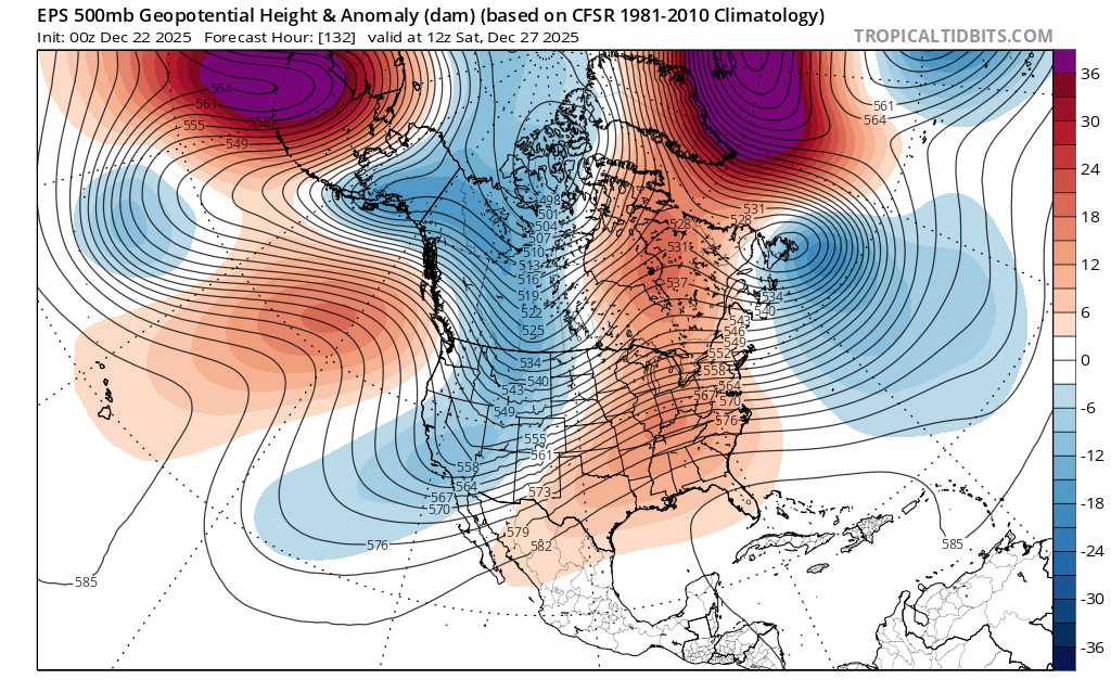
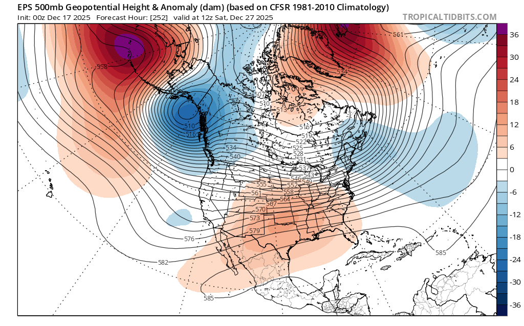
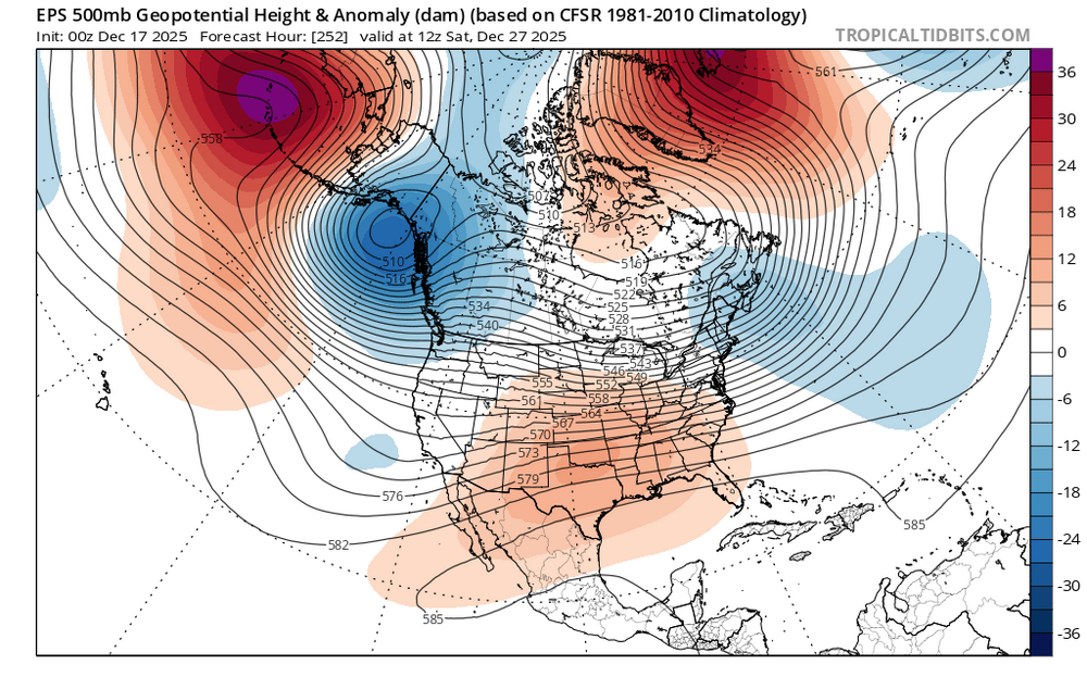
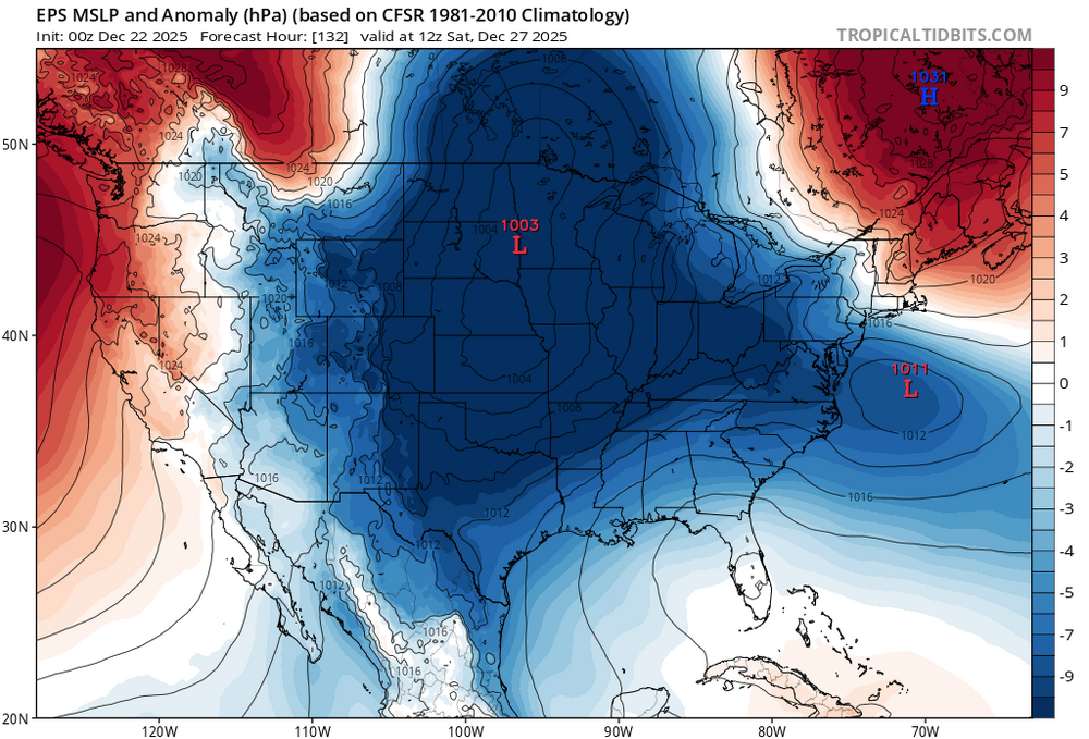
All we can say for sure is that the -NAO corrected much stronger and the PNA more negative with a stronger trough digging into the West. Certainly an unusual looking setup for snow here. But the kicker low over the Dakotas prevents the low near our area from riding too far north. So in an odd way the stronger -PNA actually helps which we don’t see much. The solution could change in the coming days with all the moving parts. New run Old run

-
6z Euro came south some, but not far enough. Slams NYC. Nobody's safe with this one before Christmas imho.
-
I think half of CWG posts are written 12 hours out and then get scheduled to post during certain high fb traffic times
-
You become closer to your weenie friends than your own spouse during winter?
-
What happens when you’re the wife running off to check the models??