All Activity
- Past hour
-

2025 Spring/Summer Mountain Thread
Met1985 replied to Maggie Valley Steve's topic in Southeastern States
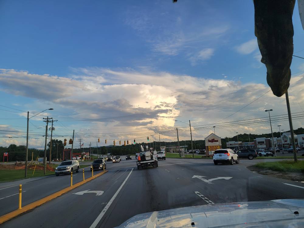
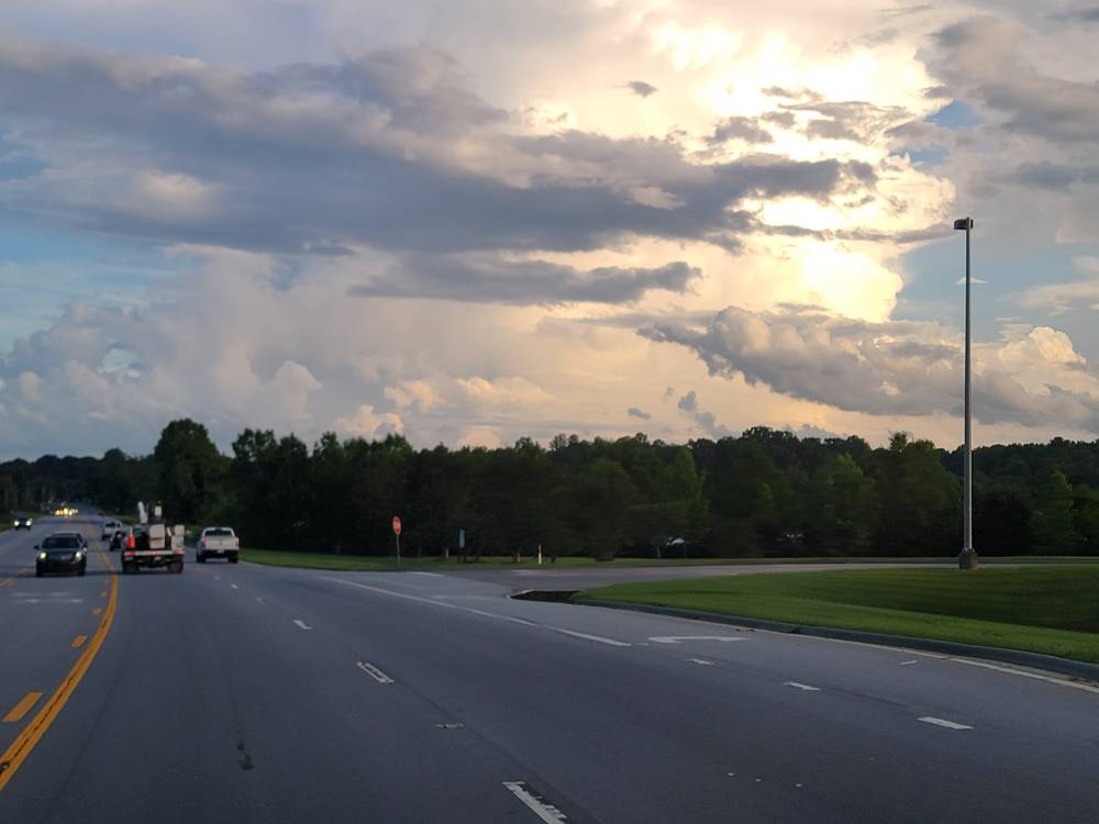
Absolutely beautiful thunderstorm heads this evening. Sent from my SM-G998U using Tapatalk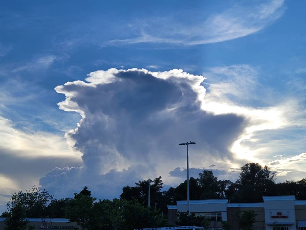
-
Point and click forecast starting Saturday here Saturday Mostly sunny, with a high near 92. Saturday Night Mostly clear, with a low around 74. Sunday Sunny and hot, with a high near 98. Sunday Night Mostly clear, with a low around 76. Monday Sunny and hot, with a high near 99. Monday Night Mostly clear, with a low around 77. Tuesday Mostly sunny and hot, with a high near 96. Pass
- Yesterday
-
It’s been sooo long since we’ve had one down here
-
Yeah. I'm a go big or go home weather guy. Give me a cane, a blizzard, a severe storm, or flooding rains. I hate the mundane. Send that up to Tamaqua please...
-
Looks like the GFS has some minor MCS into the area while the Euro has it into northern New England on Sunday.
-
Models still all over the place. GFS is pretty cool for Sunday with low to mid 80's, rains Sunday AM and clouds stick around; while the 18z Euro is now roasting hot Sunday with good offshore flow and temps in the mid 90's. Euro is still very hot Monday but places right along the coast have a sea breeze and therefore cooler. GFS has a good sea breeze for most on Monday, about 10 degrees cooler than the Euro.
-
Latest cold period Jun 14 EWR: 71 / 61 (-6) 0.31 NYC: 68 / 59 (-8) 0.23 LGA: 67 / 59 (-10) 0.13 JFK: 66 / 60 (-7) 1.00 Jun 15: EWR: 65 / 59 (-11) 0.19 NYC: 64 / 59 (-10) .03 LGA: 65 / 59 (-11) 0.03 JFK: 63 / 59 (-9) 0.07 Jun 16: EWR: 69 / 62 (-7) 0.03 NYC: 69 / 60 (-7) LGA: 68 / 60 (-10) JFK: 70 / 60 ( -5) Jun 17: EWR: 71 / 63 (-6) NYC: 67 / 62 (-8) LGA: 67 / 62 (-9) JFK: 66 / 64 (-4)
-
.1” here
-
Up to .85" with light rain
-
I still would watch for a mid weekend MCS it seems there’s a noncommittal warm frontogenesis on the leading edge of the arriving torch synoptics. An eruption along then turning SE out of lower Ontario is climo favored and the operational models already can’t seem to resist - could be a severe risk for derecho followed by a heat burst pattern. Somewhat rare sequence for our region.
-
Up to 70 for a high today some breaks in the clouds but rain into NNJ
-
Absolutely. First time I went there I said myself, so this is where they dump nuclear waste. Good spot!
-
Yes haha But 90s is nothing we've haven't seen day in and day out around here. The Euro runs of yesterday showing close to 110F heat were terrifying.
-
Speaking of gusts - Warning it's a pay site. If you haven't used it before I think you get one free. Or delete your cookies. I'm guessing by the ball sack photo most on here do. https://www.bostonglobe.com/2025/06/17/metro/boston-is-the-windiest-on-record-in-2025/
-
Agree. Desert shithole.
-
Getting the crud’s mid week like this is a switch. Perhaps this is related to the larger changes in the hemisphere that will also roast next week … It may also signify breaking the cycle of timing Saturdays for shits
-
I was in Phoenix the last week of June both in '88 and 90. The vent handles in my car melted In '88 and the speaker casings melted in '90. How people live there is beyond me.
-
I mean it is going to be quite the head fake from constant gloom and 60s to even the 90s...
-
Not directly related to what is discussed here, but still important, given the weather predictions coming up. If not appropriate to post here, I apologize in advance.
-
im hoping it can make it the far east but its wait and see I guess
-
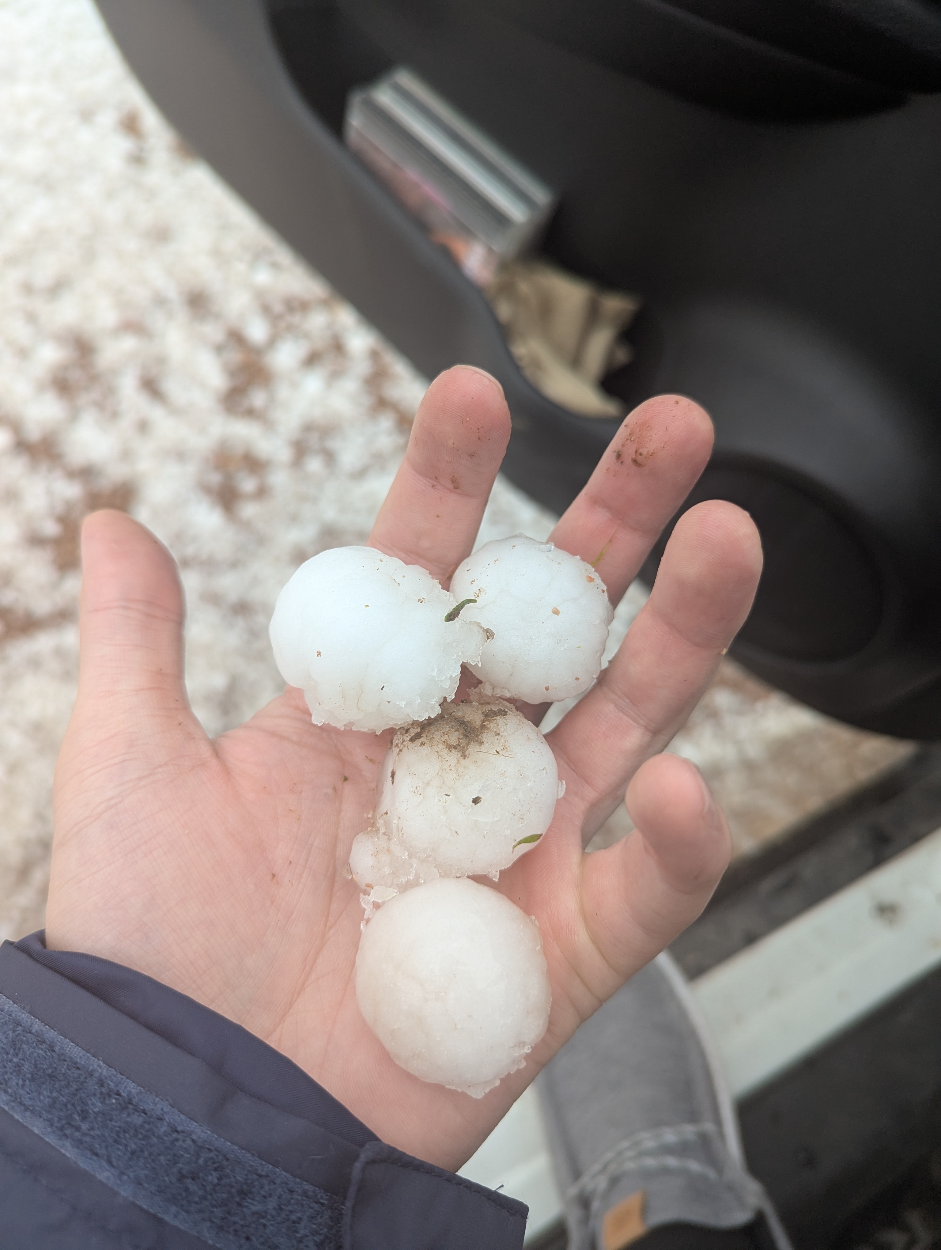
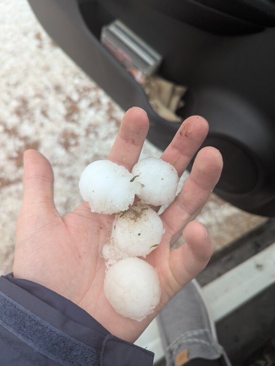
Confirmed/observed tornado just 6-7 miles east of Laramie today, crazy storm. Went and picked up some golf balls once the storm passed. Probably 2-3 inches of accumulated hail in the hardest hit areas
-
Water boy.
-
0.27” and a gust to 24mph
-
He and Julio?
-
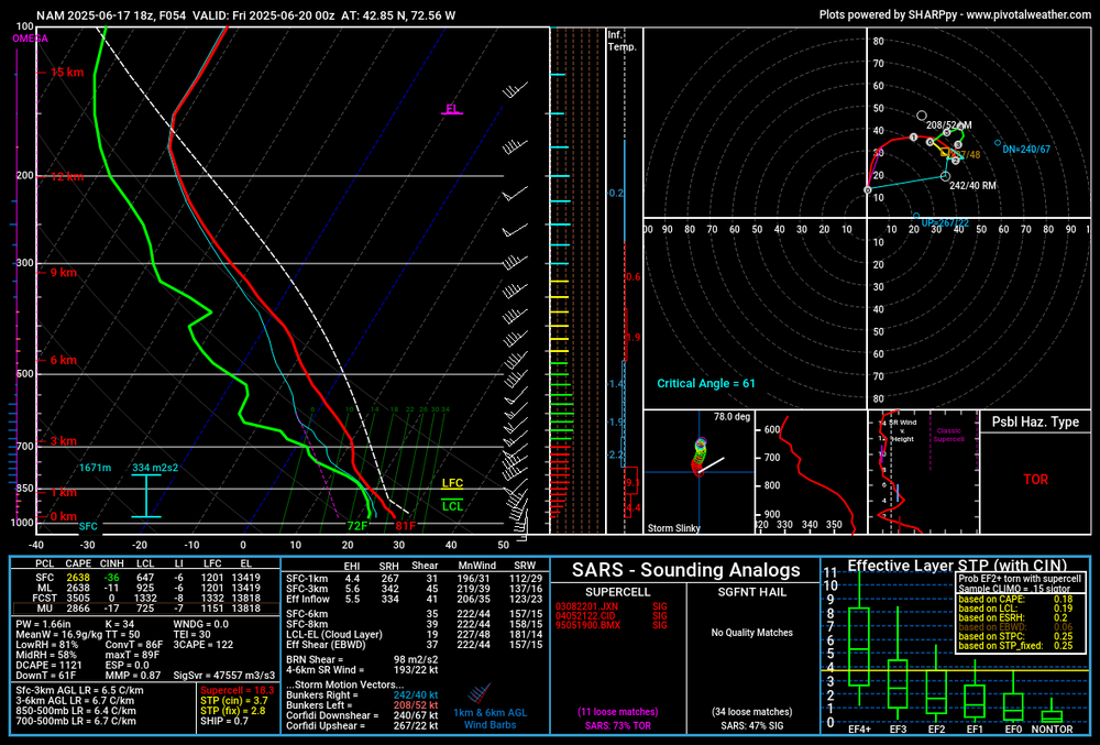
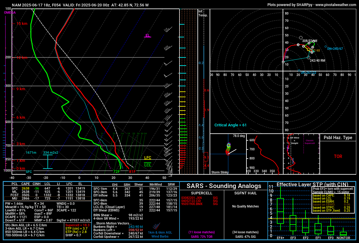
NAM refusing to back down for me Thursday... question is do I get a hailcore for the ages or a tor