All Activity
- Past hour
-

July 2025 Discussion-OBS - seasonable summer variability
LibertyBell replied to wdrag's topic in New York City Metro
You can still beat the heat by traveling outside the UHI by the way, heat is relative, it will always be cooler outside of the UHI. -
July 2025 Discussion-OBS - seasonable summer variability
LibertyBell replied to wdrag's topic in New York City Metro
The heat didn't start in June (at least not until the last week) and we're comparing sustained heat not just June but the entire summer. 1980 stands alone for July-August. -
July 2025 Discussion-OBS - seasonable summer variability
LibertyBell replied to wdrag's topic in New York City Metro
I hit 92 here at 1 PM my second heatwave so far. -
July 2025 Discussion-OBS - seasonable summer variability
LibertyBell replied to wdrag's topic in New York City Metro
It came out of the southwest and covered most of the country. Forget temperature tables and read some news sources of how lethal the summer of 1980 actually was. -
Not home, but checked in on the pet cam and it was just one crack of thunder after another. This is as electrical as I’ve seen in years.
-
Yes - I admit I was somewhat skeptical about today but no longer...radar is angry (almost looks like it's boiling) and there's no where for it to go...
-

E PA/NJ/DE Summer 2025 Obs/Discussion
Hurricane Agnes replied to Hurricane Agnes's topic in Philadelphia Region
Had to go to a dentist appointment this afternoon and then pick up something from the pharmacy and barely made it in the door. It got dark fast! So far an up to 1.26" (total) in the bucket with > 2"/hr rates. Am under a fresh warning. Temp down to 76 with dp 73.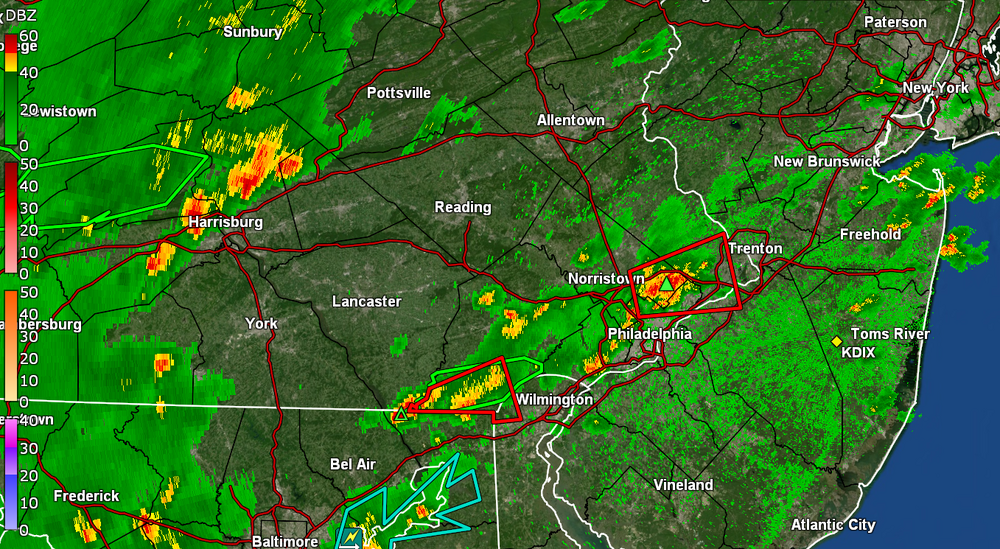
-
Maybe but right now ha
-

July 2025 Obs/Disco ... possible historic month for heat
Typhoon Tip replied to Typhoon Tip's topic in New England
I think this is my highest DP of season at 76 and it's 92. KFIT's 90/72 so the HI is up there. -
Picked up nearly an inch in 20 mins.
-
@canderson I think this may be your day Sent from my SM-X210 using Tapatalk
-
Another soaker here. Helluva pattern change the last couple months from the Great Plains pattern we were in the last 2 years.
-
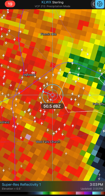
Flash Flood Warning National Weather Service Baltimore MD/Washington DC 254 PM EDT Tue Jul 1 2025 The National Weather Service in Sterling Virginia has issued a * Flash Flood Warning for... Northwestern District of Columbia... Southeastern Montgomery County in central Maryland... Western Arlington County in northern Virginia... Fairfax County in northern Virginia... The Northwestern City of Alexandria in northern Virginia... The City of Fairfax in northern Virginia... The City of Falls Church in northern Virginia... * Until 600 PM EDT. * At 254 PM EDT, Doppler radar indicated thunderstorms producing heavy rain across the warned area. Between 0.5 and 1.5 inches of rain have fallen. The expected rainfall rate is 1.5 to 2.5 inches in 1 hour. Additional rainfall amounts of 1 to 2.5 inches are possible in the warned area. Flash flooding is ongoing or expected to begin shortly.
-
Gonna get missed after it looked good for a while
-
0.85 from that first round and a fresh 75 degrees. Off to a great start!
-
3 day heat wave .
-
Storms starting to fire south of it off the outflow. It's ungodly horrible out right now with sun. I feel like rice in a steamer. Sent from my SM-X210 using Tapatalk
-
How is your annual deficit so much? I'm around 20"-21" and my deficit is only a little over 1" Sent from my SM-X210 using Tapatalk
-
1.35" was pretty much just straight down rain. Several lightening strikes and thunder
-
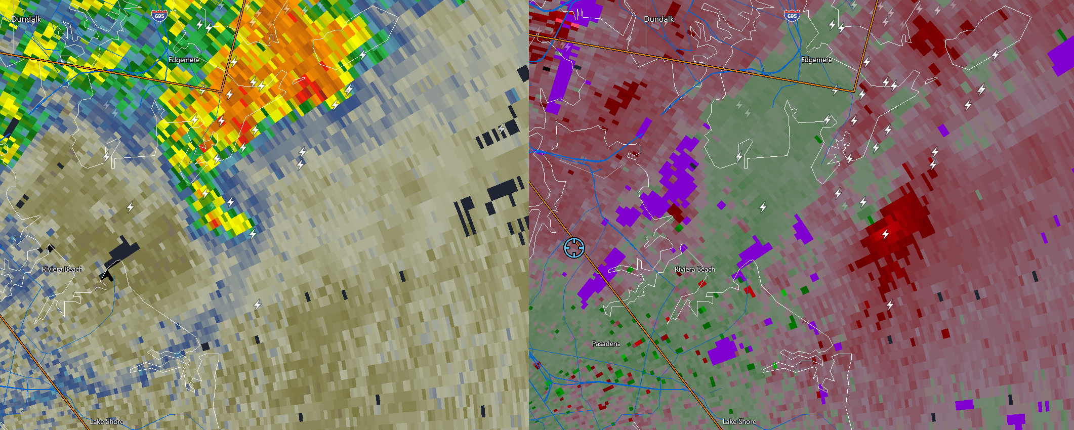
I bet this is producing a waterspout right now at the mouth of the Patapsco...

- 1,249 replies
-
- 3
-

-

-
- severe
- thunderstorms
- (and 2 more)
-
1.75 in less than an hour. (Rain is now light.)
-

July 2025 Discussion-OBS - seasonable summer variability
rclab replied to wdrag's topic in New York City Metro
I liked your idea TCC. For a moment though, I thought it was one of Liberty's posts. Well done, a# always ….. -
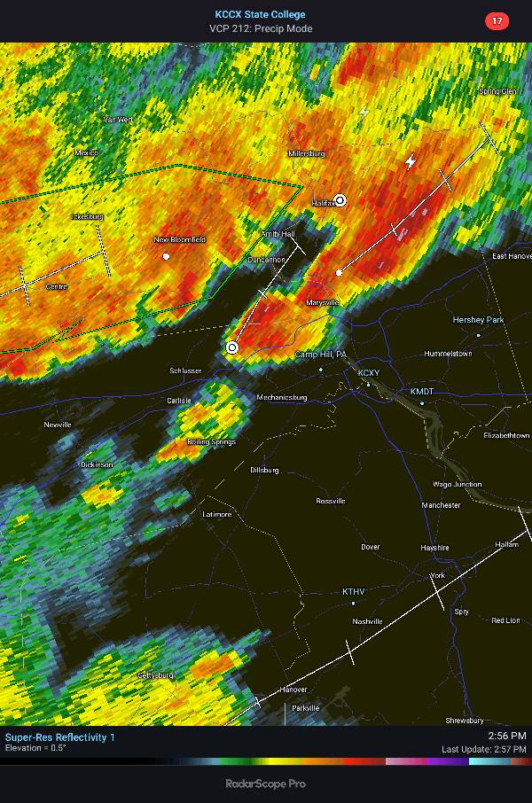
The severe storm that was birthed around here (Carlisle area) yesterday afternoon around 4:00pm caused a lot of problems in the aftermath. A combination of high winds and flooding rains created severe flooding in and immediately around Carlisle Borough. I think I was about a mile away from the worst winds and especially flooding rains. But, I have the misfortune of still being without power. They keep pushing the restore time back, so it's now 11:00pm this evening. PPL has restored much of the affected areas, however, I'm in the 338 homes without power. I ended the day with 2.10". Ended the month with between 6.4 and 6.6". YTD near 21.50", which is an annual deficit so far of about 2.50".
-

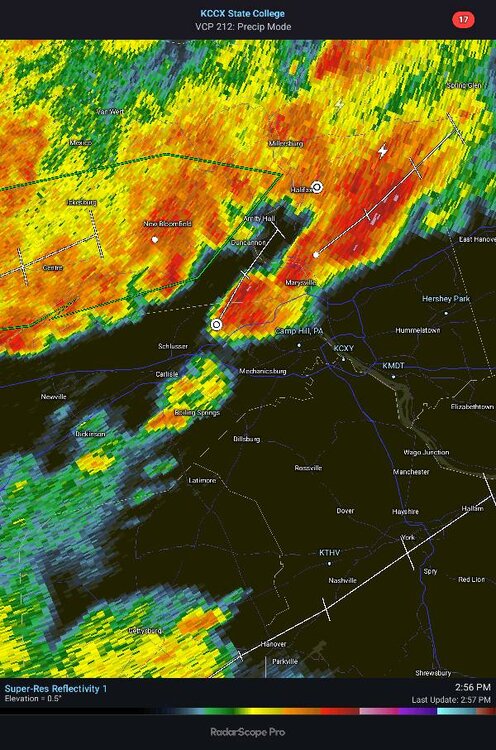
Central PA Summer 2025
Mount Joy Snowman replied to Voyager's topic in Upstate New York/Pennsylvania
Our flash flood guidance is so meager at this point, I just don't see how large swaths of Lancaster County don't have serious issues tonight. Hoping for the best but things could really go south quickly. Chiques Creek is completely swollen as it is. -
BULLETIN - IMMEDIATE BROADCAST REQUESTED Severe Thunderstorm Warning National Weather Service Baltimore MD/Washington DC 238 PM EDT Tue Jul 1 2025 The National Weather Service in Sterling Virginia has issued a * Severe Thunderstorm Warning for... The District of Columbia... South central Montgomery County in central Maryland... Southeastern Loudoun County in northern Virginia... The City of Fairfax in northern Virginia... Arlington County in northern Virginia... The City of Falls Church in northern Virginia... Fairfax County in northern Virginia... The City of Manassas Park in northern Virginia... Central Prince William County in northern Virginia... The City of Manassas in northern Virginia... The northern City of Alexandria in northern Virginia... * Until 330 PM EDT. * At 238 PM EDT, a severe thunderstorm was located over Centreville, moving northeast at 25 mph.