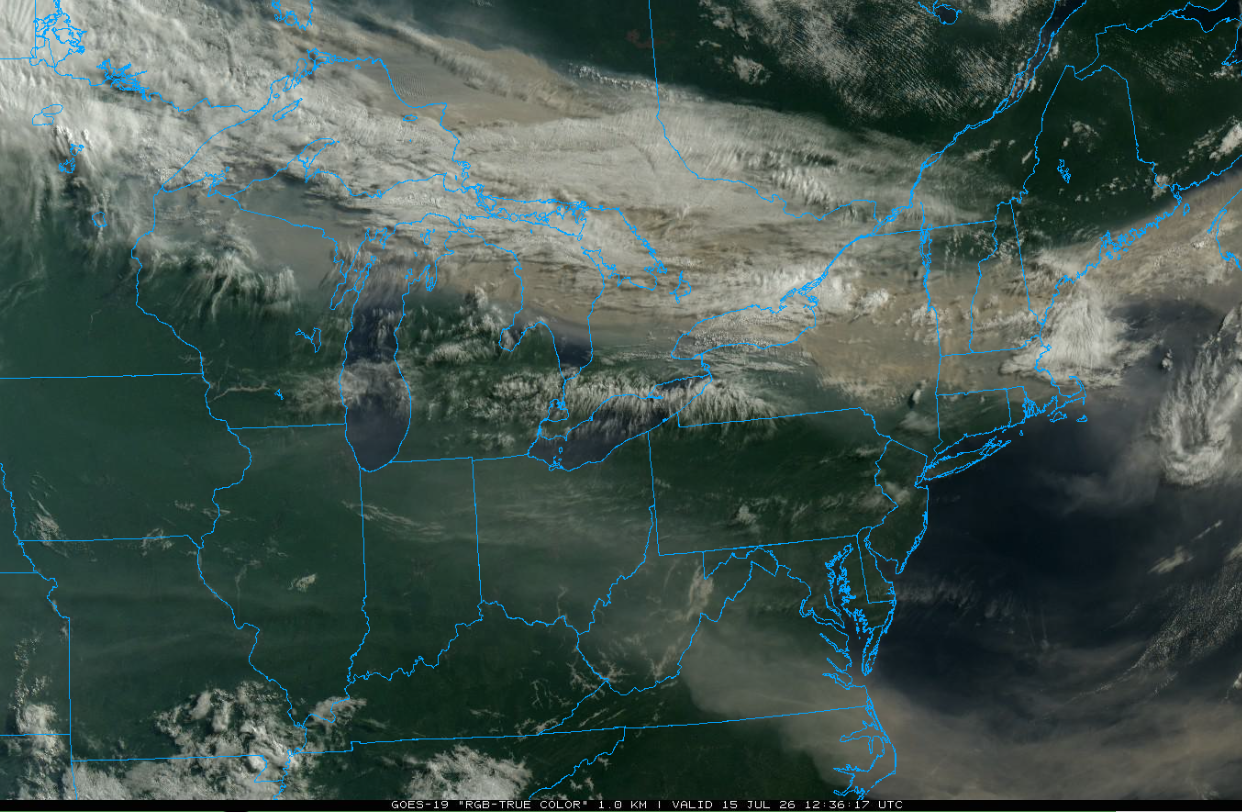
All Activity
- Past hour
-
 It’s been a very good warm season of lower dews.
 -
 Not going to lie, after just 30 minutes outside, my eyes are burning, my heart rate is up and it does feel like some slight trouble breathing.
 -
 Nature is healing. Humans will extinguish themselves in 100 years or less and the Earth will thrive.
 -
One day of yore! Now we have them multiple times a year.
-
 Google New England dark days... Also David Ludlum has a section on dark days in his New England Weather book.
 -
piss air for sure up there
-
Duluth Cam looking over the harbor.
-
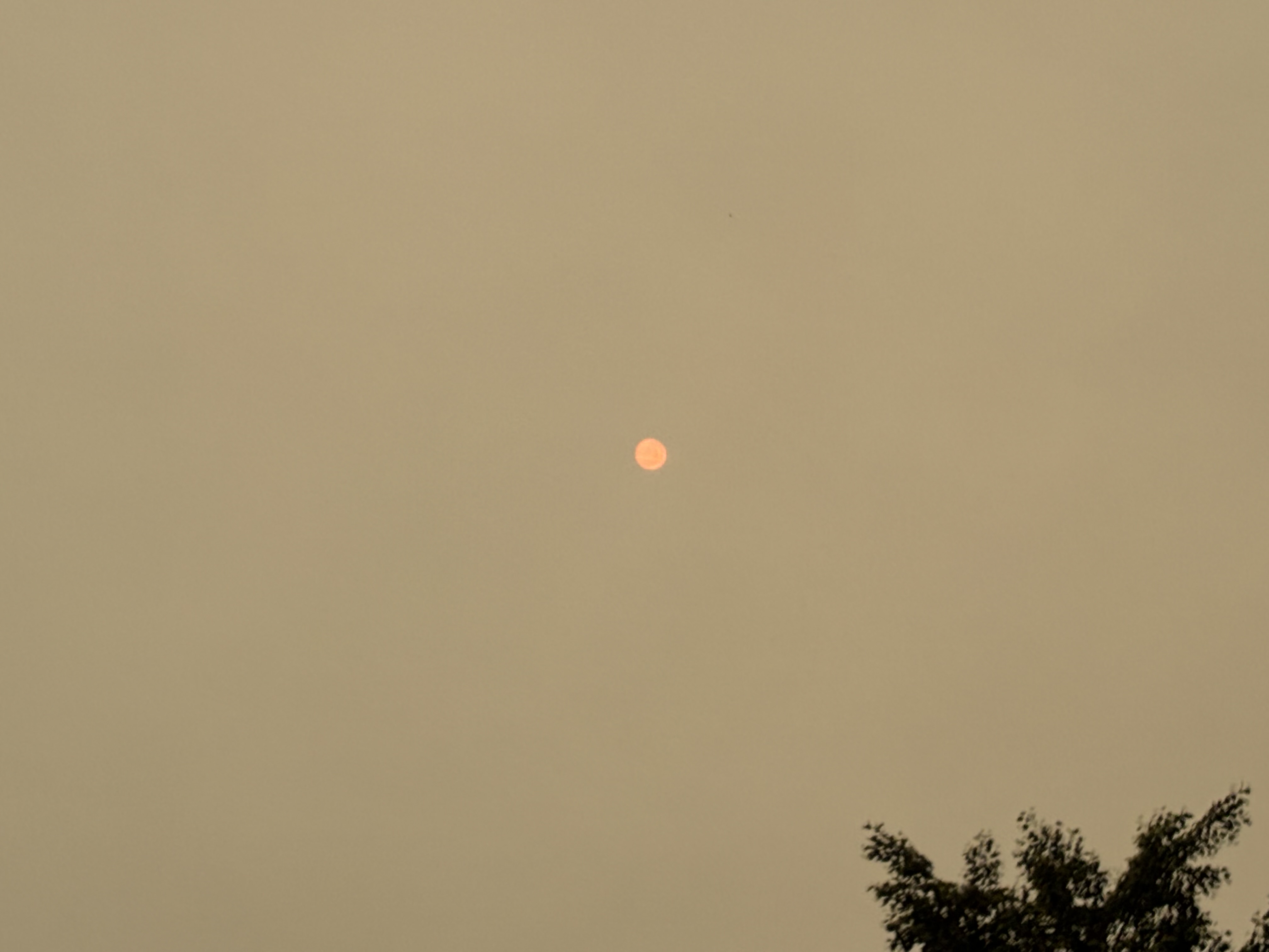
 It's the CC that's fake or over hyperbolized that's "not" causing massive upward frequency of these large scale "holocaustic - like" fire explosions setting off all over the world over recent years... This is how Gaia rids the planet of cancer. She/he/it slowly turns up the heat up on the frogs, using temperature like chemotherapy. With brilliantly insightful enabling throughput of "there's always been wild fires", this keeps the agency smoking, so there's more cancer, thus, more chemotherapy ... turning up the dial toward their own demise. I also like the metaphor for the "Clean" end of said dial on a convention electric oven's settings. We just spent that last hour at about the equiv light of a cloudy 8:24 pm Here is the sun now that it is attempting to get brighter - albeit in a sickly yellowy aura to the air
-
I just noticed that the 0Z UKMET has a NE Gulf TD from this on Sunday and a TS offshore the SE US on Tue: NEW TROPICAL CYCLONE FORECAST TO DEVELOP AFTER 108 HOURS FORECAST POSITION AT T+108 : 27.8N 83.1W LEAD CENTRAL MAXIMUM WIND VERIFYING TIME TIME POSITION PRESSURE (MB) SPEED (KNOTS) -------------- ---- -------- ------------- ------------- 1200UTC 19.07.2026 108 27.8N 83.1W 1011 33 0000UTC 20.07.2026 120 28.5N 83.2W 1007 26 1200UTC 20.07.2026 132 29.2N 82.1W 1008 27 0000UTC 21.07.2026 144 30.2N 81.2W 1007 32 1200UTC 21.07.2026 156 32.2N 79.1W 1002 40 0000UTC 22.07.2026 168 34.7N 75.5W 1000 47
-
The world is now orange.
-
I don’t remember it being as frequent in my childhood (90s &00s). But memory could be clouded by youthful ignorance. I definitely remember that one.
-
Best wishes to NJ State Climatologist Dave Robinson on his retirement. His name has been a fixture in NJ weather and climate for as long as I can remember. https://www.njweather.org/articles/june-2026-recap-plus-first-half-2026-review
-
Certainly, although Guilford county only saw .5-1.5" for the most part over the last week we'll see on all of D4 being removed
-

2026-2027 Super El Nino
Keith Central PA replied to Stormchaserchuck1's topic in Weather Forecasting and Discussion
May was the month in 1998..it went from moderate nino to modeate nina in a month. -

2026-2027 Super El Nino
40/70 Benchmark replied to Stormchaserchuck1's topic in Weather Forecasting and Discussion
I could see the mean being more like 140W, but either is reasonable. -
2026-2027 Super El Nino
40/70 Benchmark replied to Stormchaserchuck1's topic in Weather Forecasting and Discussion
I'm beginning my work on the polar domain, as far as solar, QBO, Atlantic subsurface (with help from Chuck) and ENSO considerations....I should have a more definitive stance by next week. -
 The sunbeam my cat is sitting in is making her look orange-pink. It's like it's sunset.
 -
Really extreme to see parts of France go +10° F for the first half of summer using the warmest 1991-2020 climate normals. With a +4.2°C deviation from the already warmed 1991-2020 baseline, the tally for the first half of the meteorological summer is eye-opening. The 2026 anomaly forces us to scale up the graph, to the point of literally compressing 2003 (+2.8°C "only"). ➡️From the Center-West to Burgundy, we're seeing unprecedented values of +5 to +6°C. ➡️The rainfall deficit is just as stark, ranging from -30% in the north to -100% in the Var. The Center-West, where the vegetation is already completely scorched, hovers between -60 and -80%. ➡️Over the past month, nearly every day has been spent above the heatwave threshold, with only a 4-day pause at the start of July. ➡️The third heatwave should wrap up this weekend. But in the southwest, temperatures will remain heatwave-level (34 to 38°C) for an indeterminate period. Given the hot air mass south of Europe, we're far from safe from a 4th heatwave later in the summer. France is dry and scorched. After already surpassing 2003 with the hottest day ever observed in France, the year 2026 now exceeds the droughts of 1976 and 2022. The soil moisture index reaches its lowest level ever measured for a July 9. And the situation continues to worsen. A new hairdryer effect is expected in the central west starting Sunday. From the sky, France appears literally burned: parched meadows, defoliation of forests, summer crops in great distress (corn, soy, sunflower), and early winter harvests contribute to this color. As if that weren't enough, we have just broken the NATIONAL RECORD for the hottest night ever observed with 30.6°C in Céret in the Pyrénées-Orientales at the "coolest" point of the morning. Photo from the NAOO-21 / VIIRS satellite (true color).
-

2026-2027 Super El Nino
LakePaste25 replied to Stormchaserchuck1's topic in Weather Forecasting and Discussion
Yeah I don’t think the Hadley cell will just park at 120W all winter. Kind of like what Snowman is showing in the Hovmoller above, I can see it wobbling 30-50 degrees in the mean. -
 Was it 2002 when we had the wild smoke from the fires around Montreal(?). That was nuts
 -
 Happens. Maybe a little more frequency in recent years, but it’s not anything new. Social media definitely hypes it up more.
 -
 I was thinking the same thing. I remember occaisionally having smoke from fires make its way here but not every year.
 -
 Very hazy, almost partial eclipse sky over here just north of Syracuse Sent from my SM-S921U using Tapatalk
 -
2026-2027 Super El Nino
40/70 Benchmark replied to Stormchaserchuck1's topic in Weather Forecasting and Discussion
Yea, I highly doubt we see as much MC interference as 2023, and while I am not yet convinced that there will be less than 2015, I am certainly open to the idea. -
2026-2027 Super El Nino
LakePaste25 replied to Stormchaserchuck1's topic in Weather Forecasting and Discussion
It already is in South America. Chile is getting slammed in the short-medium range models.