All Activity
- Past hour
-
The 0z CMC actually has ice ending as a little snow for Monday the 29th. This model was already the coldest for this event and it shifted even colder. Unfortunately it has close to zero support amongst the other ensembles. Then again, the thermal boundary has repeatedly trended colder in the mid-range recently...
-
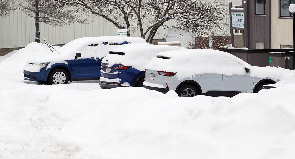
Hit 6” so far
-
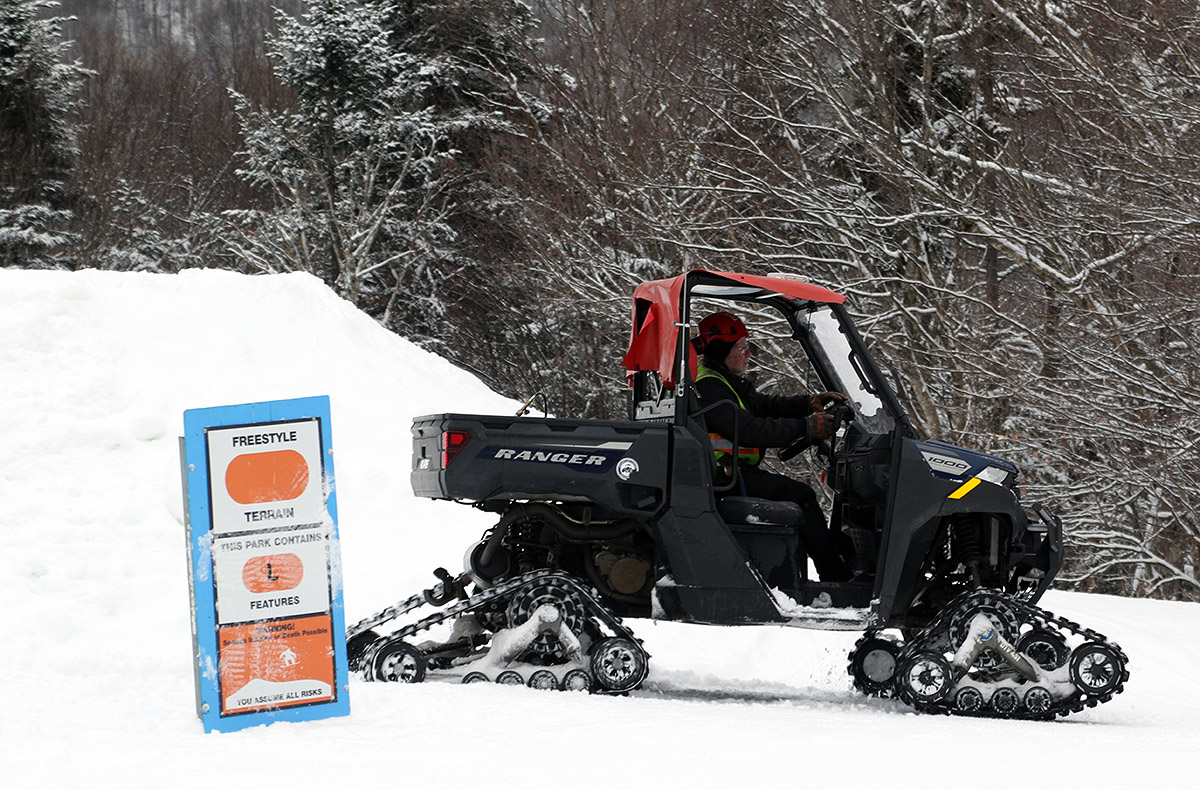
The weak mid-level trough that came through the area yesterday dropped about 3” of snow in the valleys around here, and I saw that Bolton Valley was indicating 4” new in their morning report. Combined with the snow from Sunday’s cold front, it seemed like it was time to head up to the mountain and check out how the resurfacing was coming along since the most recent consolidation storm that we had over the weekend. Temperatures were well up into the 20s F and there was no wind, so it was very comfortable out on the mountain, and although it wasn’t snowing, the skies were cloudy ahead of the next incoming clipper system. The Wilderness Lift wasn’t loading until 10:00 A.M., so I started the morning off with a tour up to the ~2,700’ elevation using the Wilderness Uphill Route. Conditions were excellent on Lower Turnpike, with several inches of powder above the old base. Turns weren’t 100% bottomless, but I was probably getting 50% bottomless turns on lower-angle terrain in untouched areas of snow. And even for turns that touched down to the subsurface, the base was nice and soft. I followed up the tour with some lift-served runs, and I can say that moderate and high-angle terrain are nowhere near being resurfaced yet. The new snow was quickly pushed around by lift-served levels of skier traffic, and it’s going to take another inch or two of liquid equivalent to get the high-angle slopes back to something respectably soft for lift-served skiing. There is an increase in powder depth with elevation, and here’s roughly what I found for depths out on the mountain today: 2,000’: 3-4” 2,500’: 4-5” 2,700’: 5-6” 3,150’: 7-8” The best turns were in areas of untouched snow, which were thankfully fairly plentiful ahead of the lift opening, but there’s just not enough liquid equivalent in the surface snow yet in any terrain area to hold up to lift-served skier traffic. The current system affecting the area is even more robust than the last one however, so it certainly should bring the snow surfaces up another notch by tomorrow morning.


-

Winter 2025-26 Medium/Long Range Discussion
Torchageddon replied to michsnowfreak's topic in Lakes/Ohio Valley
-

White Christmas Miracle? December 23-24th
weathafella replied to Baroclinic Zone's topic in New England
Crown time. Savor these moments. -
 Man went for a warmer BOS than anticipated. Also the lack of a break in the warmth out west a bit of a surprise.
 -
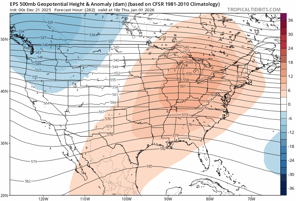
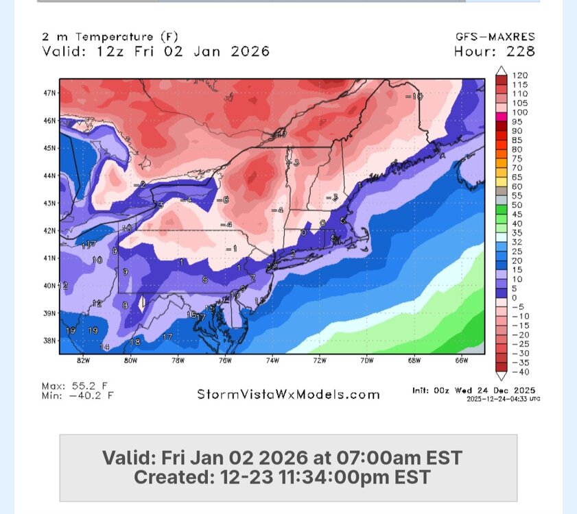
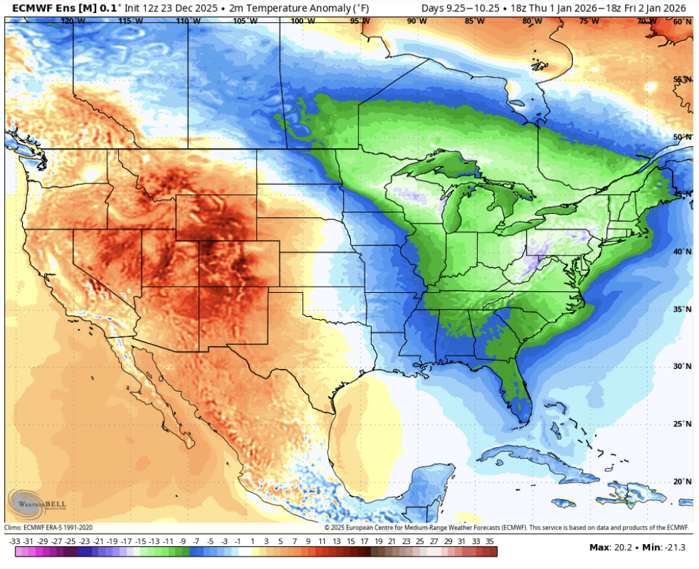
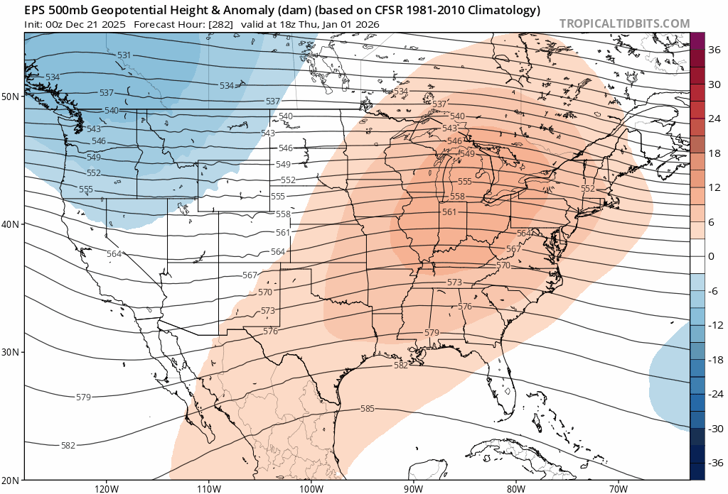
That cold shot around New Year's Day has trended quite cold from the torch it was maybe four days ago. EPS averages 10-15F below average during this time frame for much of the East Coast.

-
That cold shot around New Year's Day has trended quite cold from the torch it was maybe four days ago. EPS averages 10-15F below average during this time frame for much of the East Coast.


-
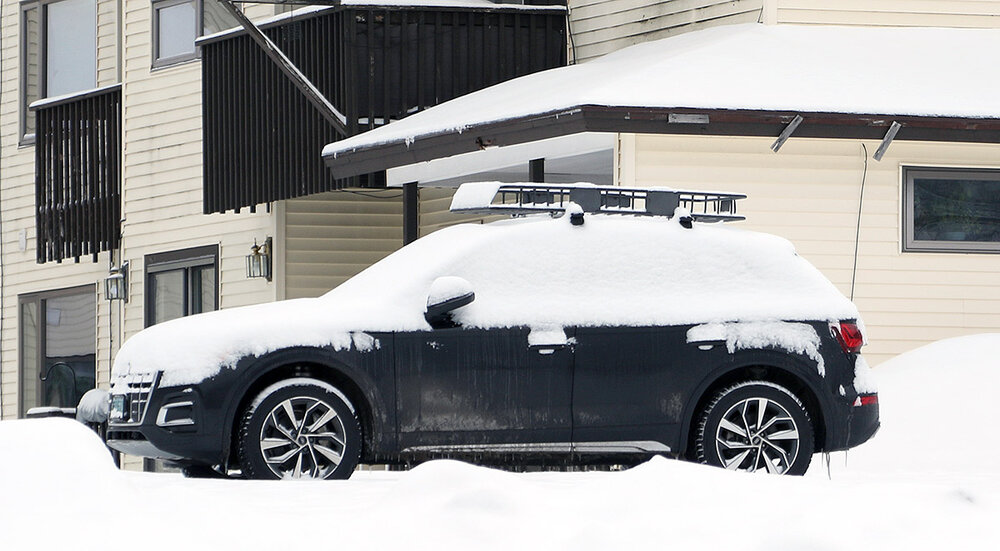
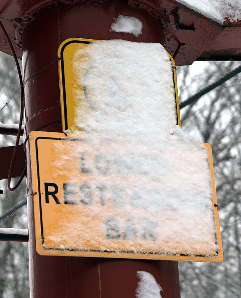
about 1.75" of dense pack.
-
2025-2026 ENSO
so_whats_happening replied to 40/70 Benchmark's topic in Weather Forecasting and Discussion
I believe a +EAMT should help in maintaining the ridge in the strat and maybe inject a bit of warming aloft. If this is the case I would watch a we go into the first two weeks of January what stirs up. Also hoping we can maintain the -NAO a bit longer to finally put the nail in the coffin. -
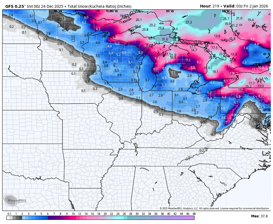
Bring that gfs a little southeast. No jackpot=bust JK good run 5-10”+
-
2025-2026 ENSO
so_whats_happening replied to 40/70 Benchmark's topic in Weather Forecasting and Discussion
You can have 2 scenarios that occur. We tend to want the top-down approach for SSWs but bottom up can still be impactful for us. The issue tends to be on top-down it can start to enhance the type of pattern we want (not always of course) with blocking and many times a very wintry time period. The bottom up approach tends to mean the troposphere is experiencing the perfect conditions but things can go awry and do not tend to last as long. Over the years watching while it is nice we do focus on the 10hPa layer I tend to think we should also be focusing on 50-100hPa layers in these displacement events to give us a better understanding of how patterns shake out. This was a wind reversal in the technical sense but was a large wave 1 process that took place with actually limited warming. I think the warming is very important in conjunction with wind reversals as sort of a 1-2 punch. The Atlantic just would not cooperate with us this go around hence the lack of a wave 2 response after the displacement. The Atlantic only just started working for us in allowing, in the last about 2 weeks, this -NAO pattern to set up. If we had the stout ridge from the wave 1 process still around from early in December we would have certainly entertained the idea of a split as we finish out the month. Also don't worry many of us are still trying to better understand the connection the processes have, even myself after many years of looking over the data..thumb.gif.aa28cd3e3a18aaba3b27e364cdf6016f.gif)
-
It never happens actually.
-

26th-27th event, coming at us like a wounded duck.
H2Otown_WX replied to Go Kart Mozart's topic in New England
Don't underestimate the power of blocking. Learned that one the hard way 16 years ago. -
The question now is after like 1/4 do we see a 7-10 day reset again or will models again be wrong
-

26th-27th event, coming at us like a wounded duck.
The 4 Seasons replied to Go Kart Mozart's topic in New England
00Z GFS had a nice bump NE. -

White Christmas Miracle? December 23-24th
NW_of_GYX replied to Baroclinic Zone's topic in New England
Radar looks great by you, 4” here, hoping for a klew jack, how often does that happen!? -
I'm listening (though I'm 10 miles north now)
-
Brrr
-
Reminds me of the Dec 2020 system somewhat. It won't be that intensity but it'll come down to it comes in like a wall or shredded. Feb's SWFE came in more like a wall and we had 4-6" for almost all. Dec 2020 came in shredded and it was still a very nice event here, but it was 8" vs 12+ because the shredded up precip shield allowed the warm mid level air to take over. We need this blocking to happen.
-
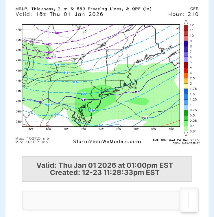
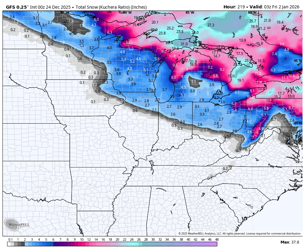
Gfs for NYD
-
A bit soon for a lock which is worrying. We got 8 more cycles to go for that. Might wobble some and expect it, so we will need to come back to ourselves and not get overly concerned. We don’t want big moves, thats for sure.
-

Winter 2025-26 Medium/Long Range Discussion
migratingwx replied to michsnowfreak's topic in Lakes/Ohio Valley
Well, this is an interesting development.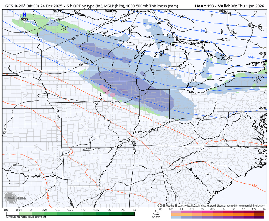
-
When the irresistible force meets the immovable object, someone could wind up under a death band even if the shortwave is a little sheared. Fun to track.
-
2025-2026 ENSO
so_whats_happening replied to 40/70 Benchmark's topic in Weather Forecasting and Discussion
Here is the latest subsurface from November to present. The wind anomalies have all but halted but things are primed if we get another solid weakening event of trades. Right now we are just maintaining the Nina SST profile. I will say it is fascinating to see how active the sun has been going into winter and us getting a pronounced -NAO periods showing up now multiple times..thumb.gif.2f198aeff236b0d0767d2751f47b4a8d.gif)


.gif.68e8ac736b9ea384d65b607322f40c68.gif)


.gif.67489d4eb9462e976c7ac38b7e4a1995.gif)
