All Activity
- Past hour
-

December 2025 regional war/obs/disco thread
Torch Tiger replied to Torch Tiger's topic in New England
AI bros ftw -
Beautiful state in any season. I grew up about 25 miles north of WV in SE Ohio
-
December 2025 regional war/obs/disco thread
Torch Tiger replied to Torch Tiger's topic in New England
It says on the caption it's ai generated lol -
Yeah, that tipped me off too. I don’t know what’s going on there, but that’s not Portland the other day.
-
At 8:30 it was raining in Holland and transitioned to snow around Zeeland with white roads by the time I got to Hudsonville.
-
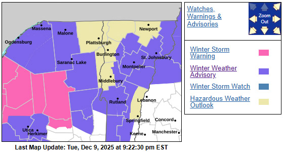
Schools already closing in anticipation for this event
-
Let’s just get rid of PA and turn it into a Great Lake.
-
That's not Portland, Plate on that vehicle is not from Maine, Neither are those vehicles.
-
Probably no more CAD events, but lot more lake effect bands, light events that get chewed up etc.
-
Looks fake
-
Lol. I was just sitting here wondering what our weather would be like if the mountains weren't there...
-

December 2025 regional war/obs/disco thread
moneypitmike replied to Torch Tiger's topic in New England
In case this wasn’t posted earluer, just came across this on Facebook. Flash freeze Monday morning down in portland. https://www.facebook.com/share/r/1BNYbj1hgA/?mibextid=wwXIfr -
I vote we blow up the mountains.
-
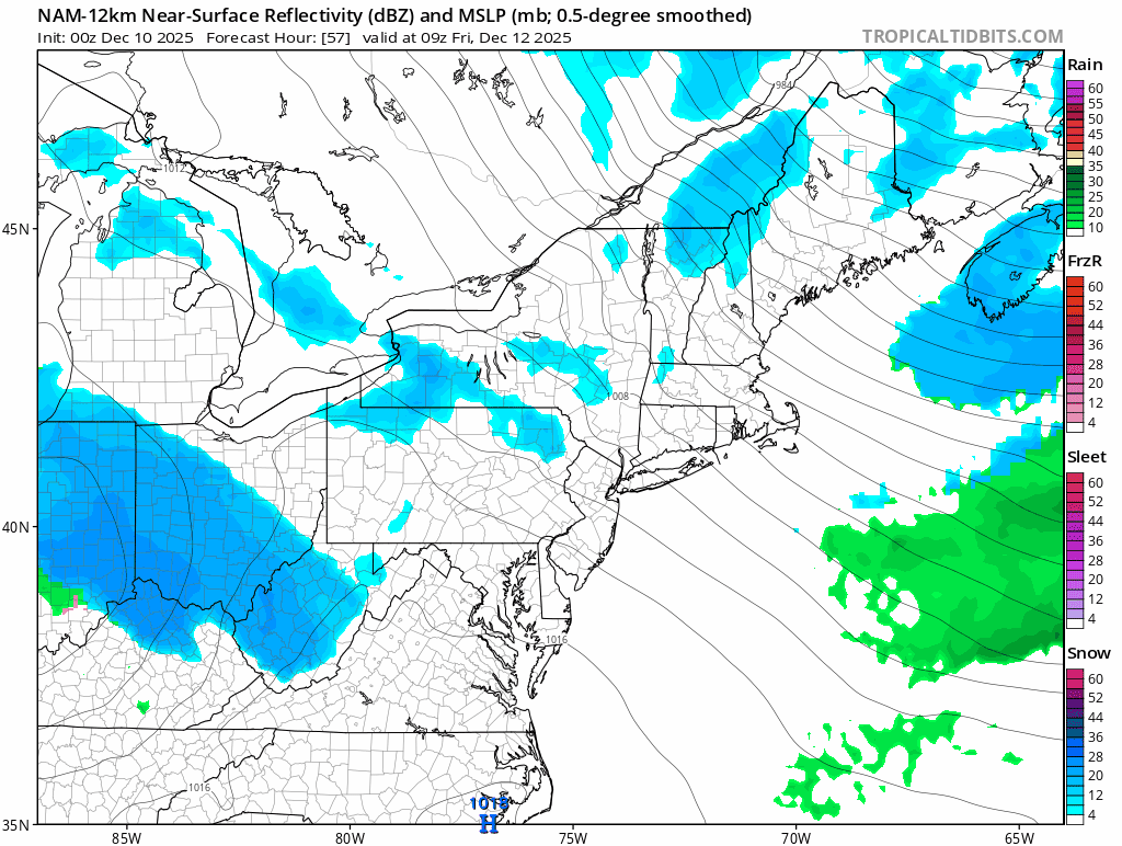
Despite the change on the 18Z runs the ingredients for this are still in no man’s land. This was stated by someone on the SNE forum too. I think this will change about two times over in the next 36-48 hours. There is even a risk for this thing to be a rainer honestly given the setup but I’d still lean towards a miss being the more likely fail
-
Ehhh just draw a second line on your Covid test and c'mon out.
-
Nam holds together a little better but loses alot of juice coming over the mountains. Hopefully we can beef this thing up a bit.

-
PWM with a -11.1°F departure is impressive for early december.
-
-
Net positive up there for you.
-
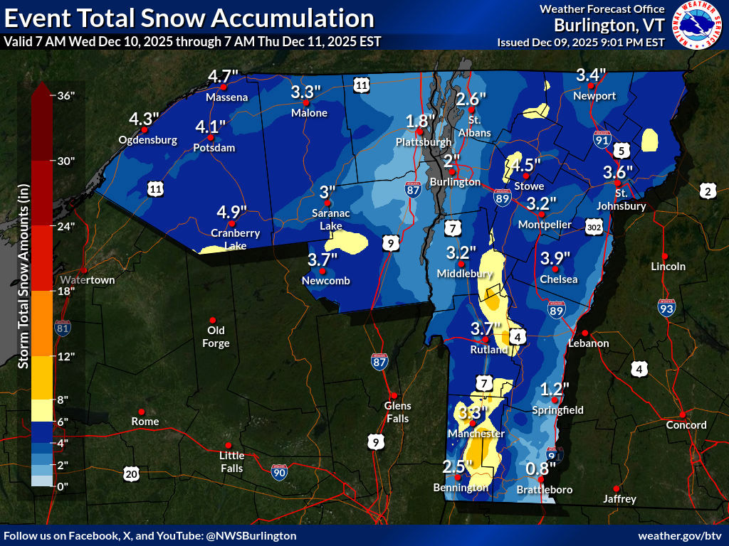
It looks like the Winter Weather Advisories in this area start up at 7:00 A.M. tomorrow, and the forecast here in the valley suggests accumulations in the 3-6” range. That seems to line up well with the BTV NWS Event Total Snow Accumulation map through Thursday morning. The forecast also calls for a few inches of snow beyond that period, which is probably covered in the longer period map that mreaves posted.
-
We live in the mid Atlantic. We all know we won’t see wall to wall cold from November onward. But there has also been a very clear pattern over the past few months of models vastly overdoing long range warmups. Modeled warm ups end up being either muted or are not occurring. We will 100% see periods of warmer weather in a niña, but I’m gonna take the under on it being 70+ on Christmas. This winter is different than the previous few in that there’s a ton of cold air nearby in Canada with a healthy snowpack to our north. Even the more relaxed zonal flow some models are hinting at in a few weeks shouldn’t be torchy. May end up just having normal temps. 70+? Call me skeptical. There will likely be a reload of the pattern around Christmas. It will probably hit 50+ some days. But idk about 70+ or this winter being over after December like some are suggesting
-

December 2025 regional war/obs/disco thread
Cyclone-68 replied to Torch Tiger's topic in New England
Let he who hath without snow cast the first snowball -
Haven't seen him since he was 5 posted
-

December 2025 regional war/obs/disco thread
Typhoon Tip replied to Torch Tiger's topic in New England
Maybe the inevitable bump north will for once help the cause -
He's Santa now


.thumb.JPG.418e8a9a2902ae687ec35ff4bc0e038e.JPG)