All Activity
- Past hour
-

2025-2026 ENSO
40/70 Benchmark replied to 40/70 Benchmark's topic in Weather Forecasting and Discussion
Take a look at July...it was much worse. Warm subsurface all beneath region 3.4. -
2025-2026 ENSO
40/70 Benchmark replied to 40/70 Benchmark's topic in Weather Forecasting and Discussion
Looking at this more, the subsurface has been beaten back in region 3.4 relative to where it was in September, but it's really a push from August....looks very similar to August. I don't think a collapse is imminent, but like I said...this does seem to validate JAMESTEC maintaining and east based event. I have been touting 2021-2022, 2017-2018 and 1995-1996 as EMI analogs since early last summer. This subsurface look is about according to plan if you ask me. -
Both the 12z CMC and Euro have some iteration of this boomerang effect where a tropical system gets caught in a strong cold front, gets pulled northeast, and becomes a monster of sorts.
-

E PA/NJ/DE Autumn 2025 Obs/Discussion
Albedoman replied to PhiEaglesfan712's topic in Philadelphia Region
All I know is this scenario model run better not happen. After looking at the CMC noon run, this would make Sandy look like a baby. With all of the dead ash trees in Eastern PA now and especially in the LV and urbanized and major riverine flooding, this would be a one hell of a disaster for our area. I would see unbelievable debris dams in the waterways from these fallen limbs and trees that would wipe out major bridges in our area. The power outages would be unmanageable and you will not find a generator in stock for 250 miles from our region. The fact this scenario is already showing up for one week away warrants further discussion by all pro's. Even a slight hit would be a huge concern. There will nothing left at the NJ beaches for next year beaachgoers and NYC will get one hell of test of its new subway drainage pumping system. Definitely will keep an eye on these model runs as the media and so-called internet weather gurus on facebook/youtube will play this up real good in the next few days if the the model runs continue to show this tonight and tomorrow. Can you say Panic? -
Interestingly, long range operational models are flirting with entraining a tropical system into an eastern trough around or just after Halloween. That is not without precedent during that time of year.
-
 Yes I see this new intensity forecast so I will edit the potential scoring to provide a look at possible 4 major outcomes too.
 -

Central PA Fall Discussions and Obs
WmsptWx replied to ChescoWx's topic in Upstate New York/Pennsylvania
Agreed. Had my wisdom teeth removed there. -

Spooky Season (October Disco Thread)
WxWatcher007 replied to Prismshine Productions's topic in New England
If the EPS is right, we're squarely in the ballpark for some sort of hybrid or "TC guts" as Tip puts it. But what happens in the Caribbean has a huge impact on whether this is kicked or captured in some fashion, and that is a legitimate unknown right now. Location and speed will matter. There's going to be a lot of uncertainty in the coming days--more than usual, but it's hard to look at the EPS and GDMI and not be modestly intrigued. Again, pure tropical is a pipe dream IMO. If people are expecting that, close the shades. If we're talking hybrid though, nobody needs the center riding over their head for a highly impactful storm in New England or Atlantic Canada. A C3 or C4 wrapping into a substantial trough in the east would do, even if it's just off the coast (though if it's captured it'll come NW/NNW).
-

Central PA Fall Discussions and Obs
canderson replied to ChescoWx's topic in Upstate New York/Pennsylvania
Woods and Meyers - can recommend for personal and my wife reasons. - Today
-

Spooky Season (October Disco Thread)
WinterWolf replied to Prismshine Productions's topic in New England
By tomorrow it’ll be congrats Spain. -
Central PA Fall Discussions and Obs
canderson replied to ChescoWx's topic in Upstate New York/Pennsylvania
Ouch - had a girl that used teeth once. Yikes -
We are once again dog parents. Say hello to Bella. She is a 4 yo beagle. Her previous owner od’d though all appearances are that she had been treated well. Norman seems to be adjusting ok. He did puff up his tail but there has been no altercation yet.

-

Spooky Season (October Disco Thread)
Damage In Tolland replied to Prismshine Productions's topic in New England
It actually is a great pattern to get one. Deep trough and a big block -
.thumb.png.4150b06c63a21f61052e47a612bf1818.png)
Spooky Season (October Disco Thread)
HIPPYVALLEY replied to Prismshine Productions's topic in New England
I mean it’s a hobby so it’s fun to chase ghosts but really isn’t a great pattern to get a hurricane into New England. A Cape Cod fringe or Nova Scotia special is possible I guess. -
Yep
-
Use ignore and act like adults. There’s no obligation to respond back to garbage/insults. Use the report button. Life happens and mods don’t monitor this place every second. When it gets absurd here and I’m around I delete posts but I’m not here much during the boring as hell weather periods we have more and more of. Life takes priority over babysitting adults acting like 5 year olds.
-
An AO+/PNA- blocking regime has developed. As a result, an extended period of cooler than normal weather lies ahead. Highs tomorrow will top out in the upper 50s tomorrow and Friday. It will then turn even cooler during the weekend. Temperatures will reach the lower and middle 50s. The unseasonably cool weather will continue into at least early next week. There is a possibility that the closing days of October into the opening days of November could experience a significant rain event. The ENSO Region 1+2 anomaly was -0.4°C and the Region 3.4 anomaly was -0.6°C for the week centered around October 15. For the past six weeks, the ENSO Region 1+2 anomaly has averaged -0.15°C and the ENSO Region 3.4 anomaly has averaged -0.47°C. La Niña conditions will likely continue through mid-winter. The SOI was +15.73 today. The preliminary Arctic Oscillation (AO) was -0.694 today. Based on sensitivity analysis applied to the latest guidance, there is an implied 51% probability that New York City will have a warmer than normal October (1991-2020 normal). October will likely finish with a mean temperature near 58.0° (0.1° above normal). Supplemental Information: The projected mean would be 1.1° above the 1981-2010 normal monthly value.
-
Would have been prolific for inland snow amounts, I think this is probably one of our all time inland lake effect rain events ever. Got two inches in my gauge already.
-
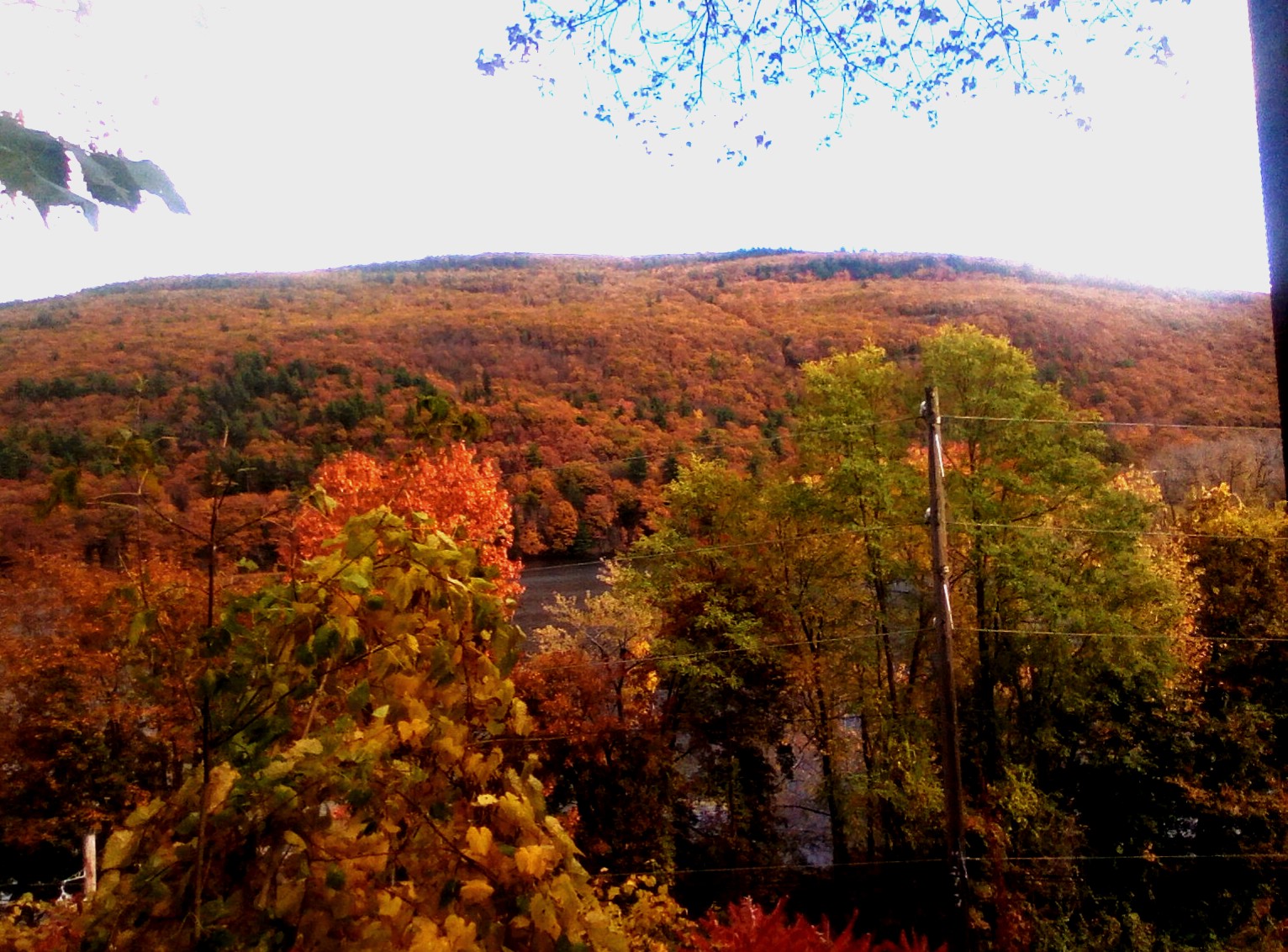
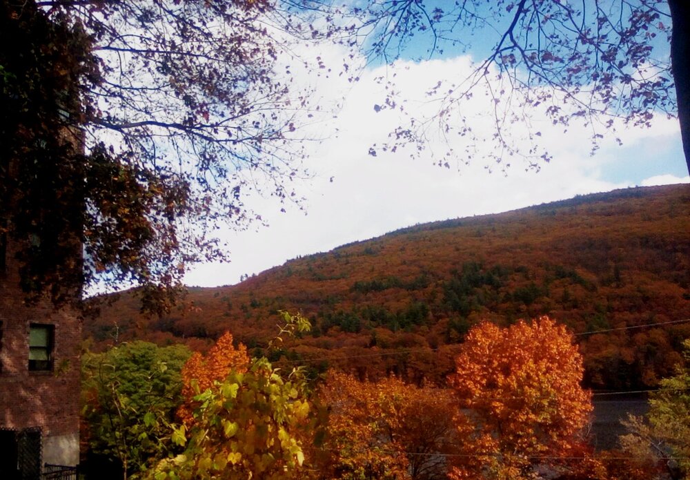
We have achieved peak color!


-
Model's are only as good as they're programmed and what's ingested into them. Probably either broadbrushes your area or the Data ingested is from Station's such as Lafollette ; warmer Locations. So, the Model's reflects that for your area. That's my Guess. Same way they are here. Pennington gap and the County Airport 7 Miles SW of Jonesville are the " official" Station's. They are warmer than most of the County.
-

Spooky Season (October Disco Thread)
Chrisrotary12 replied to Prismshine Productions's topic in New England
Stein continues on the GFS huh? Oh well. -
Spooky Season (October Disco Thread)
Chrisrotary12 replied to Prismshine Productions's topic in New England
Congrats Bermuda. It's always Bermuda. -
None of this is true but ok, it’s insane I’m 5 posted but he just runs around with nonsense… especially since I’ve been around since the 2000s but whatever
-
It's not that big of a deal. This forum isn't someone's personal curated playlist. @LibertyBell should definitely use the multiquote feature though lol
- Yesterday
-
Yeah, probably a couple feet in some spots. A promising sign of how primed the lake is again this season.