All Activity
- Past hour
-
 more like way, way north
 -
.thumb.gif.f92b16c631a1d15d405ed77b33f0710d.gif) yeah, forget it. any convection way way west
yeah, forget it. any convection way way west -
with the Central ridge being modeled more and more west, we may Stein for several weeks!
-
About to drink a 90 Min IPA
-
We are going to get skunked next week ughhhhhh
-
https://www.spc.noaa.gov/products/outlook/archive/2026/day1otlk_20260710_1300.html marginal risk issued for the majority of the state of tn just a 5% damaging wind risk for today day 1 https://www.spc.noaa.gov/products/outlook/archive/2026/day2otlk_20260710_0600.html for day 2 slight and marginal risk issued for tn with a cig 1 hatching 5-15% damaging wind risk https://www.spc.noaa.gov/products/outlook/archive/2026/day3otlk_20260710_0730.html day 3 has big marginal risk out for Tennessee with 5% probabilities
-
Anything for the hangover?
-
 What a great cool north wind. COC day at Pit2.
 -
the repair was a combo of crazy glue for skin and stiches
-
dry front about to slide through. Stein slider
-
 He’ll be on his 4th wife by Thanksgiving.
 -
Looked like we were finally going to get an actual sunny day, but here come the clouds again. Sigh.
-
 Crappy? There's some overcast but the temps are warm and the winds are light... What's the issue?
 -
 Hit 86/75 earlier, now 82/72 - summery despite the clouds
 -
@Mrs.Jsorry i missed this.. didn't see the edit you made to your reply. @CAPEis right, CHSP is great, and Lewes has an expanding eatery and brewery scene. Can you tell me more of what you might look to do? Rehoboth does have a lot to offer, but it will be crowded. Other things nearby, if you don't mind mini road trips.
-
 It's actually quite nice out. Clouds are keeping relatively cool.
 -
It will be interesting to see which model wins the heat battle this time, last heatwave it was the Euro lower on temps. This time the Euro is going nuts and the GFS is subdued.
-
I think any new gas station or existing gas station that does a renovation is required to install a generator, to alleviate any gas runs.
-

Mid-Long Range Discussion 2026
WinstonSalemArlington replied to BooneWX's topic in Southeastern States
This just in… -
That was mandated down here.
-
Mid-Long Range Discussion 2026
WinstonSalemArlington replied to BooneWX's topic in Southeastern States
July 25 -

2026-2027 Super El Nino
GaWx replied to Stormchaserchuck1's topic in Weather Forecasting and Discussion
Thanks, Adam. So, Long Paddock after ~a week finally came back to updating its daily SOIs. This is what I earlier posted about this: In doing so, it also retroactively changed some dailies prior to July 3rd. What’s most interesting is that those changes changed what had been 2 small positives to negatives: June 18th/19th changed from +4/+1 to -4/-4. Based on the original June 18th release of +4, a 37 day -SOI streak had apparently ended June 18th. However, with these changes, it didn’t and thus we’re in a very long -SOI streak that’s now at a whopping 62 days and is still going strong! How does this compare to the longest back to 1991? -100 days in 1998 -72 days in 1997 -66 days in 2015 -65 days in 2023 -62 days and counting 2026 -
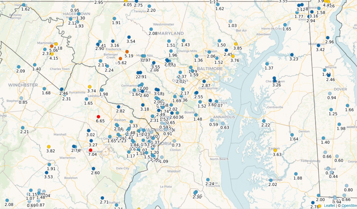
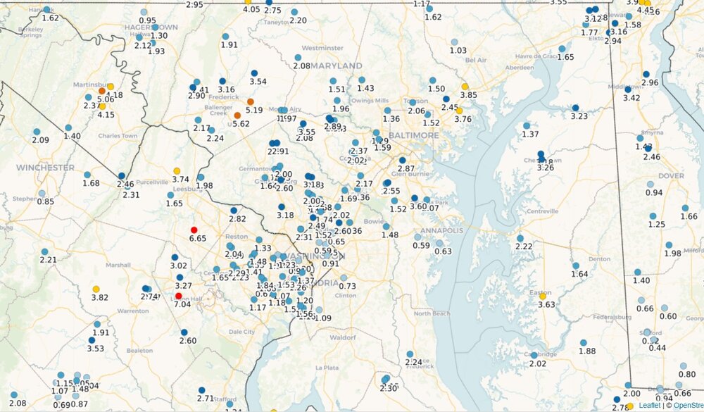
Rainfall over the last week. A lot of us in the 1-2.5" range, with some big winners near Frederick, Manassas, Dulles, and Martinsburg. As has been tradition this year, DC itself, southern DE, and Stephens City did poorly. Airport totals continue to diverge (year-to-date total, departure): DCA: 14.71", -6.94" IAD: 21.95", -0.81" BWI: 18.45", -3.94"
- Today
-
 Cold front of yore…err bore…coming through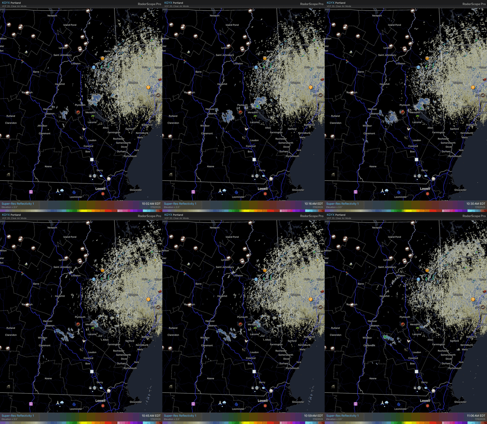
-
Looking like Sunday and Monday a lot if us will be in the 80s. Unless.....the expected happens and the "increased chance of showers and thunderstorms" disappears again. A least a small reprieve.