All Activity
- Past hour
-
The GFS seems to be pretty insistent that something might pop and at least get close to the CONUS before a recurve.
-
The GFS has been pretty insistent something develops and heads at least in the general direction of the CONUS. We'll see.
-
 Got a nice drink (2"+) from Arthur with little wind. 200 miles east, Public Lands' Cutler tract had lots of trees flattened. Had 0.09" overnight, event total 0.16". From Tuesday thru yesterday, each subsequent QPF was lower than the previous one, finally fixing on <0.1" for both yesterday and last night - both verified.
 -
July 31 1961: Very heavy rain falls at Albert Lea, where 6.7 inches is recorded in 24 hours. For Friday, July 31, 2026 1976 - A stationary thunderstorm produced more than ten inches of rain which funneled into the narrow Thompson River Canyon of northeastern Colorado. A wall of water six to eight feet high wreaked a twenty-five mile path of destruction from Estes Park to Loveland killing 156 persons. The flash flood caught campers, and caused extensive structural and highway damage. Ten miles of U.S. Highway 34 were totally destroyed as the river was twenty feet higher than normal at times. (David Ludlum) (The Weather Channel) 1986 - The temperature at Little Rock, AR, soared to 112 degrees to establish an all-time record high for that location. Morrilton, AR, hit 115 degrees, and daily highs for the month at that location averaged 102 degrees. (The Weather Channel) 1987 - The deadliest tornado in 75 years struck Edmonton, Alberta, killing 26 persons and injuring 200 others. The twister caused more than 75 million dollars damage along its nineteen mile path, leaving 400 families homeless. At the Evergreen Mobile Home Park, up to 200 of the 720 homes were flattened by the tornado. (The National Severe Storms Forecast Center) 1987 - Afternoon highs of 106 degrees at Aberdeen, SD, and 102 degrees at Ottumwa, IA, and Rapid City, SD, established records for the date. It marked the seventh straight day of 100 degree heat for Rapid City. Baltimore, MD, reported a record twenty-two days of 90 degree weather in July. Evening thunderstorms produced golf ball size hail at Lemmon, SD, and wind gusts to 80 mph at Beulah, ND. (The National Weather Summary) (Storm Data) 1988 - Twenty-one cities in the north central U.S. reported record high temperatures for the date, including Sioux City, IA, with a reading of 107 degrees. The reading of 105 degrees at Minneapolis, MN, was their hottest since 1936. Pierre and Chamberlain, SD, with highs of 108 degrees, were just one degree shy of the hot spot in the nation, Palm Springs, CA. (The National Weather Summary) 1989 - Overnight thunderstorms soaked eastern Kansas and western Missouri with heavy rain. Four and a half inches of rain was reported at Nevada, MO. Evening thunderstorms in Oklahoma produced wind gusts to 75 mph at Covington. Six cities in the north central U.S. reported record high temperatures for the date, including Williston, ND, with a reading of 105 degrees. (Storm Data) (The National Weather Summary) Observances: 31 Fri World Ranger Day 31 Fri National Avocado Day 31 Fri National Mutt Day 31 Fri Harry Potter Birthday 31 Fri Lifeguard Appreciation Day 31 Fri National Jump for Jelly Beans Day 31 Fri National Raspberry Cake Day 31 Fri Shredded Wheat Day 31 Fri Uncommon Instrument Awareness Day 31 Fri Hawaii Flag day
-
Rain incoming. Hopefully a soaker this morning.
-
Wow, that's wild.
-
 I'd actually be shocked if the ICON wasn't
 -
 3.18" for the total at CEF.
 -
i love the rain because i am pure of heart and soul
-
Despite a short heat wave near the 4th of July, this month turned out cooler and drier compared to last year at my cooperative observation site (RSTM2). July 2025 - 16, 90 degree days & monthly precip total of 6.5" July 2026 - 10, 90 degree days & monthly precip total of 3.6"
-
 Euro also has something just not as robust.. ICON also faintly seeing it
 -

2026-2027 Super El Nino
LakePaste25 replied to Stormchaserchuck1's topic in Weather Forecasting and Discussion
97-98 was not half bad for the Great Lakes/SNE if i remember correctly. December ‘97 was decent here while it was a total shutout in 2015. -

2026-2027 Super El Nino
GaWx replied to Stormchaserchuck1's topic in Weather Forecasting and Discussion
1. The July SOI comes in way down at -26.8, by far the lowest July SOI on record. The only lower ones during met. summer were the -27.7 in June of 1905 and the -27.0 in June of 1896, both incoming El Niños. 2. This brings us to 82 straight days of -SOI. Going back to when records are readily available (since 1991), this is second only to the 100 days of 1998! It’s too early to tell whether or not the current streak will reach 100 days. -
Hit 59 last night, fall is coming!!
-
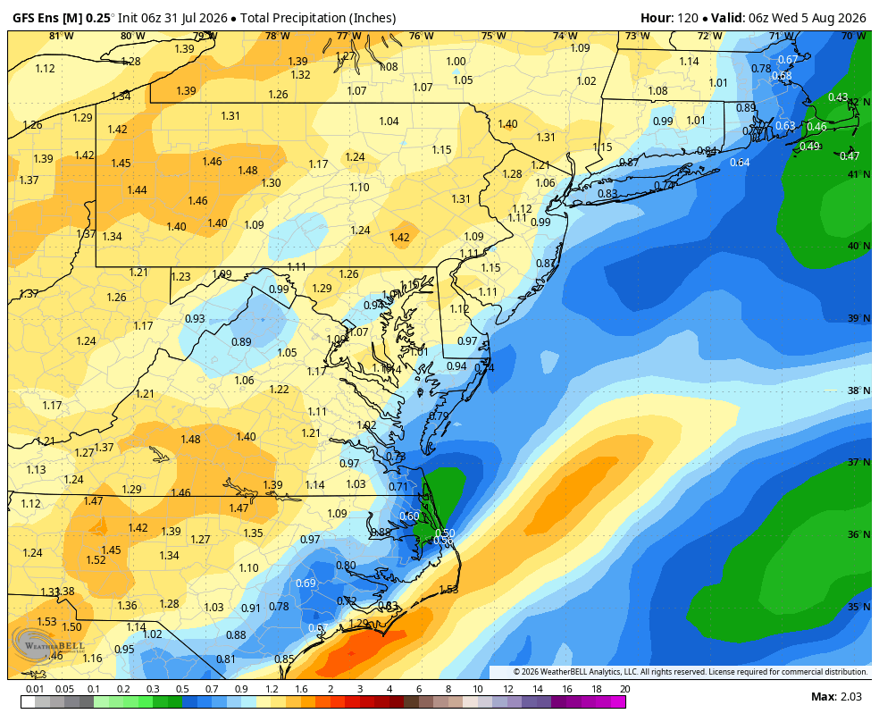
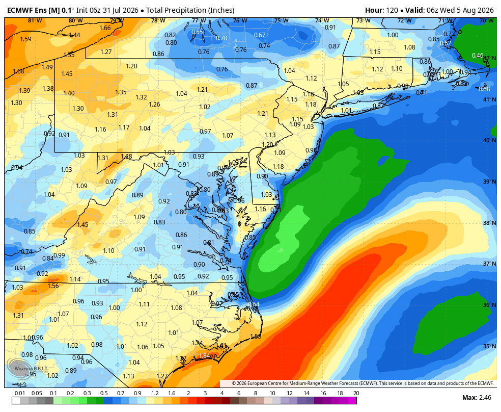
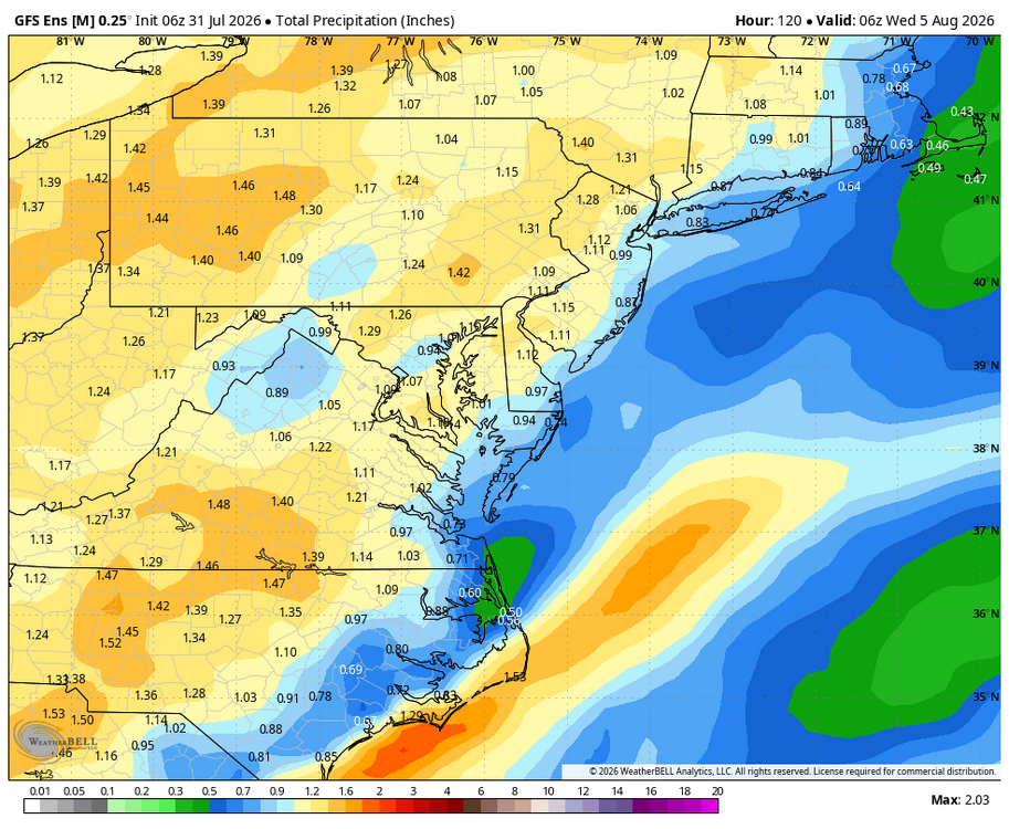
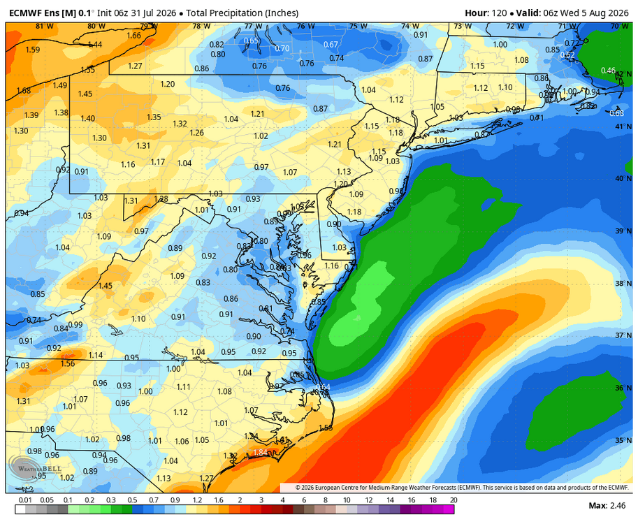
WB 6Z GEFS and EPS thru Day 5. Rain chances moving back in later on Sunday through Tuesday on Eastern shore.
- Today
-
 Viagra without a doctor prescription Canada: sildenafil 50 mg price - Order Viagra 50 mg online
 -
2026-2027 Super El Nino
LakePaste25 replied to Stormchaserchuck1's topic in Weather Forecasting and Discussion
CANSIPS now getting close to a +4C ONI peak… -

2026-2027 Super El Nino
George001 replied to Stormchaserchuck1's topic in Weather Forecasting and Discussion
I buy that for the mid atlantic but even up here? I’m concerned it will be too warm for sustained winter and we aren’t going to get the nickle and dime events we normally get. -
order viagra: MedMenNews - Cheap Viagra 100mg
-
Monday looking rainy
-
Couldn't agree more. Very disruptive and destructive in places.
-
Dewgust 2026: Summer's Last Stand
weatherwiz replied to Prismshine Productions's topic in New England
Pretty classic wet microburst look on soundings if we can get anything to materialize -
51.6 this morning. Depth, orientation and slow movement of ULL over OV in opposition to HP off the coast will determine who gets how much rain from Sunday - Tuesday. We need to start August as a wet month! I have only received 62% of normal for July.
-
After no measurable rain in the last 9 days and the low dews over the last few, the lawn is crunchy. Sprinklers are on full send this morning.
-

Dewgust 2026: Summer's Last Stand
CoastalWx replied to Prismshine Productions's topic in New England
Monday could be interesting. We are juiced to the teets as far as. Moisture goes. If we can get decent shear like gfs has, could be severe in spots. At the least could be prolific rain and maybe decent ltg with those dews.