All Activity
- Past hour
-

Feb 22nd/23rd "There's no way..." Obs Thread
Wetbulbs88 replied to Maestrobjwa's topic in Mid Atlantic
On TT it's showing 4" for DC and Baltimore. QPF pushes 1"+ so that makes no sense. What gives? -

Blizzard of 2026 Storm Thread/OBS
PhilsFanDrew replied to Mikeymac5306's topic in Philadelphia Region
Agreed. I remember even in 2016 with Winter Storm Jonas. Euro was the first to latch on and stuck with the longer range models. GFS and others caved and then about 12-24 hours before all the longer range models had it backing off. NAM held it steady as a huge snow dump, pretty much had the deformation bands verbatim to where they actually setup which caused 3+ inch per hour rates and 24+ inches. While I don't expect the LV to get into 24-30+ inches, I think it's wild to start totals any less than double digits here. I like 15-20 inches for the LV with locally higher amounts. -

Blizzard of 2026 Storm Thread/OBS
CoolHandMike replied to Mikeymac5306's topic in Philadelphia Region
Eh, what is to come shall be what it is. My snowblower batteries are charged, the shovel is at the ready, and I'll be spending tomorrow baking bread, puttering around in my wood shop and anticipating some pretty significant evening snow TV at least. This has been a great winter so far, so anything we get tomorrow/Monday is just icing on the cake for this season imho. I'm looking forward to seeing pics of front yards and decks and yardsticks buried feet-deep. With any luck I'll be able to add to those. -

“Cory’s in NYC! Let’s HECS!” Feb. 22-24 Disco
Henry's Weather replied to TheSnowman's topic in New England
True - hope this stays put -
If I remember correctly, it was never apparent that it would not be happening until the event was in progress. I think they rolled with that forecast all the way through. The sad part is that if the storm even verified halfway, 2000-01 would have been remembered as an all-time great winter, with 50+ inches in NYC and 40+ inches in PHL. Instead, that winter is remember as a bust, and not as fondly as the great winters of 2002-03, 2003-04, and 2004-05 that followed.
-

Pittsburgh/Western PA WINTER ‘25/‘26
Rd9108 replied to Burghblizz's topic in Upstate New York/Pennsylvania
Only counts the same to seasonal total atleast. -

Central PA Winter 25/26 Discussion and Obs
Jns2183 replied to MAG5035's topic in Upstate New York/Pennsylvania
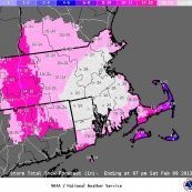
Can't see picture Sent from my SM-S731U using Tapatalk -
So that's where the wxbb veteran uncwethbee got his screen name. 25 years and I never knew that
-
When I made the reservations all I could think of was how pissed I'll be if we have a repeat of March 7 2018 while we're away. Watching on the ring cameras isn't a substitute for being out in it.
-
Yes, March 4-6, 2001
-
Jelly
-

The February 22-23 Late Season Miracle: JV Disco/Banter Thread
nw baltimore wx replied to bncho's topic in Mid Atlantic
We need a cat on that window sill! -
Man, how envious am I of you guys. What a season so far.
-
When the rain is changing to snow. Get headphones and blast every track that reminds you of past snowstorms. Watch the dendrites blow right past the streetlights!
-

Central PA Winter 25/26 Discussion and Obs
MAG5035 replied to MAG5035's topic in Upstate New York/Pennsylvania
CTP’s sending it, remaining watch area to warnings and a few extra north central counties in it as well. 4-9” . -
The February 22-23 Late Season Miracle: JV Disco/Banter Thread
nw baltimore wx replied to bncho's topic in Mid Atlantic
I abhor whining posts, and we've got a few that are so good at it. -
If only we had the mesoscale models back then
-

“Cory’s in NYC! Let’s HECS!” Feb. 22-24 Disco
OrangeCTWX replied to TheSnowman's topic in New England
Didn’t realize the mean on the SREF plumes for KBDR was 20 inches. That wild, I don’t recall it ever being that high for a mean lol -

The February 22-23 Late Season Miracle: JV Disco/Banter Thread
Wxtrix replied to bncho's topic in Mid Atlantic
-

2025-2026 Fall/Winter Mountain Thread
Daniel Boone replied to Buckethead's topic in Southeastern States
GFS backed off quite a bit from what it had been showing,here as well as the MA. I think you're pretty spot in with that call up high in favored Locations. -
The February 22-23 Late Season Miracle: JV Disco/Banter Thread
nw baltimore wx replied to bncho's topic in Mid Atlantic
I'd love a blizzard, but I'd be very happy with 6 hours tomorrow evening of below freezing temps, moderate snow, and lots of wind. If I end up with six or more inches of snow, I'd be thrilled. -
Gonna be about 6am Eastern Standard Time. It's gonna form more souther!
-
That was the early March 2001 one where there were TWC maps with 3 ft in these parts, right? That was astounding and might as well have said 8 ft. How close to the expected start time did it become apparent that it would not be happening? Also, wasn't that another case where it was on the radar a week or six days out, then the models lost it, then it was back on the radar 4 days out but in a somewhat different form? Lastly, that was 25 years ago next week. Good God.
-
Tex Antoine was a beloved New York City TV weatherman from the 1950s to 1970s, famous for drawing weather maps live with his cartoon sidekick Uncle Wethbee.[wikipedia]
-

The February 22-23 Late Season Miracle: JV Disco/Banter Thread
Kay replied to bncho's topic in Mid Atlantic
No, I just looked it up. It's not a euphemism, it's a phased approach. There's still a SOE.