All Activity
- Past hour
-

12/12: The little Friday clipper that could? Or won't.
NorthArlington101 replied to dailylurker's topic in Mid Atlantic
Smith Mountain Lake is the snow capital of the Commonwealth. We've always known it to be true -
Woke up to a nice band, quick inch or so. In a lull right now. Hoping it pukes snow later

-
Bumps the low south between hr 78 and 81 seems odd
-

Central PA Winter 25/26 Discussion and Obs
AccuChris replied to MAG5035's topic in Upstate New York/Pennsylvania
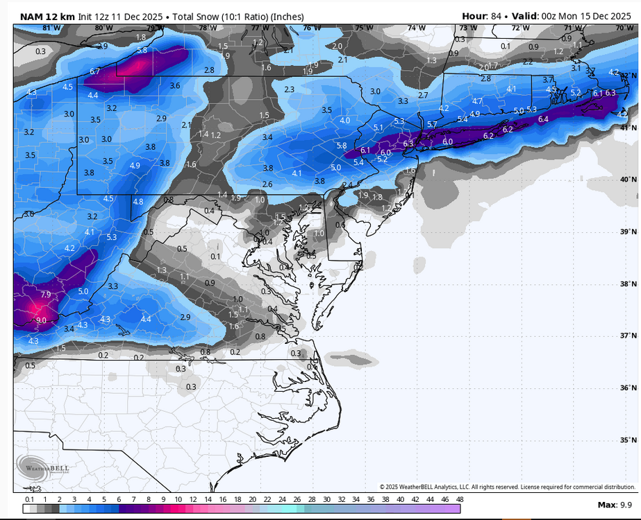
12z NAM shows a nice event Sunday morning . -
Saw some inconsequential flurries in Columbia around 5:30am 12/11/25.
-

12/12: The little Friday clipper that could? Or won't.
Solution Man replied to dailylurker's topic in Mid Atlantic
Some Virginians, that’s the chillville folks you are referring to -
Nice look for SE areas. Even most of E MA gets in on the developing commahead briefly.
-

Minor snow possible sunday 12/14/25
Stormlover74 replied to WeatherGeek2025's topic in New York City Metro
Yeah I'd gladly take that -
Drunk?
-

December 2025 regional war/obs/disco thread
TauntonBlizzard2013 replied to Torch Tiger's topic in New England
It’s definitely better, but still pretty weak. Probably hours of very light snow amount to an inch or two SOP -

December 2025 regional war/obs/disco thread
Damage In Tolland replied to Torch Tiger's topic in New England
This is a 3- 5 deal. Pretty easy and has been -

Minor snow possible sunday 12/14/25
MJO812 replied to WeatherGeek2025's topic in New York City Metro
Good to see it amped -

Minor snow possible sunday 12/14/25
BoulderWX replied to WeatherGeek2025's topic in New York City Metro
nor do I -- just sharing what it showed. I do think 1-3" is on the table for many -
I was about 10 miles to far south to remain all snow here, Needed a bit of elevation for this one.
-
Minor snow possible sunday 12/14/25
BoulderWX replied to WeatherGeek2025's topic in New York City Metro
Ignore; well known troll who is post limited. NAM is 3-5 region wide FWIW -
Minor snow possible sunday 12/14/25
Stormlover74 replied to WeatherGeek2025's topic in New York City Metro
I don't buy it but nam is warning level for parts of the area -
This one just seem like its going to be a bit late rounding the base of the trough as it remains positively tilted to far east which ultimately sends the SLP off the coast ENE under LI.
-
Mostly SOP but like some said before should be a band to the NW
-
(002).thumb.png.6e3d9d46bca5fe41aab7a74871dd8af8.png)
E PA/NJ/DE Winter 2025-26 Obs/Discussion
ChescoWx replied to LVblizzard's topic in Philadelphia Region
-
Yay! I’ll be home Saturday evening just in time for snow at the house
-
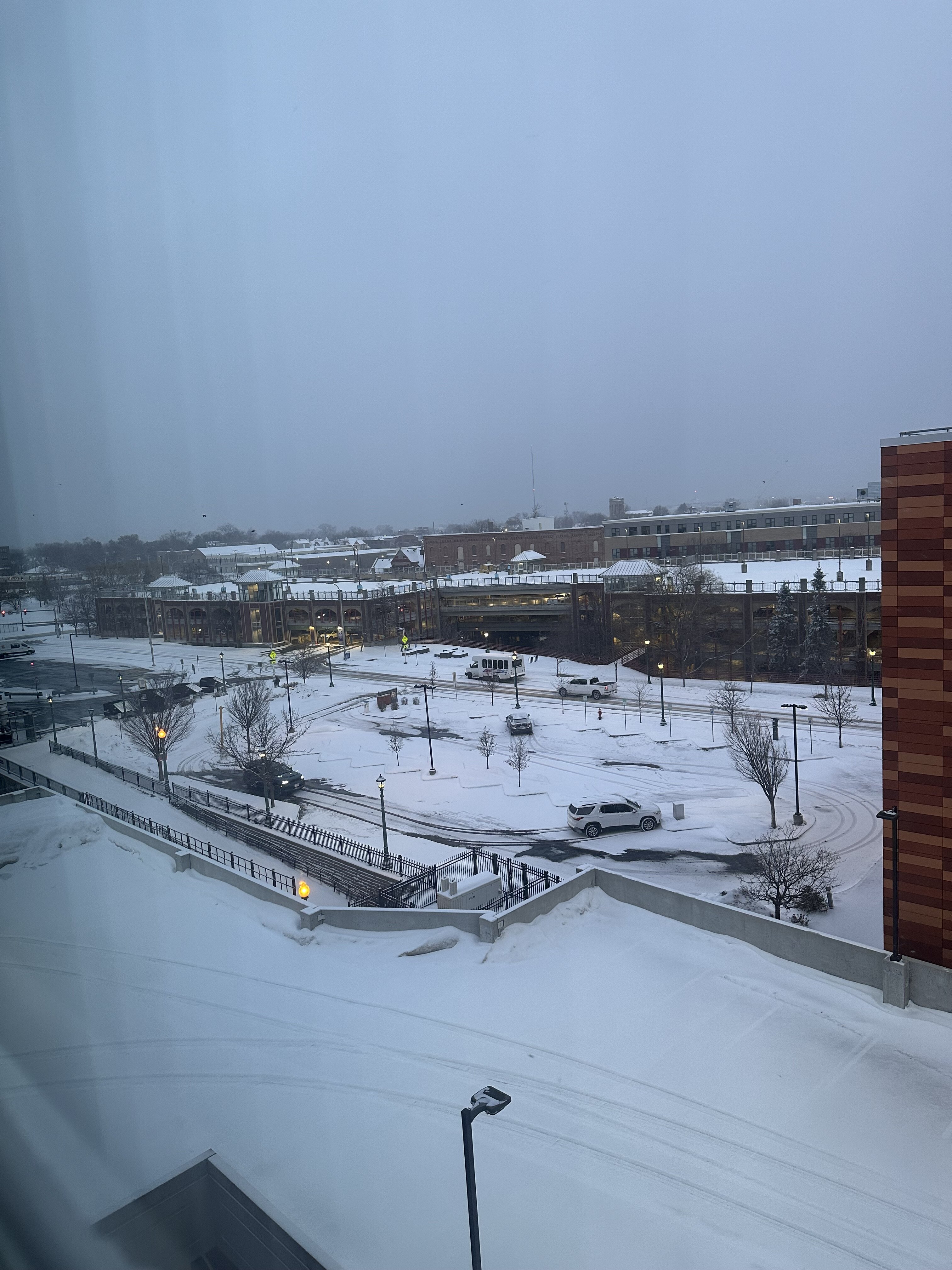
2.5”/0.22” here Just broomed the driveway. Up to 12.8” on the season. 28.0° with a -SHSN right now. It’s been snowing off and on for a few hours.
-
This sounds like your boyfriend.
-
Pretty warm down here. Looks good going up to Boston.
-
12k NAM at range doesn't suck for Sunday. But it's the 12K NAM at range, so...
-

12/14: Sunday funday? Will the south win again?
stormtracker replied to TSSN+'s topic in Mid Atlantic
Yup. I just got off the phone with the storm and it told me it was just out of the shower ready to head on over to us, but then saw the thread and went back to sleep.