All Activity
- Past hour
-
I'll be curious to see wind reports for my area this morning. My PWS doesn't pick up north winds well due to terrain, but it registered 39mph gusts, so I know it was higher than that. And my grill cover got blown off, and it's on quite tight.
-
Nothing can replace the CRAS. CRAS4LYFE
-
-
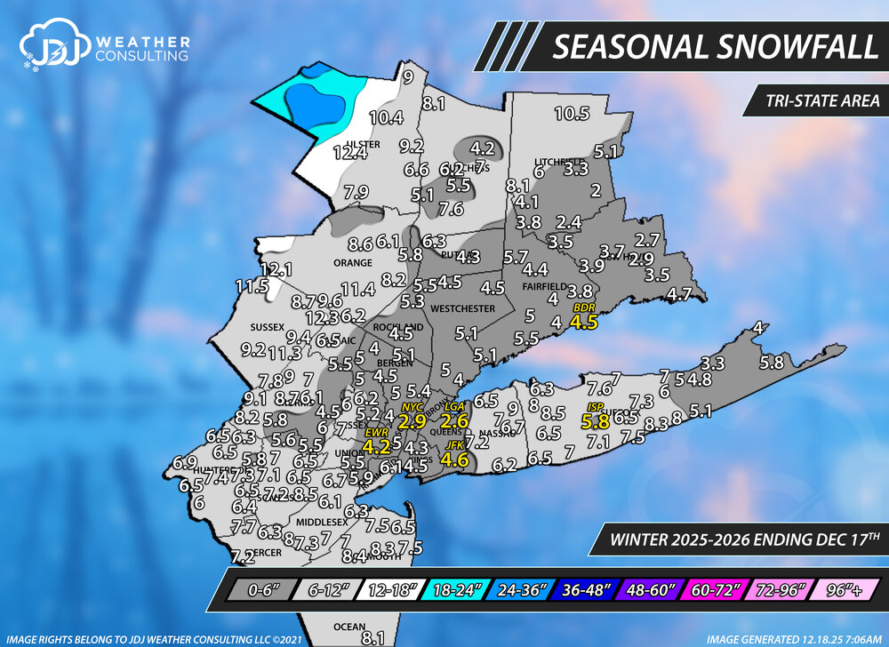
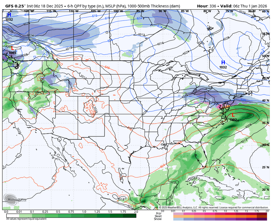
First season to date snowfall maps. This is as of December 17th, 2025. Reports are from cocorahs, COOP, and official climo sites. Contours are based on these reports and NOHRSC Gridded Snowfall Analysis. These are by far the hardest maps to put together so ill be doing them monthly similar to last season.
-
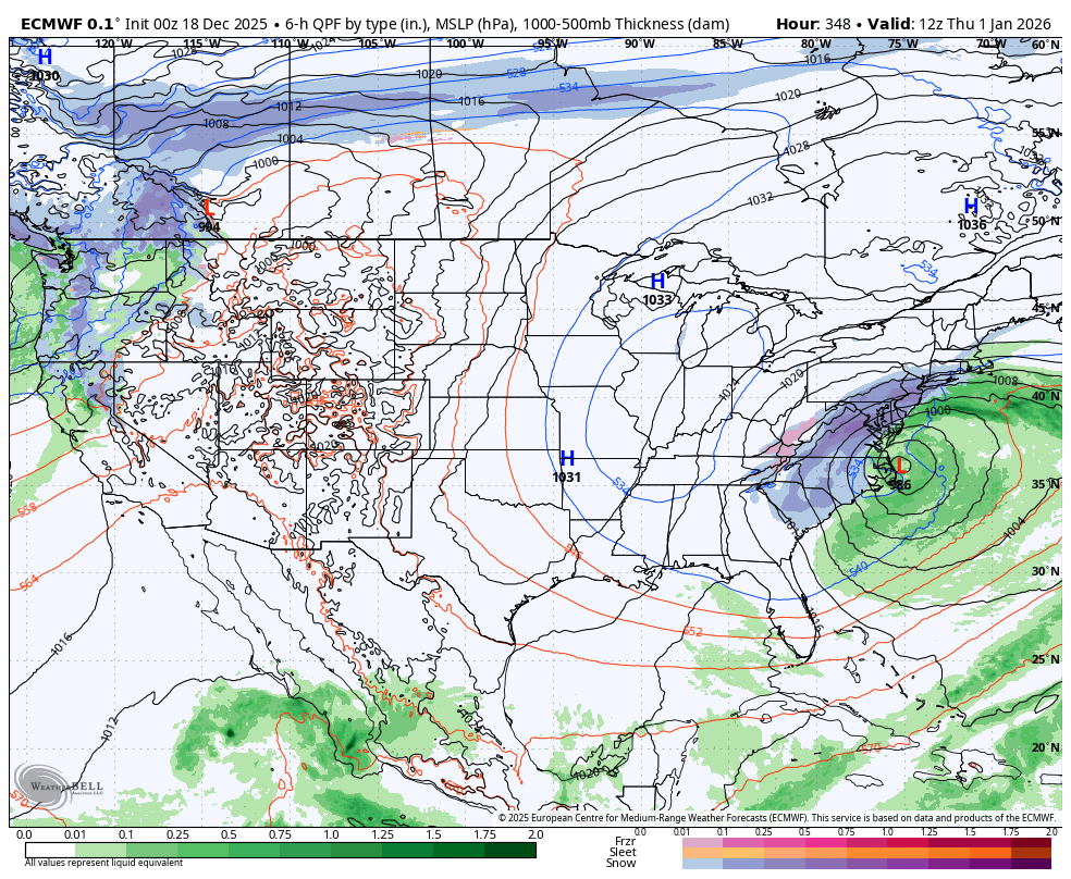
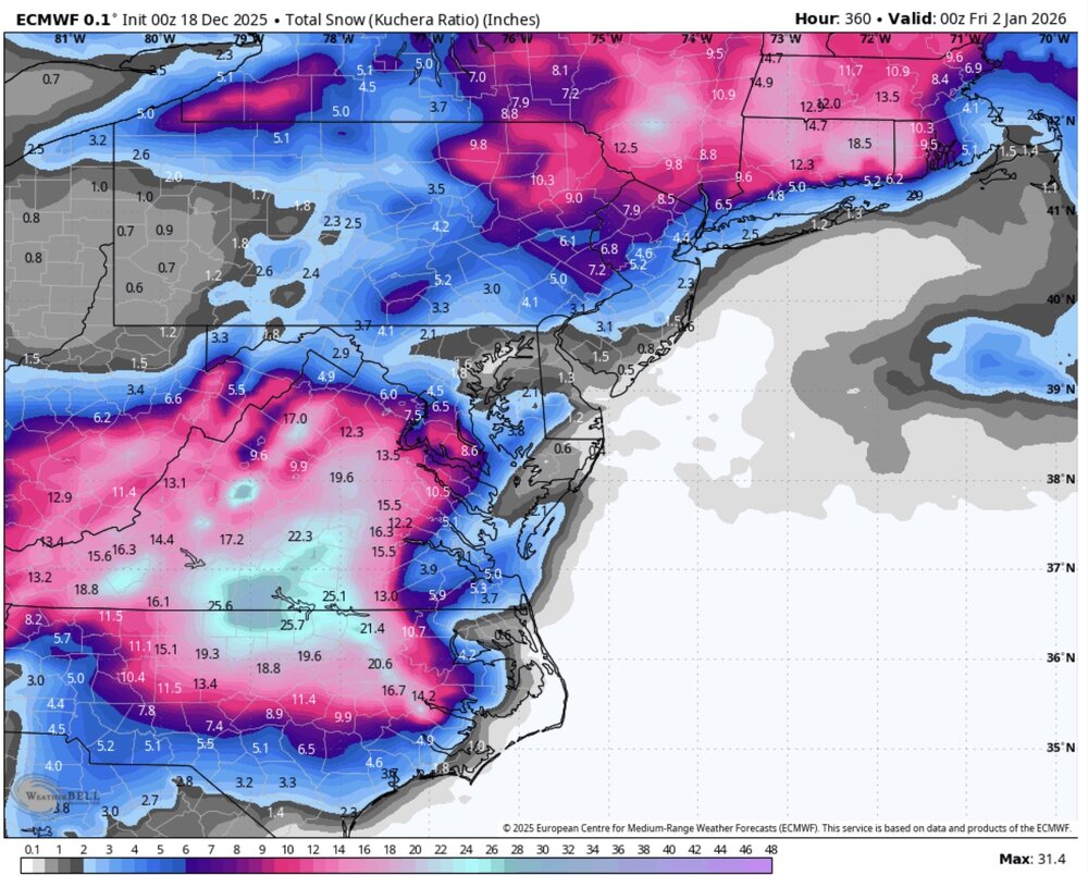
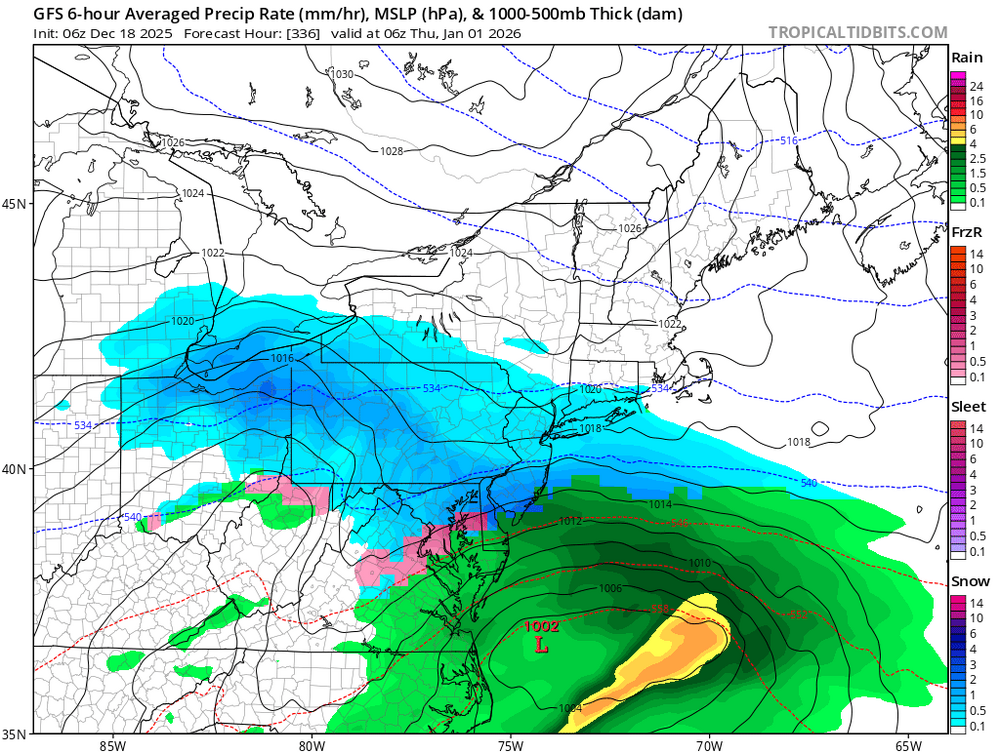
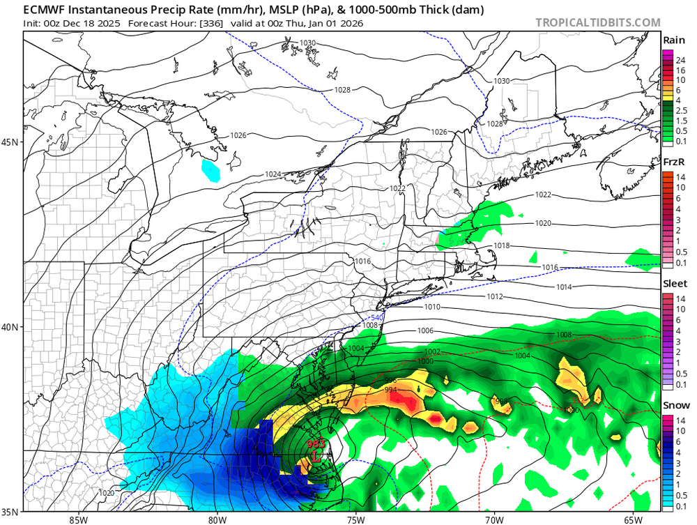
NOT hinting that this will happen, however, the setup COULD yield a storm like this. The storm tries to cut through New England however the blocking forces the storm just south.
-

Central PA Winter 25/26 Discussion and Obs
mahantango#1 replied to MAG5035's topic in Upstate New York/Pennsylvania
18 this morning. -
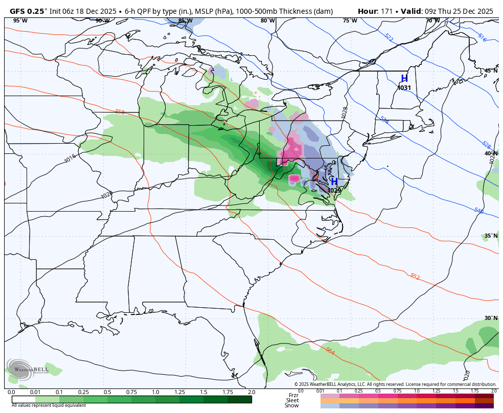
06z euro looks pretty nice for 12/23. A solid 1-3” deal for a lot of folks.
-
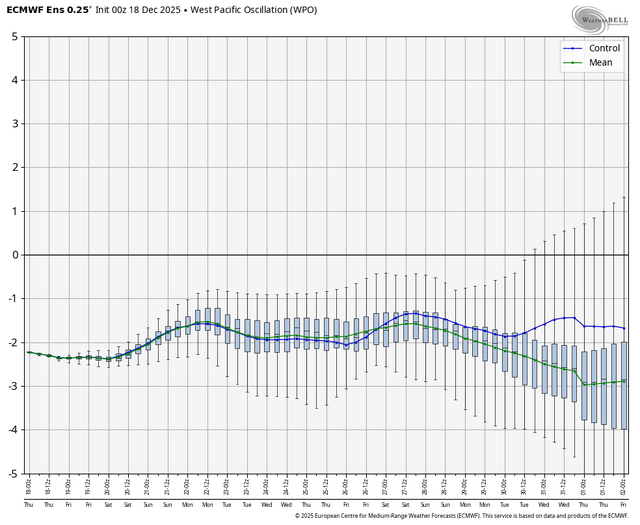
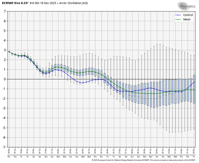
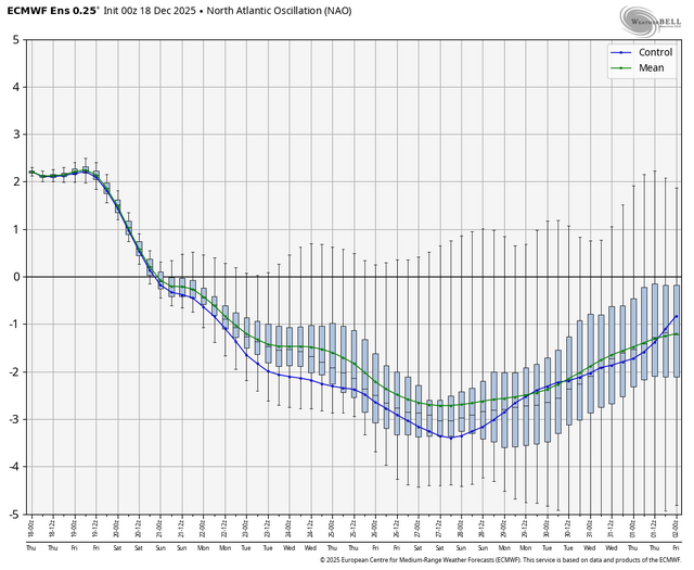
Definitely good trends overnight with a stronger NAO block. The operational models also hint at a coastal, albeit for areas south of us right now.
-
Central PA Winter 25/26 Discussion and Obs
mahantango#1 replied to MAG5035's topic in Upstate New York/Pennsylvania
-

Central PA Winter 25/26 Discussion and Obs
Blizzard of 93 replied to MAG5035's topic in Upstate New York/Pennsylvania
Longer term, the GFS & Euro both are showing the potential of a more significant coastal type of storm towards New Year’s in response to the -NAO blocking pattern that looks to become established the last week of tye month.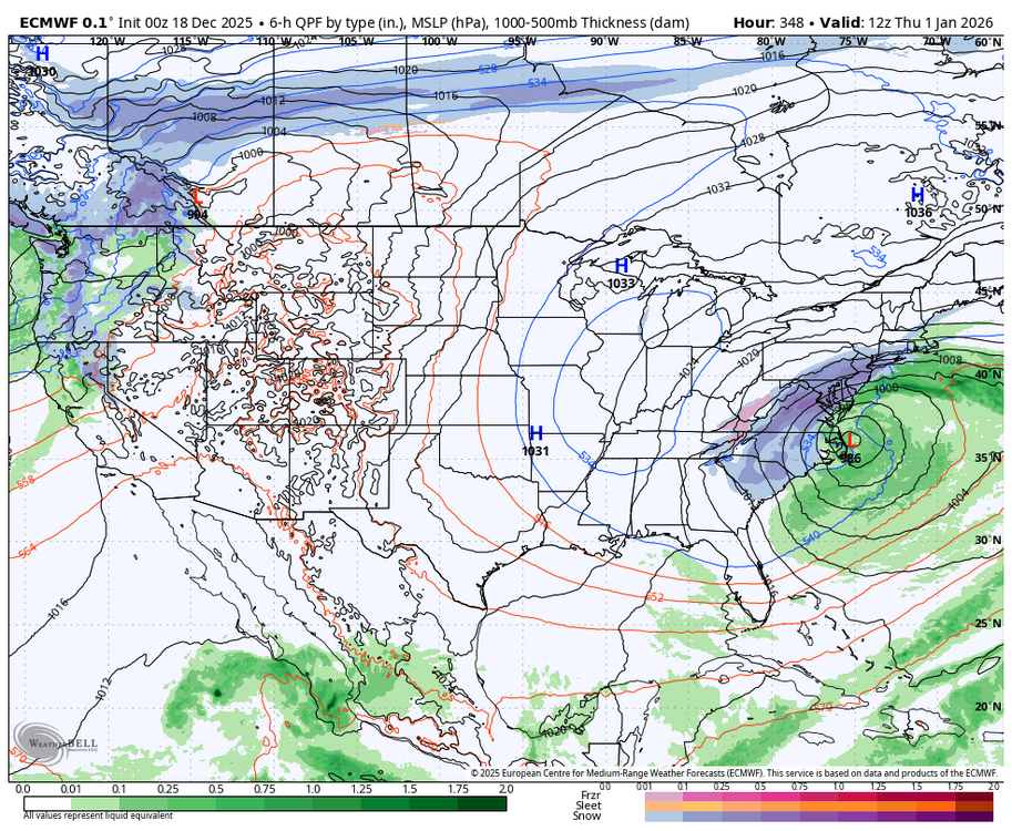
-
Nice
-
Central PA Winter 25/26 Discussion and Obs
Blizzard of 93 replied to MAG5035's topic in Upstate New York/Pennsylvania
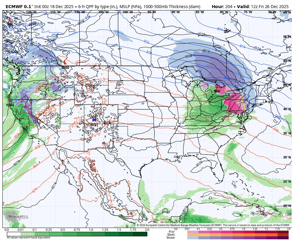
The overnight models are still trying to resolve the potential of a weak wave around Christmas that could deliver a mix for many of us.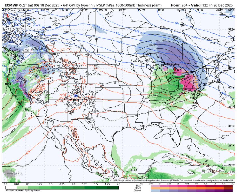
-
Yea this is kinda where I’m at, especially with peak winter climo a few weeks away. NYC metro close enough to watch with keen interest…
-
The cutter will wipe anywhere that doesn’t fall below freezing tonight. Probably the usual line cutting through DAW and N ORH to just north of PWM…
-
Hopefully enough blocking to give BWI a 2’ storm like the 6z gfs has and cirrus for us.
-
This isn’t what we want for the bulk of New England. Seasonal cold and dry, especially in northern New England. Once this -NAO gets entrenched it could even result in N, to AN in Northern and eastern sections of New England. In a La Niña this is something we should be vigilante against as tendency into January is dry up here. The main takeaway is this will send most storm tracks south. I’d be watching intently in mid Atlantic, down to Virginia.
-
-AO - WPO - PNA - NAO is a pattern where storms moving across the midsection get sheared out and could develop into NE storms.
-
Christmas Day showers on the euro AI.
-

Central PA Winter 25/26 Discussion and Obs
pawatch replied to MAG5035's topic in Upstate New York/Pennsylvania
17 degrees this morning. No fog this morning, but I think all the road salt on the roads helped the black ice situation some. -

December 2025 regional war/obs/disco thread
Damage In Tolland replied to Torch Tiger's topic in New England
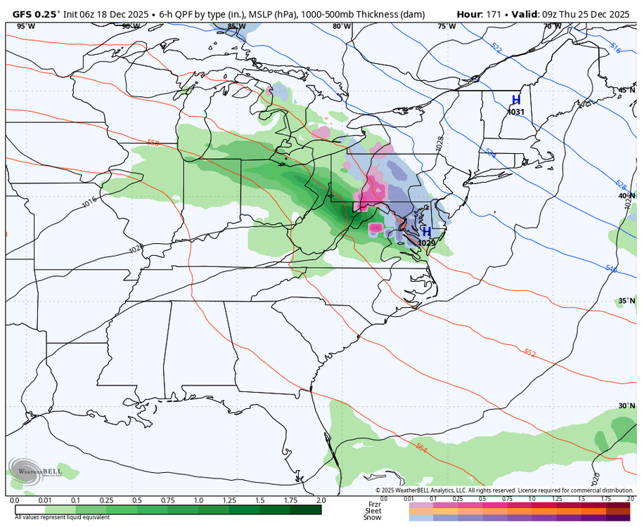
2-5” type deal Tuesday . That’s our shot -

Richmond Metro/Hampton Roads Area Discussion
Conway7305 replied to RIC Airport's topic in Mid Atlantic
I know it’s fantasy, but it’s nice to see the show up on the euro.. Maybe the pattern can flip back early January
-
No, just me ha ha.
-

December 2025 Short/Medium Range Forecast Thread
Carvers Gap replied to John1122's topic in Tennessee Valley
There will likely be some model chaos(and even real time chaos) w/ two strong and very opposite teleconnections IF they verify. The Aleutians Ridge and -NAO are not going to play well together. I suspect we end up w/ a very similar pattern to what we exited, but the pattern force south of where it was due to the NAO and seasonal climatology. It seems like the Yukon will be cold and will send cold air southeast into a suppressed storm track. I do think ridges will roll through between cold shots. But we roll the dice and take our chances if that is indeed the setup. Suppressed storm tracks with cold involved...we take. The nice thing is that most of the models are eliminating feedback over the Pacific Northwest, and we can see what is a reasonable pattern unfolding. Infinite Baja lows and Pac NW lows.... I guess the question I have now is if there is feedback w/ the Aleutians low and maybe the NAO? Those are two other areas where models will sometimes under-do and over-do things. -

December 2025 regional war/obs/disco thread
Sey-Mour Snow replied to Torch Tiger's topic in New England
So what you are saying is “No one’s ever seen anything like it”? -
Holiday period is looking exciting. Lots of s/w’s and clippers in the flow and repeating tracks. Someone might get a 1 2 punch within short order. LFG!