All Activity
- Past hour
-
Got 32F here. Third frost of the season.
-

Pittsburgh Area Fall 2026
ChalkHillSnowNut replied to Ahoff's topic in Upstate New York/Pennsylvania
Also-I’ve been reading the ENSO discussions about super El Niño and wondering how this is going to affect our winter…. -
Overall for the E Coast for the top positions, Miller As rule on the NESIS. Bliz of 93 #1 Bliz of 96 #2 https://micromet.psu.edu/ewall/NARR/1996/us0107.php Mar 2-5, 1960 #3 https://www.ncei.noaa.gov/monitoring-content/snow-and-ice/rsi/nesis/19600302-19600305-8.77.jpg Bliz of 1899 was Miller A and was on par w/ the Bliz of 93 https://www.woodtv.com/wp-content/uploads/sites/51/2023/02/1899-Weather-Map-Feb.-12-1899.jpg And best snowstorm BOS ob ever and highest gust w/ a snowstorm is from the Bliz of 93! BOS RS 2250 W0 X 0TS+BS 875/31/31/0647G62/916/R04RVR06-V06 TB50 SW MOVG N OCNL LTGIC DRFTG SNW PK WND 0670/33 PRESFR SNOINCR 3/11/12 If you had snowfall measurements done consistency and right back in the day, BOS top 10s would not be what they are currently as prior to the 1990s. Snowfall practices then resulted in too low totals. But Don't be a @CoastalWx and act IMBY only!
-
 where to buy lipitor safely: CardioStatin - discount lipitor online pharmacy
 -
Pittsburgh Area Fall 2026
ChalkHillSnowNut replied to Ahoff's topic in Upstate New York/Pennsylvania
Yes-it’s been a glorious few days and few more to come! -
Dropped to 48 coldest so far - .
-
Can’t wait to see past peak next weekend.
-
Seems like he hits the dispensary before he posts so I wasn’t sure.
-
49.6 here. I think coolest so far this season.
-
Meriden, CT? It does have a local nickname of the "Dirty Den".
-
What town?
-
BDR with a 54 for the low. BDR still hasn't gone below 50 and Upton thinks we stay above. The coolest airmass of this fall will advect into the area Monday night into Tuesday and then remain in place into Wednesday. Lows Monday night will fall into the 40s for the most part with the coolest readings well inland. The NYC metro may remain right around 50.
-
I learned to love Nina. They bring much better winters to my area in the lowlands. Starting this winter I'll be on the Tug Hill where Nina demolish the region. I think of frozen ponds, a light snowpack, deep blue sky, cold temps when I think Nina. When I think of Nino I think of mud, extended cloudy periods, 80 on Christmas, lots of rain, snow that melts the day after. Drizzly
-
Mid Atlantic Winter
-
About 0.05” of mist and drizzle this morning. Baseball cancelled for third weekend in a row.
-

2026-2027 Record-breaking El Nino
bluewave replied to Stormchaserchuck1's topic in Weather Forecasting and Discussion
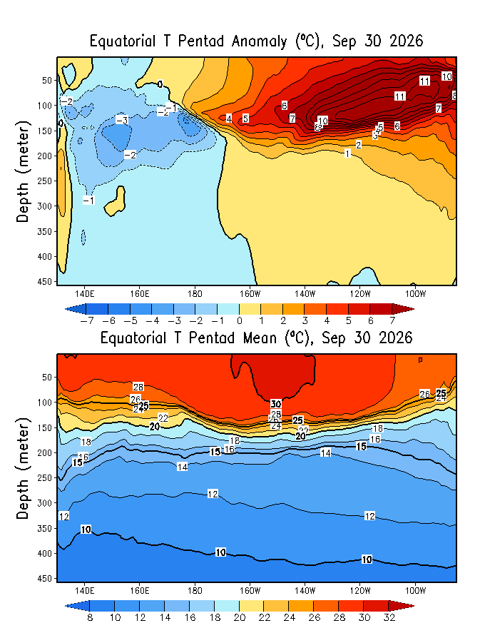
Subsurface warmth continuing to increase. Getting close to +12 now in spots. The +30C warm pool shifting further east is also a first.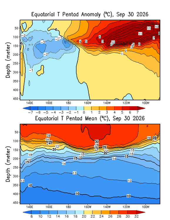
-
-
We didn't have a hint of a cloud yesterday......most of the most beautiful evah.
-
It’s actually quite frosty in the back field despite 39°
-

2026-2027 Record-breaking El Nino
OSUmetstud replied to Stormchaserchuck1's topic in Weather Forecasting and Discussion
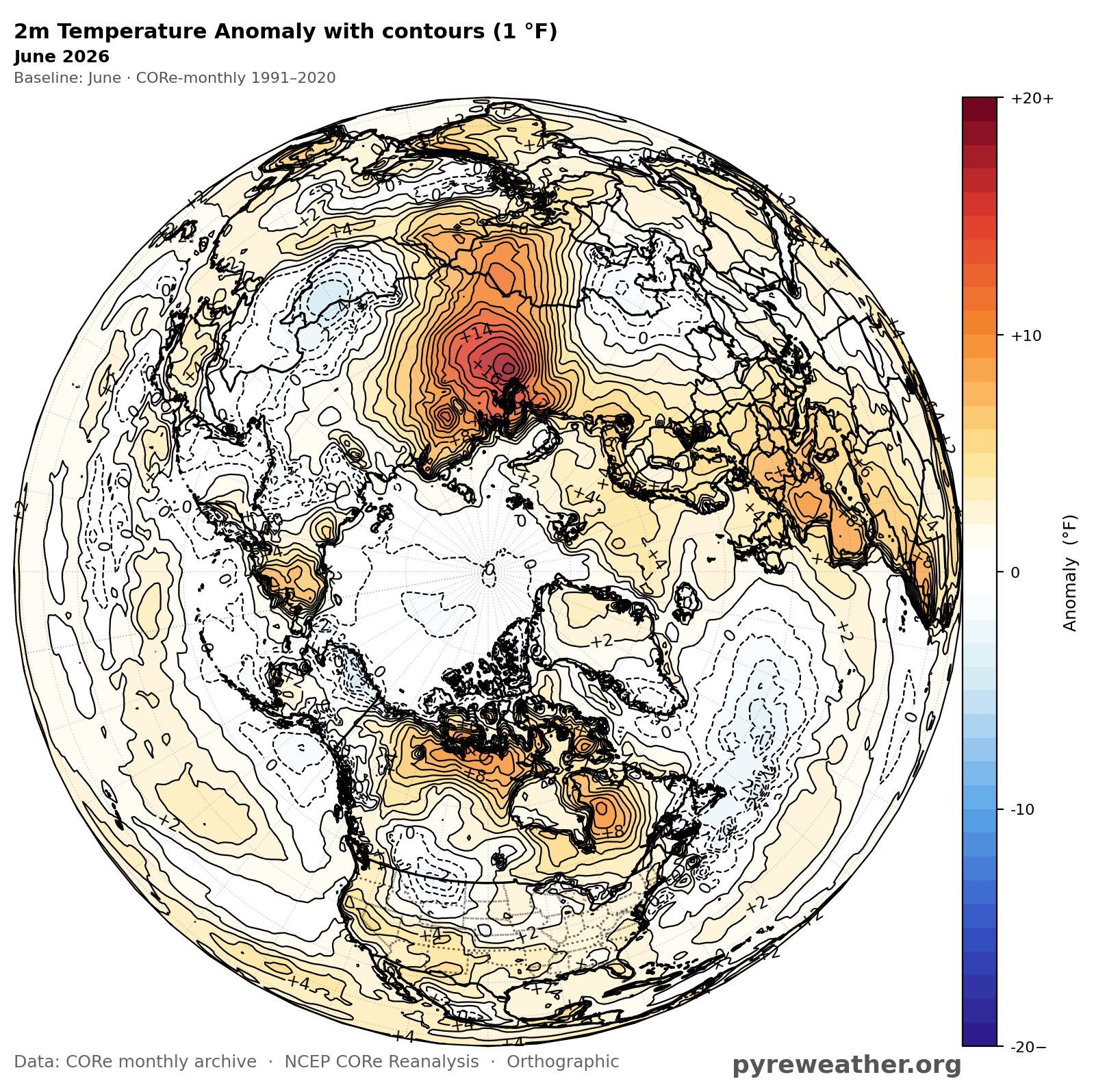
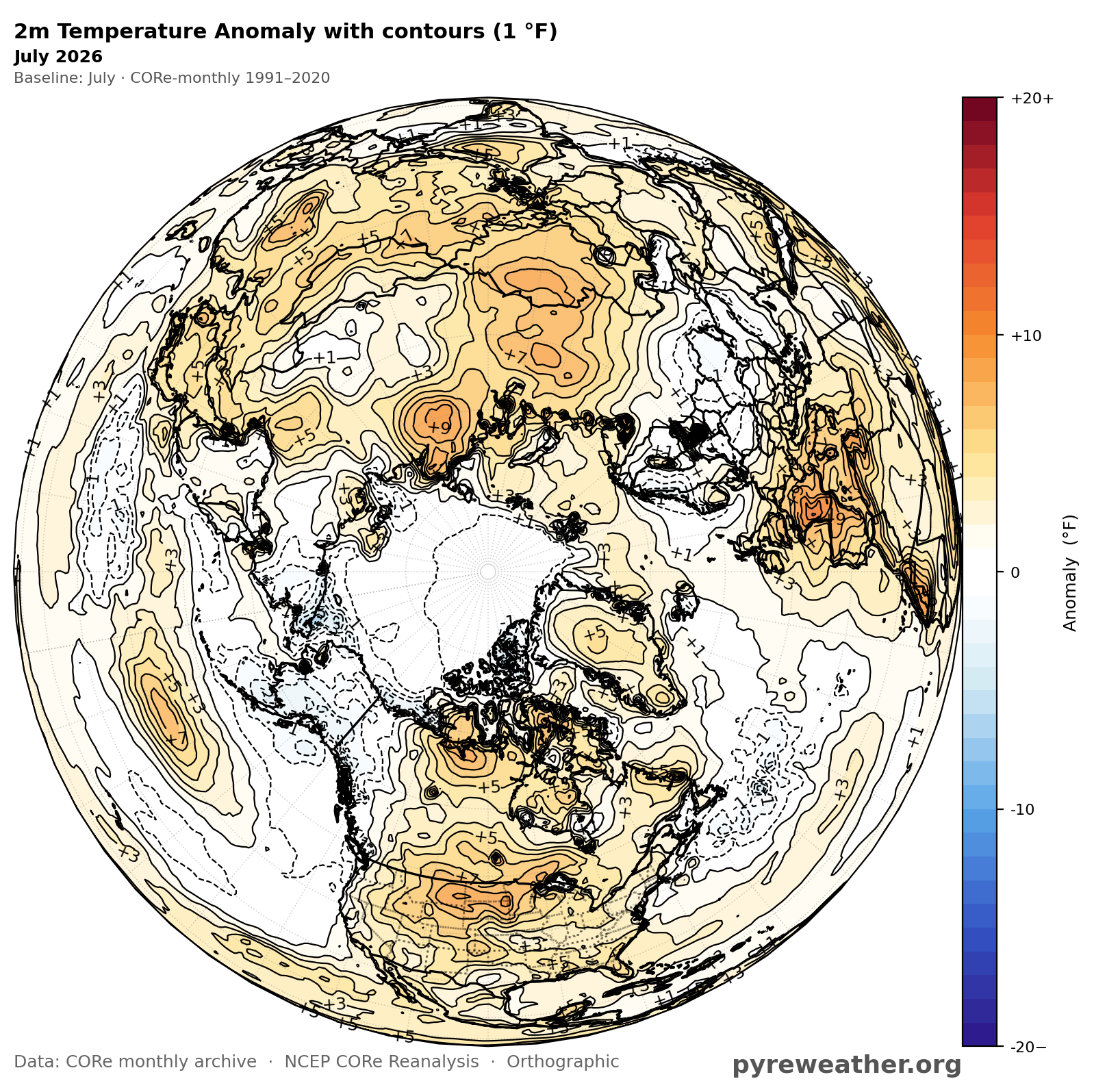
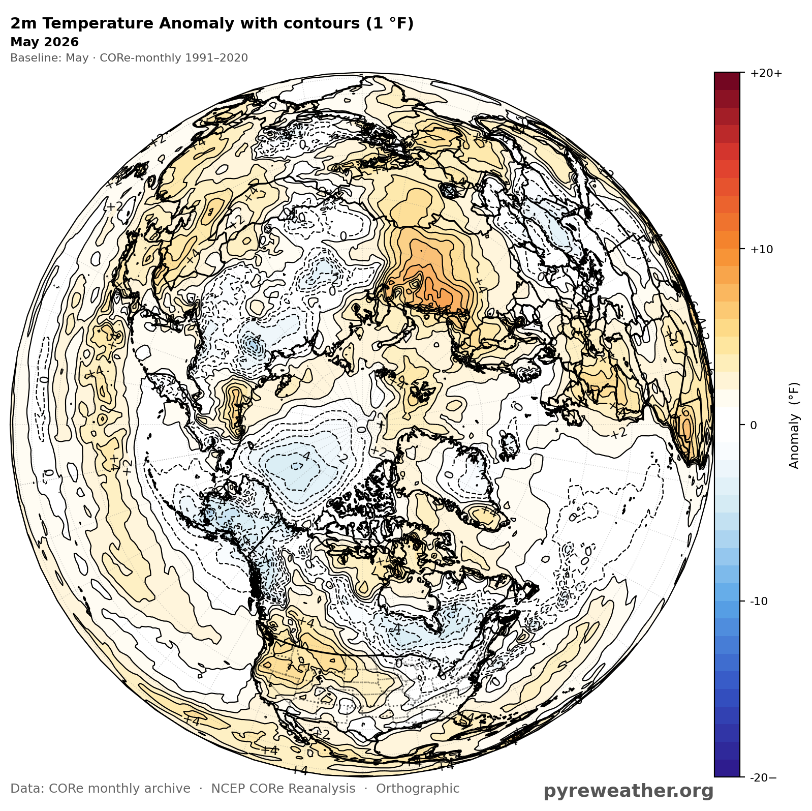
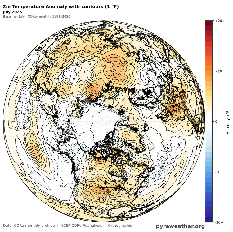
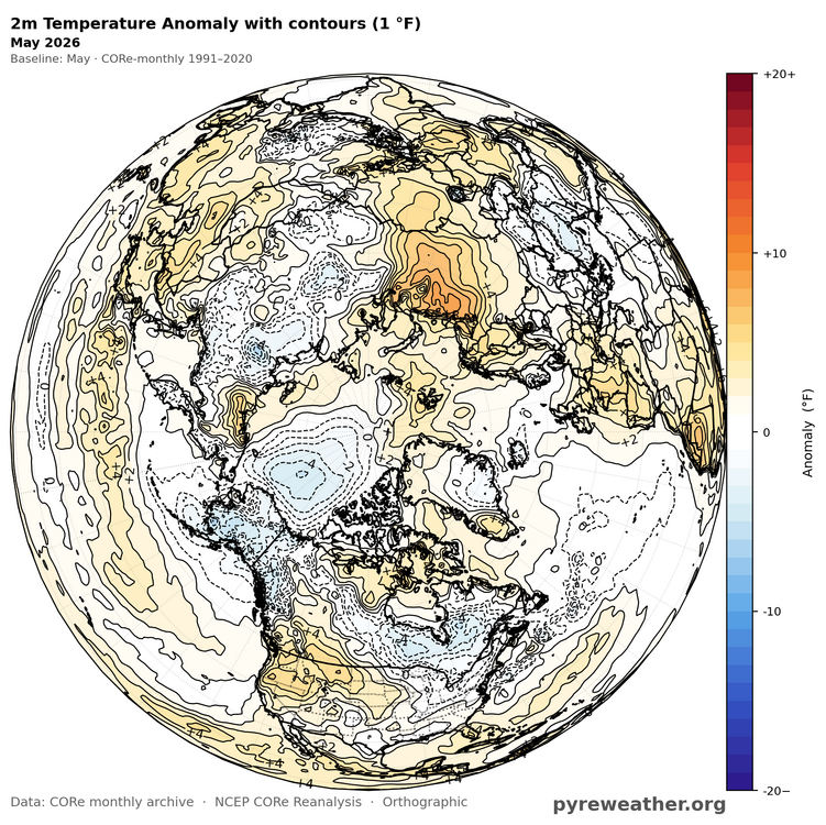
NOAA CORe showing (probably?) slightly below-normal temps in May, near-normal temps in June, and near-normal temps in July in the Arctic 80+N area. Contoured at 1F. Very difficult to get real surface temperature departures at all in this area at peak summer due to the cooling and stabilizing effect of the slushy ocean.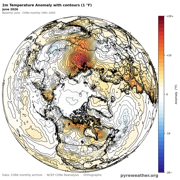
-
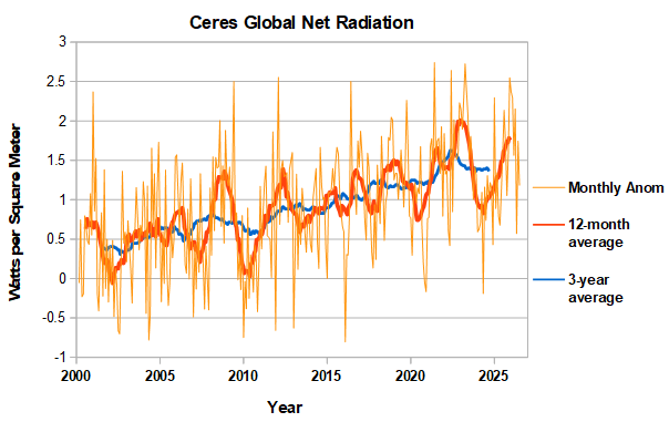
CERES net radiation (available thru July) is behaving as expected in a nino, topping out as global temperatures rise and outgoing radiation increases. The 3-year average indicates that net radiation has stabilized at a high level in the past couple of years. Rapid global warming will continue until there is a drop off.
-
80 on Friday?
- Today
-
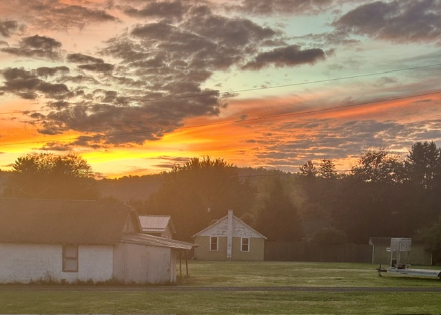
Low off 46 degrees this morning. Beautiful sky!
-
Min 39.0° Lots of 20s up north. HIE 27, HUL 28 Coldest I saw was 23° at Estcourt.
-
Pfft, if this is what we have to look forward to in the el nino - gray, misty, wet every weekend - bring back the la nina.