All Activity
- Past hour
-
12Z UKMET is 4th full run in a row with a Gulf TC and again maxes out in strong TS range but well to the W of the 0Z’s FL Pan with it coming into EC LA: NEW TROPICAL CYCLONE FORECAST TO DEVELOP AFTER 78 HOURS FORECAST POSITION AT T+ 78 : 21.8N 92.8W LEAD CENTRAL MAXIMUM WIND VERIFYING TIME TIME POSITION PRESSURE (MB) SPEED (KNOTS) -------------- ---- -------- ------------- ------------- 0000UTC 08.10.2026 84 22.1N 93.0W 1003 28 1200UTC 08.10.2026 96 23.3N 91.8W 1003 29 0000UTC 09.10.2026 108 23.0N 90.7W 1002 30 1200UTC 09.10.2026 120 24.8N 91.2W 1001 40 0000UTC 10.10.2026 132 26.2N 91.1W 997 44 1200UTC 10.10.2026 144 28.5N 90.3W 992 55 0000UTC 11.10.2026 156 31.3N 90.4W 994 30 1200UTC 11.10.2026 168 31.8N 90.3W 1006 25
-
Good morning from Detroit

-
Whatever forms in the Gulf it looks like we get the leftovers next weekend
-
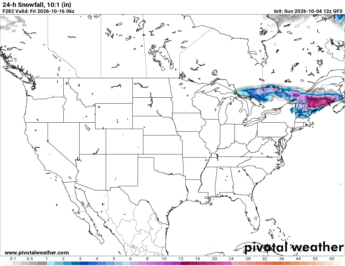
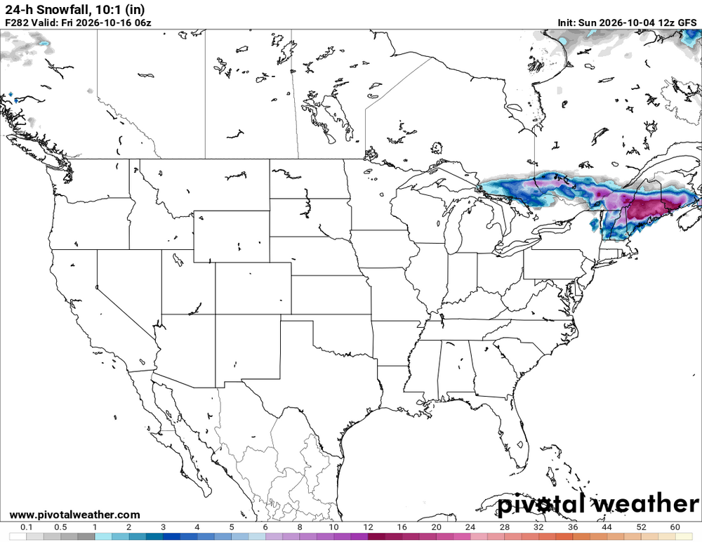
Congrats NNE on the 12z GFS
-
0.6” or so to start the month
-
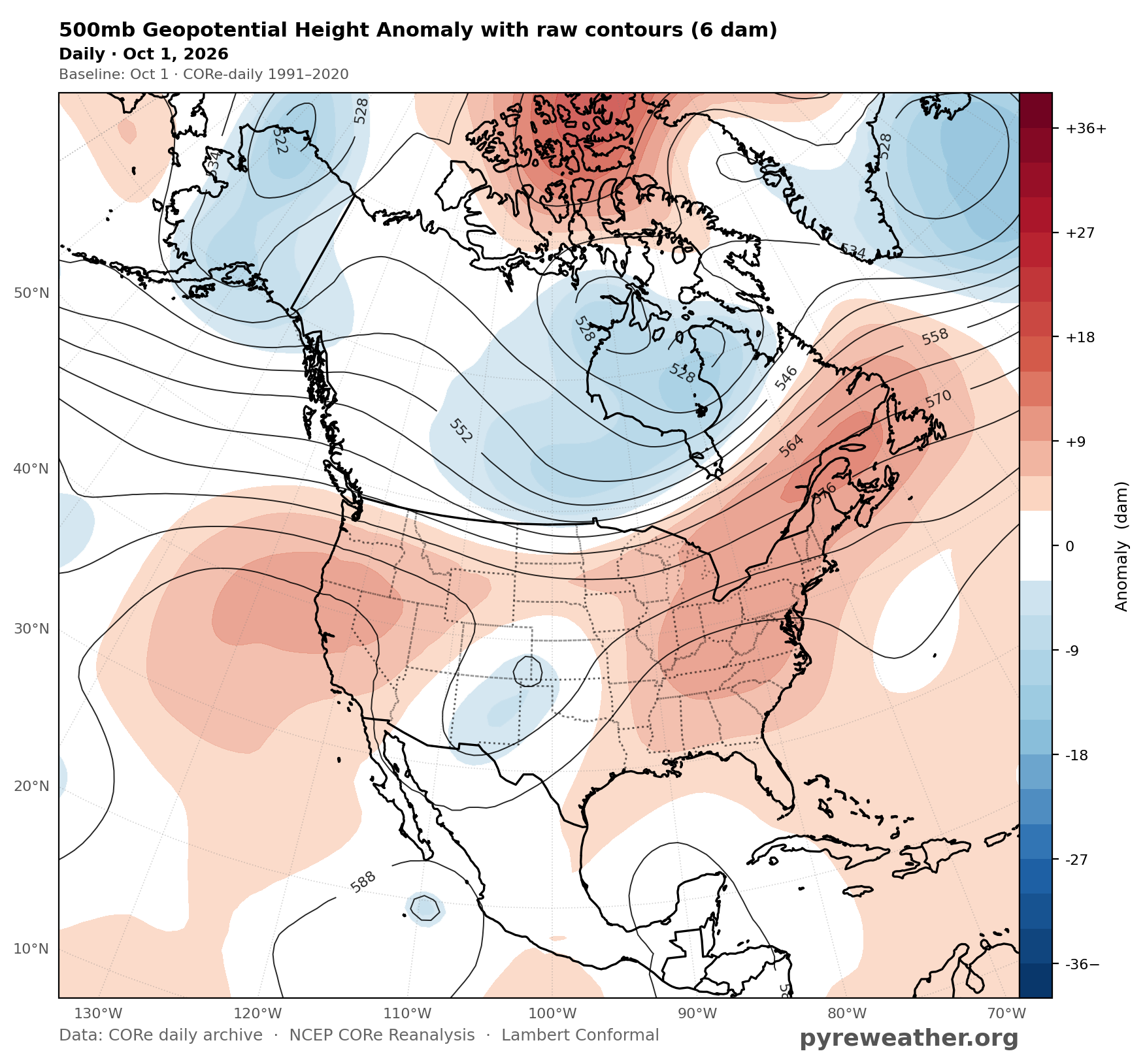
 October is not ending up like 2018, 2019, 2023.. They were cold in the Rockies and Midwest. Looks like opposite pattern is setting up this Oct
 -
Periods of light rain moving through.
-

Fall 2026 Medium/Long Range Pattern Thread
jaxjagman replied to John1122's topic in Tennessee Valley
You could be right.Hardeman Co in TN had had a EF4 right before Christmas 2015, which tracked from MS,so regardless you can never say never.But in still 2015 was a well pronounced Central based NINO compared to this year,most of the severe should be further towards the Gulf states and not into our region this winter -
1.25 Largest 24 rainfall event since the late spring...
-
Our most recent severe cold/snow Winters in October If you take out 2014 because that Winter had a record breaking ridge over the West, the October composite is much colder.
-
I mean…you could I was born in Fairbanks.
-

2026-2027 Record-breaking El Nino
40/70 Benchmark replied to Stormchaserchuck1's topic in Weather Forecasting and Discussion
God, I hope that grouping fails spectacularly moving forward....I'd just assume drive out to the desert's of Albuquerque and shot-gun a cactus than experience anything akin to the past four El Niño events during this coming season. -
Yeah it was kind of eerie after spending some time outside Fri afternoon and they were singing almost nonstop. Then we go from late summer to early fall just like that. Hopefully we can get at least a week or so of “Indian summer” before the door fully slams shut by mowvember.
-

-
Likely wait out a frost delay.
-
Looks like MPV got down to 32°. Unfortunately my PWS is down so I don’t know what I got down to here. As for foliage, I think this weekend was probably peak.
-
Of course Miller A is more prolific for the majority of the east coast, Miller B is dependent on N stream influx, so they are northeast centric....which is why we are more likely to get a favorable track and timing of evolution. Less time for it to go wrong....kind of like how storm chasers on the gulf coast would father a home-brew under pristine conditions than a CV long-tracker.
-
I don't give a rat's ass about the east coast as a whole, I care about MBY.
-
 https://dutashielddirect.shop/# where can i get generic avodart
 -
zithromax coupon: rapidzithrodirect - zithromax capsules price
- Today
-

2026-2027 Record-breaking El Nino
qg_omega replied to Stormchaserchuck1's topic in Weather Forecasting and Discussion
Never before have we seen such warmth so far east based, really historic -
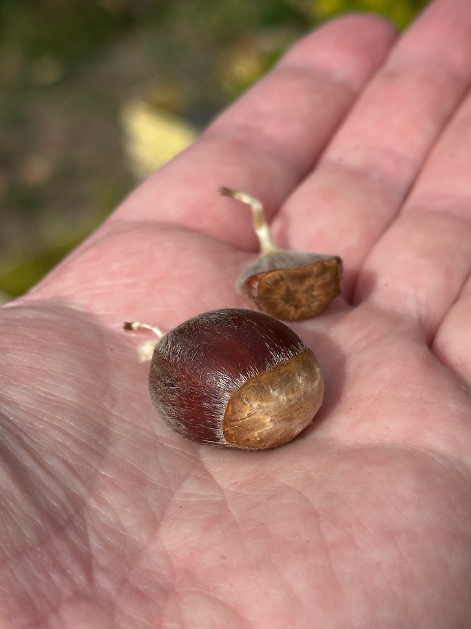
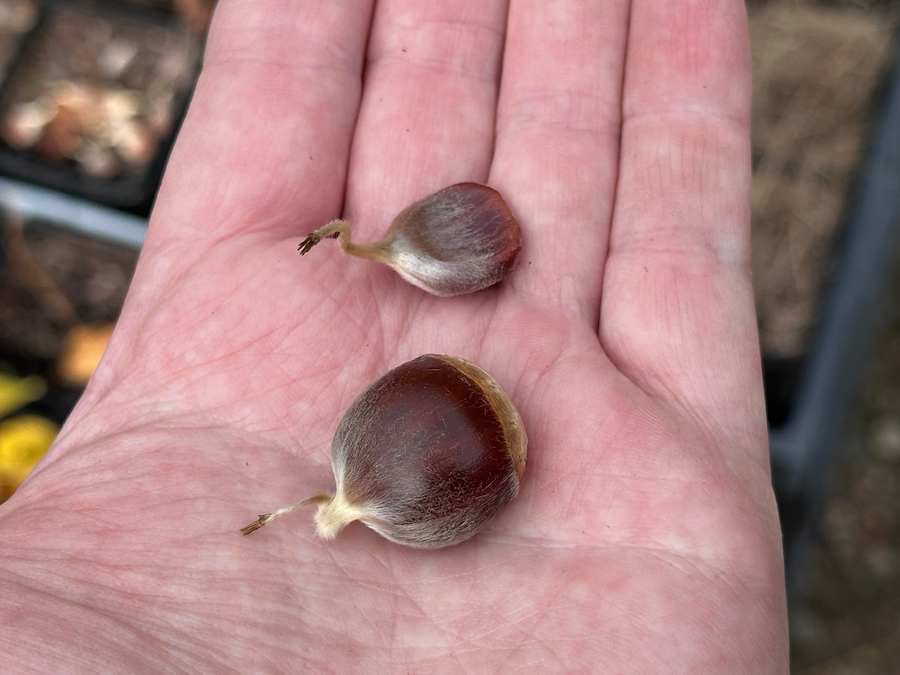
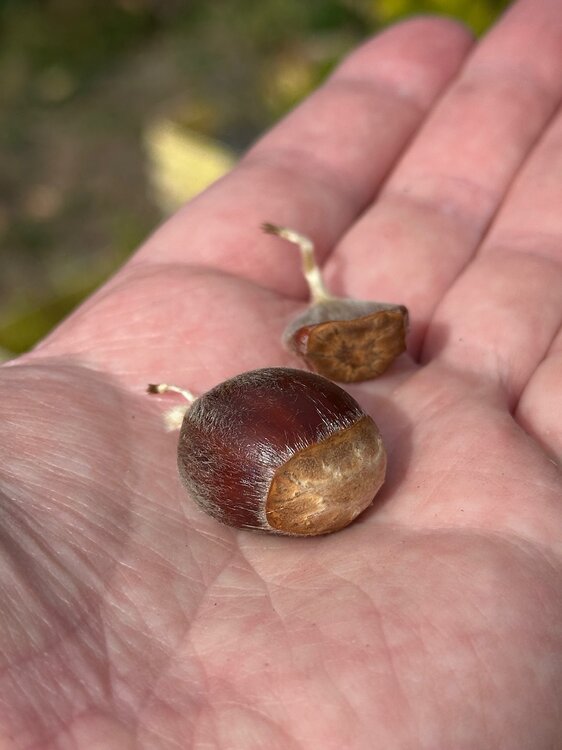
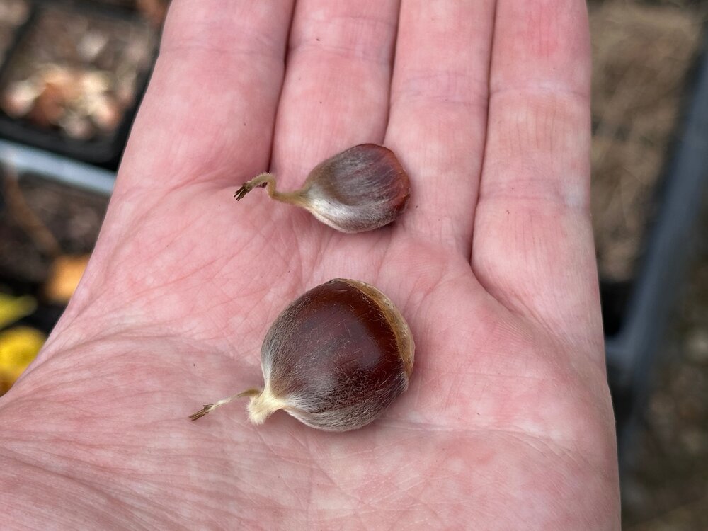
We got one. I climbed up the tree and cut the last burr off and found a fertilized chestnut. You can see the difference between the two. @wxeyeNH Any fertilized nuts up there yet?
-
Yes they do. I'm also slightly concerned about the face of my driver cracking.
-
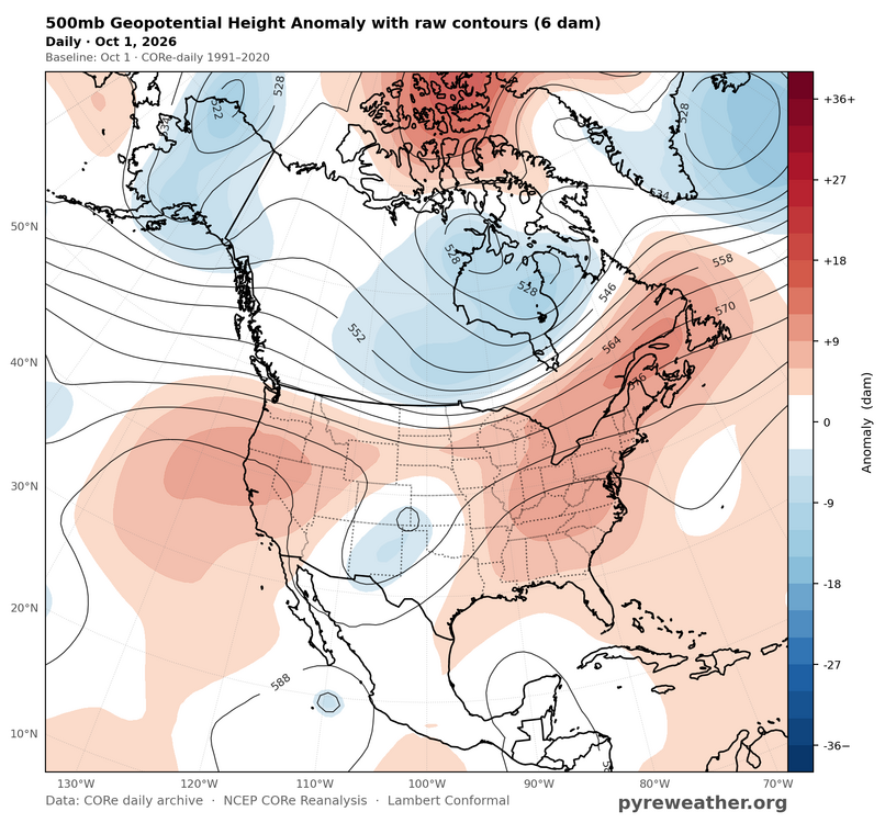
One of the few areas of North America that does really well with +EPO 500 mb pattern.
-
Dewpoint over 60. Blah.