All Activity
- Past hour
-

November 2025 general discussions and probable topic derailings ...
WinterWolf replied to Typhoon Tip's topic in New England
Exactly. 70 Is certainly not happening. -
All those times were cold decembers that changed to torches in january that persisted for the remainder of the season.
-
You guys are dumb
-
This isn’t true. For every example a pattern started in dec and persisted, I can come up with a few counter examples when the pattern changed in January.
-
0.23” here
-
.thumb.png.4150b06c63a21f61052e47a612bf1818.png)
November 2025 general discussions and probable topic derailings ...
HIPPYVALLEY replied to Typhoon Tip's topic in New England
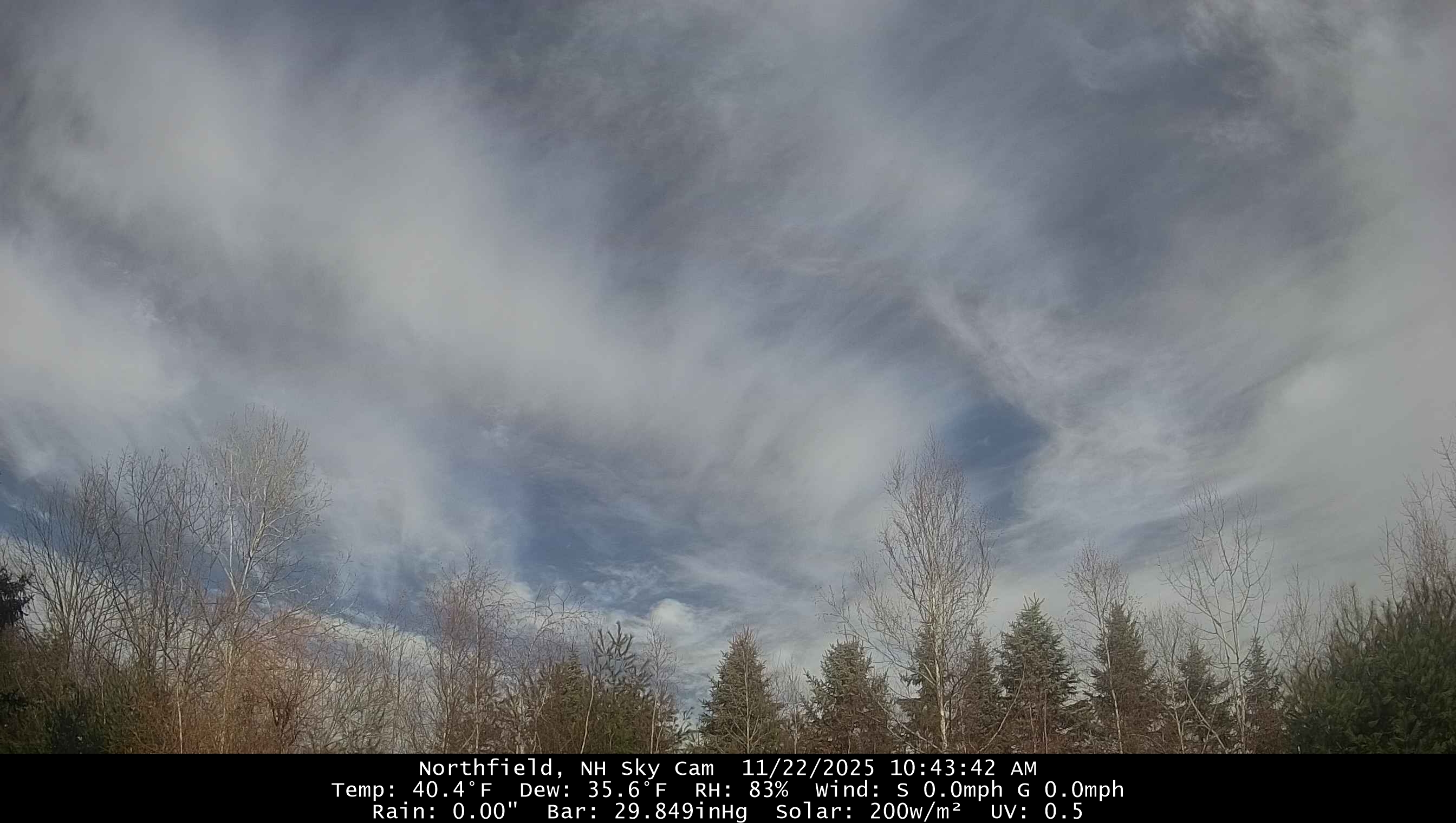
Clouds starting to clear out here. Hopefully dry enough for some yardwork this afternoon. -
Also there have been loads of times where once a crap pattern is established it persists for the remainder of winter.
-

-
Definitely something in the works for this period. We just need the shortwaves to play ball and sync up properly. Nice to have something to watch for a change.
-

November 2025 general discussions and probable topic derailings ...
jbenedet replied to Typhoon Tip's topic in New England
Dews on the Euro are showing mid 50’s. Airmass is cooked. 60’s are game but 70 is still a reach. Will have to watch bc it’s a torch setup. Question is can we maximize based on timing and clouds. -
-
 upper 50s to low 60s at best?
 -
I think people often forget that the beginning half of December is climatologically unfavorable for snow for the Mid-Atlantic
-
November 2025 general discussions and probable topic derailings ...
jbenedet replied to Typhoon Tip's topic in New England
Pretty sure there is Wednesday’s furnace to contend. Been telegraphed by guidance for a week now. -
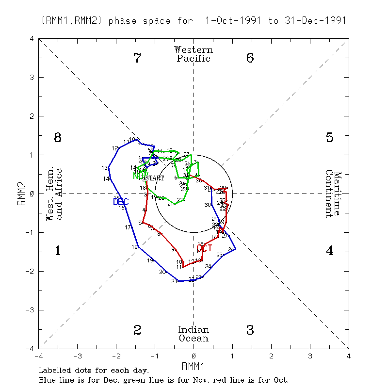
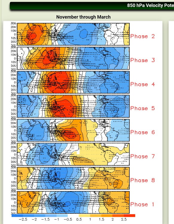
Whereas there can be a lag, the diagrams by phase are based on concurrent temps. So, phase 8 being the coldest in Dec is based on temps during phase 8 being the coldest of any phase rather than with a lag.
-
0.31” overnight Imby/Columbia. November total to date 1.20”
-

November 2025 general discussions and probable topic derailings ...
tamarack replied to Typhoon Tip's topic in New England
Farther north (Jersey Highlands) we had 7 events of 18-24" from March 1956 thru February 1961, the greatest run of big dumps I've seen anywhere. Five of those were cold powder, with temps low teens to low 20s. Closest is probably Nov 2014 thru March 2018, with 6 storms 15.5-21" plus 2 with 13". A shorter run, Feb 2007 thru Feb 2009, had 4 events 15.5-24.5". Oddly, the snowiest of those 3 winters, 07-08, had nothing over 12.5" and ony 2 in double digits. -
The can be a lag. I know Roundy has said such a common mistake is to think MJO phase correlation automatically or immediately shows up. Both are a mistake to think.
-

November 2025 general discussions and probable topic derailings ...
CoastalWx replied to Typhoon Tip's topic in New England
Yeah my sister is there with my niece. Definitely wetter than I expected and feel bad. Terrible forecast. -
No its not Stop posting nonsense
-
12/9-14/91 also was a mild strong phase 8 in the E US though it cooled afterward:
-
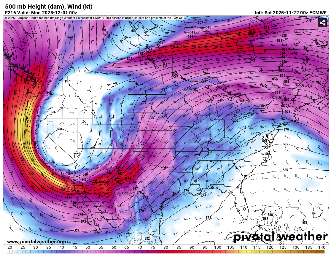
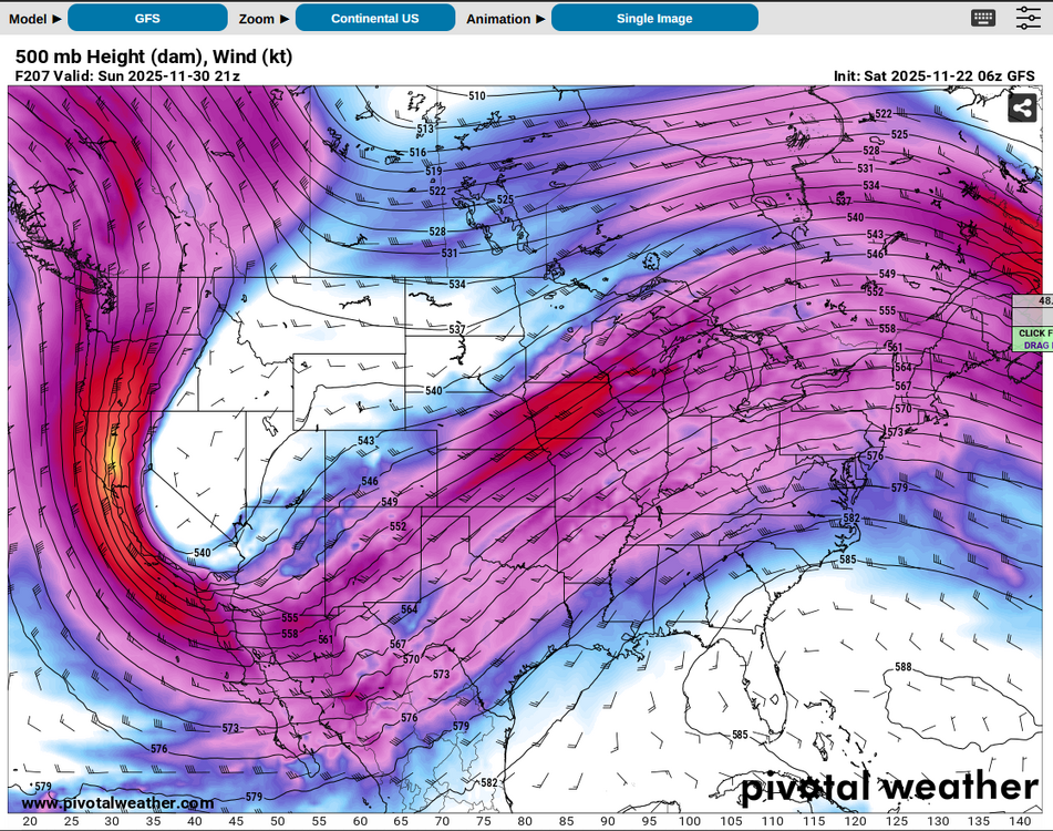
Euro and GFS both have a broad, highly amplified western trough for the end of the month. Far too early for specifics especially lately, other than to say it "should do something somewhere," from to to . Ceiling might be limited by a tendency for a positively tilted ejection with the stronger flow hanging on the back side, and of course thermodynamics this time of year. Although after days like February 8, 2024 I never count out tornado threats based solely on T/Td values, it looks like this setup would need colder temperatures aloft than what's currently being depicted verbatim to realize adequate instability.

-

November 2025 general discussions and probable topic derailings ...
radarman replied to Typhoon Tip's topic in New England
Steady rain for the parade in Plymouth today. I'm in Sandwich and have had a decent amount. -

November 2025 general discussions and probable topic derailings ...
dendrite replied to Typhoon Tip's topic in New England
Looks like 10/10 in 2011 is currently the earliest. -
November 2025 general discussions and probable topic derailings ...
dendrite replied to Typhoon Tip's topic in New England
A little after 1030am and we sun