All Activity
- Past hour
-
This name should’ve been retired in 2020 after what it did to SOMD.
-
It will be like a typical non-tropical low pressure once inland, like a Miller A storm. Atlanta has been through this many times. The problem is media hype and knee-jerk reactions from authorities end up resulting in overdoing the cancellations and shutdowns. Just b/c this storm has (had) a name on it, does not make it different overall once it goes PT/ET and for locations far inland, yes there are exceptions, like Helene, but that's not the case here. Many PT/ET storms out of the Gulf have produced the same impacts to the SEUS as Isaias will. I posted earlier about the Gulf storms in Oct 1992 and 1994. You watch, the ET part of Isaias is going to impact the entire E Coast. It will be no different than typical Nor'easter and not even as strong or impactful as the Nor'easter last month, say DCA-BOS. but it will be treated as "worse" b/c it was a former hurricane and you'll see unnecessary cancellations for it. There is no scaling or quantification of wx events these days, all are the same as to being worst ever, unprecedented, or absolute high-end events as to impact that we all have to hide and cower in fear from. Being constantly "held hostage" by the wx is not a good thing. esp for business and commerce. You can't hide behind the excuse "better safe that sorry" for every single wx situation. This mindset has real impacts. The door swings both ways here.
-
You’d think with ticket prices these resorts would be throwing the latest and greatest everything all over the mountain
-
My calf is fully healed, but not sure how much I’ll get out this year. Having a new child, has $4.50 a gallon, and lift tickets are a partial mortgage payment now. Would like to get out a couple times, but not sure it’ll be in the cards.
-
 can gabapentin cause sleepiness: Neuro Relief Direct - gabapentin pulse rate
 -
Unfortunately I don't think its going to be dry.
-

October 2026 General Discussion
hawkeye_wx replied to SchaumburgStormer's topic in Lakes/Ohio Valley
The good storms missed southwest, but I got a few rumbles and 0.48" of rain. Up until last evening, I did not know rain was even in the forecast. This weekend looks very warm, possibly getting into the 80s. Next weekend looks very chilly, first with strong nw wind and then possibly our first frost or even freeze. -
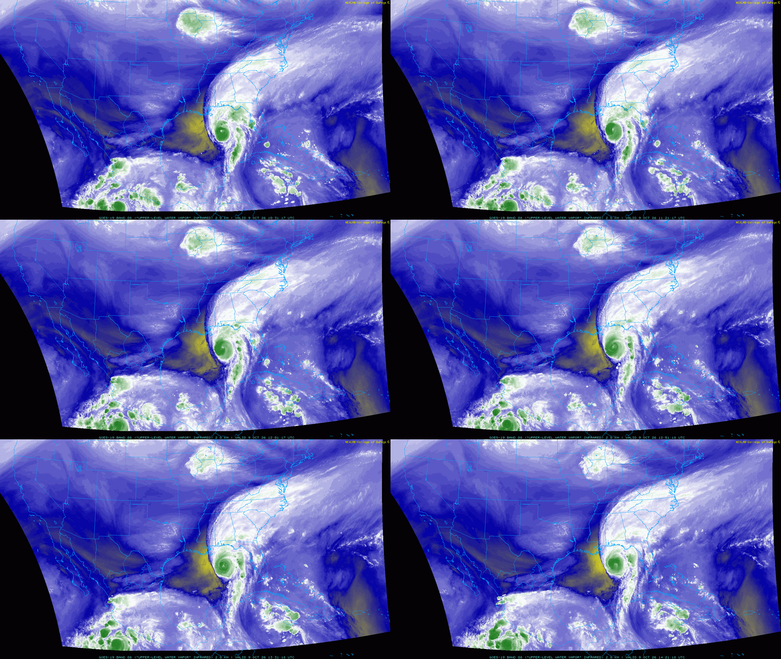
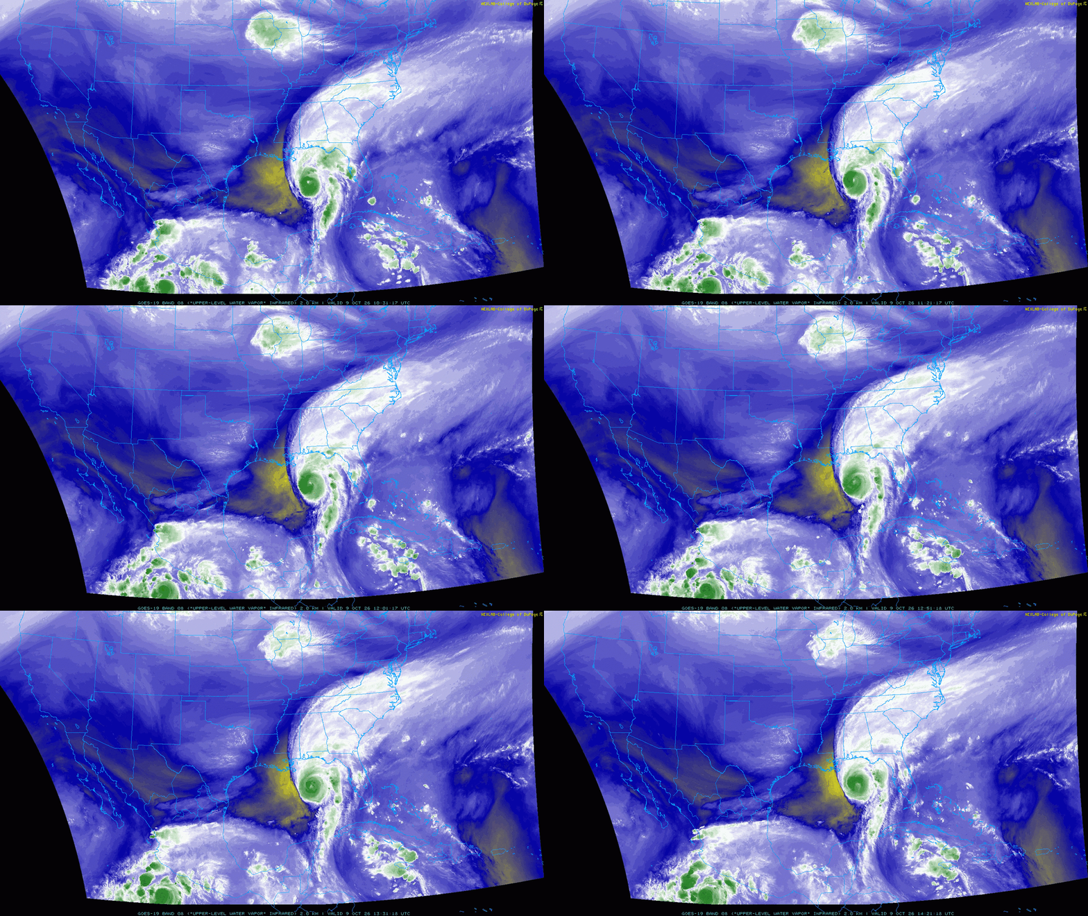
The models were pretty insistent that Isaias would be able to gradually deepen and improve structurally through most of the day today as long as it stays on a NNE heading, with shear and dry air likely to rapidly begin affecting the inner core in the last few hours before landfall as the storm's heading starts bending more towards the left/due north. The strong west-southwesterly shear and very dry mid-level air are definitely impinging on the core of Isaias this morning, but convection has continuously wrapped around the upshear side of the storm and is insolating the core from this unfavorable environment for now as a shortwave approaches from the west. With the storm over very warm waters and beneath enhanced upper-level divergence ahead of the shortwave it can continue to gradually intensify/deepen. With a very intense convective burst ongoing in the NW eyewall right now, we probably have one more burst of intensification into the afternoon. The shear will increase further in a few hours and the storm motion will become less parallel to the shear vector this evening, so it remains likely the unfavorable environment starts affecting the inner core as landfall approaches. Per the regional hurricane models the inner core may break down pretty quickly tonight right around the time of landfall, though with a bit more near-term intensification and only a few hours for the environment to negatively affect Isaias this evening before landfall my guess is landfall occurs with a peak wind between 90-100kt, with the wind field beginning to expand by then due to interaction with the incoming shortwave.
-

2026-2027 Fall/Winter Mountain Thread
wncsnow replied to BlueRidgeFolklore's topic in Southeastern States
Sure looks like this will be our heaviest rain event since Helene along the escarpment. I just wonder if there will be any new landslides where the soil is still loose from last time. -
Question for @Sey-Mour Snow @weatherwiz @CT Rain How much would CT benefit from having its own mesonet? Does being a small state cut against its need? I know we already have several airport stations around the state, but would a mesonet aid in long term data collection and forecasting in a way that would outweigh the cost of setup and maintenance?
-
Wow, what a complete turnaround overnight in the last 12 hours. Isaias was looking very ill organized about 10 hrs ago, but I am impressed this morning. Unfortunately, this obviously increases the chances for more severe impacts at the coastline. That radar from Mobile shows quite a nasty eyewall. Here is hoping it weakens in the next 12 hrs, but now the NHC sounds less sure that this wont make landfall as a major hurricane.
-
Picked up 0.10" of Iowa's scraps early this morning.
-
Nam is mid morning now
-
This is probably more apparent to those with background in weather/forecasting, but I'm curious: is the outflow from Simon potentially disrupting some of the effect of the sheer on the western side? I know the outflow affects Isaias' ventilation, but does it also have an independent effect on the actual environment of sheer?
-
This won't weaken as much as Lilly...that went from 145mph to 100mph at LF.
-
HAFS A/B yesterday did an excellent job on showing Isaias deepening in the last 12 hr and its current intensity. For the past 2 years these models have shown significant improvement over the previous TC models. I seem to recall last year the HWRF and HMON were to be discontinued, but that has not happened IMHO, there are already too many operational models the exist or available. More is not always better, and too many can distract from proper subjective forecast skill. You get *one* model that is an outlier, and that can sway you away from a better forecast. Also, the less scrupulous people on social media looking for clicks/like will often post the model that shows the worse case scenario, even if it obviously out to lunch. That makes our job that much harder because often we have to spend an inordinate amount of time debunking wild or bogus forecasts. I know some are not thrilled with the NAM and it derived products ending soon, but eventually we do need to move forward and the RRFS replaces the NAM. The NAM as a model and early name, ETA, has been around for 33 years, so time to move on. Also, from the big Nor'easter last month, the RRFS was too aggressive in showing a tropical transition for this storm, so that suggests it may not do well for TCs. Has anyone been following the RRFS as how it has handled Isaias so far?
-
Of those storms, Lili is probably the best match/analog, as that happened during a high shear/low activity/el nino year. Opal and Dennis happened in low shear/hyperactive years, so they aren't really good matches.
-
It won’t be that coherent a system by the time it gets up here. Shear will eventually get to it. I agree that these big N Gulf systems usually have a Part 2 big impact area way further north like Camille 1969 and Ida but that’s when it can remain a coherent consolidated system. Up here it looks more like a strung out frontal system.
-
Appreciate the input. I’m expecting 60 and cloudy at best if I try to host our outdoor party. Fire pit will be roaring, but I’m sure the older generation will still be cold.
-
Oh yes Dennis. That underwent rapid weakening leading up to landfall as well, after rebounding big time once off Cuba.
-
If it rains next Sunday I quit.. $2000 for fall baseball 8 tournaments at this age they only play Saturday for seeding then Sunday single eliminination.. so far 6 tournaments in and 5 have been rained out on Sundays (semis and championship), one tournament completely washed out, and this Sunday is 50/50..
-
The point some of us have been making is the double standard being applied regarding the concern for the attendees in Tuscaloosa vs that for those in Atlanta: Tuscaloosa: SATURDAY TROPICAL STORM CONDITIONS POSSIBLE. SHOWERS, COOLER WITH HIGHS IN THE MID 70S. NORTHEAST WINDS 25 TO 30 MPH WITH GUSTS UP TO 45 MPH, BECOMING SOUTH 10 TO 15 MPH WITH GUSTS UP TO 30 MPH IN THE AFTERNOON. CHANCE OF RAIN NEAR 100 PERCENT. Atlanta: SATURDAY SHOWERS. A SLIGHT CHANCE OF THUNDERSTORMS IN THE MORNING, THEN A CHANCE OF THUNDERSTORMS IN THE AFTERNOON. BREEZY WITH HIGHS IN THE LOWER 70S. EAST WINDS 15 TO 25 MPH WITH GUSTS UP TO 50 MPH. CHANCE OF RAIN NEAR 100 PERCENT. ————— As one can see, the forecast is actually much worse for the afternoon gametime in ATL for Duke/GT than it is not just for the evening gametime in Tuscaloosa but even during the tailgating time in Tuscaloosa well before the game even starts! So, gusts to 50 with possible thunderstorms/heavy rain and even a slight chance for a tornado in ATL for the game itself vs gusts only to 30, much lighter rain, and no thunderstorms in Tuscaloosa during the entire PM tailgating period well before the game even starts! @PhiEaglesfan712
-
There will be no remnants. It will be just a simple low pressure system on a front with some tropical moisture. Only the Euro give NJ more than in inch and that is only in isolated spots.
-
Euro is now faster-other models are evening....
-
I still like Choctawhatchee Bay for max surge of 10'.