
Vicious Fluid
-
Posts
31 -
Joined
-
Last visited
About Vicious Fluid

Recent Profile Visitors
1,493 profile views


-
Curious as to what tonight will look like as the cooler air settles in. I work an overnight at the hospital so i'll be in full weenie mode. Hope all of our southern GA neighbors are making it ok, especially as we continue through the evening.
-
Rain is picking up here a little. Watching radar closely because I'm sure there's plenty of tornado potential heading this way. We're still a little ways out from the remnants of the first feeder band that came ashore, but that thing had some nasty vorticities in it, and there's plenty of cold air aloft for mixing. Granted I'm sure we won't be seeing insane wind maxima, but there should be enough to see some fallen trees tomorrow AM.
-
a few Pensacola Beach cams i found are all up still as of this post - south view: https://visitpensacolabeach.com/web-cams/ - west view: https://www.visitpensacola.com/webcams/west-view-webcam/ - east view: https://www.visitpensacola.com/webcams/pensacola-beach-looking-east/ - quietwater beach: https://www.visitpensacola.com/webcams/pensacola-beach-santa-rosa-sound/ - casiono beach: https://streaming.myescambia.com:8082/ - north bridge: https://streaming.myescambia.com:8080/ - south bridge https://streaming.myescambia.com:8083/
-
This is probably more apparent to those with background in weather/forecasting, but I'm curious: is the outflow from Simon potentially disrupting some of the effect of the sheer on the western side? I know the outflow affects Isaias' ventilation, but does it also have an independent effect on the actual environment of sheer?
-
I was thinking the same thing as the track moved East this morning. I'm in NGA and after how cool its been, and knowing tropical moisture is heading this way....sounds like the perfect setup for a southeastern tornado event. We're watching closely, especially after the last few "weaker" systems that came through here over the last few years permanently altered the landscape.
-
I remember that event very well, and it was absolutely worst case for ATL and metro. I was home for the first part of it, but had to work 3 days after the snow fell. We didn't have power for 2 days, and survived by the fireplace. On day 3, we finally got power back, just in time for me to ride (no joke) a moped from Buford to the nursing home I tech'd at in Gainesville. Ah, that was some ride! One of my buddies who was stuck on 85 linked up with a friend who luckily lived off the highway near the old Duluth cinema strip mall. Took him 3 hours to walk there, in the snow, with a blanket and his phone while his car sat on the freeway. I believe it was after that storm that my area petitioned to buy their first 3 salt trucks in a decade (prior to that, we had only 1)! Sorry for the banter. Nostalgic, I guess.
-
My lady is currently at an ACLS class and being the weenie I am, I've been sending her periodic updates. With the virga this morning, and the moisture on the way, I think being cautious is probably best. ATL folk drive terribly in winter weather. I remember the snowpocalypse years back and hearing of friends stuck on 85 SB and abandoning their cars after just a couple inches!
-

1/21-1/22 Winter Storm OBS Thread
Vicious Fluid replied to metalicwx367's topic in Southeastern States
Virga over my area now (NE Atlanta Suburbs), nothing hitting the ground just yet. This is expected, considering the last few rare snow events we've had always started with "false snow" on radar before the good stuff fell. Here's to hoping for the best! ~Cheers -
1/10-11 super awesome winter SE OBS thread
Vicious Fluid replied to strongwxnc's topic in Southeastern States
31 and sleet with fat wet flakes here and there (north Gwinnett County, GA) -
(I am no met, but…) Powerful hurricanes modify the environment around them making their interactions with sheer, dry air, etc. less predictable and often less damaging to internal structure. With stronger hurricanes the complexities of internal structure changes during EWRC’s and interactions with other atmospheric features can be difficult to predict. Dry air and sheer can absolutely affect core structure, regardless of the size of a storm, however from years or being a weenie I’ve observed that smaller/compact hurricanes that reach higher intensities tend to be a little more resilient to stable air. Again, my field of study is not in meteorological sciences, so I’m sure a met could explain this better, but that’s my 0.02$.
-
I have family in some of the mountainous areas in western NC, and I am relieved to report that they are ok. They just got service back yesterday, and their town was mostly spared. Most of the areas hardest hit still don’t have reliable cell service, and I hope all who are waiting for a phonecall from friends & family receive it soon. I saw a Google doc with local resources posted here for Asheville and surrounding areas, and have shared it with as many friends/family in NC as possible. Big thank you to all on this forum who continue to look out for those impacted. Even something as simple as a google doc has the potential to impact many lives for the better.
-
I am severely disappointed that I don’t have my rig set up yet considering we’re about to get some extreme weather up near this area. Would’ve been nice to get some readings during the storm. I’m NE of Atlanta in Gwinnett County, where we may end up having a run at the degenerated eye after LF. I’ve been watching it for a few days ever since we ended up in the NHC forecast cone, and folks around here haven’t been taking it too seriously. We’ve had days of never ending rain prior to this event, and the local rivers and streams are already at max. Gonna be a lot of water damage/fallen trees in the next day or so, especially since this area was developed in the late 90’s when planting white pines was popular.
-
I love Franklin, it’s absolutely gorgeous in the fall and springtime! My mother and youngest brother live there and I visit quite often (especially for chasing snow, since I’m just outside of Atlanta where we rarely see white winters).
-
Winter Storm Izzy Obs Thread
Vicious Fluid replied to Prismshine Productions's topic in Southeastern States
Didn't reply due to lack of sleep and subsequent playtime in the snow with my kiddo, however... My area (Gwinnett County, NNE Atlanta Metro Area) ended up with some decent snow after the back end of the storm passed by. Ended up with 3-ish inches, more in some areas. That's way more than any of us expect out here, so for us its a win! Premo sledding/snowball conditions for me and my boy Snow didn't even melt till today. We got lucky this time around (usually I have to just watch everyone else cash out!).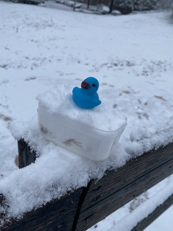
-
Winter Storm Izzy Obs Thread
Vicious Fluid replied to Prismshine Productions's topic in Southeastern States
0430 - Finally! We're at 32 here at the hospital, seeing our first dusting on the sidewalks. Precip is still intermittent between snow/ice/zr, but when it snows, it sticks. If the trend continues, I can look forward to slush on the way home, and hopefully pure snow when I take my son out to play post-work-nap! 0600: Winds have picked up tremendously. We're seeing 40mph gusts here and the precip has mostly stopped for now. Temps are below 32 but they feel way lower due to the wind. Some ice and snow has refrozen into straight ice on the grass, but I can only see a small amount since we don't have alot of that around here. Shift ends at 0700 so I'm very curious to see what the rest of the area looks like!