All Activity
- Past hour
-
Driving home from Statesville to Beech tomorrow afternoon. Could be an interesting drive coming into Boone and onward to Banner Elk. We will see.
-
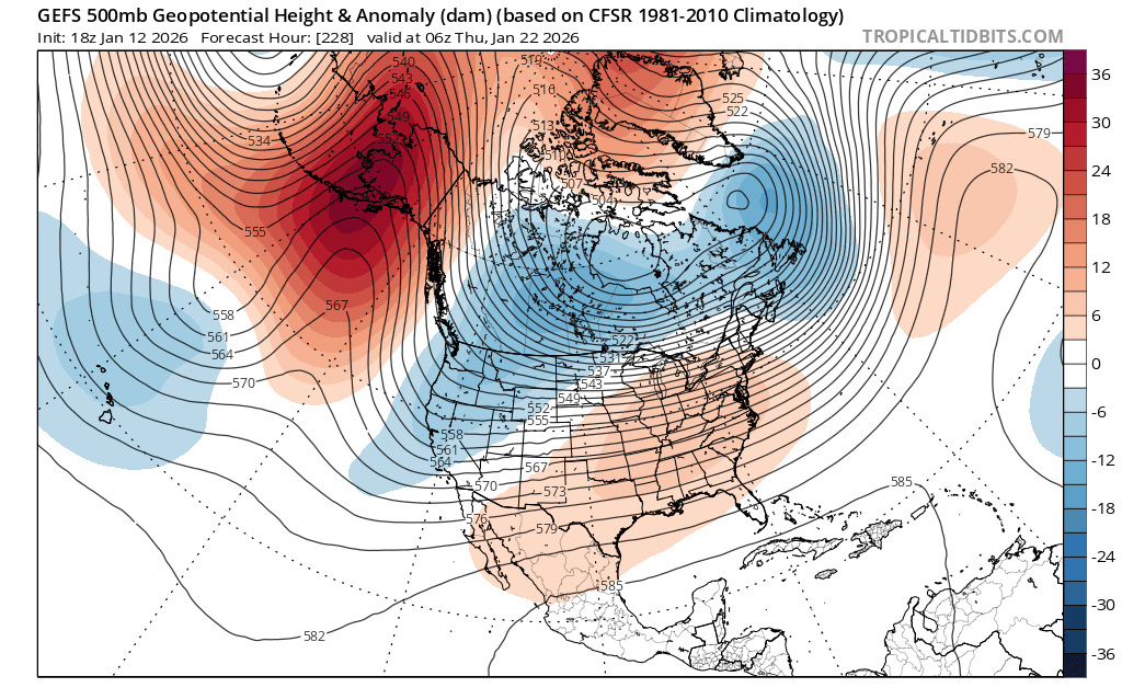
ECM-AI is west of 18z with the SLP and sharper with the trof. It's a scraper now. Very consistent trends across guidance. That's a solid improvement. 18z was well offshore and barely had a discernible coastal SLP. 0z forms a low and tracks it east of the benchmark.
-
Happening all winter
-
Will the sun angle be a problem with this storm? LOL
-
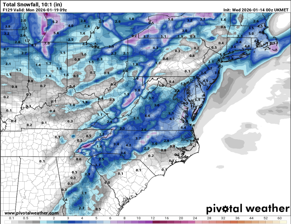
@CAPE gets buried. 1-3" for the cities, he gets 4-6"
-

2025-2026 ENSO
brooklynwx99 replied to 40/70 Benchmark's topic in Weather Forecasting and Discussion
who could have possibly seen this coming
-
I agree the 1-3" characterization is better. But the event is not quite over for I-95 by 120hrs on the UK. But only a few hundredths of QPF after.
-
A bunch of us are booked for 7 springs Laurel Highlands
-
1-3", not 2-4".
-
Thanks, that’s getting ripe for the forum….drift baby
-
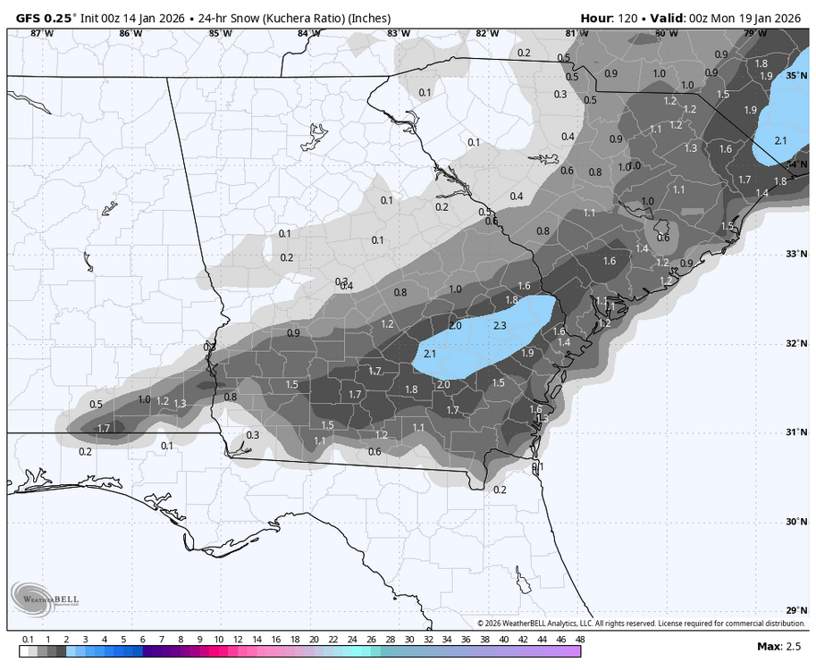
It's a juiced up low, precip maps are broken so lots of that rain is snow falling at 33-34.

-
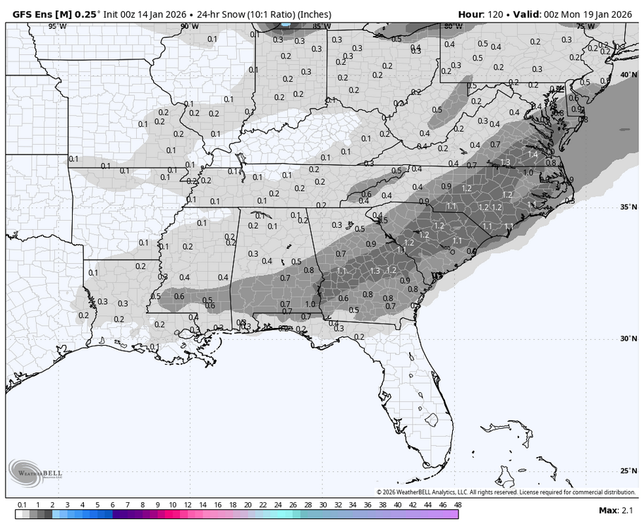
0Z GEFS has had a large increase:
-
Let’s see it or it didn’t happen, never mind I see it, thanks
-

January 2026 regional war/obs/disco thread
The 4 Seasons replied to Baroclinic Zone's topic in New England
Euro should be good then, hopefully -
UKIE is super close to something for the cape storm. 2-4" verbatim I think.
-

January 2026 regional war/obs/disco thread
TauntonBlizzard2013 replied to Baroclinic Zone's topic in New England
That is pretty funny though. Not even a step down, just gone -
Goes both ways. The emotions of people clawing at any hope for a storm is equally as annoying as those who dismiss any chance of them. Very few posters on here are capable of being even keel.
-
Hopefully Canadian Suite is correct. Thermal flawed with Ukie that run.
-
The 0Z GFS is giving >1” of snow to this area on Jan 18th, which would be the second straight Jan with measurable snow. That’s never happened since official records started 150 years ago. The closest thing to that would be Jan of 1921’s 0.5” and Jan of 1922’s major icestorm. And then the glorious Jan of 1977 had two. Climo always says bet against measurable wintry precip here as no more than 25% of winters have had that. OTOH, there has been increased ensemble support. But OTOH, there’s the typical NW trend when there’s no -NAO, which would work against it. So, keeping all of that in mind, I’m taking this with a grain (2m temps are also progged to be marginal as of now with 34-35 being the coldest):
-

Occasional Thoughts on Climate Change
TheClimateChanger replied to donsutherland1's topic in Climate Change
Obviously, it's going to come down. But the month is almost half over. Going to take a big change even to drop out of the Top 10. The next 10 days look like a fair balance of cold (east) and warm (west) so I wouldn't expect a huge negative departure - as the two anomalies should cancel each other out mostly. Even a zero departure or slightly negative would bring the current down substantially. But if we're sitting at say +7.0F-7.5F at the midpoint (15th), then even an average second half would make this a top five warmest January. I could see it being perhaps colder than normal, but not anywhere near the magnitude of the first half warmth. -
Gfs had to wait for us to lose the cold before bringing it out.
-
Ukie also. Accumulating snow.
-
Ukie !
-

Winter 2025-26 Medium/Long Range Discussion
cyclone77 replied to michsnowfreak's topic in Lakes/Ohio Valley
-
Thank you, constantly being updated, worked on and improved. New Lower Northeast views being added to the historic storms section. With updated maps for each storm. Here's the original thread explaining everything -