All Activity
- Past hour
-

2026 Atlantic Hurricane Season
vortex95 replied to Stormchaserchuck1's topic in Tropical Headquarters
Glad you pointed this out. ECMWF was unrealistically showing tropical deepening well inland from MS to the Carolinas. 18z backed off and looks more reasonable. And now the GFS has the same idea. Excellent point about how this may play a role in the SVR later in the week. It seems up until now, rich deep moisture was lacking as noted by not so high CAPE even in the Mid-Atlantic, but this tropical low could make a huge difference as to sensible svr wx, esp. NYC to DCA. -
Meh some moderate rain inbound, was hopeful for some booms but its looking unlikely.
-
Moderate rain here right now, and radar looks very good. I know HRRR weakens it, but we're looking good for at least a half inch of desperately needed rain here.
-
Echo tops collapsing. Looks like a good soaking at least...
-
We are going to get hammered
-
Have a fantastic storm rolling through currently.

-
From motherships to barely agitated cumulus?
-

2026-2027 Super El Nino
Stormchaserchuck1 replied to Stormchaserchuck1's topic in Weather Forecasting and Discussion
Northern Russia gets 4980dm in mid-June tomorrow. Pretty impressive! -
I'd pay more taxes for that big red glob to sit on Buda for ten hours at 4 inches of rain per hour! I want to watch the water rise!
-

E PA/NJ/DE Summer 2026 Obs/Discussion
KamuSnow replied to PhiEaglesfan712's topic in Philadelphia Region
It's been impressive here, 1.25" in the last hour or so. Lots of sky lightning, a couple of rounds of pretty heavy rain. -

Central PA Summer 2026 Discussion/Obs Thread
canderson replied to Voyager's topic in Upstate New York/Pennsylvania
Moving on to Thursday. I tend to think CTP is going o be right and forcing will be so strong it creates an environment here that kills severe storms. We’ll see. -
The radar's looking interesting and moving east northeast pretty rapidly...the cells are by Philly right now
-

E PA/NJ/DE Summer 2026 Obs/Discussion
RedSky replied to PhiEaglesfan712's topic in Philadelphia Region
1/4" or so the beat goes on -
Yes, it was a promotion. But I didn't know I was a closet severe weenie until I tasted it in the Midwest.
-
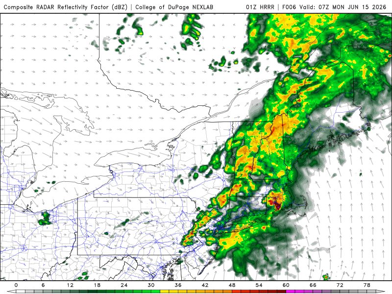
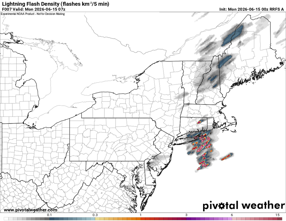
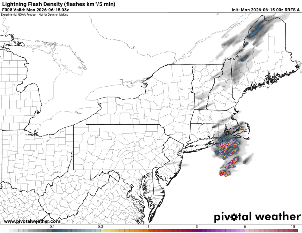
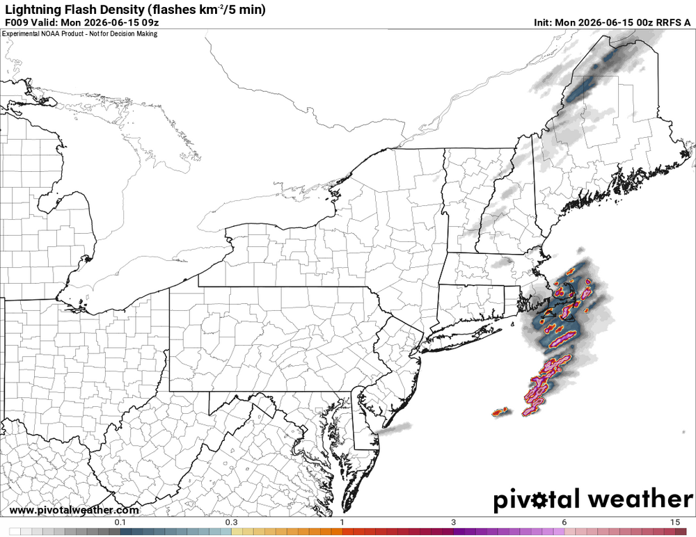
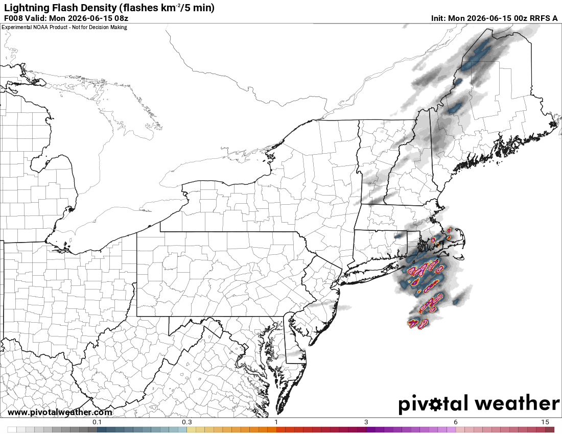
Rather meh for NNE today. Not a single svr wx report and one SVR from CAR. Seems like the overnight stuff will end up better. RRFS and HRRR show this well for ern CT/RI/SE MA. Li'l finger of CAPE quite apparent. RRFS LTG density solid (as a rock).
-
Any hrrr or updates? I flood where I am and I dont want to move the cars if its just going to be 1 inch or so of rain in an hour or so. TWC future cast shows back building severe storms from about 11 to 130 am. Noaa barely mentions anything but showers. Radar looks like a line but TWC future cast creates huge red cell over all of north NJ
-
closing in on 1.00 here!
-
I just mean convective models are pretty dry CON-south yet radar looks fairly wet to our west.
-

E PA/NJ/DE Summer 2026 Obs/Discussion
Birds~69 replied to PhiEaglesfan712's topic in Philadelphia Region
Stuff moving in....steady rain, thunder.
-
The inverse of winter weather on that map.
-

E PA/NJ/DE Summer 2026 Obs/Discussion
JTA66 replied to PhiEaglesfan712's topic in Philadelphia Region
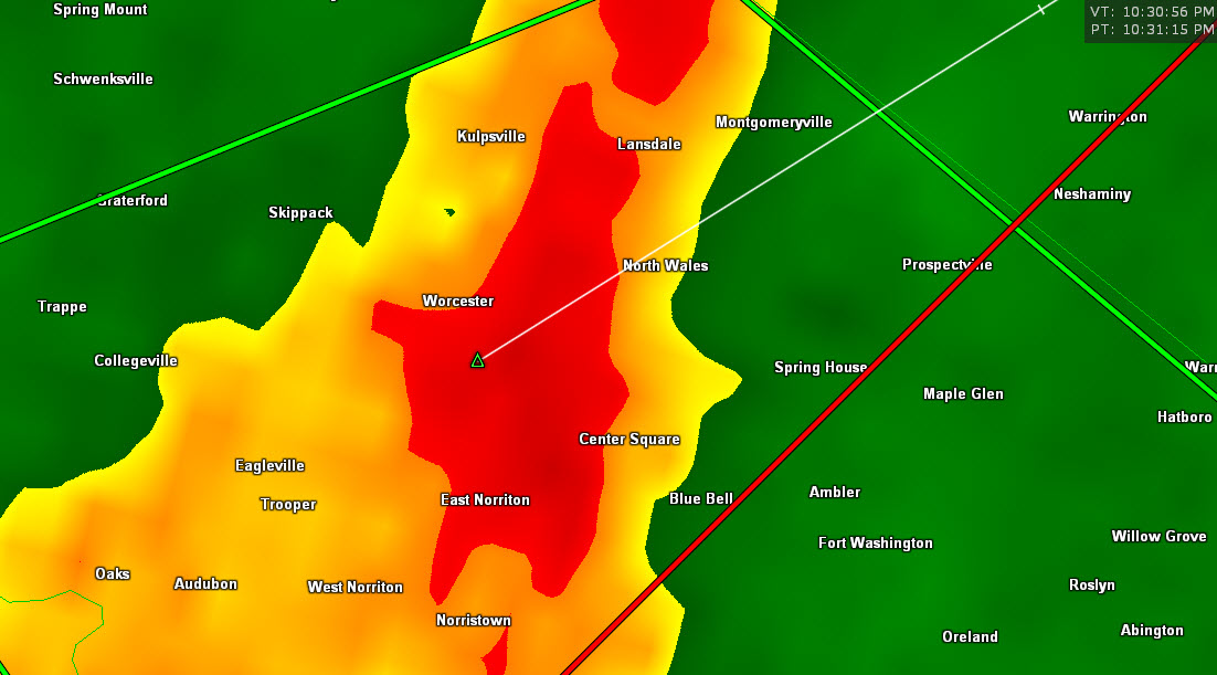
Rippin’ fatties here and under a flash flood warning. - Today
-
Was that a NWS /gov't work bid/ career move? You're originally from RI? What a mistake!
-
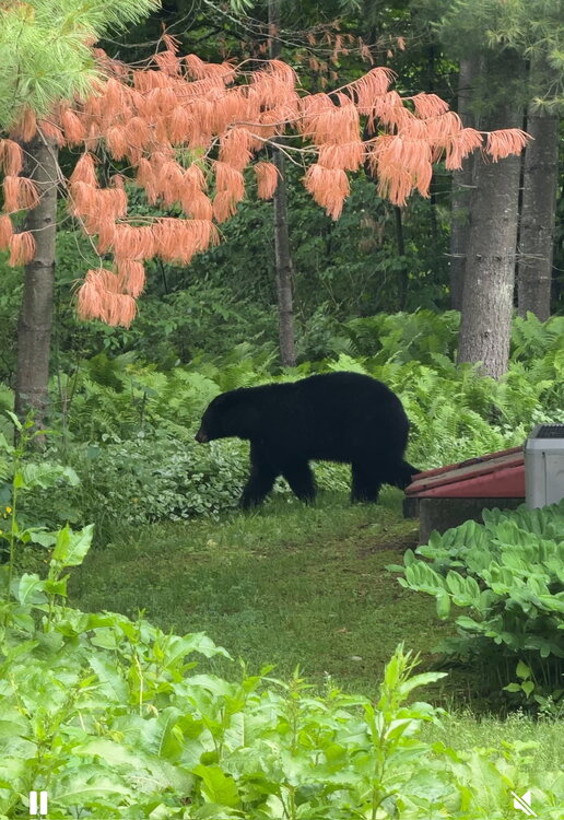
Yogi came through the yard again this evening.
-
At least you didn't make this move.
-


.thumb.jpeg.f5c6ba9d911ec96b3b124f8606aee58e.jpeg)


.thumb.gif.f92b16c631a1d15d405ed77b33f0710d.gif)

