All Activity
- Past hour
-
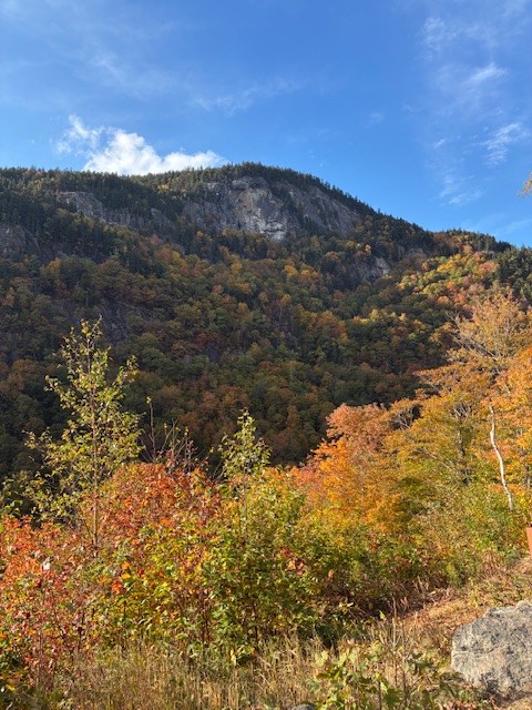
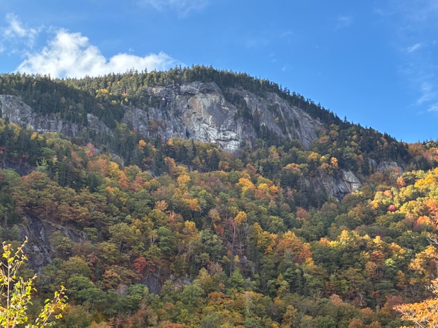
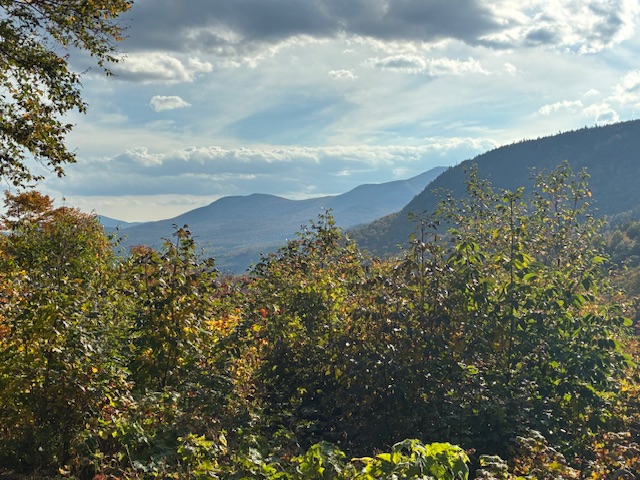
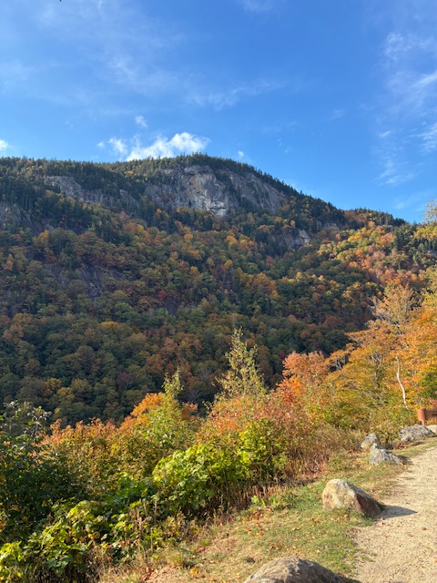
Went over to the Fryeburg Fair today. Went over through the Kanc and then went home up 113 through Evans Notch to Rt. 2. The best color was through Groton, VT and then on the western slopes of the Whites to Twin Mountain. I was surprised how little change there was in Evans Notch.
-
I still think nobody really knows what this thing is going to do. The 12z Euro was like east then west then east again, it didn't know what to do.
-
Yeah the heavier stuff has been tracking SW to NE mostly just to my west. I have been right on the edge.
-
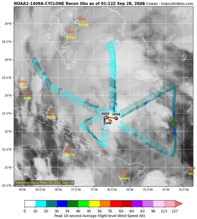
Per recon, it hasn’t been moving NNW. Actually, there apparently was just a reformation of the weak center slightly to the SE per this. Overall, it has moved very little today so far:
-
M1.2" Ferry Cove mesonet site
-
I don’t think it’s broad looking at the sharper wind shifts on recon, but it is weak—probably because it’s only now starting to tighten up and convection is limited.
-
I will watch the Ravens tomorrow if Keaton Mitchel is activated, and involved. Otherwise fuck Harbaugh for not putting the best available talent on the field. I have better things to do and will catch the 'highlights' later. Their best 2 D-Lineman are now on IR btw.
-
Base on my amateur eyes, and satellite photos, Nine's center looks very broad and disorganized right now. There is a closed low, but it is still a big mess. Wind shear seems to have let up a bit, but still exists. Plus Humberto is not far away, moving WNW at 10mph, at : 22.9°N 61.1°W. Nine is at Location: 22.4°N 76.5°W moving NW at 5mph. Can someone confirm on latest satellite that it looks more like NNW at this time as the cold front to the north west is blocking it from getting to the coast.
-
You'll get plenty of rain. Remember, Washington DC does massive, brobdingnagian rain events like a boss.
-

Spooky Season (October Disco Thread)
HoarfrostHubb replied to Prismshine Productions's topic in New England
We’d-Friday look to be in the low to mid 60’s here for highs. -
Don't let that weak Nina get to you. Mid Atlantic will still have plenty of snow and frigid Vodka-Cold weather. You're gonna need a bigger shovel.
-
Been getting steady moderate rain here the last hour or so. Just hit 0.50". Pleasantly surprised.
-

September 2025 OBS-Discussion centered NYC subforum
FPizz replied to wdrag's topic in New York City Metro
Light rain, .02" haha -

Spooky Season (October Disco Thread)
Damage In Tolland replied to Prismshine Productions's topic in New England
Put the long range GFS away . Even own ensembles don’t agree . You fall in love with with ops -
Some evening analysis
-

Central PA Fall Discussions and Obs
WxUSAF replied to ChescoWx's topic in Upstate New York/Pennsylvania
Really fortunate this a tie game. Kudos to the defense. Offensive line getting dog walked. -
Although the convection is weak and disorganized, recon is now showing a much more well defined circulation, which if it holds will allow for gradual organization. Note how much tighter the circulation is in the image above, compared to some of the recon images posted earlier. You can also see a pocket of slightly stronger winds on the far eastern side of the system. Below you can see how the circulation is becoming better organized. Slowly. Convection is weak, but there has been some firing of stronger thunderstorms near the center. Shear has remained an issue through the day, but analysis shows that the shear may be abating, especially near the center. TD9 is in one of the best thermal environments in the entire Atlantic, so if it can start generating deep convection over its tightening center it should gradually intensify. While I am posting the SHIPS here, there looks to have been a bit of an uptick from hurricane guidance in overall intensity over the coming days. That's something we'll need to pay attention to, with the caveat that the trough and possible dry air will continue to lurk and will likely put a cap on intensity. Now for the track. There is increasing confidence that future Imelda will in fact turn away from the SE coast, but there is still a lot of uncertainty on how close the center gets to the coast and critically, the speed of the turn. Most guidance now turns the system away from the coast and accelerates it east into an Humberto created weakness. But within this evolving track forecast there are two diverging camps. The first, and most numerous, is one that easily follows Humberto out to sea. The second, which is led by the Euro and Euro AI to an extent, turns the system more slowly and allows a ridge to build over the top and close the escape route. The result is Imelda being turned back toward the coast. There aren't a lot of members that are held back, but the ones that do are pretty strong. So while it very well may be the case that this does turn and accelerate out to sea, there's still uncertainty. Remember, the models struggled with this inside of 100 hours. I'm not sure we should be locking in anything 5+ days out yet. Additional recon and finally having a well defined center should help with both track and intensity guidance. Finally, just because this is likely to stay offshore initially, that doesn't mean no impacts. TS force winds, coastal flooding, and flash flooding are still squarely hazards for coastal FL, GA, and the Carolinas. Just slight track changes could make the flood threat more impactful along the coast.
-

September 2025 OBS-Discussion centered NYC subforum
Stormlover74 replied to wdrag's topic in New York City Metro
Well the models backed off. I was surprised to see anything -

September 2025 OBS-Discussion centered NYC subforum
Picard replied to wdrag's topic in New York City Metro
Yes, in a few towns. Most aren't seeing anything. Maybe overnight, but I have some doubts. - Today
-
Strange stall
-
This has been very underwhelming.
-
0.68", picked up 0.4" in the past hour
-
there's no february 19-20 redux dude. we're not talking about a blizzard, we're talking about a hurricane.
-

Spooky Season (October Disco Thread)
ineedsnow replied to Prismshine Productions's topic in New England
have you looked at a model? -
September 2025 OBS-Discussion centered NYC subforum
Stormlover74 replied to wdrag's topic in New York City Metro
Its raining right now


