All Activity
- Past hour
-
My point is the idea that the Gulf or Caribbean is some sort of escalated threat because they haven't been 'touched' or active so far. It's almost always supportive (when it comes to sst's/ohc) throughout the season regardless of activity.
-
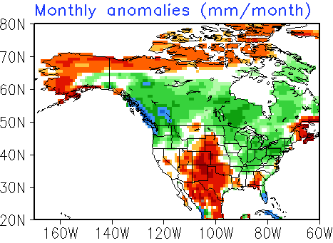
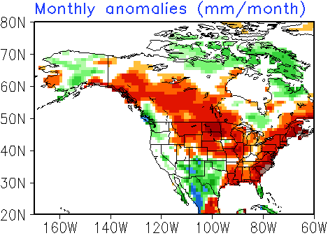
It is now all but certain that New York City will see no rainfall for the August 22-31 period. Such an outcome favors a drier than normal September. When this was first noted last Sunday, the CFSv2 showed wetter than normal conditions for September. The CFSv2 now shows a drier than normal September:
-
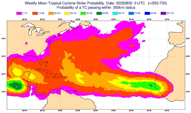
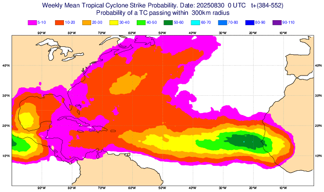
And that’s not surprisingly the area of formation where the EWs have been suggesting would probably be the greatest threat to the US 9/15+ though SC north has a notable threat from the open Atlantic, too: 9/15-21: 9/22-28:
-
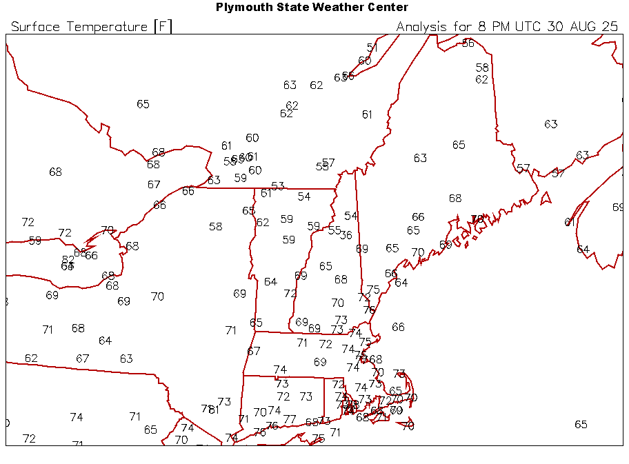
The coolest air mass so far this season moved into the region last night. The temperature fell into the 50s in New York City and 40s in some outlying areas. Low temperatures included: Atlantic City: 51° Binghamton: 44° Bridgeport: 55° Danbury: 47° Farmingdale: 55° Islip: 56° Montgomery: 45° New Haven: 58° New York City-Central Park: 57° New York City-JFK Airport: 57° New York City-LaGuardia Airport: 59° Newark: 57° Philadelphia: 57° Poughkeepsie: 46° Trenton: 51° White Plains: 53° Tonight will be a similar night. Afterward, temperatures will finish the weekend with highs in the middle and upper 70s under abundant sunshine. Generally cool and dry conditions will persist through the middle of next week. A system could bring some rain on Thursday or Friday. The big weather story next week will be the development of a massive heatdome oer western Canada. Temperatures in parts of British Columbia could challenge the Canadian national September record of 101° (38.3°C) from Windsor, ON that has stood since September 6, 1881. The ENSO Region 1+2 anomaly was -0.1°C and the Region 3.4 anomaly was -0.4°C for the week centered around August 20. For the past six weeks, the ENSO Region 1+2 anomaly has averaged +0.45°C and the ENSO Region 3.4 anomaly has averaged -0.28°C. Neutral ENSO conditions will likely continue into early autumn. The SOI was +8.01 today. The preliminary Arctic Oscillation (AO) was +0.382 today. Based on sensitivity analysis applied to the latest guidance, there is an implied near 100% probability that New York City will have a cooler than normal August (1991-2020 normal). August will likely finish with a mean temperature near 73.7° (2.4° below normal). That would make August 2005 the coolest August since 2000. Supplemental Information: The projected mean would be 1.5° below the 1981-2010 normal monthly value.
-
What a day. 10/10 all day on these.
-
No but warmth and some dews are
-
This could be the most overplayed and tiring argument year after year when it comes to ssts/ohc and the potential. When it comes to the 'waters' the GoM and NW Caribbean are generally always supportive of not only tropical formation but intense storms throughout the season. I
-
So, we're just about to finish CoCgust. Now on to CoCtember and then CoCtober. Low dews and sunshine for all. Don't ask for rain, it ain't coming.
-
-
Boy, what a low temperature this morning! 44.2 degrees around 6:45am. Like many others have mentioned, it's been a really long time since widespread 40's were recorded in August, albeit the 30th, but officially August and still both meteorological summer and astronomical summer. This weather is so wonderful, especially the low dew points. Oh, I forgot to mention that this low was 14 degrees below the average low of 58.2 degrees for today. Normal (average) high for today is 82 degrees. It seems it's been impossible to score a low temp departure this great in late summer in a really long time.
- Today
-
Update on EW from Lazza at S2k: Update on EW vs 2 days ago: slightly quieter 2nd 1/2 but still much more active 2nd half of Sep vs 1st half:1-7: 4.5 (0.3)8-14: 8 (0.5)15-21: 14 (0.9)22-28: 18.5 (1.3)
-
Curious is the pattern is trying to tell us something for the upcoming Winter? When was the last time ended Summer this cool? Obviously more questions than answers but getting a little excited with how things are setting up.
-
-
Let's hope that warm pool migrates east toward Alaska like JD posted about a while ago.
-
But it’s not fall. This is cooler than most of Sept will be
-
Same to you !
-
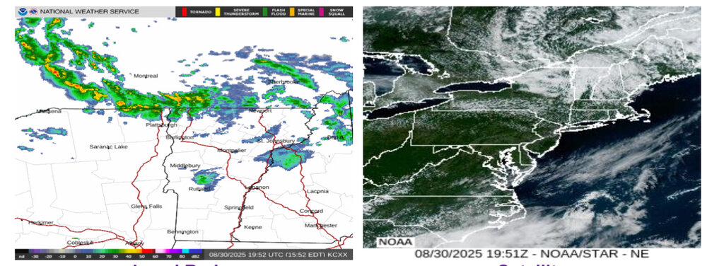
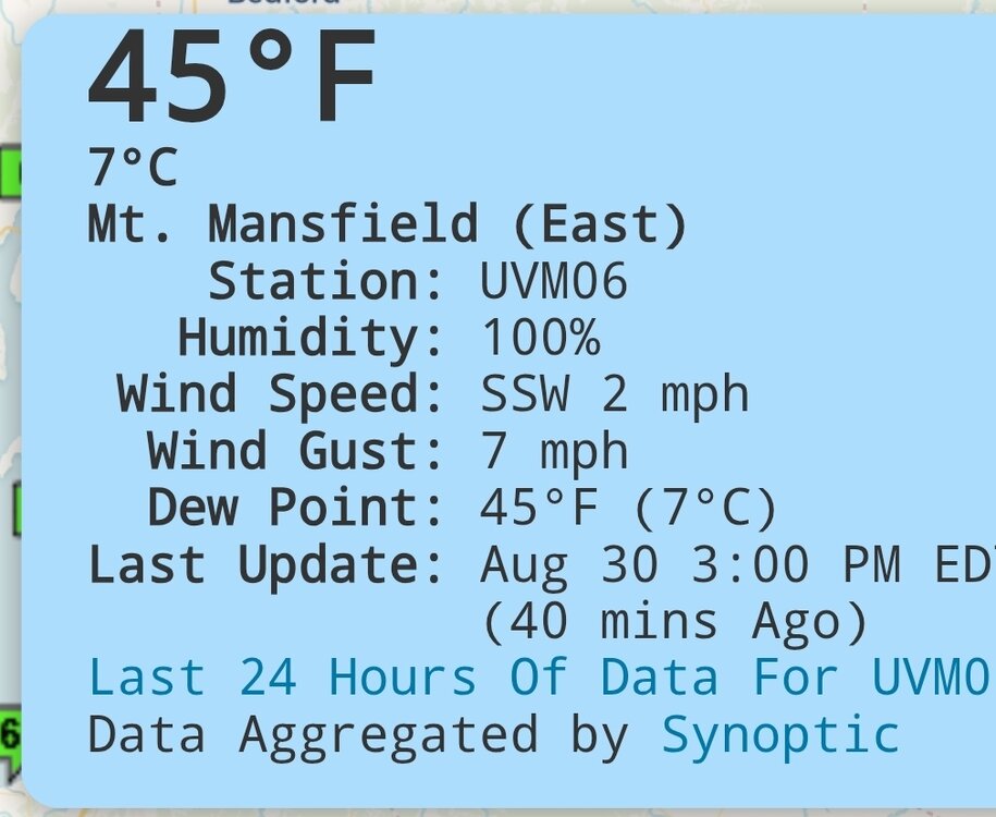
At 3 PM, 36F, 39G47, vis. zero. Hope no climbers (also drivers and Cog passengers) were expecting a view. Just had a quick shower with some gusts into the 20s and temp dropped into the 50s. Had showers at midnight and 8 AM also, probably under 0.2" in total though the MTD is about 1.3".
-
-
Things should begin to change soon out West.
-
I’m not saying it’ll be upper 60s to low 70s all September, but at BDL climo is 81/59 today and 77/55 two weeks from now. Solidly above in a backsliding climo isn’t really deep summer as we progress through September.
-
Congrats on a sunny august day with a high in the 60s
-
I hope that is true. It's slightly encouraging to see above normal sea surface temps along the Inside Passage.
-
If I could get a job in Lancaster I would.

