All Activity
- Past hour
-
Yeah. Woke up to no power and some damage here.

-
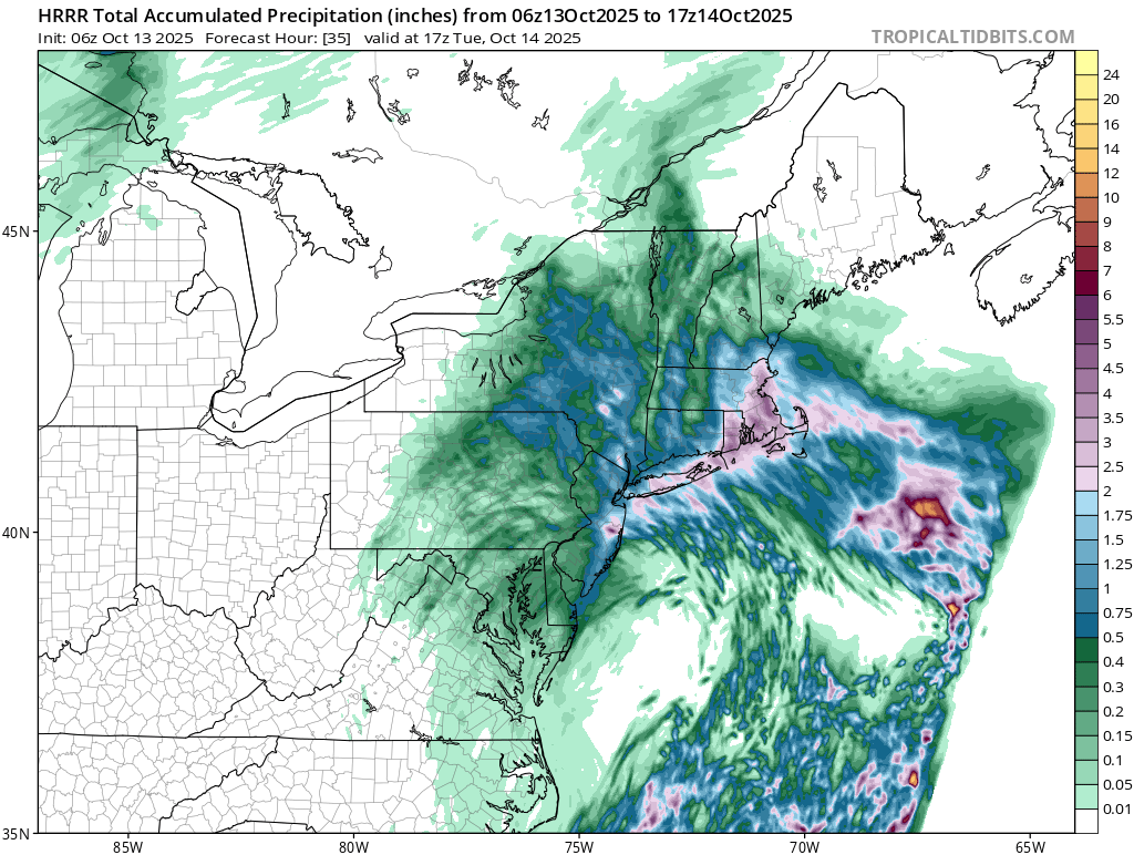
 Very moderate event as the system split into two weaker lows instead of one strong consolidated one. Generally 1 to 1.5 for my area. While we have had much heavier rains with October Nor'easters in the past, I will take it since we need the rains.
 -
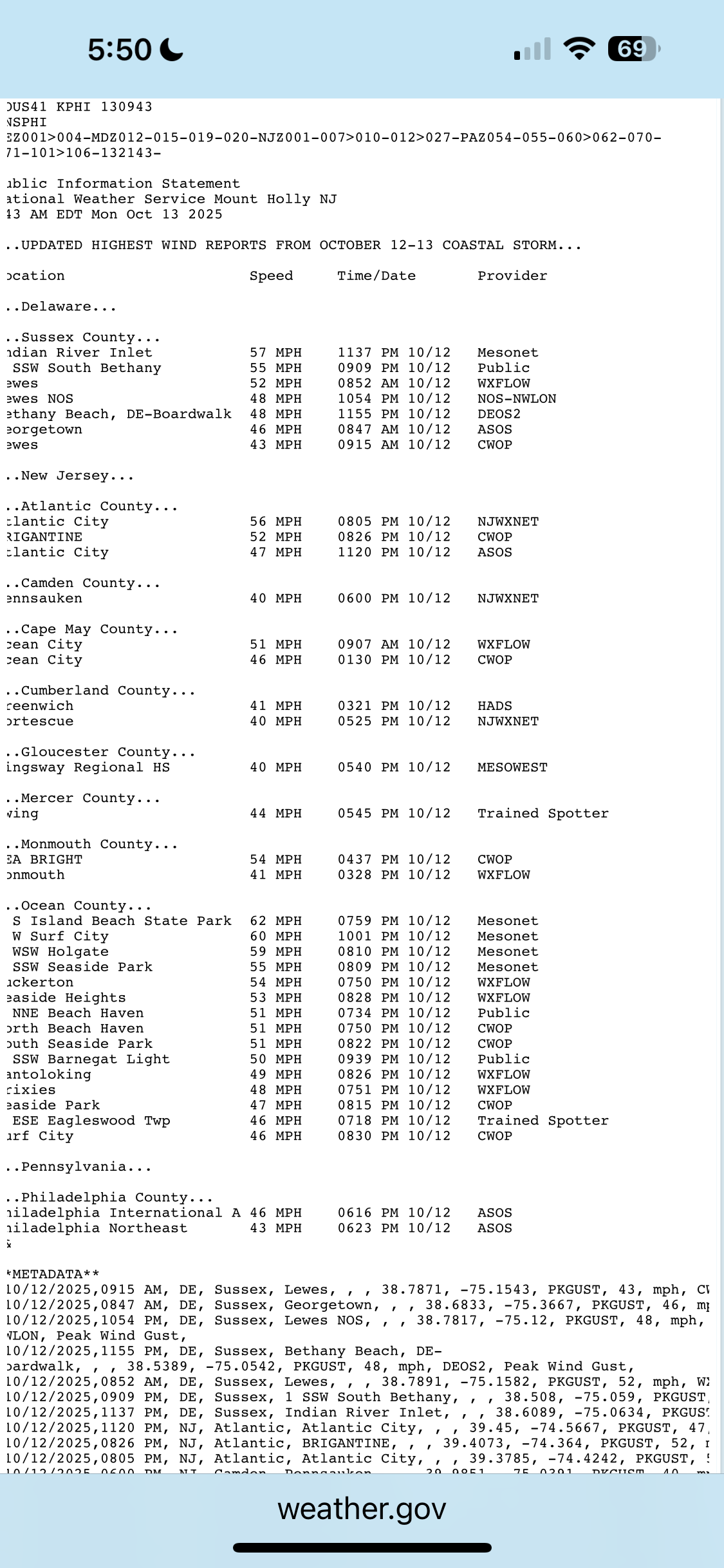
Some big, house creaking gusts. Power went out 10 minutes ago. Damage!
-
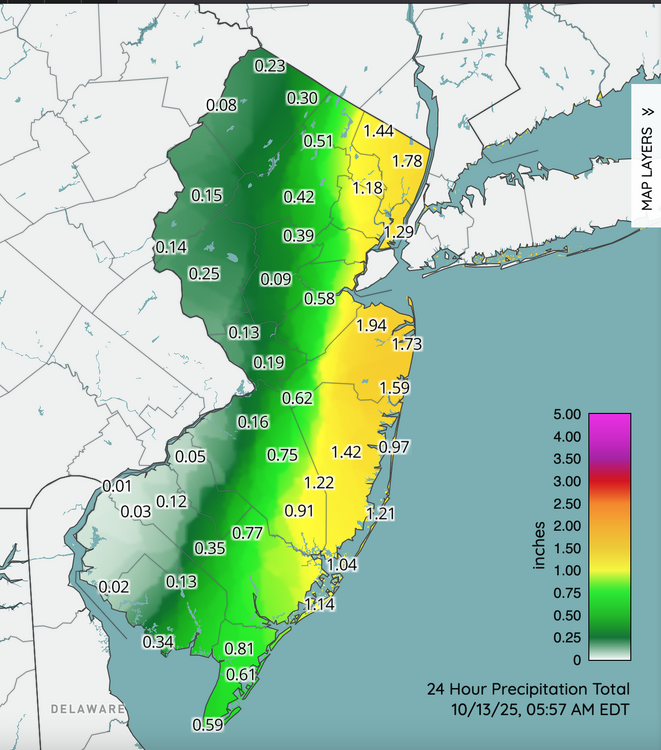
0.80 total here so far. Meh
-
 2.09 inches of rain for the event so far. Very satisfied
 -
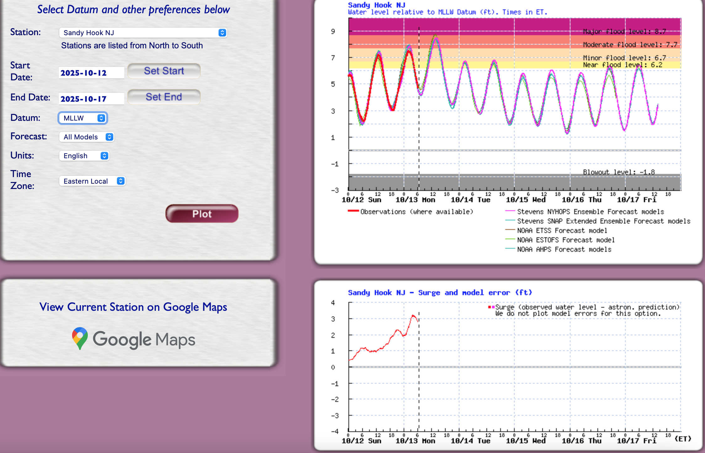
 Added the most likely scenario for the afternoon high tide, SANDY HOOK representing the onshore packed in water. Rainfall runoff and backed up streams that empty into the Atlantic will exacerbate the flooding this afternoon. So far, no official storm reports that I can see from OKX.
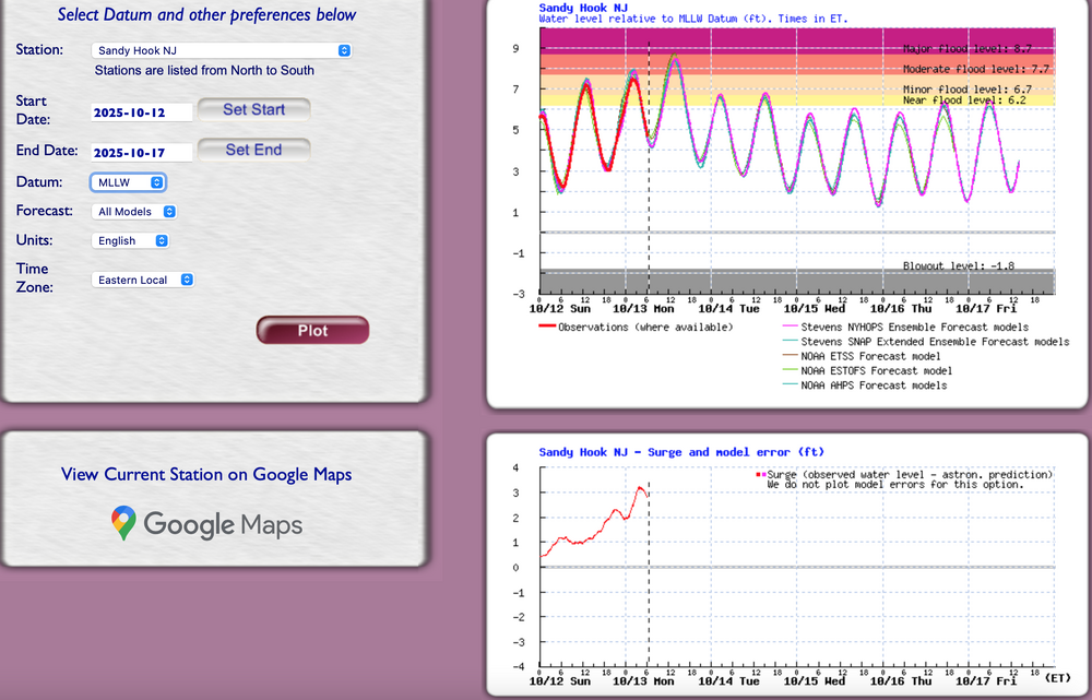
- 543 replies
-
- 1
-

-
- heavy rain
- damaging wind
- (and 2 more)
-
1.31 inches total so far.
-
I’m out on Fishers island for this one. It’s still wild out there. Gonna be a bumpy ferry ride back to the mainland today. That’s for damn sure.
-
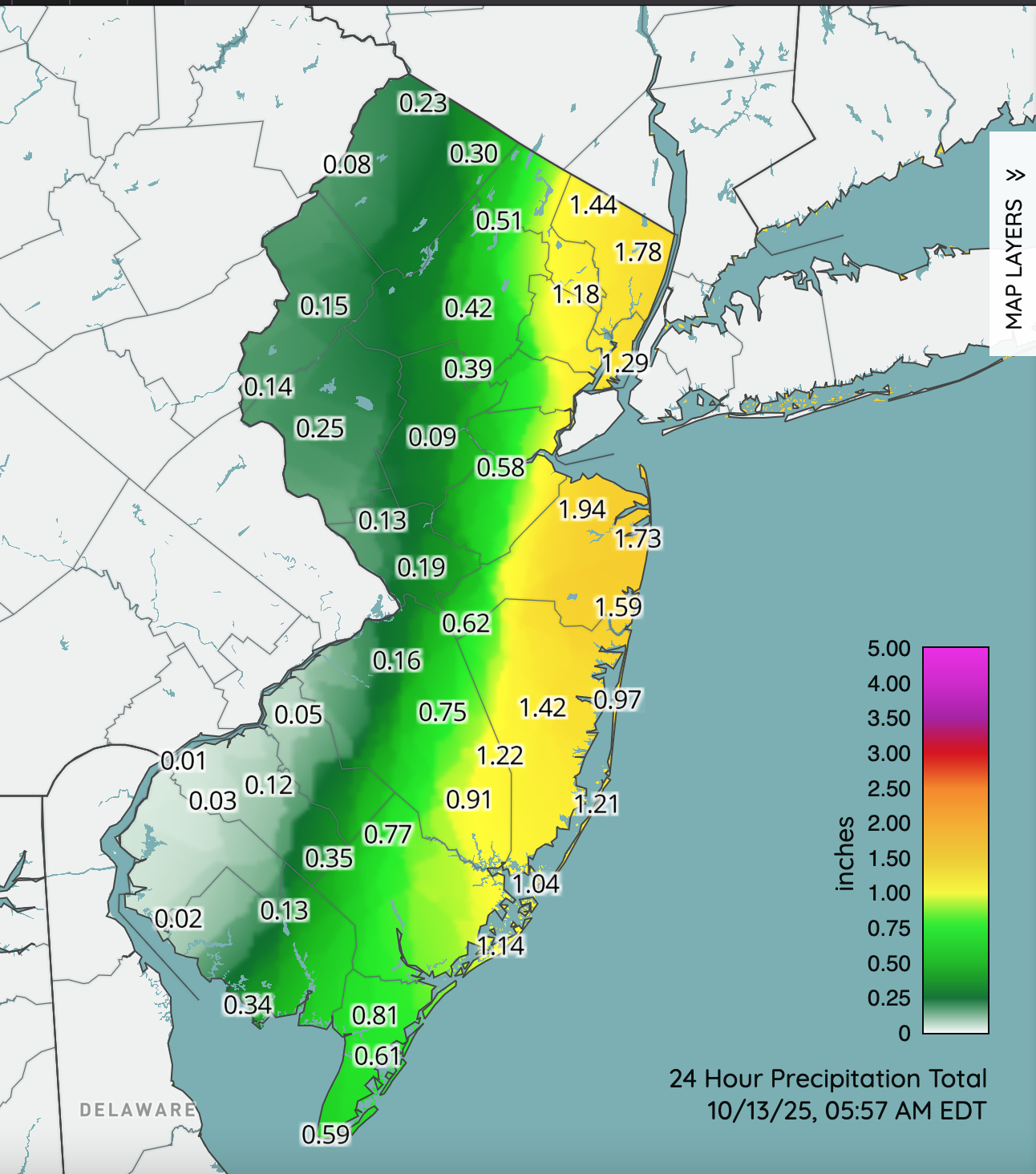
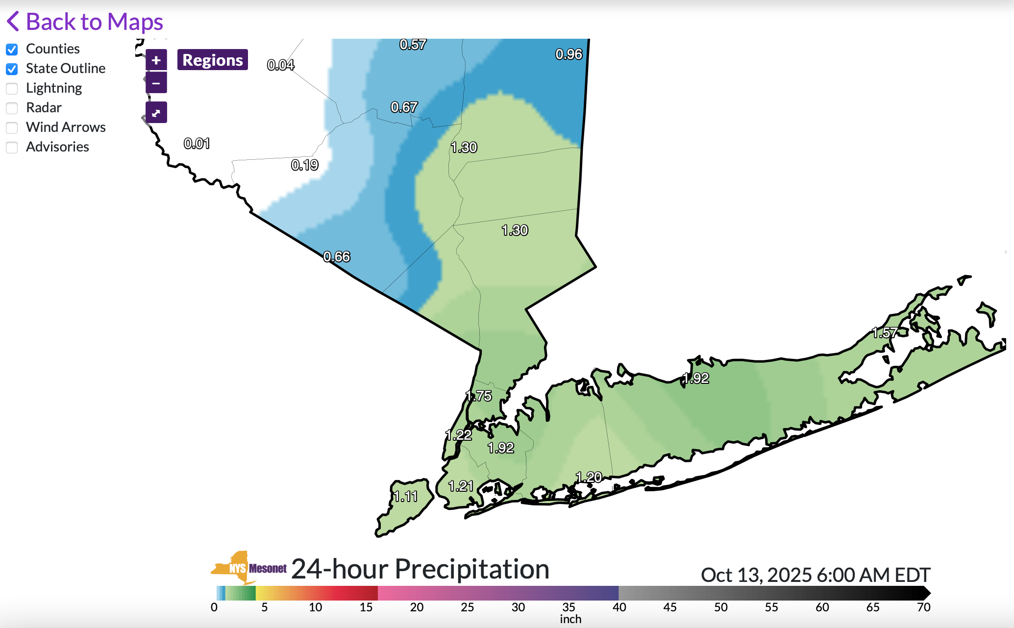
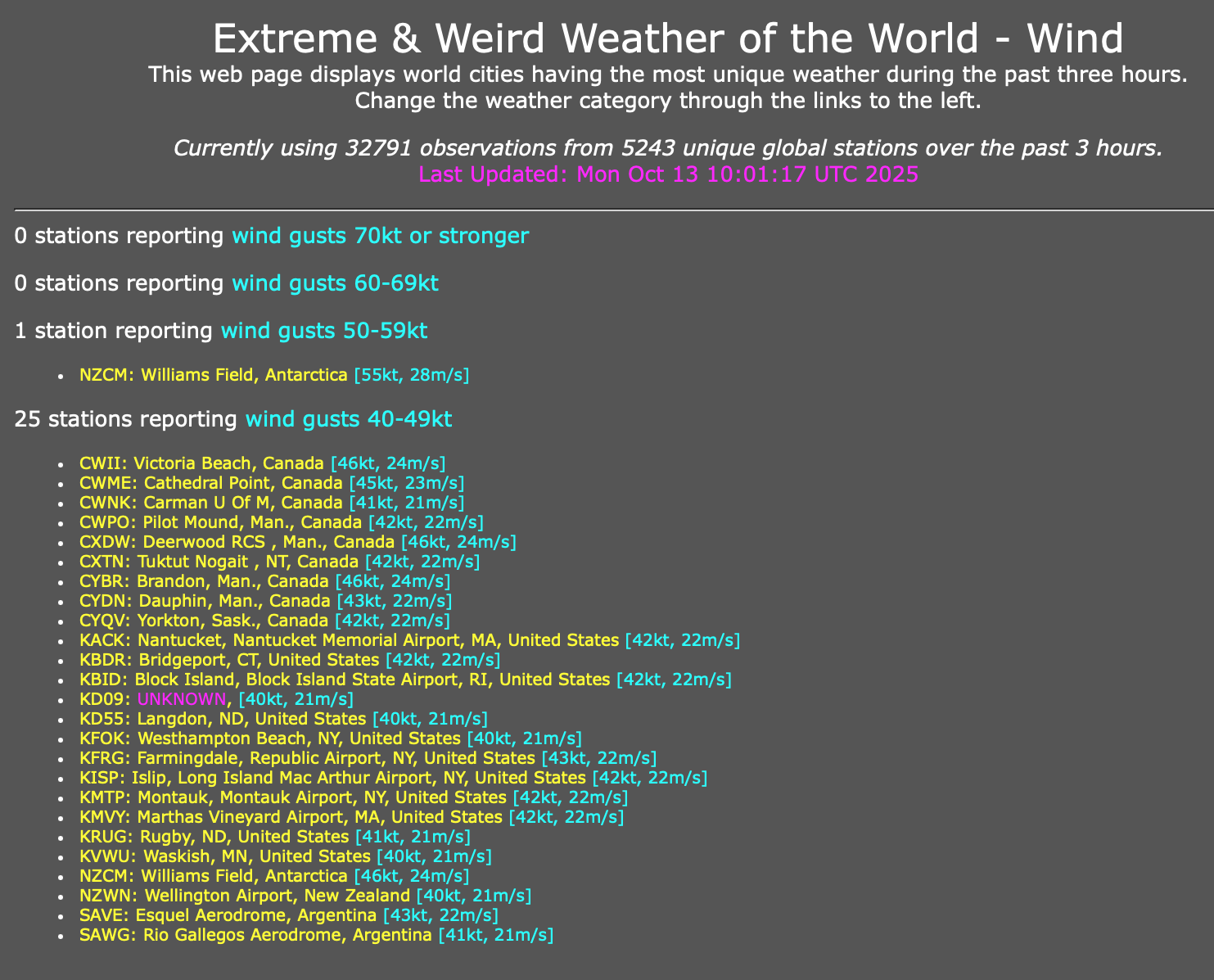
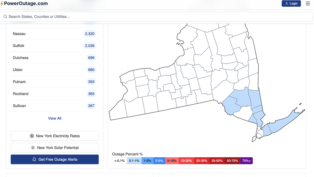
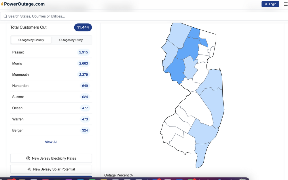
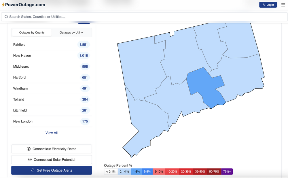
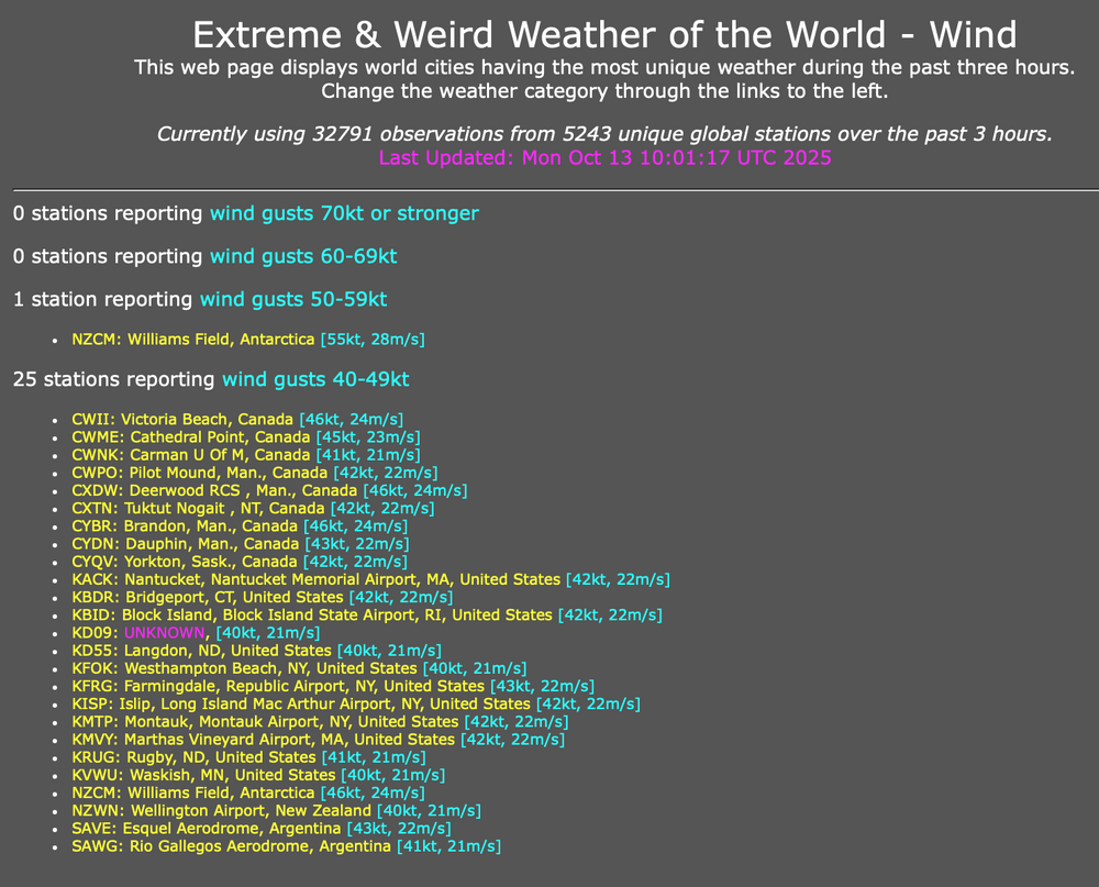
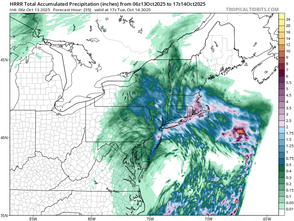
Visuals with power problems, even in nw NJ at 620AM Rides running 3' a move normal right now so a very good chance of moderate coastal flooding with the midday-afternoon high tide. Winds a little lower than expected on LI but the Fire MIN GUST tool from SPC HREF set the bottom line very well. So... here are some visuals on rainfall, power outages and airport gusts 46MPH or greater the past 3 hours ending around 6AM.

- 543 replies
-
- 2
-
-

-
- heavy rain
- damaging wind
- (and 2 more)
-
2.83" total so far
-
If this pattern continues into November, at least as far as the “warm blob”/2013 SST pattern, it’s going to be real difficult to continue to use it as an SST analog. The warm blob came right back in early November, 2013 and we went into a Victoria mode PDO for the winter. So far, the cooling has not reversed over the last month and is continuing….
-
 Rainfall totals OKX https://forecast.weather.gov/product.php?site=NWS&issuedby=OKX&product=PNS&format=CI&version=1&highlight=off&glossary=1#:~:text= 4
 -
Max winds OKX https://forecast.weather.gov/product.php?site=NWS&issuedby=OKX&product=PNS&format=CI&version=2&highlight=off&glossary=1
-
Quite the orographic precip shield after that main band lifted north on models?
-
 Over 4k workout power now
 -
Gusty at times here during the overnight and currently ongoing. Estimated up to 30 mph at times here on too of the hill.
-
ALEET! ALEET! Mt Bachelor has picked up their very first 4 inches from the ground up, in the past 24 hours!!!!!!!
-
 Heavy rain overnight. 2.18” total so far.
 -
Looks like the wind, the rain made it up here overnight. Almost an inch so far .90. Hopefully can match that today it's needed.
- Today
-
The one main staple over the last several winters besides the negative ENSO tendency and reoccurring MJO phases has been the marine heatwave in the NW PAC around Japan. It’s been extremely anomalous
-
For most places from RDU to BOS, Sunday was the coolest daytime since June 1.
-
 The NHC has named Lorenzo in the tropical Atlantic, another likely fish storm but hey we'll take what we can get. Scoring tables will be adjusted yet again. Jerry disappeared so no chance of becoming a hurricane. They say Lorenzo has an outside chance. I am guessing the coastal low will get a name a few days from now when it's out over warmer waters. That will be Melissa, or Nestor, or ...
 -
ENSO thread. Not the NYC who can be more wrong and whine forum.
-
 Over 1.5” now, at least it feels like autumn outside lol.
- 543 replies
-
- 1
-
-
- heavy rain
- damaging wind
- (and 2 more)