All Activity
- Past hour
-
You made me look. Dang, Eps even better than the 6z Gefs 24hr period! But to answer your question, looks like a weak sign of a threat at the end of the run.
.thumb.png.81ff559e4e66fde5b36d11a607338421.png)
-

First Legit Storm Potential of the Season Upon Us
The 4 Seasons replied to 40/70 Benchmark's topic in New England
WWA for T-1 and WSW for 1-2 lol. but i get it, they dont even have plows down there and no one knows what to do in the snow -
Nws is hilarious they call for a rain snow mix today and 35 with 1-2 inches. How do you get 1-2 inches with a rain snow mix at 35? Then you click on the wwa and it says 2-4 inches. i guess they are covering all their bases. I think this is mostly a rain storm the HRRR is already wrong they said we would be 15 minutes of rain with the change over to snow and we’ve been waiting for about an hour so it’s already Wrong.
-

First Legit Storm Potential of the Season Upon Us
WinterWolf replied to 40/70 Benchmark's topic in New England
Snowing right on the gulf coast in western Florida(panhandle), and Alabama…two years in a row for them. Impressive. -

January 16-18th: Rolling the dice
Stormchaserchuck1 replied to SnowenOutThere's topic in Mid Atlantic
I have some big flakes starting to mix in. It seems to be changing over here. -

First Legit Storm Potential of the Season Upon Us
BrianW replied to 40/70 Benchmark's topic in New England
Nice band setting up into RI.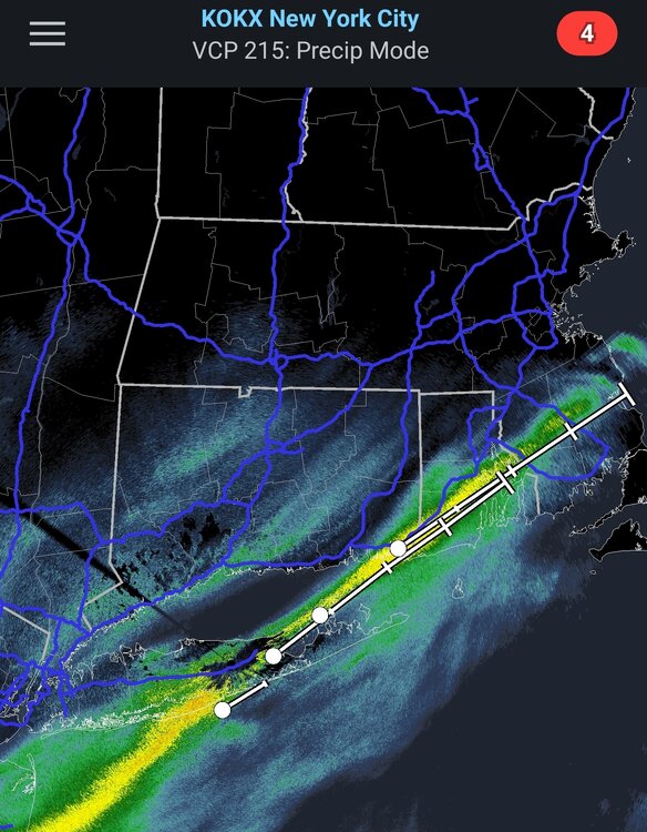
-
Does the EPS like any other windows or is it mostly from the 1/25-27 period?
-

January 18th Back Door NW Trend Snow OBS Thread
KamuSnow replied to Mikeymac5306's topic in Philadelphia Region
Light snow in Glen Mills, 32F. -
Finally starting to changeover here (central Balt. county). Noticeable uptick in the amount of snow mixing in during the past 10 minutes or so.
-
It’s just rain in Fallston as of 6:15 am.
-
-
Undoubtedly, the best 24hr ensemble forecast period of the year on the 6z Gefs. EDIT: I should add that this is 180 hours, so you can't expect a big number like 6"+. Those won't come until we're closer to the threat.
.thumb.png.a64884f086cc4eb655978ad4c7ea1405.png)
-
First Legit Storm Potential of the Season Upon Us
BrianW replied to 40/70 Benchmark's topic in New England
Yeah. One of the snowiest starts to winter down here on the shoreline in many years. Up untill this winter I haven't used my snowblower in like 5 years. -
It's going to be close buddy. I think we will at least get to see some snow falling here shortly this morning. Good luck my friend and everyone else in the area.
-
Lgt snow here coating on all surfaces
-
First Legit Storm Potential of the Season Upon Us
The 4 Seasons replied to 40/70 Benchmark's topic in New England
feel much better about 4-8 after seeing overnight runs and looking at bufkit for tonight. though still think more 4-6 than 6+ totals. temperatures are running a bit colder than fx so not really worried about accumulation problems at the shore/se. think itll rip tonight for a while at 1"+/hr 6Z GFS beefed up a bit again -

First Legit Storm Potential of the Season Upon Us
wokeupthisam replied to 40/70 Benchmark's topic in New England
-
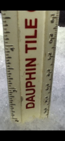
Wantage NJ 6AM/18: 0.3" so far. a little more ice encrusted flakes today. Flurries at 345A but all of the accumulative after 5AM.
-

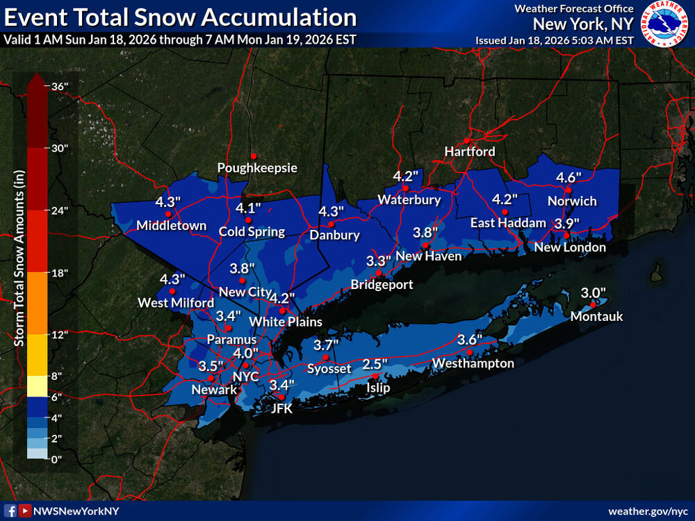
Central PA Winter 25/26 Discussion and Obs
mahantango#1 replied to MAG5035's topic in Upstate New York/Pennsylvania
At least an inch of snow here. But we all know how CTP is with their warnings and advisorys when it comes to winter weather. -
First Legit Storm Potential of the Season Upon Us
WinterWolf replied to 40/70 Benchmark's topic in New England
It’s been quite good here…and for you too. -
January 16-18th: Rolling the dice
Stormchaserchuck1 replied to SnowenOutThere's topic in Mid Atlantic
I've been mostly rain. A few flakes are trying to mix in. -

First Legit Storm Potential of the Season Upon Us
HoarfrostHubb replied to 40/70 Benchmark's topic in New England
Has it even begun? -
Moderate/heavy snow.
-
.thumb.jpg.6a4895b2a43f87359e4e7d04a6fa0d14.jpg)
Central PA Winter 25/26 Discussion and Obs
Yardstickgozinya replied to MAG5035's topic in Upstate New York/Pennsylvania
2" on the ground here. Rt 114 lewisberry road here in northernmost york county 6:05 am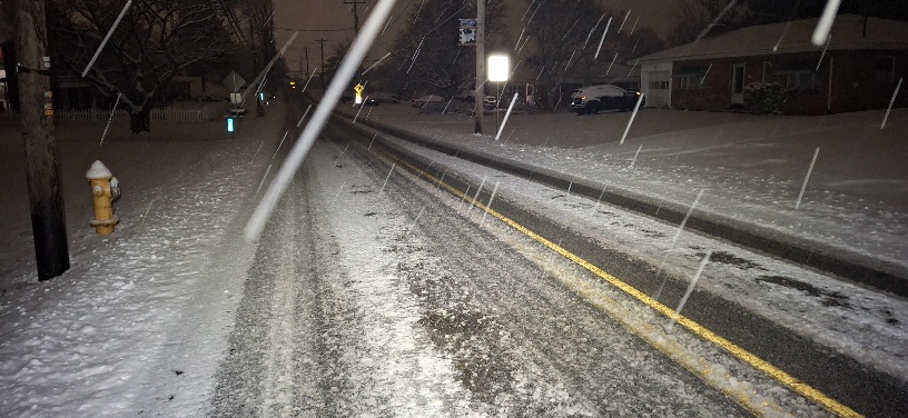
-

E PA/NJ/DE Winter 2025-26 Obs/Discussion
Duca892 replied to LVblizzard's topic in Philadelphia Region
No matter what it ends up as GFS has showed next weekend run after run

.png.b41658fdce789768f5ee164933f63c60.png)


.png.9bf0c909c553c0c737b46b3ef3678d0e.png)


