All Activity
- Past hour
-
 4….
4…. -
 Is there a sign up sheet ??
 -
You’re just now learning how to drive like the rest of us?
-
From a satellite protestation, I agree w/ the NHC upgrade to TS at 00z, sheared as it may be. Look at the last VIS, it seems one LLCC is moving farther away from the convection to the N, and it looks like there may be another LLCC to its WSW that is drifting SSW. This is common for broad, nascent TCs -- more than one LLCC. For a sheared system, I am surprised the convection on the downshear side is not more intense. It has struggled to get to -75 C for cloud tops. Often, sheared TCs have much colder convective tops (<-90 C) than even a mature hurricane as wind shear actually promotes more intense convection from dry air mid-level and better lapse rates hence stronger tstm updrafts. Not the best looking TC on sat or radar, but they come in all sorts of types. A Spectrum, not one-size-fits-all! Such a formatio outside the MDR/deep tropics) is consisten for a strong El Nino year.
-
We’re up to 3 helpers by my count. It’s early with not a lot of traffic on here now.
-
 He’s too far gone to see what is happening objectively. Nothing we can do but laugh and help him move…
 -
PR was a mess, but it did serve its purpose!
-
A top ten day like today followed by a rain day? Hell…….
- Yesterday
-
NHC agrees, we have TS Bertha. .
-
Had two severe warned storms today. Rain totaled 1.78", with some small hail and gusty winds with each one. Garden took a bit of a hit but nothing a stake and some rope didn't fix. Weather the next couple days looks cool, high in the 60's tomorrow with a low in the 40's. AQI of 101 should improve further tomorrow.
-
Lee Goldberg was showing an HRRR model output showing 2-4" rain totals for NE Jersey, Hudson Valley, and SE CT tomorrow with NYC at the southern end of it.
-
 I'd love to respond to the so-called "leftism" comment but I know we aren't allowed to be political in the weather subforums (unless of course you support the side of the Epstein Administration). bring back PR and bring this "leftism" bullshit to where it belongs so it can be properly addressed outside of the weatherside
 -
Pretty much the same here. Just had to share my generator with 2 other family households to keep their chest freezers from thawing. Heated water bed saved my ass!
-
.thumb.jpg.6a4895b2a43f87359e4e7d04a6fa0d14.jpg)
Central PA Summer 2026 Discussion/Obs Thread
Yardstickgozinya replied to Voyager's topic in Upstate New York/Pennsylvania
This video was made five hours ago and the enhanced risk has expanded since, however I'm still always interested to hear Trey Greenwood's take over convective chronicles. -
Agree with this, we will see what NHC says though. .
-
this is how i managed the 2011 Octobomb. Grabbed the Honda 2000 we had at work second day in. It would run the forced air heating system, I macgyver'ed in a temporary plug. After warming the house, the important functions were easy: coffee grinder/coffee maker, power vent water heater, and some temp lighting and phone charging; cooking was on the grill and the camp stove
-
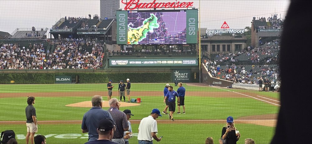
And now a delay
-
Pretty close to TS status if not already there.
-
Getting hit by multiple storms this evening.
-

2026-2027 Super El Nino
40/70 Benchmark replied to Stormchaserchuck1's topic in Weather Forecasting and Discussion
It seems that NAO is far more malleable and influenced by the solar cycle and ENSO than the AO, so I feel strongly that the AO will be lower than the NAO this season. -
Mike Masco doesn't say but explains NYC weather
-
2026-2027 Super El Nino
40/70 Benchmark replied to Stormchaserchuck1's topic in Weather Forecasting and Discussion
Well, I do see an opportunity for some of that, but I'm speaking of the seasonal mean. it clearly will not be the predominate DJFM pattern. -
Hi
-
Saw a post on FB about three Tornado Warnings in the UP at the same time. A rarity for sure