All Activity
- Past hour
-
Verbatim it’s 6-10” at 10:1. We take that.
-
-

January 2026 Medium/Long Range Discussion
Scarlet Pimpernel replied to snowfan's topic in Mid Atlantic
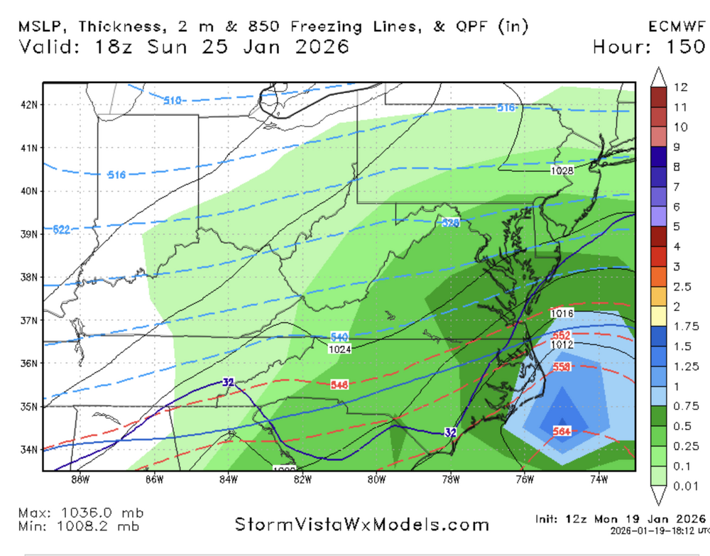
@stormtracker, were those SV Euro precip maps for 6-h amounts, I assume (the two you showed a short while ago)? -
3 stacked rolls of tp
-
what do your crap ones give us
-
Euro is further north
-
I believe the Euro AI had been showing that 29th storm for a few days now as well.
-
I think it's a foot for DC
-
Euro gets snow into SNE
-
Pretty rare for a amped up storm to trend south isn’t it? .
-
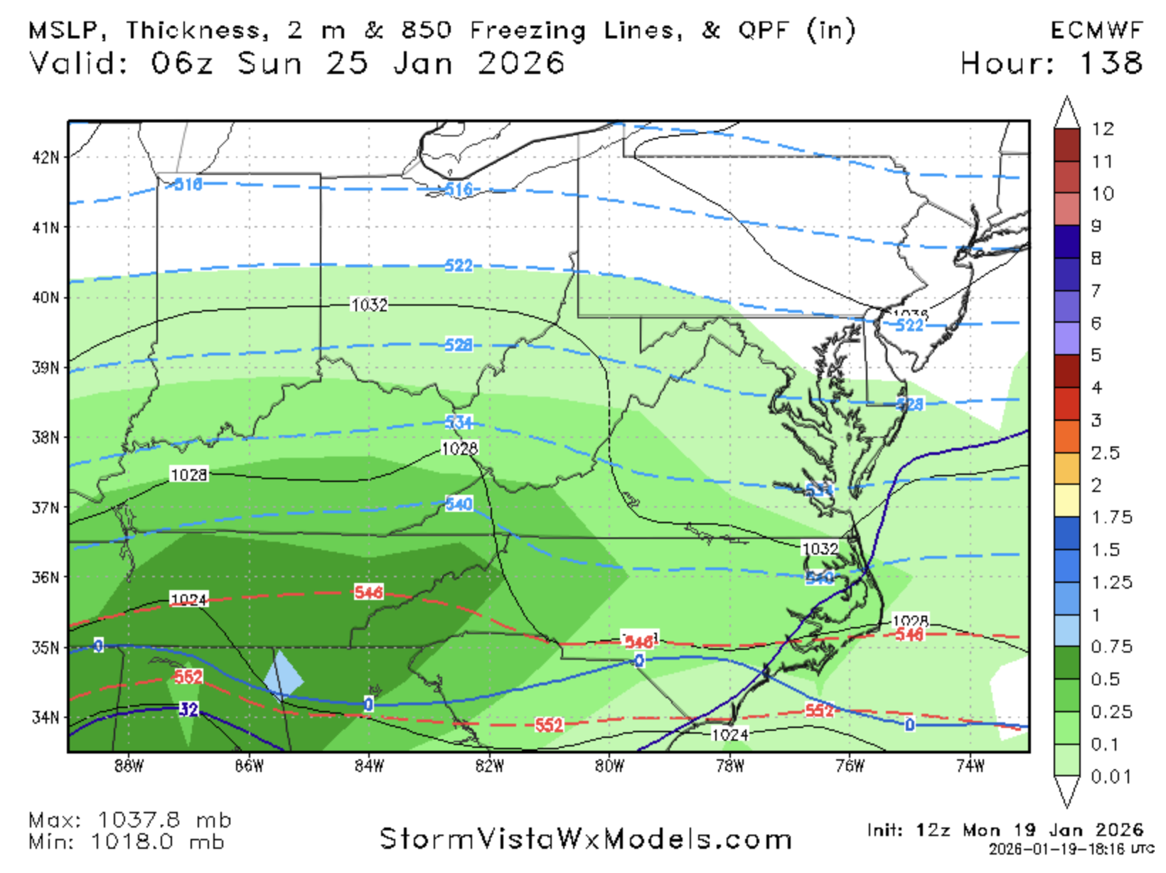
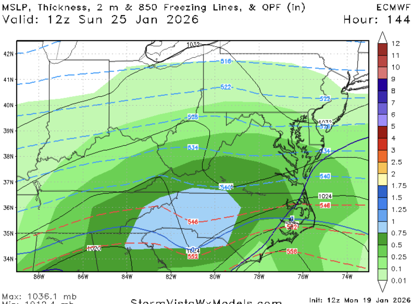
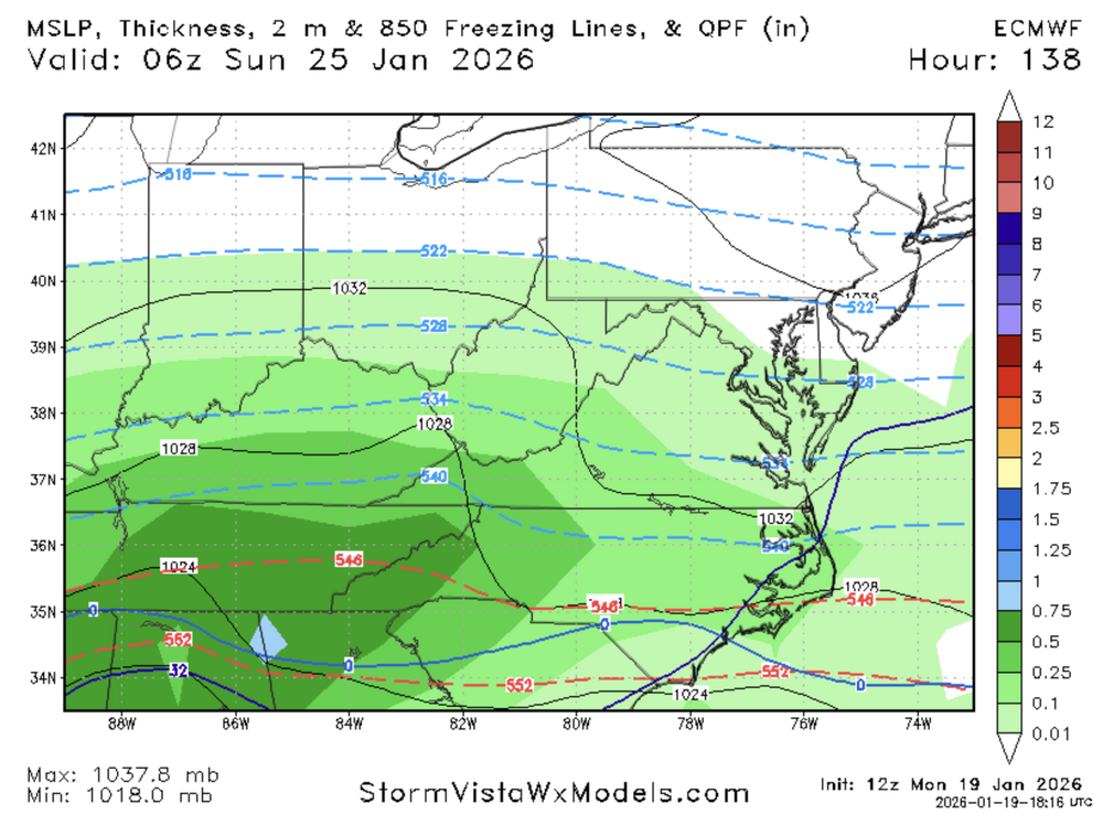
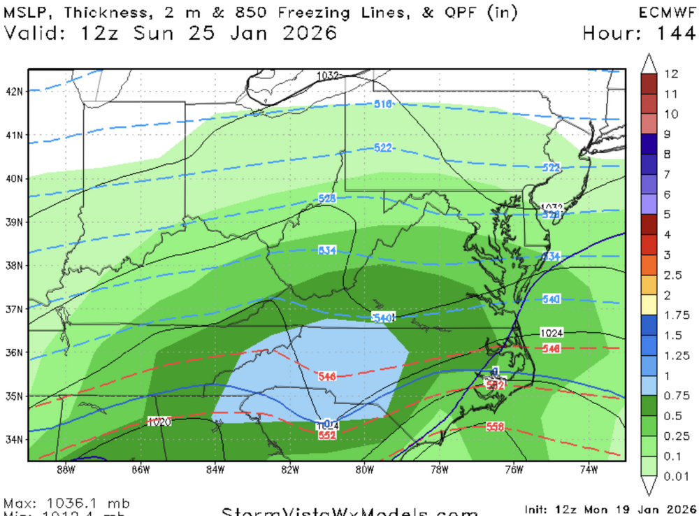
Not too bad on the euro. Don’t love slower for an evolution, but precip gets a decent bit north. SLP and RH’s are north of 6z
-
One must wonder how space weather effects winter weather .
-

January 2026 Medium/Long Range Discussion
NorthArlington101 replied to snowfan's topic in Mid Atlantic
WxBell is only to 87 -

January 2026 regional war/obs/disco thread
40/70 Benchmark replied to Baroclinic Zone's topic in New England
You don't need synoptic snow there. -
45 inches in Richmond? That would set their seasonal record in a one week period. Unlikely but there's always a first for everything.
-
Gfs AI has 3 threats too
-
Probably not a bad thing that the multi-year base state has been for mostly weaker/suppressed/strung out storms and that is the exact scenario that works in our favor this time.
-
@NorthArlington101, you're up with the snow maps
-

January 2026 Medium/Long Range Discussion
Stormchaserchuck1 replied to snowfan's topic in Mid Atlantic
By the way, since this is still a long range thread -- the EPS did MUCH better than the GEFS regarding the upcoming cold pattern. 5 days ago the GFS ensembles had huge SE ridge, and EPS was below average in the Mid Atlantic for last 8 days of January. -
More amped and further south it seems .
-
Incoming on the euro
-
I sort of feel like it's 2010 plus 2016. 2010 was a series of storms while 2016 was all at once.
-
WB is still at 80h. I swear I've refreshed my phome so many times I used up all my Comcast bandwidth for the month.
-
That's the phased Miller A I refer to a few posts ago. Would be a true bomb! But this 12Z Euro is a combo of that HP anchoring and dynamic cooling (for this weekend). These models are a frickin' buffet line!
-
Don't like extreme cold without snow cover. Frost goes deeeeep.