All Activity
- Past hour
-
Severe or not, just bring some rain.
-

Central PA Summer 2026 Discussion/Obs Thread
Voyager replied to Voyager's topic in Upstate New York/Pennsylvania
You yell at me about heat in the car, and look at you. Wearing a winter coat...lol -
We picked up 0.77” overnight and still raining lightly. Up to 2.92” for the event and 11.94” for the month!
-
Not really. 2009 was cold throughout, with the exception of one week in August. 2015 was warm from July-September. 2023 was cold in June, but very warm in July and September.
-
.thumb.jpg.6a4895b2a43f87359e4e7d04a6fa0d14.jpg)
Central PA Summer 2026 Discussion/Obs Thread
Yardstickgozinya replied to Voyager's topic in Upstate New York/Pennsylvania
Maybe those rascals over at the SPC are making up stories again, who knows. Day 4-8 Convective Outlook NWS Storm Prediction Center Norman OK 0337 AM CDT Fri Jul 24 2026 Valid 271200Z - 011200Z ...DISCUSSION... ...Day 4/Monday... A prominent upper high will remain centered over the central and southern Plains with a belt of enhanced mid-level flow forecast along the periphery of that feature from the northern Plains into the Great Lakes. Within that flow regime, a short-wave trough is forecast to translate through the Great Lakes in tandem with a surface low and trailing cold front. A hot and moist boundary layer is expected ahead of the front, yielding moderate to strong instability by afternoon. Despite veered low-level winds, strengthening mid/upper-level winds in the exit region of a jet streak will contribute to sufficient vertical shear for organized severe storms across portions of the Great Lakes into the OH Valley Monday afternoon into night. ...Day 5/Tuesday... The Day 4/Monday short-wave trough is forecast to evolve into an upper low across southwest ON and the lower Great Lakes with an associated belt of stronger cyclonic flow developing from the OH Valley into the southern Mid-Atlantic and NC. At the surface, an area of low pressure will develop from the lower Great Lakes into central NY with a trailing cold front advancing through the upper OH Valley, central Appalachians, and Mid-Atlantic. Thunderstorms may be ongoing Tuesday morning along and ahead of the front from the lower Great Lakes and upper OH Valley into the Mid-Atlantic. Stronger heating is anticipated to the south of the early-day storms from the southern Mid-Atlantic into NC, where moderate to potentially strong instability is forecast. The strongest instability will coincide with modestly strong deep-layer shear to support some severe weather threat in those areas Tuesday afternoon and evening. -

Chester County PA - Analytical Battle of Actual vs. Altered Climate Data
chubbs replied to ChescoWx's topic in Climate Change
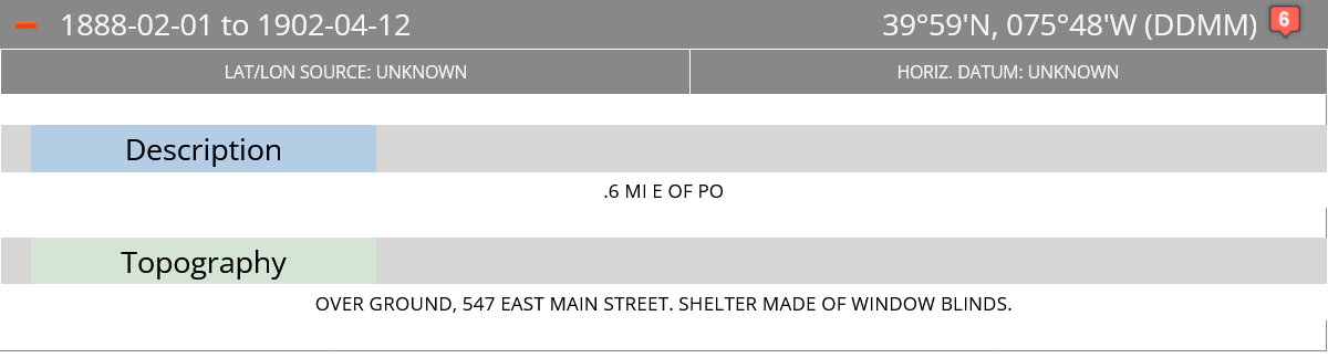
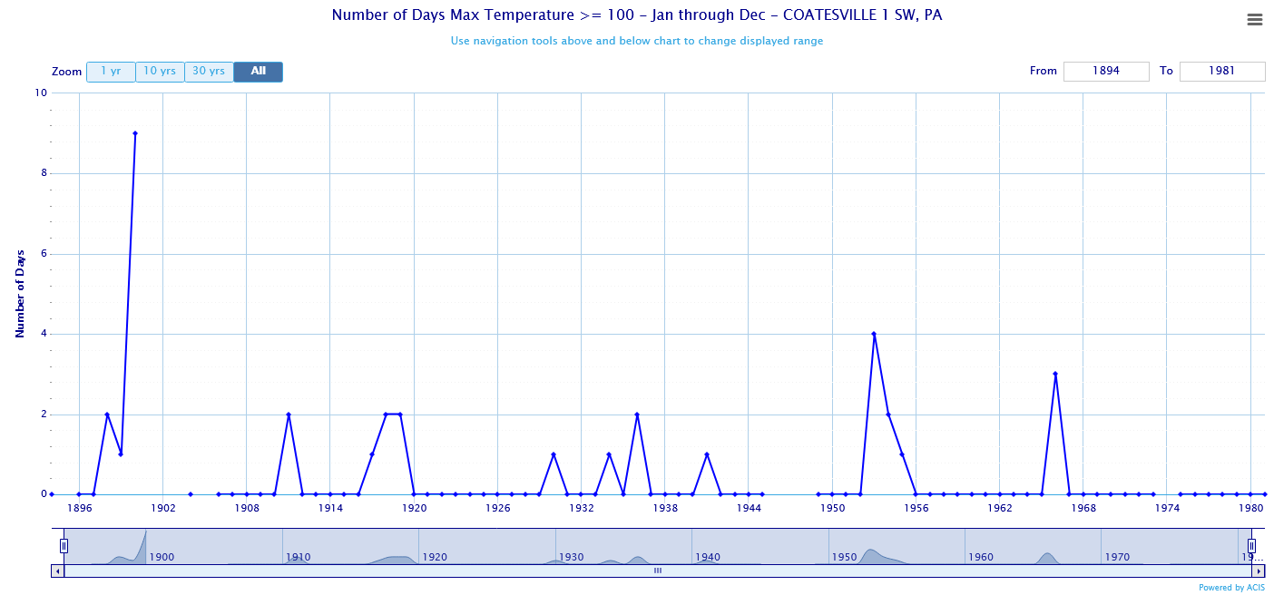
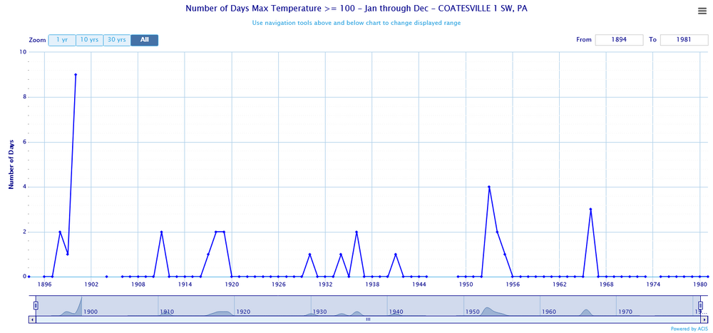
You left in all the other station changes. Your current station population is much cooler, more rural, and higher elevation compared to the older COOPs. All the COOPs were in towns before the Coatesville post-war move. Below is the 100F day data for Coatesville 1SW. Per NCDC the shelter was made of window blinds before 1902. Comparing to West Chester, the spike to 9 in 1900 is spurious. Overall the Coatesville 1SW data is similar to Philadelphia and West Chester with no indication of the pronounced downtrend you are showing. All your charts have built in bias. That's why they don't match the charts from the individual stations.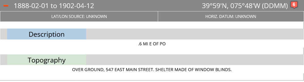
-
Central PA Summer 2026 Discussion/Obs Thread
Yardstickgozinya replied to Voyager's topic in Upstate New York/Pennsylvania
Day 4 clips, western Pa nwhat's slighr risk and Day 5 clips, southeastern Pa with slight risk. -

Central PA Summer 2026 Discussion/Obs Thread
anotherman replied to Voyager's topic in Upstate New York/Pennsylvania
50 here. -
 Hartford + 0.8
 -

Central PA Summer 2026 Discussion/Obs Thread
mahantango#1 replied to Voyager's topic in Upstate New York/Pennsylvania
45 this morning here. -
Central PA Summer 2026 Discussion/Obs Thread
Yardstickgozinya replied to Voyager's topic in Upstate New York/Pennsylvania
New records are broken here and definitely not very impressive. -
Central PA Summer 2026 Discussion/Obs Thread
Yardstickgozinya replied to Voyager's topic in Upstate New York/Pennsylvania
Some mornings you just have to step out of the house and stretch bare ass. -
52 at the homestead currently; awesome for late July.
- Today
-
Chester County PA - Analytical Battle of Actual vs. Altered Climate Data
chubbs replied to ChescoWx's topic in Climate Change
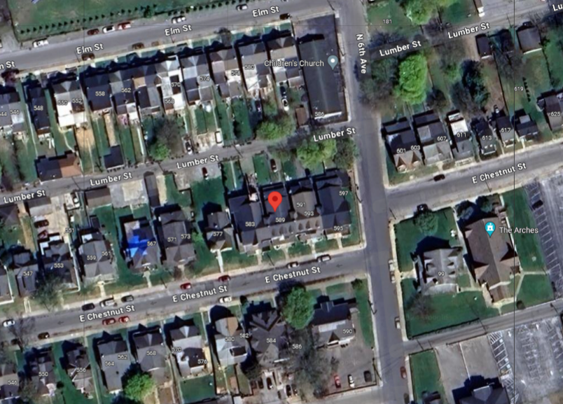
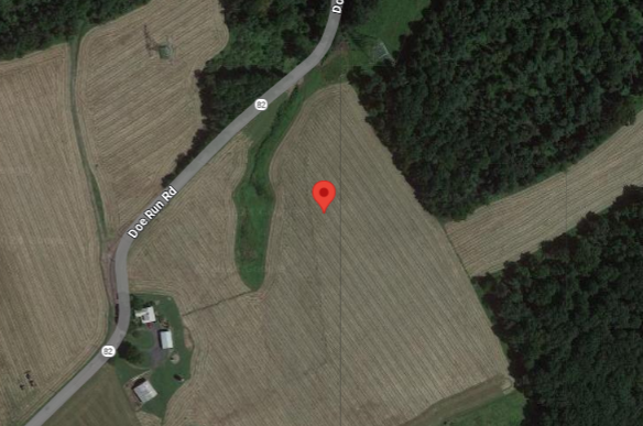
Yes TOB is not an issue at Coatesville. The big issue is station moves and other changes. The NCDC chart below shows all the locations of the Coatesville COOP station. The station numbers increase as you go back in time: Site 1 is the newest and site 6 is the original site. The most consequential move was the last one from site 2 in the City of Coatesville to to a rural site on Doe Run Road. The pictures illustrate the change. As documented in the Chester County thread roughly 2F cooling with this move. Thats why the raw data at Coatesville show cooling. Also why bias adjustments are needed, the cooling is spurious. photos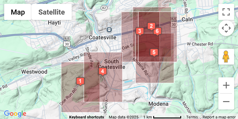
-
Heading to O.C. Touch of fall in the air at 58 degrees.
-
 Definitely running warm again. Looks like maybe a step change last fall, but it’s a lot more noticeable this summer.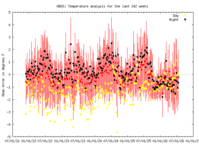
-
Central PA Summer 2026 Discussion/Obs Thread
Voyager replied to Voyager's topic in Upstate New York/Pennsylvania
Oh, and for this morning, down to 51 at approximately 4:45am. The usual cold spots (especially where my work home base is) are down into the mid and upper 40's. -
Central PA Summer 2026 Discussion/Obs Thread
Voyager replied to Voyager's topic in Upstate New York/Pennsylvania
That was one of the most impressive posts I've seen! I don't know how you do it, but what an amazing breakdown. Thanks so much! -
 Bump.
Bump. -

Central PA Summer 2026 Discussion/Obs Thread
TheDreamTraveler replied to Voyager's topic in Upstate New York/Pennsylvania
Might have broken the record low tonight. If not it's tied here. Pretty impressive. -
 TheraCore: TheraCore - buy prednisone from canada
 -
It's 3.15am Texas time today July 24 2026 and we have light rain from Bertha. Guess all that SHEAR wasn't quite as strong as had been thought, huh? This is Jeb, reporting to you LIVE from Buda, Texas where we ARE getting some light rain from Bertha's remnants. Temperature 79 degrees, dewpoint 77. Winds NE about 4 mph.
-

2026-2027 Super El Nino
GaWx replied to Stormchaserchuck1's topic in Weather Forecasting and Discussion
-SOI has reached 74 straight days! That will continue supporting robust warming of Nino 3.4. -
That's exactly how this summer seems to be shaping up to be.
-

2026-2027 Super El Nino
snowman19 replied to Stormchaserchuck1's topic in Weather Forecasting and Discussion
It’s the latest fantasy from the usual east coast weenie suspects on social media who are looking for any excuse possible to downplay and say a super El Niño is not going to happen and it’s not going to couple in the atmosphere/ocean. First it was the RONI cope, failed, then it was the SOI cope, failed, then it was the Modoki cope, failed, then it was the MEI cope, failed, now it’s the negative PDO cope. Just an insane circus show this year. This asinine, delusional “-PDO with a super east-based El Niño means a very cold and snowy winter in the east..1957-58 and 1965-66 are the analogs” wishcast was dreamed up by none other than JB once he realized his MEI cope was destined to fail and it’s spreading like wildfire with Mark Moregarbage and the other fools on twitter