All Activity
- Past hour
-
And that training rain doesn't seem to be in a hurry to go anywhere -- going to be another crazy day of reports across the region.
-
0.95" here seems like the actual heavy stuff is hitting the city and nassau more but it looks like its making its way into western suffolk now unless it fizzles out
-

E PA/NJ/DE Summer 2026 Obs/Discussion
LVLion77 replied to PhiEaglesfan712's topic in Philadelphia Region
Definitely did not verify for the Lehigh Valley. -
Unfortunately, the BLM site is offline. Observations would be helpful.
-
it's too far north. NJ and LI are the bullseye
-
Such a bad job it’s insane
-
Major flooding in Monmouth County also.
-
Insane rates long branch area. About 2.5 inches to 3 inches in last hour
-
Radar us deceiving. It is pouring under these yellow and orange echoes. 2"/hr rates
-
Unfortunately, where the worst of the drought is in South Jersey has seen little to no rain. Cape May still sits at 0 for the event.
-

E PA/NJ/DE Summer 2026 Obs/Discussion
Kevin Reilly replied to PhiEaglesfan712's topic in Philadelphia Region
Anyone have official NWS rainfall totals for the area? I said 2 days ago that the area will see 3-6” of rain Saturday to Monday night and I’m being questioned lol??? -

E PA/NJ/DE Summer 2026 Obs/Discussion
BBasile replied to PhiEaglesfan712's topic in Philadelphia Region
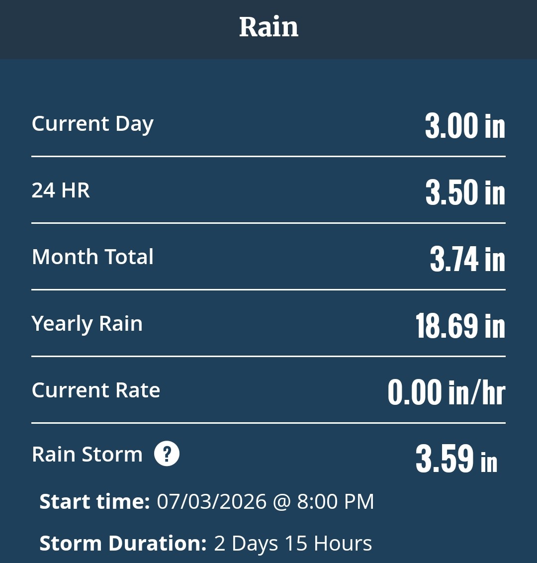
Finally stopped raining. Looks like 1.94" from that round.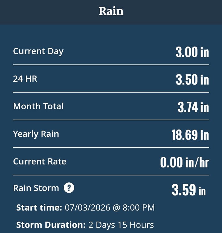
-

Hoisting the Sultan Signal: Heavy Rain Event July 5-7
CoastalWx replied to WxWatcher007's topic in New England
7/10/25 we had 7” in like 3 hrs with most of that in 90 min. -

Hoisting the Sultan Signal: Heavy Rain Event July 5-7
butterfish55 replied to WxWatcher007's topic in New England
Was working in Taunton by route 44 all morning with off and on light rain. Just drove to a job in Brockton with dry roads and breaks in the clouds. Very sharp cut off for rain. -

Hoisting the Sultan Signal: Heavy Rain Event July 5-7
Typhoon Tip replied to WxWatcher007's topic in New England
NAM appears to have already busted too wet in CT through 15Z ... Just a quick eye-balling of rad trends over the morning hours, looks like primarily light right with a few moments in there of moderate have taken place thus far. I can't imagine what's in the rain cans from that rad evolution, matches that plume of QPF the model painted moving through there over the same time - again...just a cursory look over. So those justifying your d-drip highs, please don't be offended. -
So far, both JFK Airport and Islip have set daily rainfall records for July 6th.
-
Its a mess here. Branches all over and flooding everywhere.
-
Sorry to hear
-

Hoisting the Sultan Signal: Heavy Rain Event July 5-7
ChangeofSeasonsWX replied to WxWatcher007's topic in New England
The heaviest rain that I can remember besides the floods on March 30, 2010 was during the remnants of Hurricane Ida. I remember driving home from work that night and actually having to stop multiple times because visibility was zero from the relentless pounding rain. -
-
Oh I did and my car felt very far away lol.
-
Since Friday nights storm!
-

Hoisting the Sultan Signal: Heavy Rain Event July 5-7
HoarfrostHubb replied to WxWatcher007's topic in New England
Not a drop here in the HUBB. Mostly cloudy with some sun. 71F -
Yeah, at the very least I would say that Gay in 1992, Angela in 1995, Haiyan in 2013, and Meranti in 2016 have all surpassed Tip. Maybe Patricia in 2015 and Monica in 2006, as well. I remember seeing some estimates of pressures in the 860s for Monica, but nothing proven. Patricia may have also surpassed Tip since it was still intensifying after the record breaking recon pass.
-
Flash Flood warning for Nassau, Queens and Brooklyn. Up to 1.80" here