All Activity
- Past hour
-
Nope. I doubt we get higher than 72.
-
It was a 1 minute shower here.
-
 buy cheap generic zithromax: Rapid Zithro Direct - zithromax for sale usa
 -
I bet we'll see 80 again, but this was very likely our last day with temps well up into the 80s until next spring. It hit 87 here today.
-
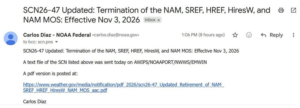
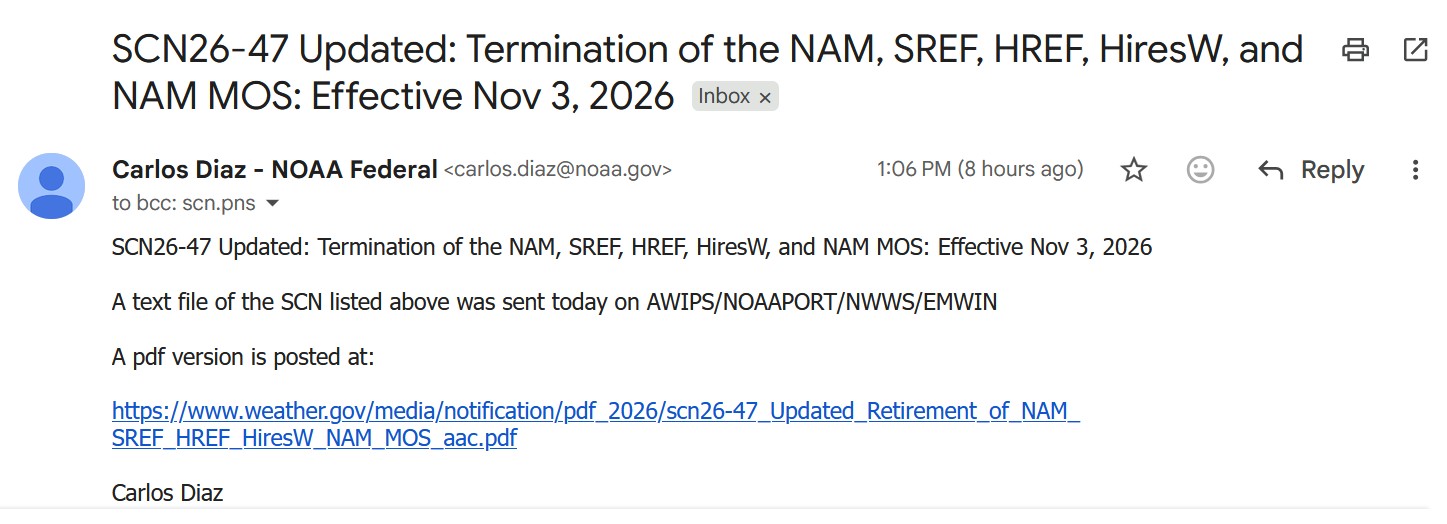
We’re ending the NAM about as fast as the Iran war.
-
Looks like @CoastalWx gets to keep his beloved NAM a little longer! As for his "garbage" model (RRFS), it does appear to have issues w/ making deeply occluded lows into TCs too easily. It did that for the most recent storm. But non-TC CAMs usually do.
-
the south wins once again lol
-
https://isocleardirect.shop/# buy isotretinoin 40mg capsules
-

2026 Atlantic Hurricane Season
vortex95 replied to Stormchaserchuck1's topic in Tropical Headquarters
Since operational intensity was borderline and it's not really a sampling issue, I don't really see how they would bother. I mean, that's not overwhelming data for reanalysis to circumvent the operational intensity, IMO. Lots to consider in this case, and given the dearth of HUs this season, I hope focus on Fay by NHC is not overthought or nitpicked if we do not have any clear HUs for the rest of the season! I am just thinking external pressures that can hurt the objectivity of the met science here (e.g. social media making a stink or crying foul w/ armchair mets and hype-masters going off!). ASCAT has issues in heavy rain areas leading to a high bias. And in convective area that pulse when downbursts are more likely, that is an issue. On that ASCAT image provided from the X link, it is a very small area of 65 kt winds, that can suggest a mesoscale transitory feature., Also, I have seen it noted that Fay had an eye briefly. That was more dry slot residual b/c leading up to that appearance you could see a narrow band of dry air curling into the center. This dry air present also promotes pulsing convection and downbursts. That's one thing I have found questionable at times for assigned intensity. Spot winds are not the same as mean winds. Local convective winds are not the same as avg synoptic gradient winds. Many moderate to strong TS briefly have HU force winds from localized intense convection that pulses in blobs, esp. when some shear and dry air is present, but that does not make them a HU. So one has to be careful here. Sometimes I see "given the possibility of undersampling." That is a slippery slope IMHO. You can always say that in measuring meteorological phenomena, but does that mean you always say it was stronger and go higher? If so, what is the limit as to how much stronger? It is subjective and fluid. Dvorak classifications for TCs do best for winds approx 60 to 105 kt, so that means TDs are often min TSs and intense HUs are often stronger in reality. We know this from recons, but in the absence of recon, we don't officially assign a stronger value due to the limitations of Dvorak. It's why you will not see a system above 160 kt in the Atlantic or eastern/central Pacific in the absence of a recon. Best you can say w/ high confidence is that it was at least this strong and mention "it could have been stronger" in something like the TCR given any number of ancillary factors that can exist when it comes to determining TC intensity. A SAR pass showed 73 kt for Fay, but this remote sensing tech has been shown high bias here as well compared to recon measurements. -

2026-2027 Fall/Winter Mountain Thread
Met1985 replied to BlueRidgeFolklore's topic in Southeastern States
What site are you using Tyler? -
2026-2027 Fall/Winter Mountain Thread
Met1985 replied to BlueRidgeFolklore's topic in Southeastern States
Book it! -

2026-2027 Fall/Winter Mountain Thread
Tyler Penland replied to BlueRidgeFolklore's topic in Southeastern States
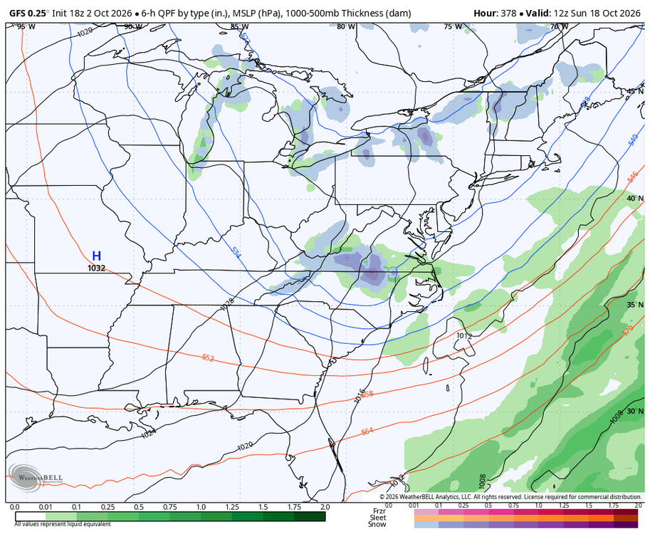
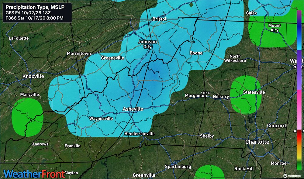
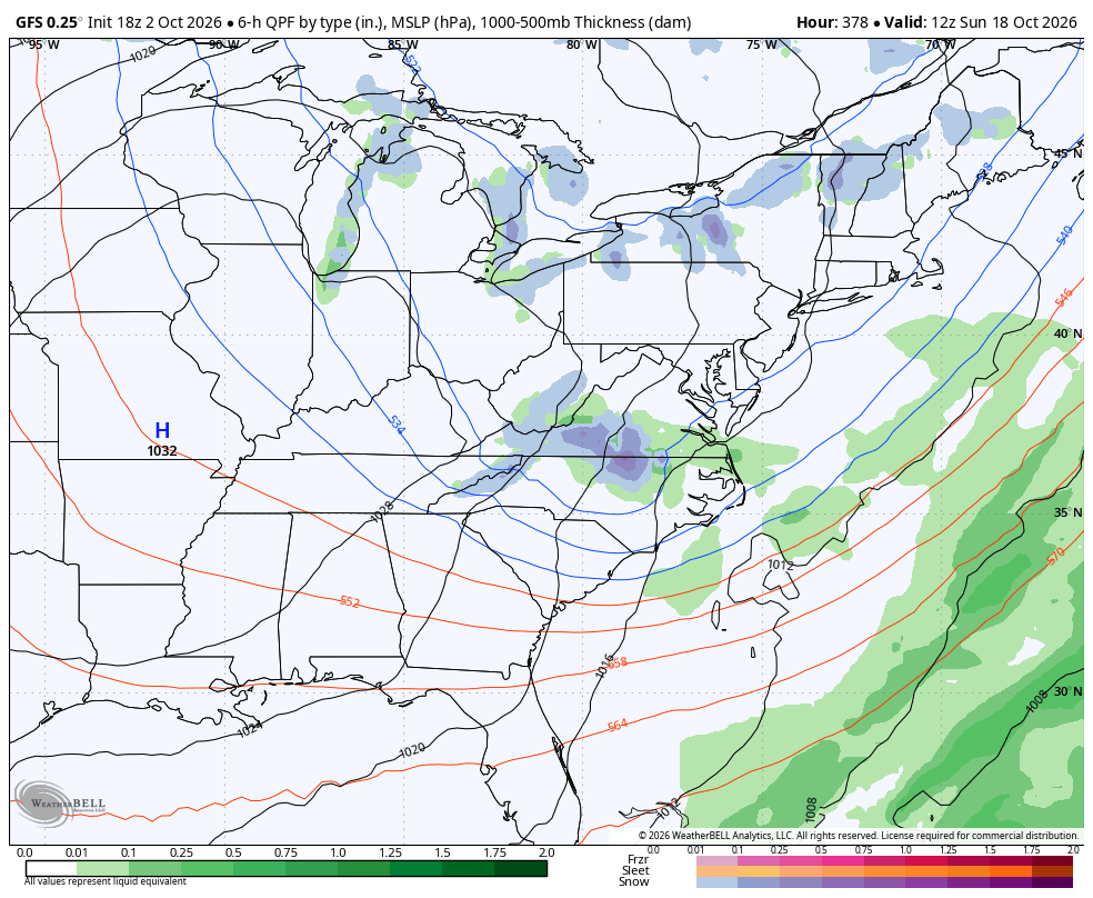
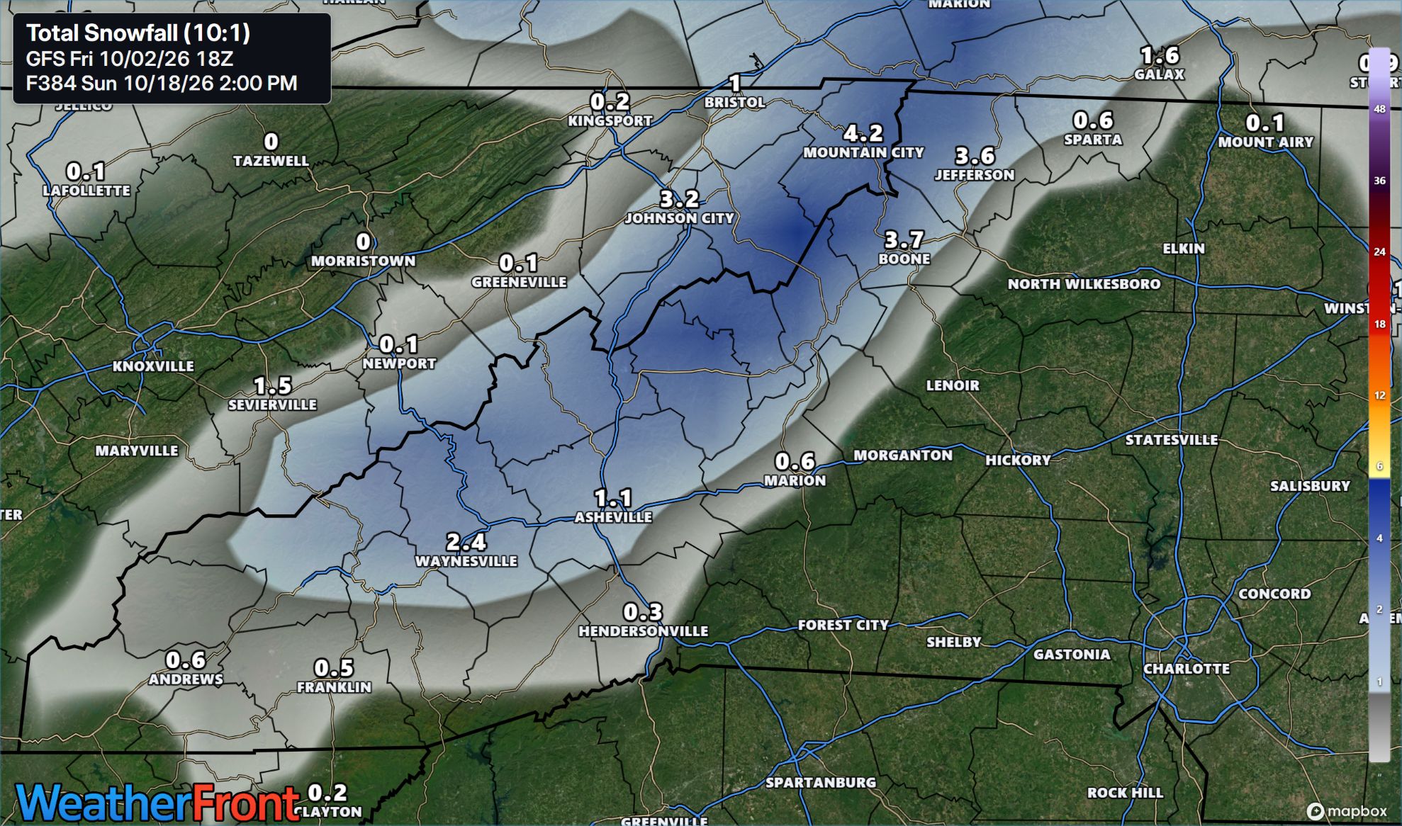
Been pretty busy lately, but looks like we have our first fantasy NW flow storm on the GFS at 18z- first one I've noticed at least. Winter is definitely on the way.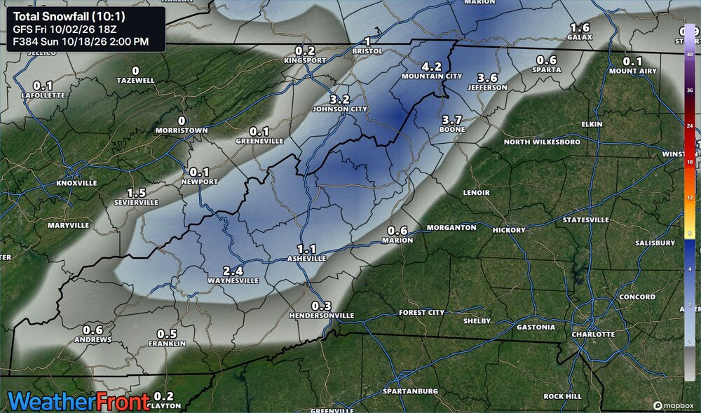
-
how can i get cheap avodart no prescription: dutashielddirect - get generic avodart tablets
-
Tuesday looks like a chilly time to do it, ha.
-

2026-2027 Record-breaking El Nino
LibertyBell replied to Stormchaserchuck1's topic in Weather Forecasting and Discussion
NYC weather is much more like Philly than it is Boston and Philly has already had a T of snowfall and NYC has had less than 6 inches of snowfall half a dozen times. It's only a matter of time that NYC gets a T of snowfall for the season too. I'd say there's more than a 50 percent chance it happens by or before 2050. It's not a matter of wetter winters you can very easily have a cold and dry pattern alternate with a wet and mild pattern. It's a very stable configuration that can last an entire season. And with an ocean to the south and east it's very easy to warm up quickly enough that no snow accumulates even transitioning from an arctic to a maritime airmass. It's happened many times. -
Another one @wxmeddler is on a roll.
-
I'm glad it will be sunny and dry all of next week, rain is not needed anymore. No more rain until 2028 and I'm not going to be nice enough to say "please" this is a demand NOT a request. I want either snow or sunny nothing else. I almost got stuck in a wet mound of clay where water had ponded. That was this morning when it was still sunny. 70 percent of this planet is covered in water there is no such thing as a "drought" anyone who wants water can just find the 70% of this planet covered in water and go jump in it!
-

2026 Atlantic Hurricane Season
olafminesaw replied to Stormchaserchuck1's topic in Tropical Headquarters
Since operational intensity was borderline and it's not really a sampling issue, I don't really see how they would bother. I mean, that's not overwhelming data for reanalysis to circumvent the operational intensity, IMO. Basically, after further review, the ruling on the field stands is the most likely verdict -

2026-2027 Record-breaking El Nino
FPizz replied to Stormchaserchuck1's topic in Weather Forecasting and Discussion
His take wasnt bad at all and seems reasonable. Its not like he is saying big winter like a weenie - Today
-
they did good for ya'll now, but that'll change in a few weeks.
-
At least the acorns are dropping this year. We had zero last year. Now it seems like a lot of smaller and normal acorns everywhere. Just took the dog out, Owls still trying to scare the rabbits out of their comfort zone. What a night.
-
83 today and 0.03”. so long summer
-
They were pretty good last winter with maintaining the cold. I haven't followed them since March.
-
With some models hinting at an early frost next week can our first freeze be far behind? Below are current reporting stations across the Chester County PA area with last year, average, earliest and latest first freeze dates.

-
It’s a step down the staircase to winter. Maybe there’s 3 more stairs to go down if we have a warm wet torch, 5 or 6 if we have cold/snowy periods but step down today for sure.














(002).thumb.png.6e3d9d46bca5fe41aab7a74871dd8af8.png)