All Activity
- Past hour
-

Central PA Summer 2026 Discussion/Obs Thread
Itstrainingtime replied to Voyager's topic in Upstate New York/Pennsylvania
I dunno - that is one vicious line moving through western PA. TOR warned as well. It should weaken some I would think but it's hard to believe we don't get some rain at the very least from it. -
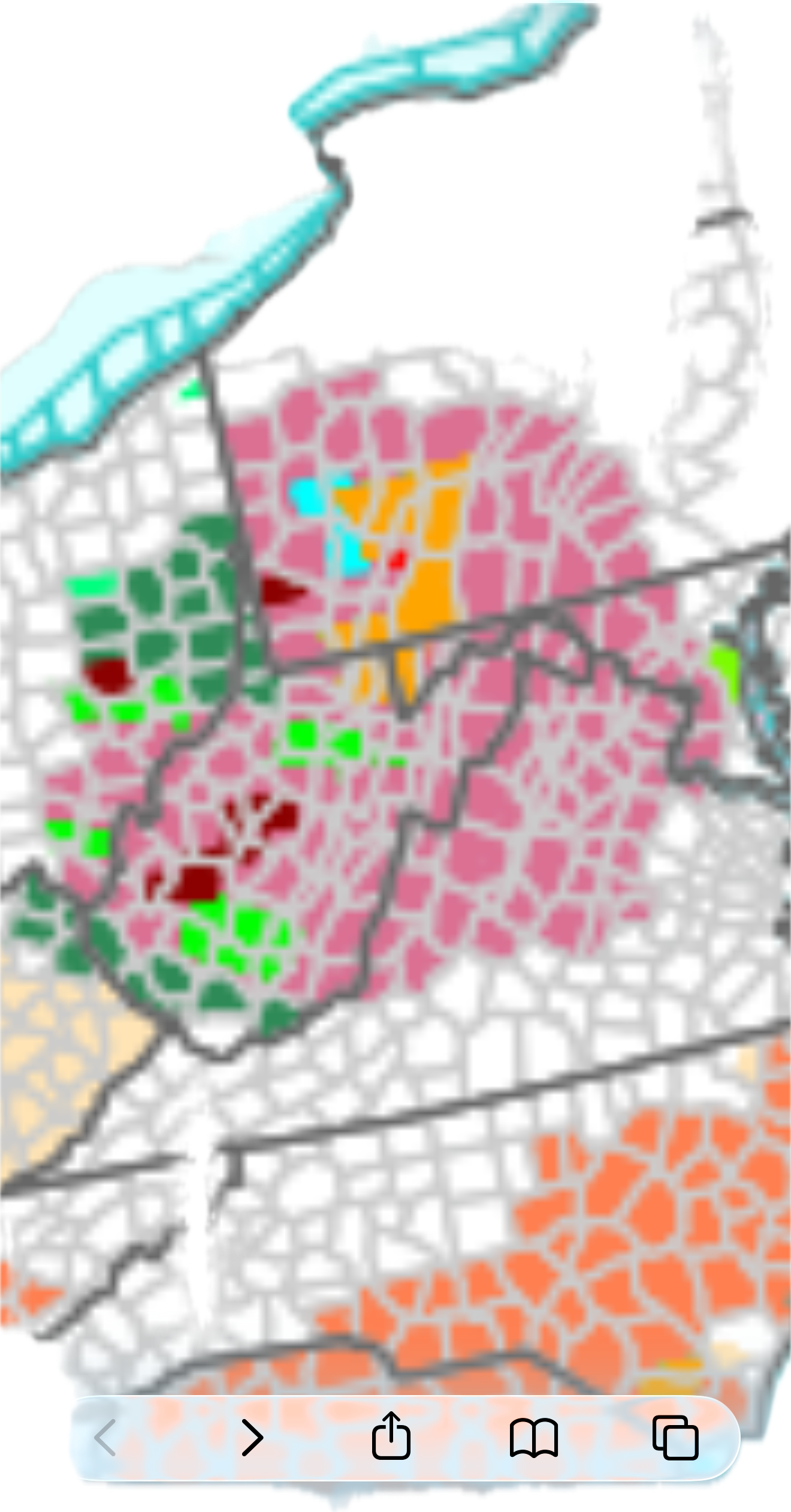
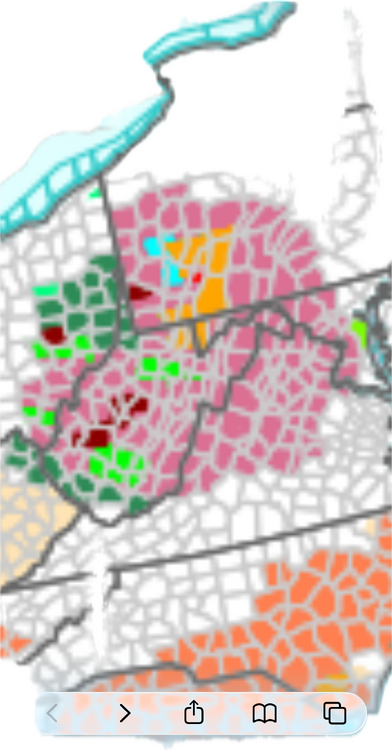
Severe thunderstorm watch until 11 for western and central areas:
-
- 1,945 replies
-
- 1
-

-
- severe
- thunderstorms
- (and 7 more)
-
Severe Thunderstorm Watch up until 11pm URGENT - IMMEDIATE BROADCAST REQUESTED Severe Thunderstorm Watch Number 588 NWS Storm Prediction Center Norman OK 435 PM EDT Sun Aug 16 2026 The NWS Storm Prediction Center has issued a * Severe Thunderstorm Watch for portions of District Of Columbia Maryland Central Pennsylvania Virginia Eastern West Virginia Coastal Waters * Effective this Sunday afternoon and evening from 435 PM until 1100 PM EDT. * Primary threats include... Scattered damaging wind gusts to 65 mph likely A tornado or two possible SUMMARY...Multiple organized clusters of storms will likely cross the mountains and generally persist east-southeastward into the region, as the downstream air mass near/east of the mountains destabilizes in the wake of early morning storms and cloud cover. Damaging winds are the most common severe hazard expected, but some tornado potential may exist as well, particularly near an effective warm front. The severe thunderstorm watch area is approximately along and 65 statute miles east and west of a line from 40 miles east northeast of Altoona PA to 50 miles south southwest of Staunton VA. For a complete depiction of the watch see the associated watch outline update (WOUS64 KWNS WOU8).
-
BULLETIN - IMMEDIATE BROADCAST REQUESTED Severe Thunderstorm Warning National Weather Service Baltimore MD/Washington DC 435 PM EDT Sun Aug 16 2026 The National Weather Service in Sterling Virginia has issued a * Severe Thunderstorm Warning for... Garrett County in western Maryland... * Until 515 PM EDT. * At 434 PM EDT, severe thunderstorms were located along a line extending from 8 miles east of Point Marion to 11 miles east of Brookhaven to Newburg to 7 miles east of Grafton, moving east at 40 mph. HAZARD...60 mph wind gusts. SOURCE...Radar indicated. IMPACT...Damaging winds will cause some trees and large branches to fall. This could injure those outdoors, as well as damage homes and vehicles. Roadways may become blocked by downed trees. Localized power outages are possible. Unsecured light objects may become projectiles. * Locations impacted include... Mountain Lake Park, Oakland, Bayard, Bittinger, Grantsville, Loch Lynn Heights, Friendsville, Deer Park, Accident, Redhouse, Hutton, Gorman, Jennings, Keysers Ridge, Mineral Spring, Crellin, Deep Creek Lake State Park, Swallow Falls State Park, McHenry, and Selbysport. PRECAUTIONARY/PREPAREDNESS ACTIONS... Remain alert for a possible tornado! Tornadoes can develop quickly from severe thunderstorms. If you spot a tornado go at once into the basement or small central room in a sturdy structure. For your protection move to an interior room on the lowest floor of a building. Damaging wind, and continuous cloud to ground lightning are occurring with these storms. Move indoors immediately. Lightning is one of nature`s leading killers. Remember, if you can hear thunder, you are close enough to be struck by lightning. If on or near Deep Creek Lake, get away from the water and move indoors or inside a vehicle. Remember, lightning can strike out to 15 miles from the parent thunderstorm. If you can hear thunder, you are close enough to be struck by lightning. Move to safe shelter now. && LAT...LON 3972 7911 3930 7930 3930 7933 3928 7935 3927 7937 3924 7942 3922 7943 3920 7947 3920 7949 3972 7948 TIME...MOT...LOC 2034Z 284DEG 36KT 3975 7974 3965 7968 3940 7982 3938 7989 TORNADO...POSSIBLE HAIL THREAT...RADAR INDICATED MAX HAIL SIZE...<.75 IN WIND THREAT...RADAR INDICATED MAX WIND GUST...60 MPH
-
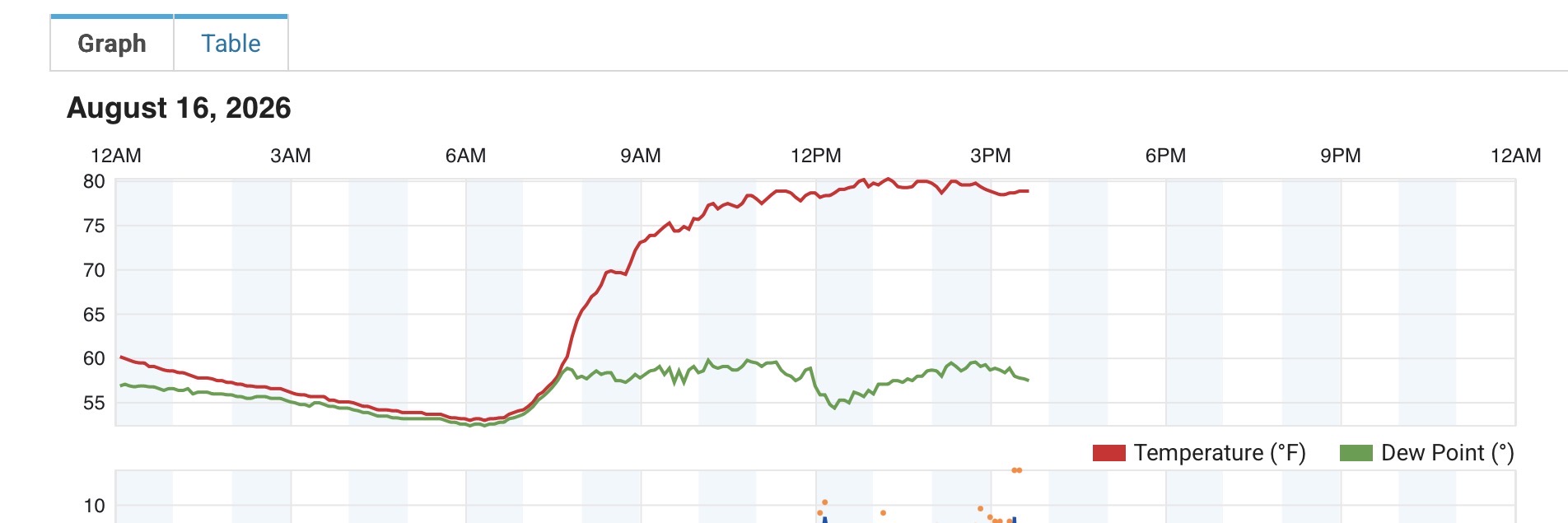
Forecasts here were way off today. It's already hit 88.5 with lots of sun.
-
Updated afternoon AFD from LWX DISCUSSION... KEY MESSAGE 1...Severe weather and flash flooding are possible through tonight. Very active weather is expected over the next 12 hours, with the threat for flash flooding, damaging wind gusts, and a few tornadoes. As of 330 PM, regional radar shows two developing MCSs across western Pennsylvania and West Virginia, both with a history of producing damaging winds. These MCSs are expected to continue eastward into our area over the next few hours. Skies have cleared out ahead of the storms, so strong daytime heating is underway and conditions are destabilizing. MLCAPE values are forecast to increase to around 1500-2000 J/kg ahead of the line, with effective bulk shear increasing to around 30-35 knots. This parameter space should allow these storms to continue across much of the forecast area, leading to a threat for primarily damaging winds. With around 30 knots of 0-3 km shear oriented roughly perpendicular to the lines, a brief QLCS tornado also can`t be ruled out. This threat could be locally maximized as the line encounters a warm front oriented from north to south extending from near Frederick to Fredericksburg. The storms should tend to weaken later tonight as they move east of this boundary into a lower instability airmass. Storms are right on the doorstep of the Alleghenies at the moment, and should press eastward toward the I-95 corridor by around 8-10 PM. Additional storms are also in the process of developing across central Indiana to north central Ohio. Some recent CAM runs hint that those storms may develop into a secondary line that would move through a couple hours after the first round. There are also some hints of backbuilding, especially in the DC Metro area between those rounds as low- level flow picks up behind the first MCS, equaling or exceeding winds higher up in the atmosphere. This results in Corfidi upshear vectors near zero, suggesting that backbuilding and localized training could be possible in the vicinity of the warm front. Thermodynamically, the environment is extremely favorable for heavy rainfall production, with precipitable water values well in excess of 2 inches, and forecast to potentially near 2.5 inches this evening. That coupled with MLCAPE values around 1000 J/kg and deep warm cloud layers will make any storms capable of producing very heavy instantaneous rainfall rates. That coupled with the potential for multiple rounds of storms, and/or training/backbuilding raises concerns for flash flooding this evening. A Flood Watch remains in effect for Garrett County, which had a flood event a few nights ago. Another Flood Watch may be considered for the DC Metro shortly, given the above conditions. Storms are expected to clear the area by around 2 or 3 AM, with dry conditions later tonight. Additional thunderstorms may be possible tomorrow afternoon, but coverage of storms is expected to be much lower, and the threat for both severe thunderstorms and flash flooding is expected to be much lower, if not zero.
- 1,945 replies
-
- 1
-

-
- severe
- thunderstorms
- (and 7 more)
-
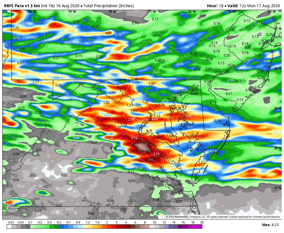
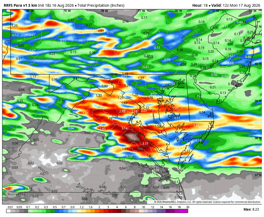
WB 18Z RRFS: I guess we will see if the line approaching western MD will bring the goods after sunset.
-
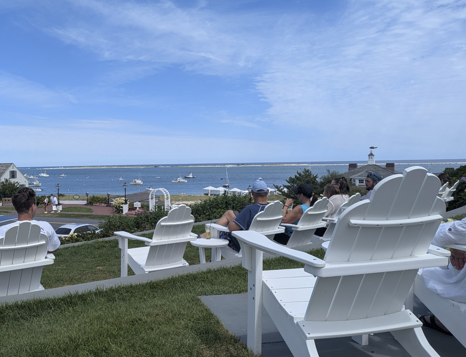
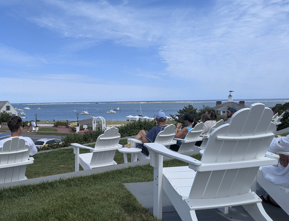
Spent the weekend in Chatham with a friend who lives there.. we took a walk over to Chatham Bars for a glass of wine.. weather was spectacular..
-

Central PA Summer 2026 Discussion/Obs Thread
AccuChris replied to Voyager's topic in Upstate New York/Pennsylvania
0.56” so far on the day in Lebanon. Misty presently . -
 https://mencarevirtual.shop/# MenCare
 -
Interesting... Special Weather Statement National Weather Service Baltimore MD/Washington DC 410 PM EDT Sun Aug 16 2026 MDZ509-510-162130- Eastern Garrett-Western Garrett- 410 PM EDT Sun Aug 16 2026 ...A LINE OF SEVERE THUNDERSTORMS IS APPROACHING GARRETT COUNTY... At 405 PM EDT, radar indicated severe thunderstorms were located along a line extending from near Jefferson Boro to near Cassville to Monongah to near Enterprise. Movement was east at 50 mph. Locations impacted include... Mountain Lake Park, Oakland, Bayard, Bittinger, Grantsville, Loch Lynn Heights, Friendsville, Deer Park, Accident, Redhouse, Hutton, Gorman, Jennings, Crellin, Deep Creek Lake State Park, Swallow Falls State Park, McHenry, Big Run State Park, Piney Grove, and McComas Beach. This includes Interstate 68 in Maryland between mile markers 1 and 30. Frequent cloud to ground lightning is occurring with this line of storms. Lightning can strike 10 miles away from a thunderstorm. Seek a safe shelter inside a building or vehicle. If you are on or near Deep Creek Lake, be preapred to take swift action to get out of the water and move indoors or inside a vehicle as storms approach. Remember, lightning can strike out to 10 miles from the parent thunderstorm. If you can hear thunder, you are close enough to be struck by lightning.
-

2026 Mid-Atlantic Severe Storm General Discussion
Eskimo Joe replied to Kmlwx's topic in Mid Atlantic
Also a heavy precip disco for our far western posters: -
2026 Mid-Atlantic Severe Storm General Discussion
Eskimo Joe replied to Kmlwx's topic in Mid Atlantic
Definitely looking like a non zero tornado threat west of US 15 this evening. Mesoanalysis and mesonet data showing some nice backing of winds and surge in dews.- 1,945 replies
-
- 2
-
-
- severe
- thunderstorms
- (and 7 more)
-

2026-2027 Record-breaking El Nino
jaxjagman replied to Stormchaserchuck1's topic in Weather Forecasting and Discussion
PDO is gonna fluctuate by the tropical PAC,strong WWB along with Rossbly Waves its gonna get quite active in the PAC the next few weels.Last thing is wanna see is another typhoon hitting East China,which seemingly might happen again -
Rinse repeat....poof when everything approaches wake co.
-
These showers are fizzling out faster than the panthers offense in the 4th quarter.
- Today
-
(002).thumb.png.6e3d9d46bca5fe41aab7a74871dd8af8.png)
Central PA Summer 2026 Discussion/Obs Thread
ChescoWx replied to Voyager's topic in Upstate New York/Pennsylvania
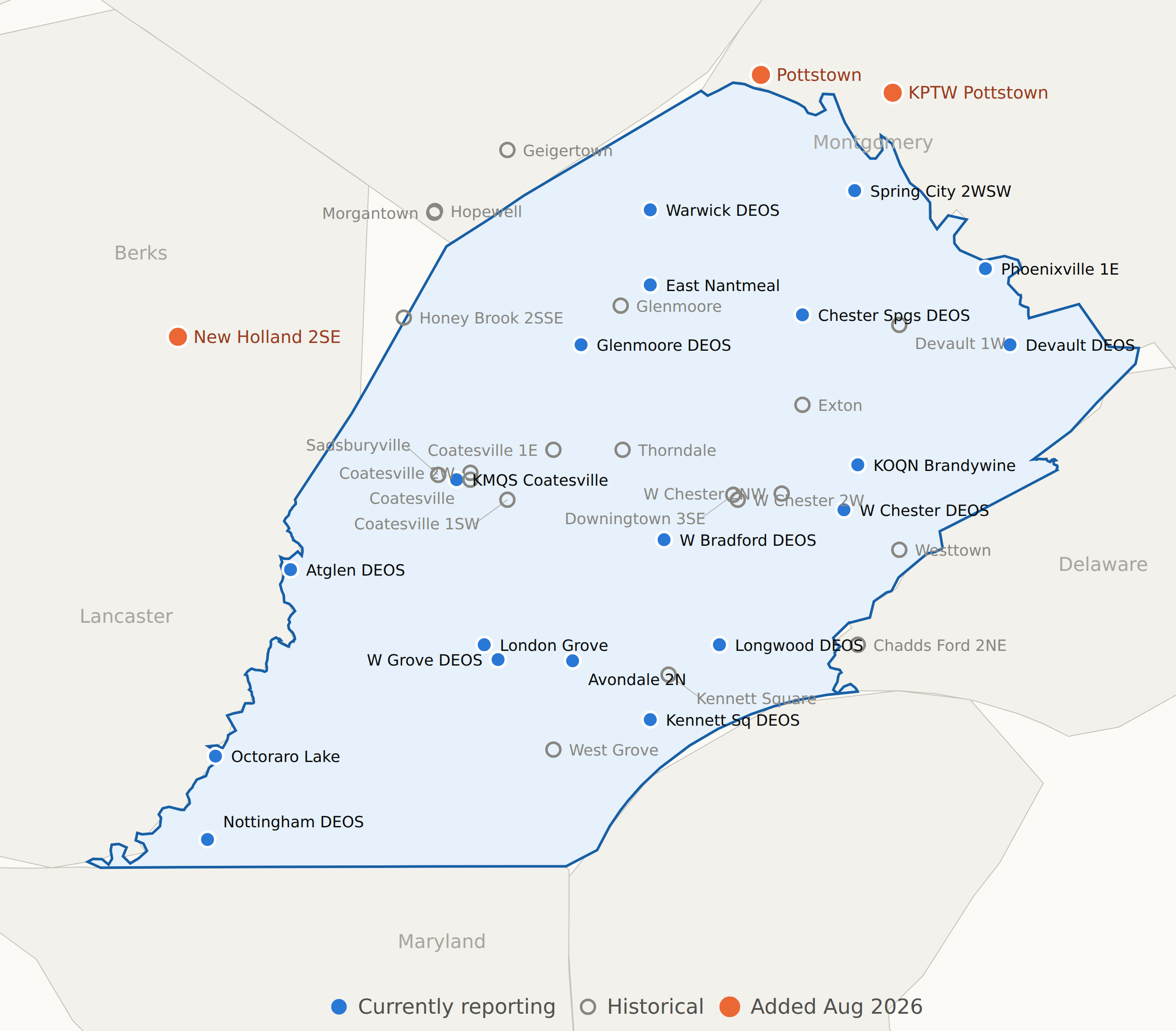
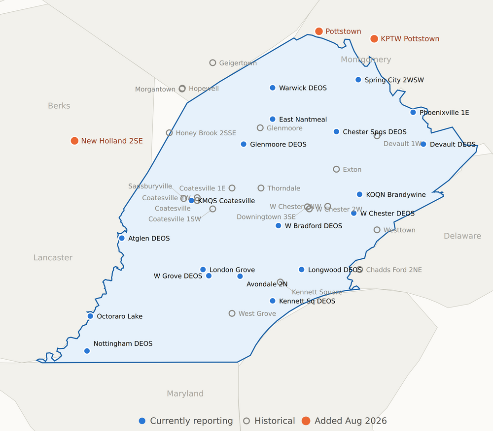
Just an FYI for those that may be interested.I have added a few additional stations to join the few we already have included that are while not in Chester county are close to the Chester County border and meets our area description. Some are only historical like NWS COOP locations for Pottstown which has precipitation and snow only while New Holland NWS COOP in Lancaster County is temperatures, precipitation and snow. Below are all stations not in Chester County - some are as close as 400 feet such as at Octoraro Lake , All other stations with the exception of New Holland are within 2 miles of the Chester County border. Also attached is a map with all current and historical stations included for reference.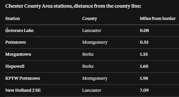
-

Augdewst 2026: Summer's Last Stand
Baroclinic Zone replied to Prismshine Productions's topic in New England
Corporate ownership does not care. Bottom line is $. If they can cut spending on newscasters they will. AI is going to make a lot of current occupations obsolete. -
Mesoscale Discussion 2000 NWS Storm Prediction Center Norman OK 0228 PM CDT Sun Aug 16 2026 Areas affected...south-central Pennsylvania...the Maryland and West Virginia Panhandles...and northern Virginia Concerning...Severe potential...Watch likely Valid 161928Z - 162130Z Probability of Watch Issuance...80 percent SUMMARY...The threat for severe storms capable of mainly damaging wind gusts is expected to increase late this afternoon into evening. A severe thunderstorm watch is likely. DISCUSSION...In the wake of an MCV moving from south-central into southeast PA, clouds are gradually clearing, allowing for increased diabatic heating this afternoon. When coupled with a moist boundary layer characterized by boundary-layer dewpoints in the upper 60s to mid 70s F, latest objective analysis indicates MLCAPE of 1000-1500 J/kg with decreasing convective inhibition. Additional air mass destabilization is expected through the remainder of the afternoon, allowing ongoing QLCSs to spread east into the discussion area. Damaging wind gusts will be the primary hazard with the most intense storms, especially in the vicinity of any embedded bowing structures that may persist. A brief tornado or two is possible in areas that can maintain more of a southerly wind component, where low-level shear is locally enhanced. ..Mead/Guyer.. 08/16/2026 ...Please see www.spc.noaa.gov for graphic product... ATTN...WFO...AKQ...CTP...LWX...RNK...PBZ... LAT...LON 38357955 38947931 39407927 40267895 40477848 40397801 39307761 38237782 37877812 37537857 37497918 37897993 38357955 MOST PROBABLE PEAK TORNADO INTENSITY...UP TO 90 MPH MOST PROBABLE PEAK WIND GUST...55-70 MPH
-
E PA/NJ/DE Summer 2026 Obs/Discussion
ChescoWx replied to PhiEaglesfan712's topic in Philadelphia Region
Just an FYI for those that may be interested. I have added a few additional stations to join the few we already have included that are while not in Chester county are close to the Chester County border and meets our area description. Some are only historical like NWS COOP locations for Pottstown which has precipitation and snow only while New Holland NWS COOP in Lancaster County is temperatures, precipitation and snow. Below are all stations not in Chester County - some are as close as 400 feet such as at Octoraro Lake , All other stations with the exception of New Holland are within 2 miles of the Chester County border. Also attached is a map with all current and historical stations included for reference.
-

Augdewst 2026: Summer's Last Stand
Brian5671 replied to Prismshine Productions's topic in New England
it's a dying entity like FM radio-young adults under 30 are unlikely to watch a TV newscast.....I'm guessing the viewership right now skews older. Another 10-20 yrs and alot of those folks will be gone without anyone to replace them. TV anchors/personalities are expensive so with declining ratings I can see why they are doing the above. -
Watch coming shortly... looks like for i95 corridor westward https://www.spc.noaa.gov/products/md/md2000.html
- 1,945 replies
-
- 1
-
-
- severe
- thunderstorms
- (and 7 more)
-
Augdewst 2026: Summer's Last Stand
Baroclinic Zone replied to Prismshine Productions's topic in New England
Dew drop in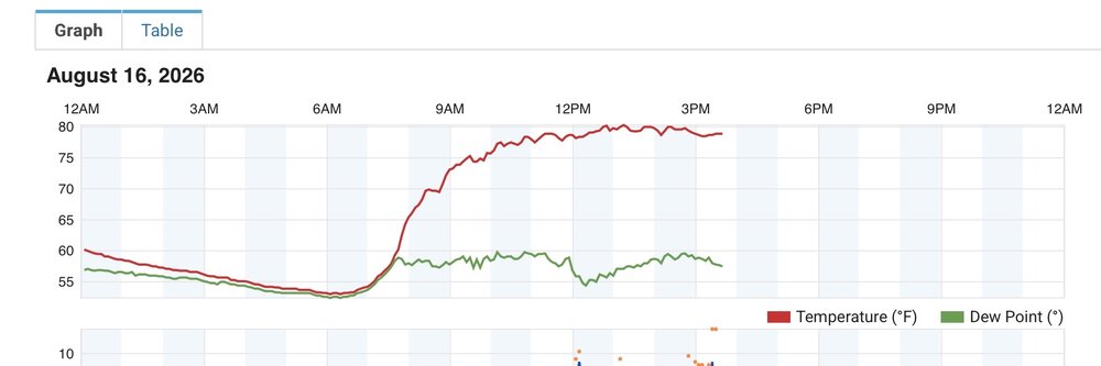
-
Augdewst 2026: Summer's Last Stand
Baroclinic Zone replied to Prismshine Productions's topic in New England
Amazing song. Made some great music post Dio.