Cheeznado Posted September 24, 2016 Share Posted September 24, 2016 Euro 938mb west of Jamaica at 240 hours..... Link to comment Share on other sites More sharing options...
hawkeye_wx Posted September 24, 2016 Share Posted September 24, 2016 The next few days are obviously pretty important for the future of this system. If it can organize into a TD or TS before the islands, then a strong western Caribbean cane is a good bet. If it just races into the Caribbean as a sloppy wave, then its future is a bit less certain. Link to comment Share on other sites More sharing options...
jojo762 Posted September 24, 2016 Share Posted September 24, 2016 50 minutes ago, hawkeye_wx said: The next few days are obviously pretty important for the future of this system. If it can organize into a TD or TS before the islands, then a strong western Caribbean cane is a good bet. If it just races into the Caribbean as a sloppy wave, then its future is a bit less certain. Generally disagree. EC/GFS both bring this past the islands as a wave... Then develop it. GEM is the only one that develops it east of the islands. Haven't seen the UK Link to comment Share on other sites More sharing options...
hlcater Posted September 25, 2016 Share Posted September 25, 2016 I find the fairly low latitude of this system fairly interesting, I mean, the euro and GFS both have this scraping South America. Pretty sure this is fairly rare, I havent heard of any tropical cyclones ever significantly impacting South America. Link to comment Share on other sites More sharing options...
jojo762 Posted September 25, 2016 Share Posted September 25, 2016 21 minutes ago, NWLinnCountyIA said: I find the fairly low latitude of this system fairly interesting, I mean, the euro and GFS both have this scraping South America. Pretty sure this is fairly rare, I havent heard of any tropical cyclones ever significantly impacting South America. Hurricane Felix in 2007. Link to comment Share on other sites More sharing options...
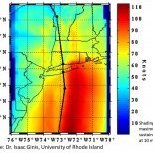
MJO812 Posted September 25, 2016 Share Posted September 25, 2016 Link to comment Share on other sites More sharing options...
packbacker Posted September 25, 2016 Share Posted September 25, 2016 2 hours ago, NWLinnCountyIA said: I find the fairly low latitude of this system fairly interesting, I mean, the euro and GFS both have this scraping South America. Pretty sure this is fairly rare, I havent heard of any tropical cyclones ever significantly impacting South America. 1 hour ago, jojo762 said: Hurricane Felix in 2007. Hurricane Ivan/2004. Hurricane Hazel/1954. Link to comment Share on other sites More sharing options...
wxmx Posted October 4, 2016 Share Posted October 4, 2016 New invest area approaching the Windward islands. Euro tries to develop it, but it gets entangled into Matthew's madness. Some ensemble members develop it and heads it to the Gulf. Link to comment Share on other sites More sharing options...
Boston Bulldog Posted October 6, 2016 Share Posted October 6, 2016 Lost in all this madness regarding Matthew, Nicole has remarkably become an 80mph hurricane in the face of 20kt shear. Eye popped this morning. Link to comment Share on other sites More sharing options...
Bruinsyear Posted October 6, 2016 Share Posted October 6, 2016 Nicole looks far better than Mathew on IR. If you took two snapshots of storms at this moment in time you'd think the intensities were the other way around. Link to comment Share on other sites More sharing options...
MJO812 Posted October 7, 2016 Share Posted October 7, 2016 Nicole is now a Category 2 storm. Link to comment Share on other sites More sharing options...
Morris Posted October 7, 2016 Share Posted October 7, 2016 1 minute ago, Snow88 said: Nicole is now a Category 2 storm. Closing in on cat 3. First time since 1964 that we have two cat 2 hurricanes in the Atlantic west of 65w. Link to comment Share on other sites More sharing options...
Bruinsyear Posted October 7, 2016 Share Posted October 7, 2016 One thing is for sure, even after this is through with SC/NC there is going to be some very interesting meteorology to watch with Mathew/Nicole and these ridges. Some of these models do some very wacky things long term with these two storms. Link to comment Share on other sites More sharing options...
Amped Posted October 8, 2016 Share Posted October 8, 2016 GFS is now showing a possible system near Panama at 150hrs eventually gets it's act together and hits Cuba and FL in Fantasy range. Link to comment Share on other sites More sharing options...
MJO812 Posted October 8, 2016 Share Posted October 8, 2016 1 minute ago, Amped said: GFS is now showing a possible system near Panama at 150hrs eventually gets it's act together and hits Cuba and FL in Fantasy range. Weenie range but a very deep trough comes swinging through. Link to comment Share on other sites More sharing options...
Amped Posted October 8, 2016 Share Posted October 8, 2016 Euro and GFS look identical at 240 in the Caribbean. 1007mb low, but you can see from 850 maps it's the beginnings of a TC. Too early to start tracking, I'm gonna need a bit of a break. Link to comment Share on other sites More sharing options...
Jason WX Posted October 8, 2016 Author Share Posted October 8, 2016 Great, more nights with 3 hours of sleep Link to comment Share on other sites More sharing options...
MJO812 Posted October 9, 2016 Share Posted October 9, 2016 1 hour ago, Jason WX said: Great, more nights with 3 hours of sleep Great practice for winter Link to comment Share on other sites More sharing options...
Amped Posted October 9, 2016 Share Posted October 9, 2016 Nicole!!! Link to comment Share on other sites More sharing options...
nycwinter Posted October 9, 2016 Share Posted October 9, 2016 15 hours ago, Snow88 said: Great practice for winter 4 hours sleep you gain a hour due to the end of daylight savings time Link to comment Share on other sites More sharing options...
Jason WX Posted October 9, 2016 Author Share Posted October 9, 2016 Link to comment Share on other sites More sharing options...
PaEasternWX Posted October 11, 2016 Share Posted October 11, 2016 GFS shows a signal for something in the LR. That is all we can say for certain at this point. Link to comment Share on other sites More sharing options...
MJO812 Posted October 11, 2016 Share Posted October 11, 2016 9 minutes ago, WeatherFan202 said: GFS shows a signal for something in the LR. That is all we can say for certain at this point. Gefs also Link to comment Share on other sites More sharing options...
jojo762 Posted October 11, 2016 Share Posted October 11, 2016 If this system does materialize, at least we have another 7+ days to get caught up on rest... I'd rather have something to track, then nothing. 12Z OP-GFS was similar to other runs in developing a system. Euro isn't in yet, of course. Link to comment Share on other sites More sharing options...
Windspeed Posted October 11, 2016 Share Posted October 11, 2016 12z Euro is also resolving a low pressure system in the SW Caribbean in the LR, but it doesn't intensify like the GFS. Key is that both models are toying with a feature in the LR. We're probably three days away from seeing any kind of surface feature IRL. Link to comment Share on other sites More sharing options...
Amped Posted October 11, 2016 Share Posted October 11, 2016 Looks like a slopgyre on the EURO. I remember STS Nicole in 2010 was similar. Favorable conditions exist for a few days before the storm finally forms. Low Shear and high RH in the area, but little surface wind to help the storm establish a structure. Those AEW have the benefit of having trade winds on the north side. Link to comment Share on other sites More sharing options...
Amped Posted October 13, 2016 Share Posted October 13, 2016 12z Euro has a hybrid in the eastern gulf moving up the east coast. Link to comment Share on other sites More sharing options...
isohume Posted October 14, 2016 Share Posted October 14, 2016 On a EMC call yesterday, the UKMET did the best with Matthew's track and the HWRF (not suprisingly) did the best with intensity. Hard to see in the images they sent, but the black line in each plot is the verification, the blue line is the unperturbed run, and the green line is the ensemble mean. The top 4-panel shows an 8-day prog and the bottom a 4-day. In the top, the UKMET is only one with a sigfnt FL impact and the bottom shows the UKMET with the best ens mean affecting the SC coast, while the others re-curve too much. All hail the King UKMET! Link to comment Share on other sites More sharing options...
Suncat Posted October 18, 2016 Share Posted October 18, 2016 Any comments on future Otto? Certainly eastern NC could do without more rain next week! Link to comment Share on other sites More sharing options...
hawkeye_wx Posted October 18, 2016 Share Posted October 18, 2016 It looks like this new system will just get swept up and out by a strong trough that digs into the eastern US. Models focus much of the moisture on the northeast US, with just a quick frontal passage for North Carolina. Link to comment Share on other sites More sharing options...

Recommended Posts
Archived
This topic is now archived and is closed to further replies.