MillvilleWx
-
Posts
5,530 -
Joined
-
Last visited
Content Type
Profiles
Blogs
Forums
American Weather
Media Demo
Store
Gallery
Everything posted by MillvilleWx
-
Tucker absolutely killed this teams mojo today. That kind of stuff is not only mentally taxing on a kicker, but the entire team. And since it keeps happening, it’s becoming a chronic concern. Will likely cost us any chance at a deep playoff run and we have no chance of a SB unless he rights the ship in a hurry. Sad to say
-
This is 100% correct. If you look back at history, our averages are really a major combo of big snowy seasons coupled with doldrums. We don't necessary have a general persistence like some areas of the CONUS have because a lot is contingent on organized SLP's or SWE's since we typically miss out on clippers and anafrontal snowfall like areas north and west of here.
-
Actually really like this look a lot. We can work with something like this. I just hope people here realize that this will end up being a N/S dominated regime and we'll need energy to dig in order to really get anything substantial. One thing I do think we have in our favor is colder temps will be around more often than not. Then it just comes down to timing something. If we get ANY blocking whatsoever, I would be really excited on the prospects. Fingers crossed!
-
I upped them a touch after my initial. I think we see a few events for the region and one could be a big one if all things break. I think a colder winter is plausible this go around, but of course moisture and timing will be our biggest hurdles. I think we see plenty of storminess east of the Mississippi, but no blocking will likely cause a lot of failure.
-
This is likely the story for the entire winter. One of the reasons I'm not bullish on snow for these parts and remained below normal for my forecast. Hopefully we can luck into a really good one. I do think that is on the table this year compared to some of our recent years.
-
Honestly, this is just a byproduct of only a few teams in the NFL that are really any good anymore. There might be 5 really good head coaches, 20% of players with great to elite talent league wide, and the rest is average to below average, or even trash compared to the previous NFL standards. The league is not nearly as good as it used to be. Add in the horrible rule changes and shifting things like the way the Kickoffs are now and it's not really a great product. NBA the same way with babying players who make considerably more money than they ever did in recent history. I just think we have surpassed the golden era of football and the product will just be watered down. A lot of these breaks the Chiefs are getting are vs bad competition which they seemed to get this year by playing almost no one through 12 games. They aren't as good as recent years when they won, but they still have the best HC in the league and a defensive wizard at DC that will help the team win a lot of games just making great calls and allowing the team the best opportunities to win on a weekly basis. LV are choke artists and have been for years. Expected them to F it up in some way in that last drive. I thought it would come down to an INT, but instead it was a laughable fumble. Sad
-
Happy Thanksgiving everyone!!
-
35° at mi casa this morning when I left for work. Actually one of the colder spots on my commute.
-
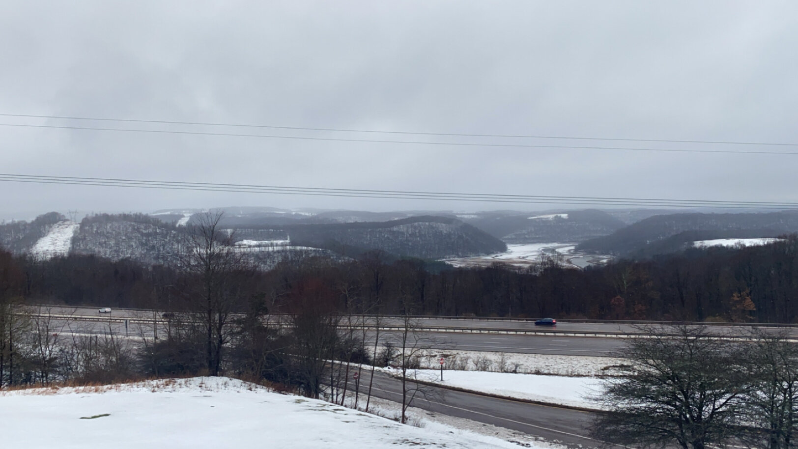
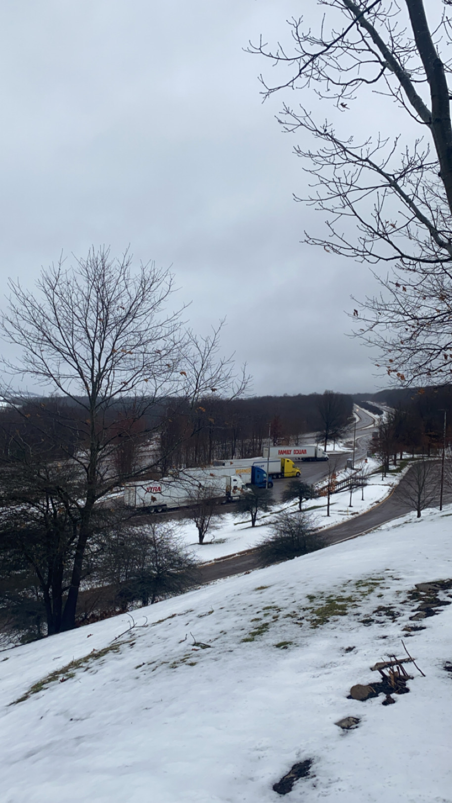
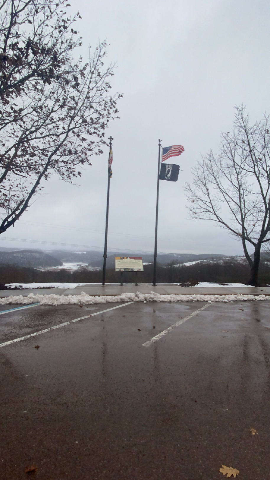
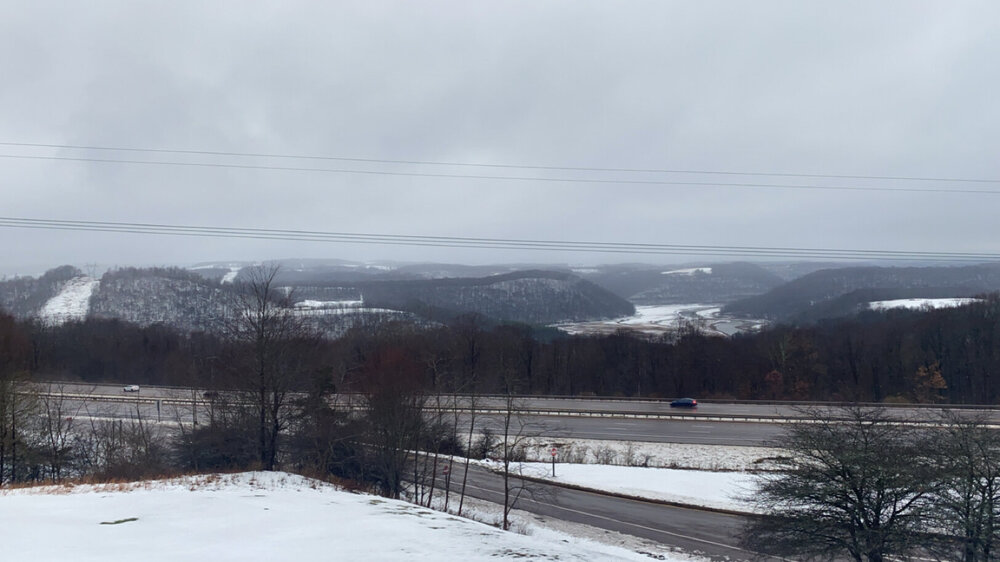
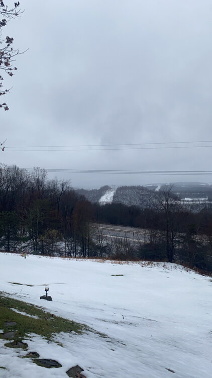
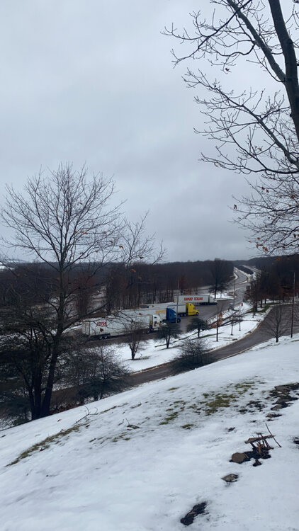
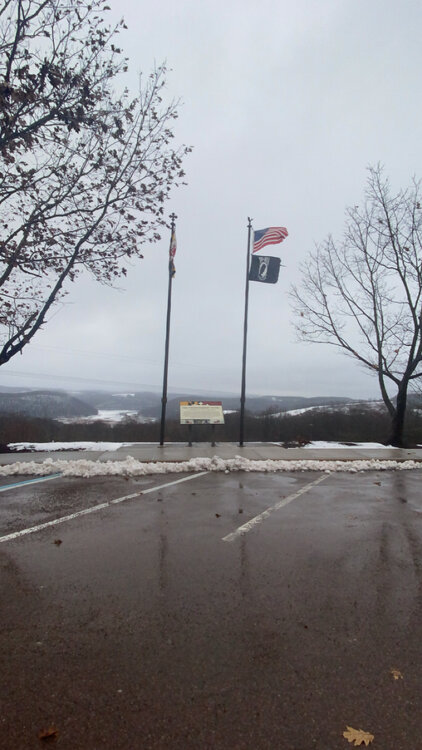
Came back home yesterday evening after a long day of travel back from Western KY area. Cut through I-68 in Garrett and saw a beautiful winter landscape. It was really stark the cut off points where the best snow fell. Basically just across the WV line to about Big Savage Mountain was where the snow was still remaining and certainly got the best of Friday. Took some of these pics from the top of the rest area near Keysers Ridge. Gorgeous!!
-
Those lake effect bands came roaring off the lake and they meant business. Delta T has to be pretty crazy off Erie right now. Easy 1+”/hr stuff earlier. A steady 0.5-1”/hr probably through the remainder of the game. This would’ve been so awesome to experience, so I’m right there with you!
-
This is legit SN/SN+ for that Cleveland game. Incredible
-
 I told my wife I want to do that at some point this winter for a getaway. I’ll make sure to PM you when the time comes. Would love to come up there and give some small businesses my money.
 -
I’m traveling back home from KY on Saturday. I’ll take some pictures from the landscape out there on my way back. Cutting up 79 to 68 on trek back, so I’ll see it all. Should be a scenic view on that trip back!
- 728 replies
-
- 13
-

-
It's both nice and horrible outside (I want fall temperatures). Currently 72 here in Edgewater
-
This is the ML guidance, which is good to see, but not the operational. The trajectory for getting colder end of month has legs, but when and magnitude will be question marks for the next 3-5 days before the guidance gets a better handle on the upper level evolution. Still some moving parts.
-
If SBY gets shelled like that, I will be visiting my parents at some point at the shore haha
-
0.17” for the event. Fortunate to have a weather station close by to me (Walking distance) at my new location.
-
Small revision ^ from previous forecast. Utilizing statistical reasoning for the adjustment based on historical prescedence from Weak La Niña’s in past years. I will say that the pattern will likely be pretty amplified in parts of the winter, especially in the back half of winter with parts of January into February potentially showing more meridional components to the jet. There is always a chance we luck into something big, just not as likely without a buckled jet as the moisture stream from the STJ will be less pronounced given the slightly colder ENSO signal. Always luck involved and I would be glad to be very wrong and we get hammered
-
DOH Thanks guys. It has been edited.
-
BWI: 11.4” IAD: 13.8” DCA: 7.1” RIC: 6.8” Tiebreaker (SBY): 5.5” Will revise before end of contest entry period for official. Just off the top of what I’ve parsed through.
-
Beautiful morning down in Londontowne. Was 39° on the thermometer when I left. Glorious
-
Love those shots. That’s a nice camera you got there.
-
Howdy neighbor! We live right along the South River now up in Londontowne. The foliage along shore drive is beautiful. Tonight will likely help change everything that’s hanging on, for good. Solid color this year. Might not be as good as past few years, but certainly not bad.
-
Track was good until the last day, which unfortunately is the most critical. They made a lot of adjustments till game time, and even then missed the full eastern progression of the cyclone compared to forecast. Messaging otoh was very good as WPC and NHC really wanted to hammer home the highest impacts being flash flooding and major River flood prospects. I worked the lead chair at WPC that week and those were my first with no trainer. Quite a week, but was a great experience. We had a crescendoing message through the week that culminated in Catastrophic, life-threatening language with 24-36 hrs prior to landfall. Unfortunately, that worked out too well
-
Some of the posts earlier questioning the entire forecast are really abhorant and lack general substance. This storm is going as planned intensity wise with all the different variables discussed with regards to EWRC/Shear/Dry air entrainment all basically going to plan from what models/NHC have been indicating for days. Yes, storms can surprise and deviate from the official forecast, but insinuating it’s off base from the forecast is just unsubstantiated bloviating at this juncture. Milton still has a fairly strong core with a very stout Northeastern Quad that will likely be more resilient to any factors involving dry air entrainment. These storms that have had a well-defined core for long periods of time have historically been able to thwart off rapid weakening attempts unless its protruded by a significant dry air tongue (Irma near Cuba) and/or shear running perpendicular to the storms path. The storm was always expected to weaken today, but the synoptic pattern over the Eastern CONUS will still maintain favorable RER dynamics that will favor wind field expansion and begin the initial stages of some extra-tropical transition with the precip field becoming more asymmetric and focused on the northern half of the circulation. Even if the storm runs down to low-end Cat 3, the amount of IKE that is built up will drive surge throughout much of Western FL with a significant surge progged for the Southeastern Quad of where Milton comes ashore. The angle of attack is such that a prolonged southeast fetch will lead to gradual waves of surge inundation along the coast with a focus likely Fort Meyers up through Tampa Bay. The main wall of surge will be focused towards timing and location of landfall. The track is still within the cone of uncertainty and any adjustments will be made through the course of the day for the LF positioning. For all intents and purposes, this is going according to plan and any significant shifts will be relayed to the public and stakeholders alike.