Winter Wizard
-
Posts
671 -
Joined
-
Last visited
Content Type
Profiles
Blogs
Forums
American Weather
Media Demo
Store
Gallery
Everything posted by Winter Wizard
-
Textbook

-
Here is my first stab at the forecast.
-

Wednesday 12/8 Possible Snow/Ice/Rain? Discussion
Winter Wizard replied to Torch Tiger's topic in New England
0.5" in Somerville. We will rebuild. -
Wednesday 12/8 Possible Snow/Ice/Rain? Discussion
Winter Wizard replied to Torch Tiger's topic in New England
About as good of a trend as you like to see over the past 24 hours. Legit or is the NAM off its rocker?.gif.240d3d724c929d9331e05b22dff96afe.gif)
-
December 2021 Medium/Long Range Discussion Thread
Winter Wizard replied to North Balti Zen's topic in Mid Atlantic
Pretty clear to see why GFS has trended toward the Euro/CMC: stronger confluence to the north in each successive run squashes the system. Given the +EPO/-PNA and the disappearance of Atlantic blocking, it'll be in and out in a hurry. Doesn't mean the MA can't thread the needle, but a completely sheared out mess is very much on the table.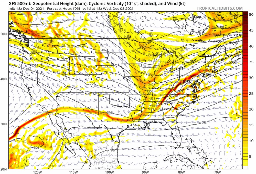
-
11/26-11/27 Rain Ending as Snow Obs/Disco
Winter Wizard replied to 40/70 Benchmark's topic in New England
We have flakes in Cambridge -
GFS looking stronger and farther S with the northern stream vort at hour 96. Could be interesting.
-
Pretty decent shift north. Not far off from being interesting all the way to SNE but need that vort to dig a little more and pop sooner.
-
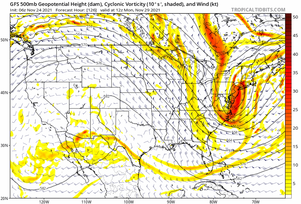
December 2021 Medium/Long Range Discussion Thread
Winter Wizard replied to North Balti Zen's topic in Mid Atlantic
GFS shifts well north with the vort, so it's a congrats Mount Washington.
-
December 2021 Medium/Long Range Discussion Thread
Winter Wizard replied to North Balti Zen's topic in Mid Atlantic
Going to be a pretty messy, volatile forecast with a pattern that supports multiple weak waves over the coming days. Have to think the Euro is a bit too amplified, but key difference I see between the models is greater separation between the Friday-Saturday wave and the early week wave. If that first system lingers, would likely keep it south and sheared apart like what the GFS showed. On the other hand, a more amplified system usually trends north. -
And this is still a few hours before high tide and the heaviest rain bands. Extremely concerning.
-
Worst natural disaster in the Northeast since Sandy
-
Wow can’t believe the photos I’m seeing today from my old stomping grounds of Annapolis. Just received word that my friends still in the area and my old apartment are safe so big sigh of relief. Hope everyone is safe! Ground truth probably confirms the EF2 rating.
-
Still some discontinuity between the low-level and mid-level centers this morning, but Henri should strengthen a decent amount today as it moves into a low shear environment.
-
Some similarities to the upcoming pattern though the northerly tracks into New England are totally unprecedented.
-
Been here quite a few times and have family in Natick. Decently familiar with the area but any suggestions are greatly appreciated.
-
Just moved to the Davis Square area. Very excited!
-
Hey everyone, just moved to Somerville so figured I'd introduce myself. I'm a degreed meteorologist from Penn State who spent many winters suffering from mid-Atlantic screw jobs and being envious of you New England folks. Hopefully I'll get to join in some of the fun this year. Nice to meet you all!
-
2021 Mid-Atlantic Severe Weather - General Discussion
Winter Wizard replied to Kmlwx's topic in Mid Atlantic
Yeah very close to there, right off Old Hanover Road. That’s funny. -
2021 Mid-Atlantic Severe Weather - General Discussion
Winter Wizard replied to Kmlwx's topic in Mid Atlantic
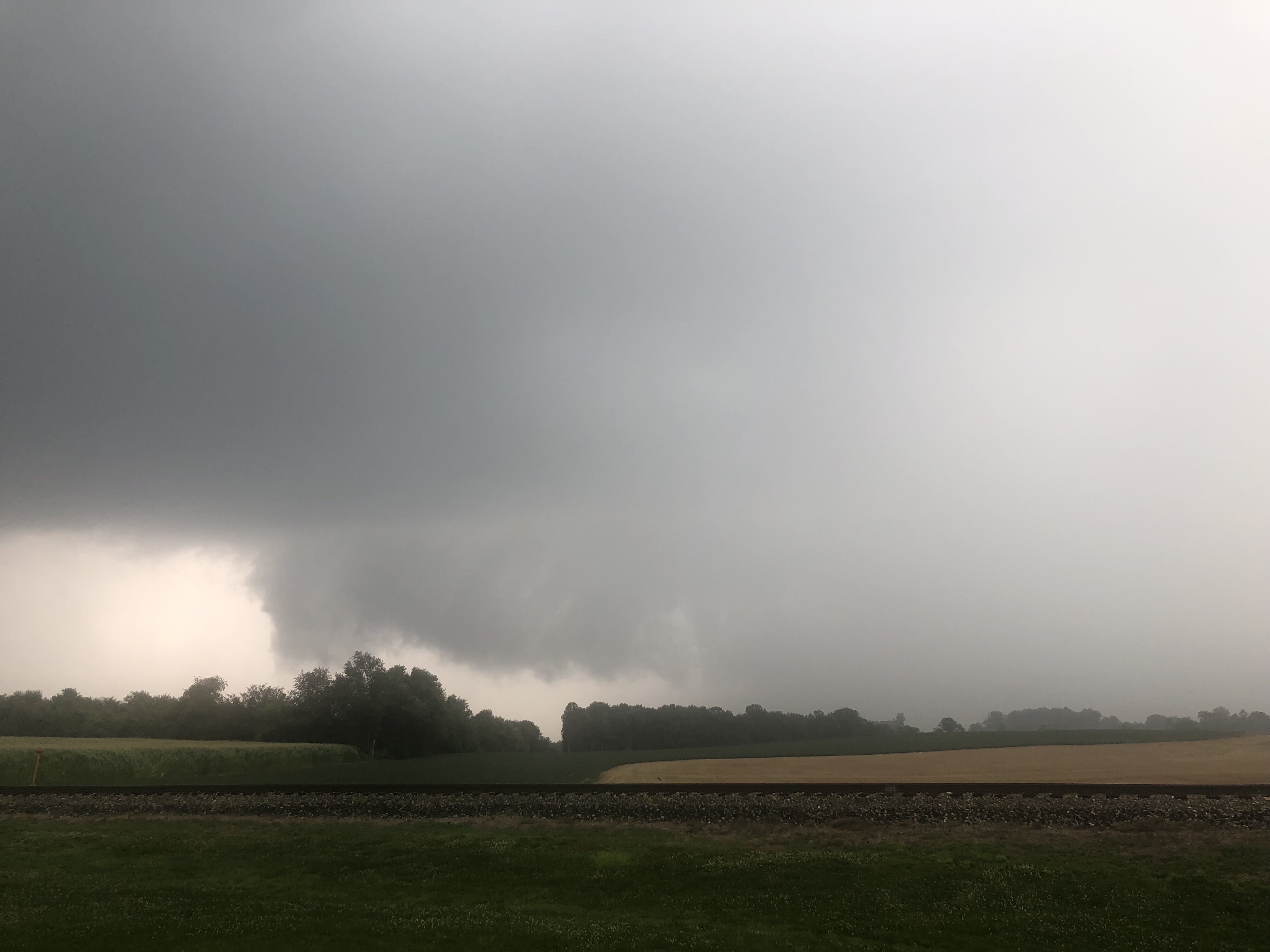
Captured this wall cloud from the storm near Reisterstown earlier today. Tried to capture that storm near Elliott City but ended up getting caught in the rain shaft and 695 traffic. Hope everyone stays safe out there.
-
2021 Mid-Atlantic Severe Weather - General Discussion
Winter Wizard replied to Kmlwx's topic in Mid Atlantic
Could say that about 90% of these severe weather setups around here. -
2021 Mid-Atlantic Severe Weather - General Discussion
Winter Wizard replied to Kmlwx's topic in Mid Atlantic
Not sure if it was mentioned, but CAMs did an abysmal job last night and this morning with the MCV over the Great Lakes region, everything developed farther south and west than progged. Obviously we have the usual limiting factors in this area, but best jet dynamics still appear to be near the Mason-Dixon Line despite the enhanced moving northward. Need to keep a close eye on that line today. -
Stuck in the low 50s here in Annapolis. Thank you bay breeze.
-
Yay! Thanks to this post I just checked and got my grandparents an appointment this weekend at CVS, over 2 months before their originally scheduled date!
-
Annapolis, MD: 38.968532, -76.513223