LongBeachSurfFreak
-
Posts
9,330 -
Joined
-
Last visited
Content Type
Profiles
Blogs
Forums
American Weather
Media Demo
Store
Gallery
Everything posted by LongBeachSurfFreak
-
 You can include the city itself in that currently. On the uws currently sleet and freezing rain mix. Paved surfaces with a crunchy glaze. Not sure how long we can hold on to this.
- 21 replies
-
- 1
-

-
- freezing rain
- ice pellets
- (and 1 more)
-
I agree in regards to the nyc urban heat island. It hasn’t changed much in comparison to other city’s to our south which have experienced much more growth. In fact the NYC heat island was fully functional as early as the early 1900s. It’s impossible to say what any given airmass would have been like 25 years ago though. This wasn’t a true arctic cold shot with strong CAA to begin with.
-
Nothing better then a real cold snow storm. There were a bunch of good one in the 13/14-14/15 winters
-
You can still put up big numbers if the lift is intense enough. Boston saw a 12” storm in December 03 which was supposed to be 2-4” but instead it snowed 2-4” an hour for a couple hours
-
One of our next big climate milestones will be a winter we’re it doesn’t drop below 20. That would bring us to zone 8 and introduce allot of semi tropical plants and trees (many more hardy palms) luckily we are already safe this winter with 19 at the park this morning.
-
january 3rd potential coastal grazer
LongBeachSurfFreak replied to forkyfork's topic in New York City Metro
Good trends for at least seeing accumulations for the city. The issue is, we will need 1/2” hr rates to overcome the warm ground for any pavement accumulation. That’s the snow removal side of me. I told my management I’m available if need be, but they are hesitant on making a call as yet on the uws. Colleges aren’t going to call in workers during winter break without a better guaranty. I like 1” colder surfaces CPk. 3” JFK. This one really splits the city -
january 3rd potential coastal grazer
LongBeachSurfFreak replied to forkyfork's topic in New York City Metro
Based on past similar events, there will likely be a northern band that produces some decent rates and that’s where you see 1-2”. While just north of that it’s all subsidence and a few flakes. It’s way too early to say where that band sets up. -
january 3rd potential coastal grazer
LongBeachSurfFreak replied to forkyfork's topic in New York City Metro
Best to go into this not expecting much. Rates will likely be light which means mostly a grass and car topper. Obviously this isn’t a true repeat of feb 5/6 10 but the net results are similar. -
The beginning decades had one 40 degree winter and lots below 30. This plays into why snow is so commonly associated with Christmas. December 89 is one of my most distinct early weather memories. Playing on the ice on the frozen canals where i grew up. The continuous cold and very minimal snow. Which all came from a couple clippers.
-
There are way better places to live if your going to live somewhere for snow in the north east. Tug hill puts them to shame most years. With limited cold moving over the lakes this isn’t one of them. Who wouldn’t want to experience 76/77 there. 400+ inches.
-
Nice inversion today above 3k 38 and snow dwindling fast at 850’ SVT
-
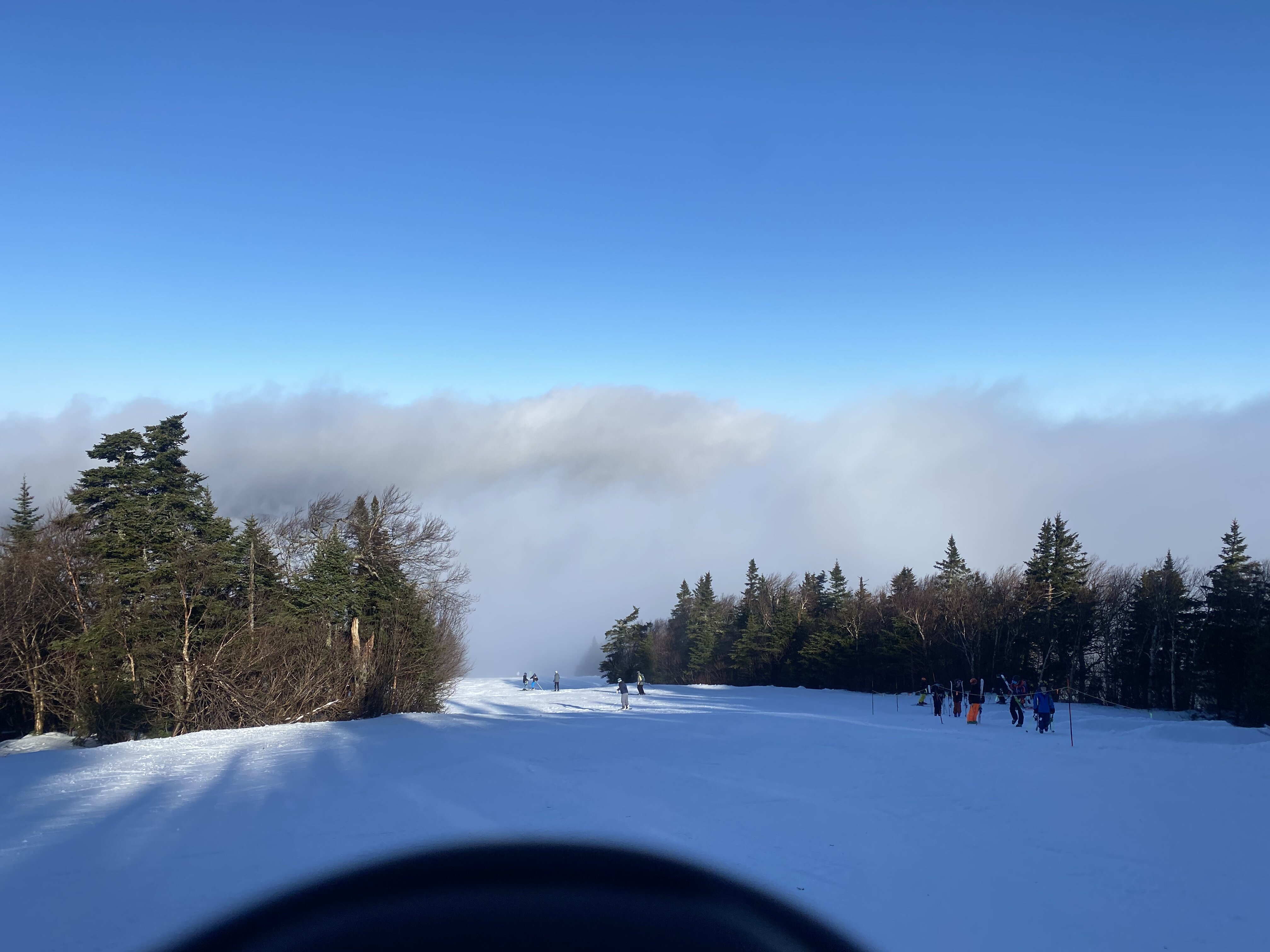
Depends on where, rode Stratton tues/weds and with minimal trails open it got dicey quickly with ice and Moguls. Driving back currently from sugar bush where it was much much better. Still limited terrain but conditions were so much better overall with limited ice and much more snow.
-
Decided to make the drive north today from SVT where its barely winter. My house this winter in west townshend is only at 800’ and it shows. A couple inches of slush. Things are only marginally better at Stratton. The winter line (real snow cover) starts about 30 miles north on 91. Hoping for some better conditions at the bush.
-
The only thing good, is it’s not displacing and dumping into Eurasia. Other then that it’s more of the same.
-
A few flurries on the uws currently. Finishing a project at work and heading to my house in SVT for the week, where winter is winter
-
Nice find, they should be -40. That’s one hell of a departure and incredibly anomalous. I would like to see some more stats!
-
It does, but it also means amped up super moisture charged Miller A’s. Time some cold just right and you have January 16s record NYC snows. Tweak a few variables and that’s how you go for 50”. Chances are warmth will win before we ever see that however.
-
The super super duper El Niño is most likely on the way. There’s just too much heat around to sustain La Niña (even though it’s wind based). If NYC were to ever see a 50”+ storm that’s how you get it done, with an atmospheric river flowing in to a nor’easter with a nice source airmass
-
Thank you. With zero to back it up. We need the few good posters left or this board is shot. Walt, keep up excellent informative posts. Real meteorology vs. agenda biased modelology. frozen may be a stretch for the coast, but this board includes areas inland and elevated enough to be in the game
-
Merry Christmas everyone. Here’s to threading the needle and scoring a couple moderate events the next few weeks!
-
They are very far north so all it takes in the proper flow and your closely linked to arctic air with little modification. As far as the summer heat, I would think some of those extreme temps include some downslope compression. Typical Christmas weather in our new climate. Meanwhile an ice storm is underway in southern Vermont at my house there.
-
I’m starting to like 11/12 as an analog for this winter. We may be able to pull off a wintry week with a moderate even in the mid January, peak climo time frame. Then it’s just warm. The big takeaway about our new climate is, stuck patterns can suck just as much as they can be amazing. If your a snow lover in the PAC NW, this is a dream pattern.
-
Prediction of the first snowfall for the NYC area.
LongBeachSurfFreak replied to MJO812's topic in New York City Metro
I know your joking, but it’s only a matter of time before we have our first ever 0 winter -
Yeah, shades of 01/02-11/12-19/20 are definitely in the air. We really need a full scale pattern reversal. That might not happen until we have our next Nino. But your just not going to cut it with such a persistent -pna. I’m not the type to throw in the towel, but generally a rat winter shows itself early on.
-
11” seems very high. I was at Stratton this weekend and we had about 5”. It just wasn’t enough to really rebound the mountain. There were some major ice challenges by the early afternoon