batmanbrad
-
Posts
289 -
Joined
-
Last visited
Content Type
Profiles
Blogs
Forums
American Weather
Media Demo
Store
Gallery
Everything posted by batmanbrad
-
fro those who follow Bernie Rayno, he has posted another video on X within the last hour... naturally he believes the GFS is "off its rocker"...
-
might the CMC do the hand-off to a coastal like the ICON?
-
ICON leads... will GFS/CMC/Euro/UKMET/AI's follow?
-
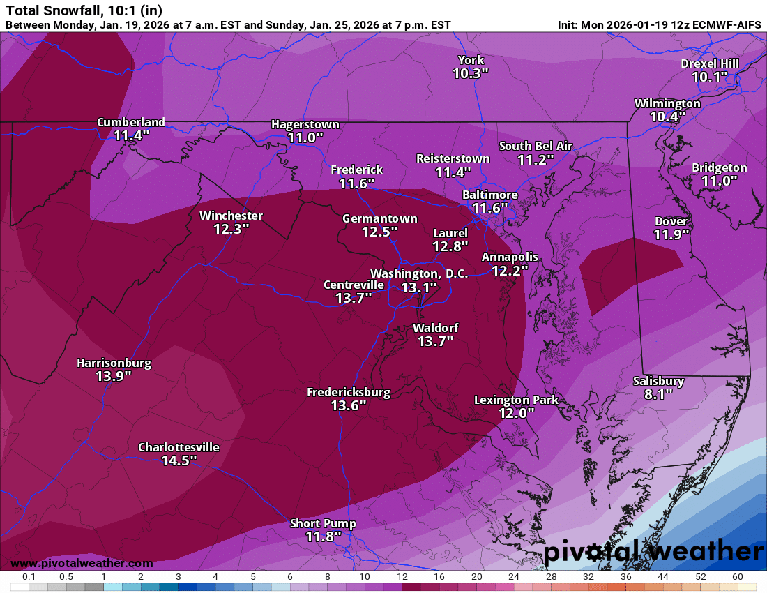
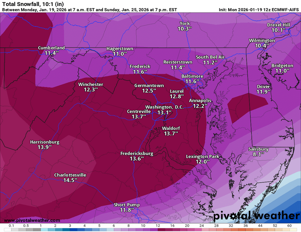
a solid 11-14" for most of our area using 10:1 by early Sunday evening says the AI Euro, wow
-
trying to play catchup? already out to 48 on Pivotal. (edit: was referring to AI) What happened to Beethoven? Did he get kidnapped?
-
I see that big-ass 1050mb HP, where would we LIKE that to set up so that suppression is lessened and yet is close enough to keep the cold air around?
-
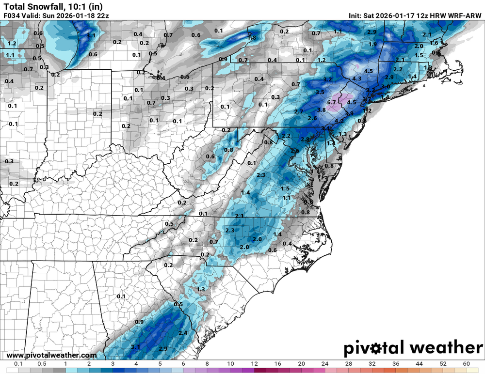
WRF-ARW on board as well for tomorrow
-
kind of a weird snowmap for our area, but it will do for now. Until it changes next run.

-
GFS at 312 now on Pivotal looks somewhat interesting, but too far out to pay too much attention to.
-
I'd think if the more bullish model trends continue (let's see how the Euro's 12Z run looks), NWS could issue some warnings with their afternoon package if there's a decent chance the necessary criteria for a warning could be met.
-
I also remember that my dad had a radio that could pick up NOAA Weather Radio stations, kinda dull way back in my youth but for its time it was pretty cool.
-
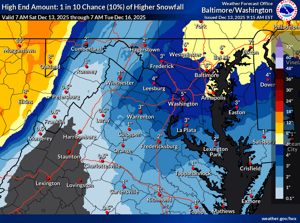
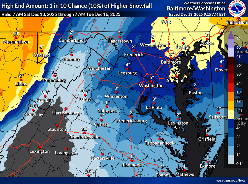
latest NWS high-end map, probably not going to verify but we can dream, right?
-
yes I have fond memories of the Trammel Starks music that TWC used to play a lot of, oh, 25-30 years ago?
-
That 3.5" marker over central MoCo is just about on top of where I live (Gaithersburg, near Laytonsville), I'll take that.
-
But gotta remember that Lucy will always pull back the football...
-
gotta love how the Canadian sticks its (middle) finger of snow-hole right through our region...

-
one last band trying to move E/NE from Loudoun County, if it holds together could give much of Central/Southern MoCo a bit more accumulation in the next hour or so.
-
measured about 1.5" on my deck railing, not as accurate as a snowboard measure, but considering a bit of compaction possible I'll take it! Wasn't expecting more than an inch up this far (NE Gaithersburg, close to Laytonsville)
-
have to say that overall this was fairly well predicted by the models, Euro gets props for having been the earliest and fairly consistent to predict that places even north of DC up to around I70 would get measurable stuff... and the timing of when it would begin and (soon) end was accurate as well. Some of the other models were late to the northern shift but did catch on as we got closer to the event.
-
clearly they built that stretch of I-70 to coincide with the northern extent of the green portion of the precip! Pretty much in line with much of the model predictions as to where the cutoff would set up?
-
18Z RGEM about the same as previous run, maybe just a hair better but mostly noise I think
-
let's see if King Euro comes back north as well and joins the rest of the 12Z model suite. It might as well finish what it started, right?
-
yep, no more snow for us on the 18Z, everything shifted significantly north - northern New England and interior New York get a good snow from this run.
-
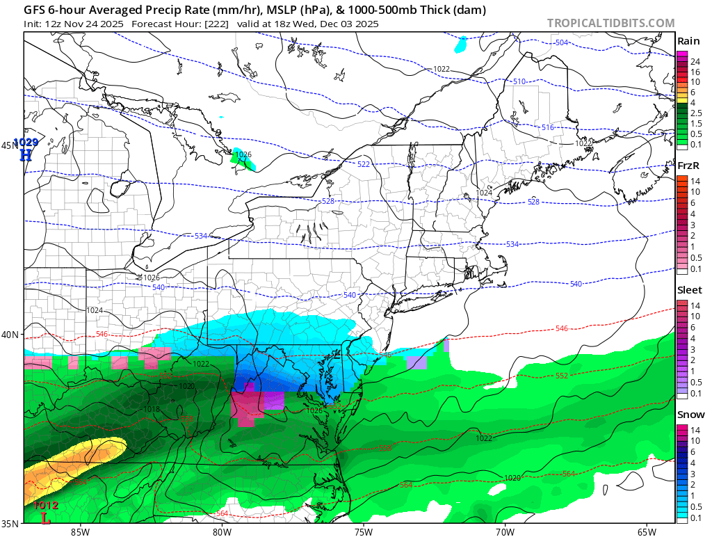
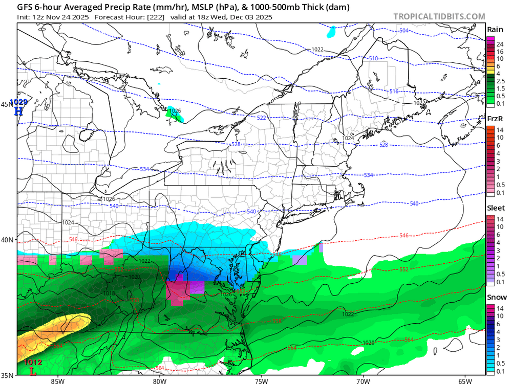
and now the 12Z GooFus has backed that up to 12/3!
-
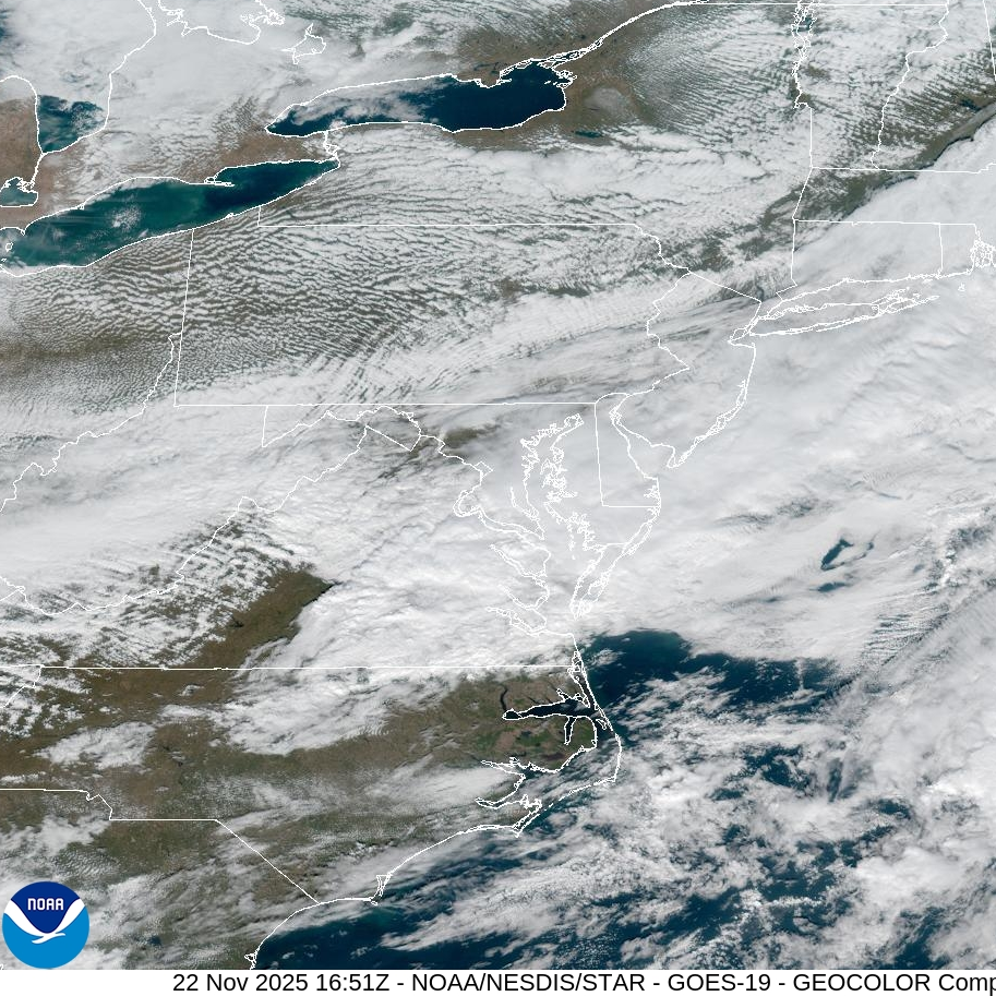
nice break in the clouds over MoCo, full sun here in Gaithersburg (near Laytonsville)!