nrgjeff
-
Posts
4,256 -
Joined
-
Last visited
Content Type
Profiles
Blogs
Forums
American Weather
Media Demo
Store
Gallery
Everything posted by nrgjeff
-

Wild Speculation for Winter 20 -21
nrgjeff replied to Holston_River_Rambler's topic in Tennessee Valley
Latest European weeklies line up with the tropical convection for the last forever. Except for next week's cold front, it's mainly warmer than normal weeks. Especially weeks 3-6 have a screaming +ABNA pattern. That's not super warm here, but no way to deliver cold. Warmest anomalies are north and west. I would think it's the secondary pattern. Would last until about Thanksgiving. Then the primary pattern in La Nina would be that stubborn SER. Neither is really cold here, which is not a surprise in La Nina. Guess I'm saying the same thing over and over. Mainly warm. Hope for a well timed miracle. One of those Plains cold outbreaks bleeds southeast correctly timed. -
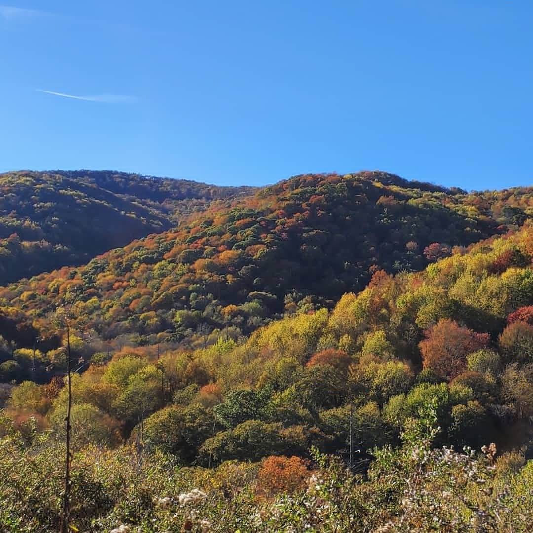
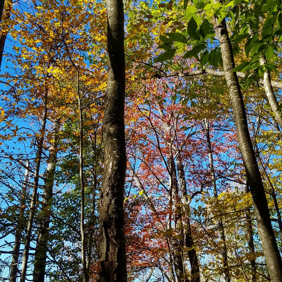
Yes this weather is simply perfect. Looks to continue for several days (except maybe Saturday) as all global models slow down the Big Front. Only the ICON is still cold before Halloween; but, it's an outlier. Looking for more leaf viewing this weekend. Probably about 3,000 FT. We jumped a bit early last weekend, but still made the best of it. Got the blue sky pics which might be elusive this weekend. However sometimes bright overcast is good in photos, with minor 'help' on the PC, lol! Halloween weekend could be good lower elevations if the front just prior is not too windy. Also note the early Fall time change this year Sunday November 1.
- 168 replies
-
- 5
-

-
- leaves changing
- temperatures
- (and 2 more)
-
Fall/Winter Banter - Football, Basketball, Snowball?
nrgjeff replied to John1122's topic in Tennessee Valley
Let's do it! I'm happy the Challenge will go forward despite the pandemic. Kansas at Tennessee will be close. We might not know the winner for a couple weeks. Just kidding! Last I checked the Champions Classic is still on for late Novie. However I think some of the bigger early season tourneys are cancelled. Big 10 fb starts this weekend. LOL that two of their teams have such high probabilities for the BCS. Really? They haven't even played one snap yet! -
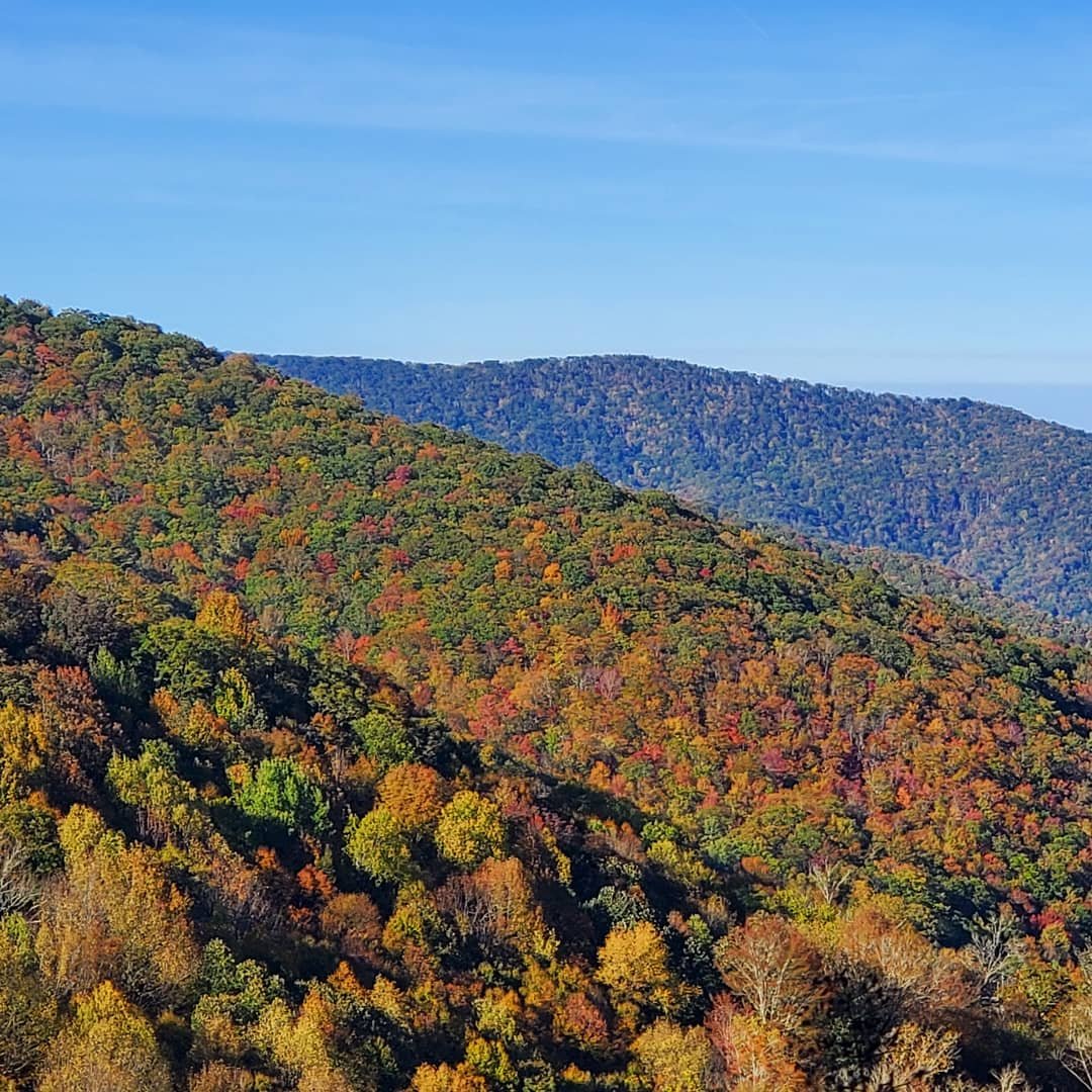
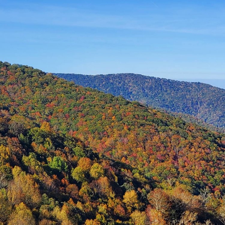
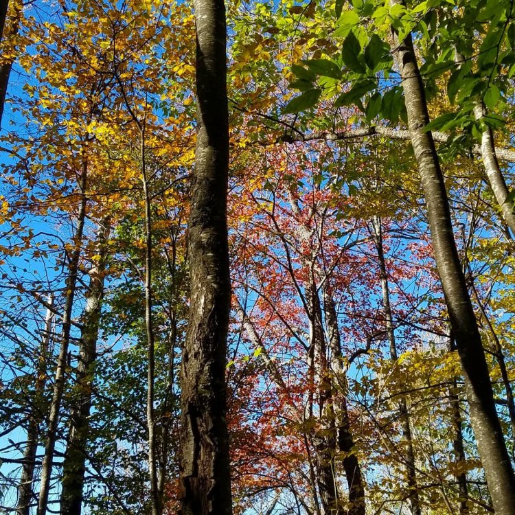
Next year we will do the Blue Ridge on Fall Break. Seems to go 7-10 days earlier than Tennessee or even the Smokys, timed with fall break. Those pics on the Parkway are stunning. Even the cloudy day the trees pop out. Here is Saturday October 17 on the Cherohala Skyway. Pictures are taken from just inside NC at about 4,500 FT. Higher was well past peak. Lower was green. Past weekend only a thin 500 FT section was peaking. We enjoyed that elevation quite well. I suspect the 3,000-4,000 FT area will be great this coming weekend on the Tennessee side.

-
Wild Speculation for Winter 20 -21
nrgjeff replied to Holston_River_Rambler's topic in Tennessee Valley
My only thoughts are Bearish. What's new right? North Pac certainly helps with cold air delivery - just not here! OK the Mid South maybe. But I forecast a winter of malaise for the actual Tennessee Valley. Farther northeast (MRX/TRI) could do ok. I have strong doubts anything of note will happen HSV to CHA. I know it only takes one bowling ball, but nah. Forecast model failures recently point to the trend. SER likes to hang on, even w/o an upper ridge. Just stay warm. Eventually cold air will bleed southeast a few times. Then I'll forecast drizzle and 38 for KCHA. -
Fall/Winter Banter - Football, Basketball, Snowball?
nrgjeff replied to John1122's topic in Tennessee Valley
Sports has been a disaster from Volunteer football to Braves base running. The only thing harder than being a Vols fb fan is being a Kansas fb fan. Poll. What's worse. 1. GFS extended 2. Kansas football 3. Atlanta base running Kansas and Tennessee fans look to NFL/Pro or await basketball season, and pray it's not covid crazy. -
Fall/Winter Banter - Football, Basketball, Snowball?
nrgjeff replied to John1122's topic in Tennessee Valley
Ensembles and Weekies have settled on the hurry up and wait solution. Cold front coming. Just wait another 10 days. We can trust the timing. Halloween cold front is usually money. -
Oh I saw a webinar yesterday about SSW and related events including early season, last warning, and something called reflection. I'm sorry I can't share it. However the reflection case resembles the ABNA Asia Bering Sea North American pattern, which is also related to charts Jax shares including Asia and North America. All 3 tie in. Good stuff! Reflection is both horizontal and vertical. The vertical requires the stratopause be in a certain state. Warm energy from the West Pac Tropics pumps up a ridge in eastern Siberia. China gets cold. Pattern reflects a wavelength downstream over North America. Canada mild USA cold. At the right wavelength looking at Asia weather charts can help with USA forecasting.
-
Fall/Winter Banter - Football, Basketball, Snowball?
nrgjeff replied to John1122's topic in Tennessee Valley
Eddie Van Halen passed away. I'm going to be pretty bearish for a few days. Much above normal temps this winter. No snow. Nocturnal tornadoes. -
Looks like MDT Nina. Oh yeah Jax our posts are three weeks apart. Definitely a different sequence. At any rate, tee up a SER most of winter. Cutters. Severe wx. SOS
-
Fall/Winter Banter - Football, Basketball, Snowball?
nrgjeff replied to John1122's topic in Tennessee Valley
That's good news, except for more of those snow clown maps on Twitter, lol! Euro at times gets even more carried away than the GFS, depending on the vendor algorithm. Baseball wild card was fun. Games all day like March Madness. Still have a ton of sports overlapping now with the NBA Finals, MLB playoffs, and lots of football. Ironic that after missing sports for several months, we now enjoy a huge sports period that started with the NHL and NBA playoffs. Now college football is full steam ahead. -
Fall/Winter Banter - Football, Basketball, Snowball?
nrgjeff replied to John1122's topic in Tennessee Valley
Yes 1989 was the winter of record back in KC. All-time record low was set two nights in a row at -23 F. However that's for MCI since 1973. I think Downtown MKC has a colder older record, but that'll stand due to the urban heat island now. Apparently the 1989 wavelength was fairly big if Kansas and Tennessee followed the same pattern, vs cutter city over here. The blowtorch second half was the same too. Wow back in the days we had full latitude troughs for everyone! Other big years 1985 was more over here, cold but nothing spectacular in the Central Plains. 2000 was more there than here. I was about to put this in Fall; then, realized it's winter. All the out-of-region stuff I'll go Banter. Now in 2020 I'll go stubborn SER for at least southeast Tenn. I could see northeast Tennessee doing fine in La Nina. Then when the trough is Central US, a nice Mid South winter hammer. Everyone but CHA and HSV. Barring a one-day miracle. -
Yeah the +ABNA does have some blocking as Carvers notes. However the Alaska / northwest Canada source region is on fire. +ABNA can get it done down here locally with split flow, but that's not usually good for Region wide fun. Plus I'm just a very skeptical bear. If I can find just one reason to go warm, against 3 cold, I'll go warm. It is the South. Everything lines up, or cue up Toad the Wet Sprocket 1992, something's always wrong. Given a decent La Nina and QBO fail I'm seriously warm winter at work, no joking. However fall leaf season looks superb!
- 168 replies
-
- 3
-
-
- leaves changing
- temperatures
- (and 2 more)
-
European weekly charts line up with the cooler than normal outlook through the first 10 days of October. However, it ends there. Rest of the weeks are slightly warmer than normal. AN heights stretch from the West across Canada. Return of the +ABNA. Cancel winter? Well, this is the fall thread. Good news is the next few weeks will be good for leaves turning on time. Just avoid any wet wind storms. Early next week is not an issue. Same system in 15 days would be awful.
- 168 replies
-
- 3
-
-

-
- leaves changing
- temperatures
- (and 2 more)
-
Wild Speculation for Winter 20 -21
nrgjeff replied to Holston_River_Rambler's topic in Tennessee Valley
Latest QBO coming in positive. The -QBO appears to have failed like a few years back. Looks like a long mild winter. Might as well look to Dixey Alley action. Wake me up in March for basketball and storms. -
I want to be a cynic and say it failed the last two times in the 11-15 day. However this time it has plenty of teleconnection support. Also East Asia looks more friendly upstream. That's just for the next 2-3 weeks. For winter, revert to cynical skeptic.
- 168 replies
-
- 4
-
-
- leaves changing
- temperatures
- (and 2 more)
-
Fall/Winter Banter - Football, Basketball, Snowball?
nrgjeff replied to John1122's topic in Tennessee Valley
I felt the same watching the Chiefs. When they looked awful I actually said out loud, I wish CBS would have saved me the pain and just shown Baltimore here! Things turned around of course. Why can't we have normal wins anymore? Always with a side order of heart attack, lol! Meanwhile the Saints choked last night. What is it with the NFC South? Can't stand the Raiders! -
I like John's cynicism. I strongly approve that message! Remember November 2019 setting the table for this epic snowy below normal temps winter? Sure was a nice early spring! OK I will try to share a shred of optimism. Only takes one day. Chattanooga Magic Saturday February 8.
- 168 replies
-
- 5
-

-
- leaves changing
- temperatures
- (and 2 more)
-
I saw the same. Weeklies do look blocky; however, we still might have to hurry up and wait on wavelengths and other features. If the Canada ridge goes mega-ridge, we are back in that +ABNA summer weather pattern. Siberia is also doing +ABNA things on the weeklies. Fortunately in October that's not as humid. Temps near normal, but no big trough either. Also, to give fair time, haha... There are some 16-30 day analogs with blocking and the +PNA and +WPO that go pretty cool. +WPO might be meh in winter; but at these early fall wavelengths, it's actually cold East. Selfishly I'm hoping for the normal/warm scenario. While I love cool mornings, warm afternoons get me more in the mood for fall foliage. In the relatively shorter-term there's Wilfred/22 for next week. ECMWF favors a track between that of Laura north and Sally south. Caution a 7 day forecast; but, inland storm chasing hopes always spring enternal!
- 168 replies
-
- 3
-
-
- leaves changing
- temperatures
- (and 2 more)
-
Wild Speculation for Winter 20 -21
nrgjeff replied to Holston_River_Rambler's topic in Tennessee Valley
More positive news from MEM to BNA. Depending on wavelength and the like southeast Tenn could still be in the SER screw job. -
Big trade winds push in progress. Moderate La Nina is within striking range. Still feel like a good weak Nina. No borderline.
-
I saw some 1965 hype, but didn't check snow. Severe wx that spring, lol! My guess is Memphis and Nashville will do OK this winter. Southeast Tenn will be blanked, or have an upper low surprise. All or nothing, lol!
- 168 replies
-
- 4
-
-
- leaves changing
- temperatures
- (and 2 more)
-
European monthly charts are classic La Nina, except a little better shot at cold Jan vs Dec. Verbatim that's great for a chance at snow. Jan > Dec. Feb-April annihilate Dixie Alley.
- 168 replies
-
- 5
-
-
-
- leaves changing
- temperatures
- (and 2 more)
-
It will eventually come through, but might be limping and weak. That kind of cold anomaly in the Plains will usually bleed southeast even this time of year. My biggest gripe is the awful evolution of the trough overall. Not only do we get robbed of a true cold front, no severe set-up in the Midwest. Could it be any worse? Actually I should not ask it's 2020, lol!
- 168 replies
-
- 3
-
-
-
-
- leaves changing
- temperatures
- (and 2 more)
-
A boundary cooking all day makes my heart wish I'm there. Terrain? I'm used to it in East Tenn.