vortex95
-
Posts
2,209 -
Joined
Content Type
Profiles
Blogs
Forums
American Weather
Media Demo
Store
Gallery
Everything posted by vortex95
-
2026 Atlantic Hurricane Season
vortex95 replied to Stormchaserchuck1's topic in Tropical Headquarters
I think TCs result in 10-15% of rainfall overall in the tropics. Some areas much more. like Cabo San Lucas MX. Most sig rainfall here comes from TCs or their remnants. -
K4MD - Baltimore/Pier 7 MD KBDQ - Morrilton AR KCHT - Chillicothe MO KK51 - Medicine Lodge KS KM46 - Colstrip MT PACE - Central AK PACI - Chalkyitsik AK METAR Site ID Change: K2V5 to KRYA - Wray CO
-
2026 Atlantic Hurricane Season
vortex95 replied to Stormchaserchuck1's topic in Tropical Headquarters
Yes, "the door swings both ways" as I always say. Sure, when you have high-end wx event that has big impacts, that is going to be front and center. However, there is flip side, when you get atypically inactive or quiet periods, or a pattern/cycles that suppresses extreme wx events. Heck, we've seen that over the decades for East Coast snowstorms, much to the dismay of snow weenies! I get it, out of sight, out of mind, and that does not sell, but that does not mean it is not important or should be ignored from scientific or meteorological POV. The reporting bias of wx from the MSM and social media is obvious. and that skews perception. What suppresses TC activity, or any stormy wx, is just as important as what favors it. There should be more study on this. TC are more tenuous as to existing than many think. They require very specific conditions to develop and maintain. and SSTs alone do not cut it (far too much emphasis on those IMHO). What matters most is in the atmosphere, not the ocean. Wind shear and TPW are paramount. You can have all the warm water in the world, but if the atmosphere does not cooperate, you get nothing or TCs that have trouble getting intense. This Atlantic season so far displays it more obvious than I think any other recently. High shear across the MDR?, no dice. And what manages to develop, struggles big time and does not last long. And look at Edouard. Over 31 C SSTs, and it still took its time developing b/c of a lot of dry air present and minor shear. Close to landfall, it got closer to the center of a 250 mb high pressure, and only *then* did it make its move, so to speak. The shear decreased to near zero, and less shear stopped the entrainment of dry air into the core. Edouard being so small, it makes a TC more vulnerable to even small environmental changes, and drier synoptic environment typically means TCs will be smaller overall. So you see how it is all tied together. You can't treat any wx parameter in a vacuum. The ocean and the atmosphere are coupled. -
2026 Atlantic Hurricane Season
vortex95 replied to Stormchaserchuck1's topic in Tropical Headquarters
Ginger in 1971 is one of the oddest TC tracks and second-long lasting TC in the Atlantic on record. https://en.wikipedia.org/wiki/Hurricane_Ginger The "Yankee" hurricane in 1935 started near Bermuda and ended up hitting MIA from the ENE! https://en.wikipedia.org/wiki/1935_Yankee_hurricane For the oddest track globally?, Typhoon Wayne in the NW Pacific in 1986 takes the cake here! https://en.wikipedia.org/wiki/Typhoon_Wayne_(1986) -
2026 Atlantic Hurricane Season
vortex95 replied to Stormchaserchuck1's topic in Tropical Headquarters
The CONUS has no major hurricane landfalls Nov 2005 to July 2017, that 11.5 year gap is the longest on record going back to 1851. New England or LI has not had a hurricane landfall since 1991, it's longest such gap period on record. Contrast this to 5 from 1938-1960. During the Atlantic inactive period 1970-1994, there were 3 hurricane landfalls in this same region, but 1995-2025 is the most active Atlantic period on record, and none here! So you see it works in bursts and in non-even/linear ways, and this is true worldwide w/ many wx phenomena. This why you can not let short-term cycles/trends (say 30 year or less) or "recency bias" influence scientific objectivity. Human quirks and fallacies in perception/behavior are an issue here as to reality (and the MSM takes full advantage of this, unfortunately). Geologically, the atmosphere cycles/patterns work on much longer time scales. What is a "long time" to people (say 10-20 years) is not a long time geologically! In the case of Atlantic TC cycles, they work on a 25-50 cycle from the AMO phase. This is clearly evident in the data going back to the mid-19tn century. And of all the TC basins in the world, the Atlantic is the most variable overall. -
Septorcher 2026 Discussion - Endless Summer
vortex95 replied to Damage In Tolland's topic in New England
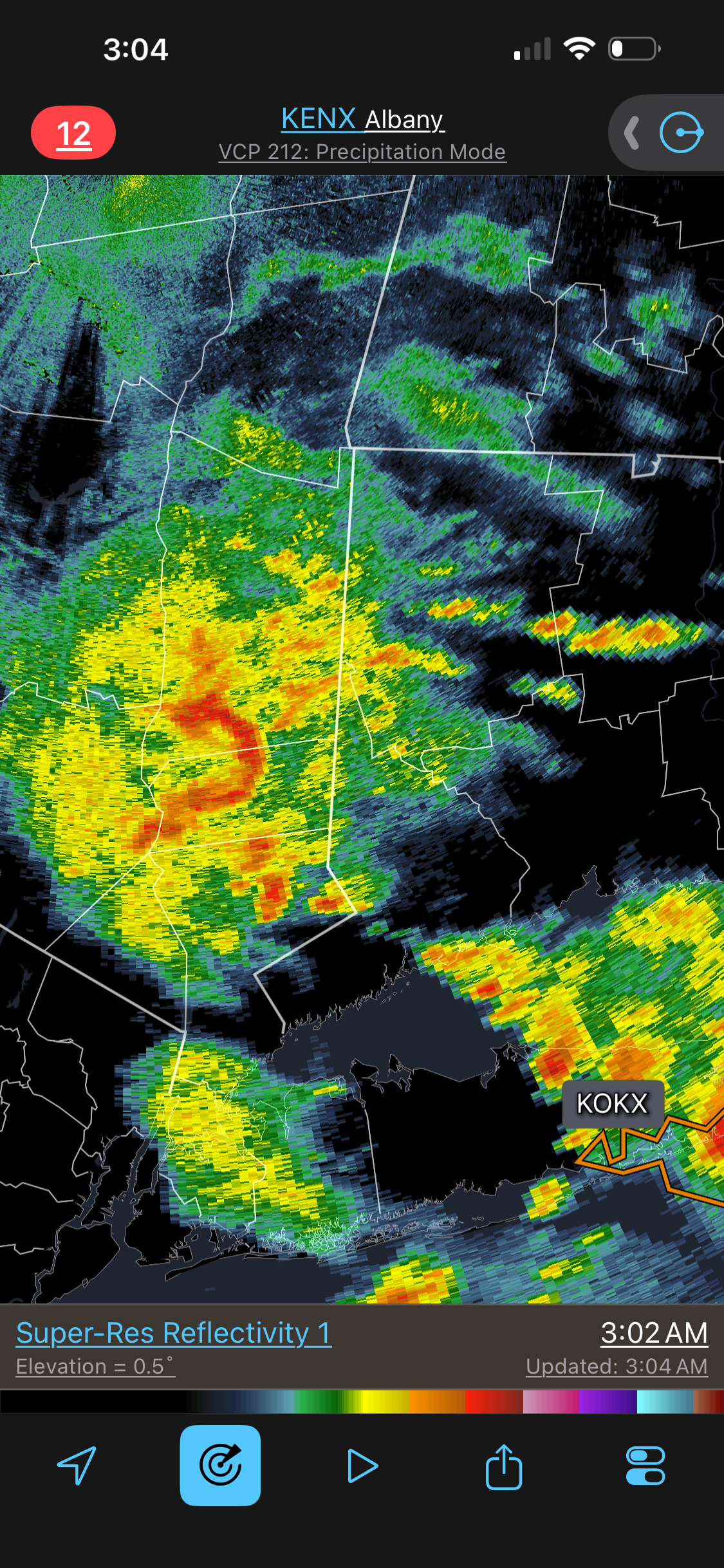
And it continues for swrn CT...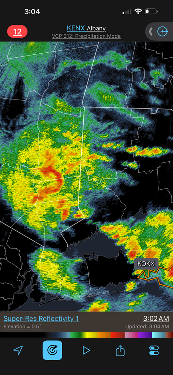
-
"Car wash" rain!
- 2,604 replies
-
- 4
-

-
- severe
- thunderstorms
- (and 7 more)
-
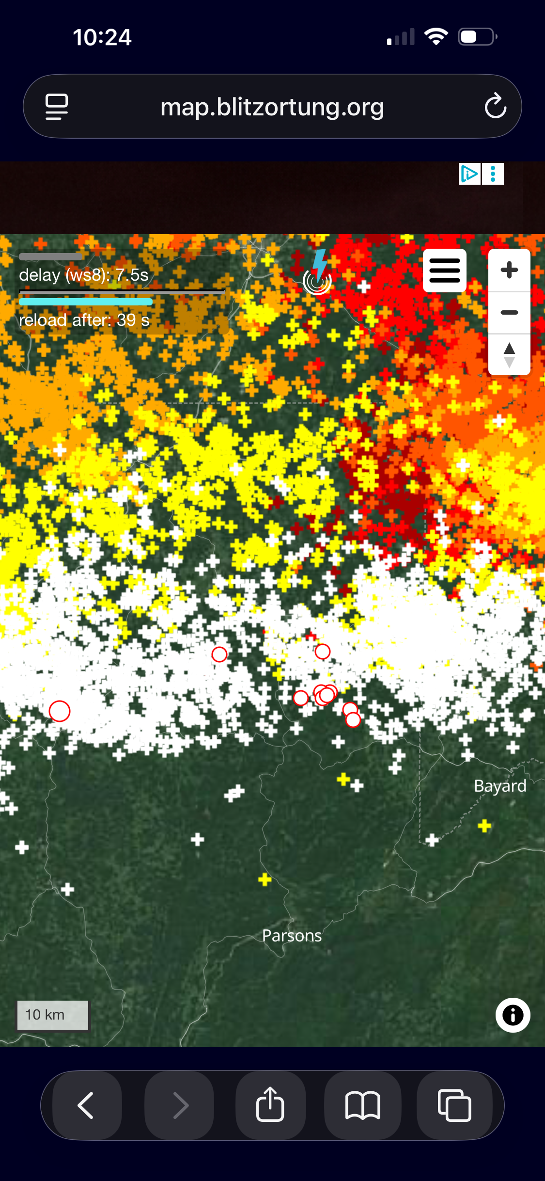
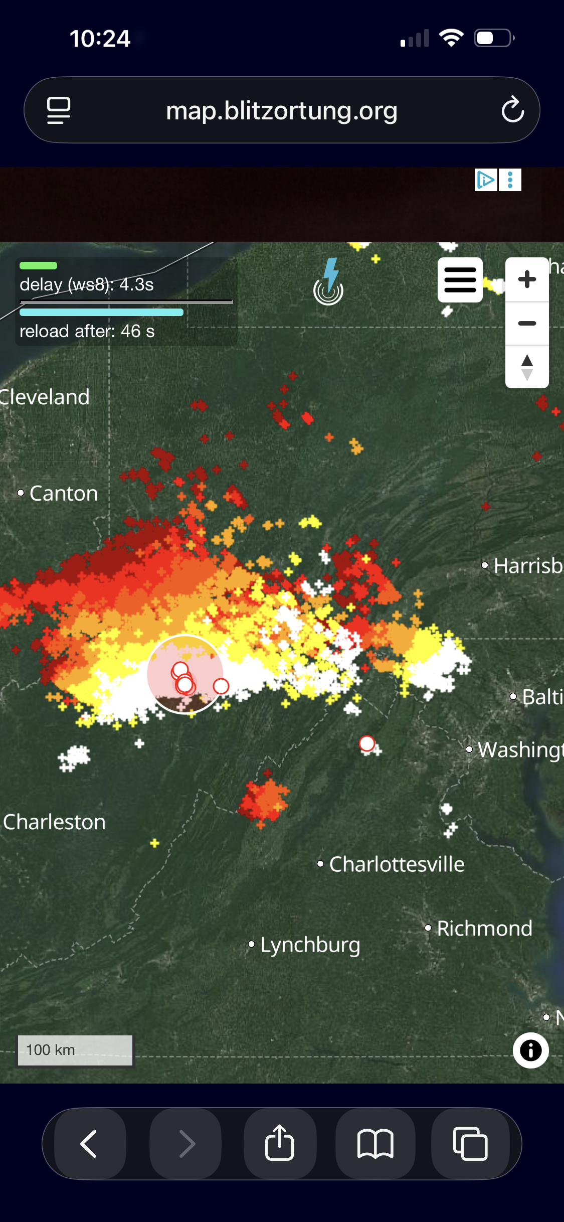
Nocturnal tstms w/ elevated CAPE often deliver big w/ LTG of all types. The crazy "quick" flickering constantly is a telltale sign! I think it is tied to the high CAPE in the mixed-phase layer of the storms. Really cranks up charge separation!
- 2,604 replies
-
- 5
-
-
- severe
- thunderstorms
- (and 7 more)
-
And the most extreme example I can think of is Katrina. Down to 125 mph at at landfall, but still all-time record surge of 28 ft!
-
Nocturnal tstm development is a different animal than daytime. Very quick development and not always apparent where exactly it will fire. Lots of surprises. Td 77 at DCA currently!
- 2,604 replies
-
- 1
-

-
- severe
- thunderstorms
- (and 7 more)
-
Yes CGs density is excellent in nrn WV and wrn MD. So a night of near constant "flickering" seems likely some locations! I like the there is OFB headed for the metro.
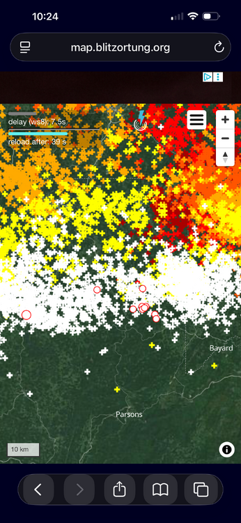
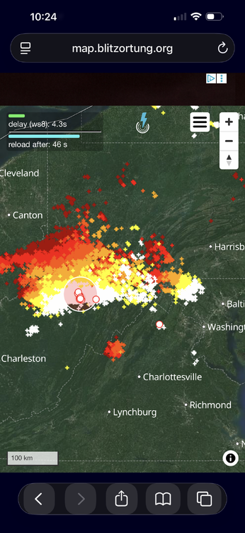
-
That is a lot of CAPE, and a ton elevated (wide at mid levels). Not the best EML, but 6.6 C/km 850-500 should do the job to have some solid overnight storms (for once)!
- 2,604 replies
-
- 1
-
-
- severe
- thunderstorms
- (and 7 more)
-
Well, the say the same thing in the New England forum (I am from the BOS area originally), but they abbreviate it "WCWGTH?!" (why can't we get that here?!).
-
Septorcher 2026 Discussion - Endless Summer
vortex95 replied to Damage In Tolland's topic in New England
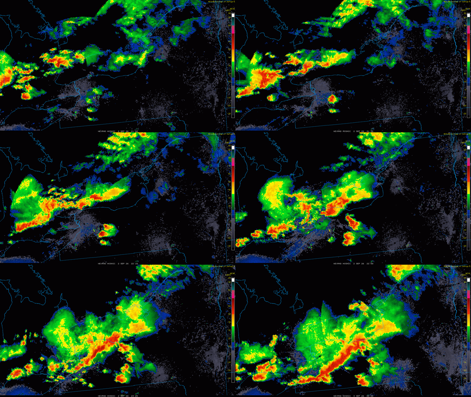
And that Elba NY unreal HP supercell Wed. Look at the radar loop. Classic splitting and merging supercells and then a raging SQLN same area right after? Again, WCWGT???? At least NW flow is living up to is name for nasty cells somewhere in the NEUS.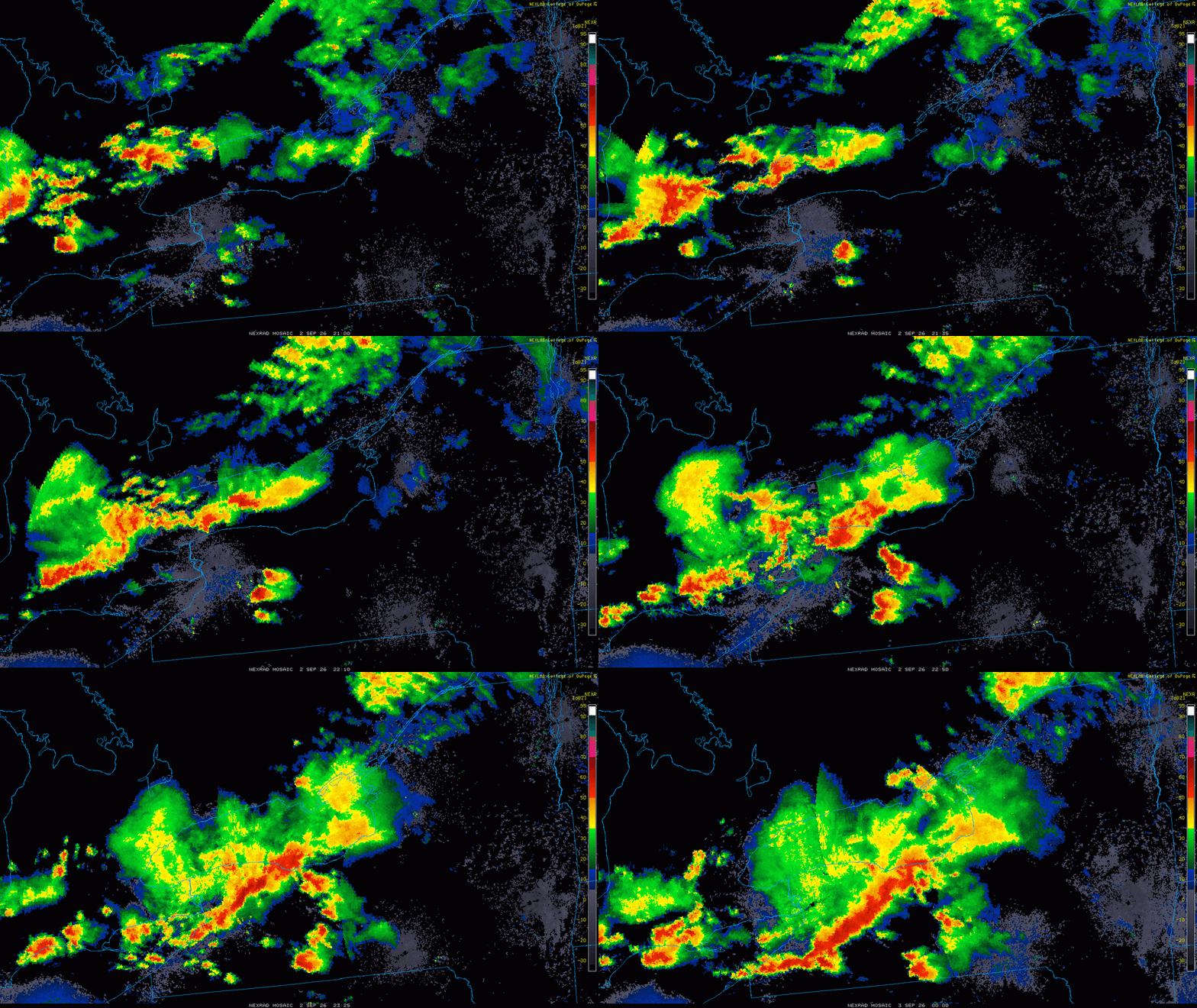
-
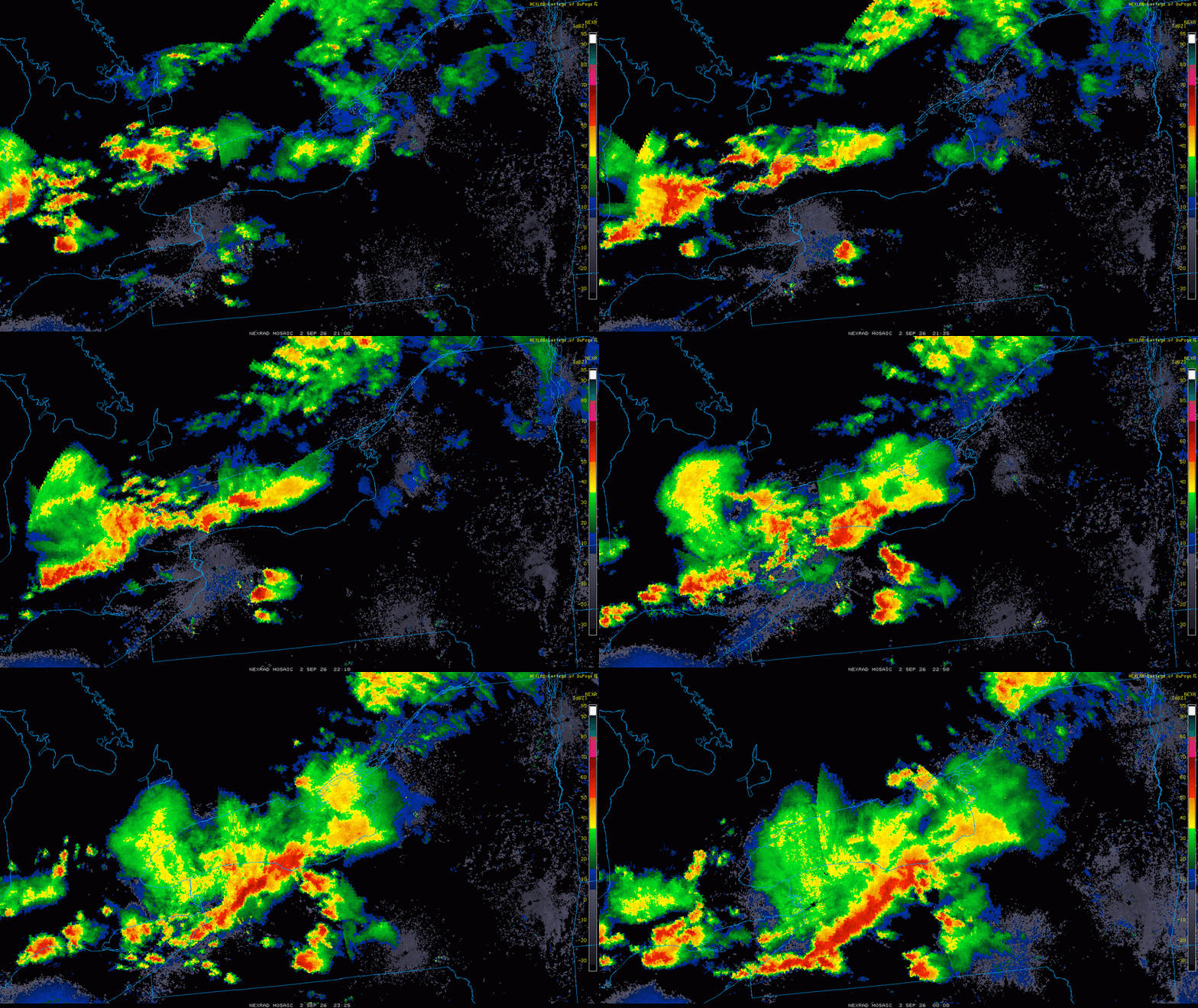
Also, see this ydy in wrn NY? That is *unreal* supercell structure for the East! https://x.com/voglerweather/status/2095284232893473216/ Radar loop shows classic splitting supercells and then a raging squall line into the same area. Why can't we get that?
- 2,604 replies
-
- 2
-
-
-
- severe
- thunderstorms
- (and 7 more)
-
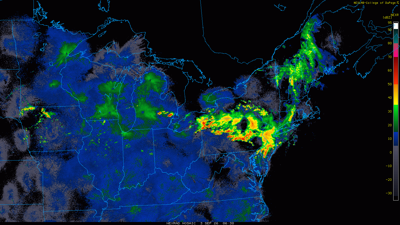
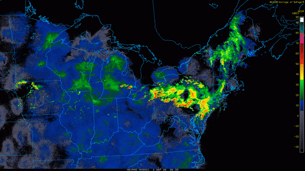
Darn it! You'd think w/ the BDF getting much farther SW than fcst, and a general rule about 50 mi N of the front when EML-type NW flow, we'd have a nice nocturnal MCS right over the DC area now, but it's still way N still in PA/NJ at this hour, which has got hit repeatedly in the last few days. Also, the squall line that came through early aftn ydy, you'd think that would have meant convection firing farther S as that what usually occurs in NW flow Two days ago the axis was just to our NE, and moves S for ydy aftn, but apparent has moved back N? Odd. Maybe today finally w/ the svr risk axis fcst right through us, but it was ydy also.
-
Monday, August 31 - Thursday, September 3, 2026 Convective Episodes
vortex95 replied to weatherwiz's topic in New England
No "Holy Sh*t!" from @weatherwiz? -
Monday, August 31 - Thursday, September 3, 2026 Convective Episodes
vortex95 replied to weatherwiz's topic in New England
One chaser I know way back always put in his signature file: I FEAST ON THE SMORGASBORD OF ATMOSPHERIC VIOLENCE!" @weatherwiz should come up w/ a similar tagline! -
Monday, August 31 - Thursday, September 3, 2026 Convective Episodes
vortex95 replied to weatherwiz's topic in New England
Good points, just don't less recency bias influence you! I go back to the big snowstorms this past winter, and you still act like, "never any good winters again!!" 4 lousy snow years/storms until Jan 2026, and you act like it was 40 years! And I hear things like, "PVD gets 37" and I only get 24" -- "WORST STAWM EV-A! -
Some historical cases where RI cycle/markedly improved upper-level outflow at and after landfall. Andrew Aug 1992 S FL Andrew was undergoing RI at at landfall, and the eye was actually 1 C warmer 1 hr after landfall. I recall the last recon pressure was 932 mb, and they estimated 926 mb for landfall, but readings on land n the eye found 922 mb in post-storm analysis. Charley Aug 2004 SW FL Charley was undergoing RI those last 12 hours up until landfall as upper-level outflow was improving due to favorable trough interaction upon recurvature. A very compact hurricane that maintained its inner core w/ usually high winds well inland all the way to MCO (G108mph there). Fay Aug 2008 SW FL Fay was a disorganized TS at landfall, but in the next 6 hours, satellite presentation improved big time, and eye formed on sat/radar, and its symmetry was outstanding (on the VIS image link below, it even developed a subsidence ring around its CDO, which is a telltale sign of strong TC on sat). It was the only time I have seen NHC increase the winds for a TC significantly inland (60 to 65 mph - winds over Lake Okeechobee). https://upload.wikimedia.org/wikipedia/commons/thumb/5/50/Fay_19_aug_2008_1615Z_Cropped.jpg/960px-Fay_19_aug_2008_1615Z_Cropped.jpg?utm_source=en.wikipedia.org&utm_campaign=imageinfo&utm_content=thumbnail http://ultimatechase.com/chase_accounts/Images/Tropical_Storm_Fay/RAD_KMLB_N0R_ANI.gif Harvey Aug 2017 TX Harvey was undergoing RI those last 12 hr to landfall, and the eye remains intact very well some distance inland. Look at this EIR loop of Harvey, Very strong, practically ideal, upper-level outflow develops not long before and after landfall as evidenced by the large anticyclone cirrus plume. https://www.youtube.com/watch?v=8qjhW6lxkws These are just some examples. There are many others.
-
But we have Lowell and HI for it all to focus on now. Let the games (hysterics) begin!
-
There is another effect overlooked here, actually two. 1) I would argue there is a "tropical landscape effect," meaning lowlands/swamps/marshes and a general tropical marine air mass that is not far inland provides at least neutral moisture/latent heat to keep things going better or maintain than say and area that is not like that, but not a desert either (brown ocean effect). 2) Look at the mid-level WV loop for the past 3 days. One, you have a trough nearly stationary over NE Mexico. Two, watch what happens over the FL PH. An upper low cuts off and deepens. Now look at the 250 mb analysis. I attached the 02/00z ECMWF fcst 03 hr 250 mb. Edouard moved directly under a large upper level ridge center. Note that a small cyclonic center is right over Edouard's center, but that is ok b/c TCs often has a tiny cyclonic low even at this level. So upper level conditions became nearly ideal aloft for outflow given two upper troughs either side of the TC, and a upper level ridge directly over it. This can and does result in intensification at times, at least the mid-level circulation and for satellite presentation, for a TC moving inland. Recall before Edouard's landfall, there was some shear evident, and the convection was pulsing in blobs. At 1230z on landfall day, after struggling a bit satellite, a big blow up of convection occurred directly over the center, and radiated out uniformly, which is a solid sign of intensification, and often this is due to an improvement of the overall environment, In this case, the small amount of shear likely lessened, and that resulted in less dry air being pushed into the core, so Edouard "made its move," so to speak. And once inland, continued improvement aloft and the dry slots on radar vanished, and we got a solid/coherent precip swirl area, as tiny as it was! Overall radar presentation improved *after* landfall! So the brown ocean effect, or the "tropical landscape effect," does not tell the entire story I think. When upper level conditions improve markedly at and after landfall, this positive offset can intensifies the TC, or slow weakening. In Edouard's case, since it was a mdt-strong TS at landfall, it has not much to "lose," so to speak, say compared to a Cat 3 landfall. Yes, sfc winds will come down regardless b/c of friction, but system itself structurally improve, and I think this is what happened to Edouard. I'll give some actual historical examples in the next post.
-
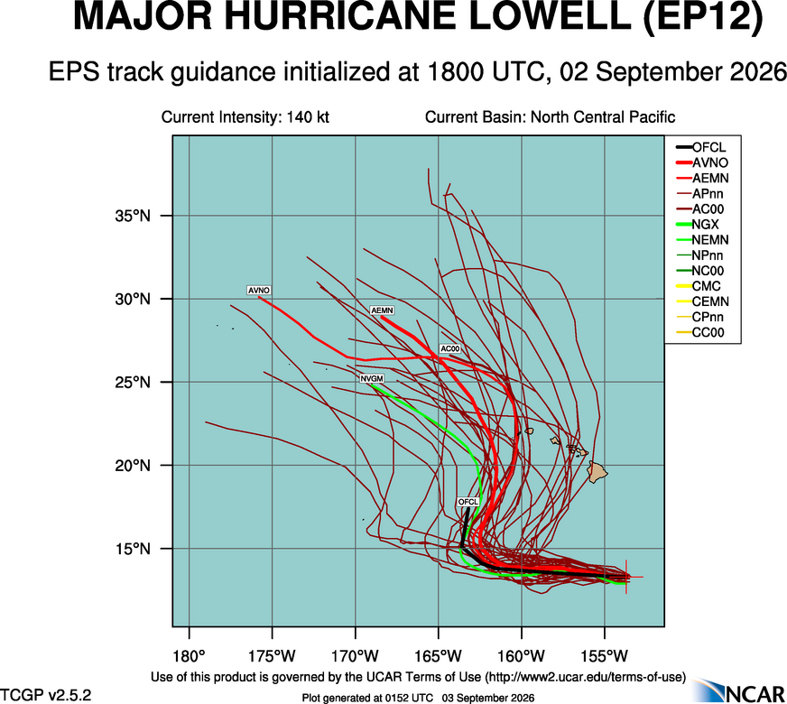
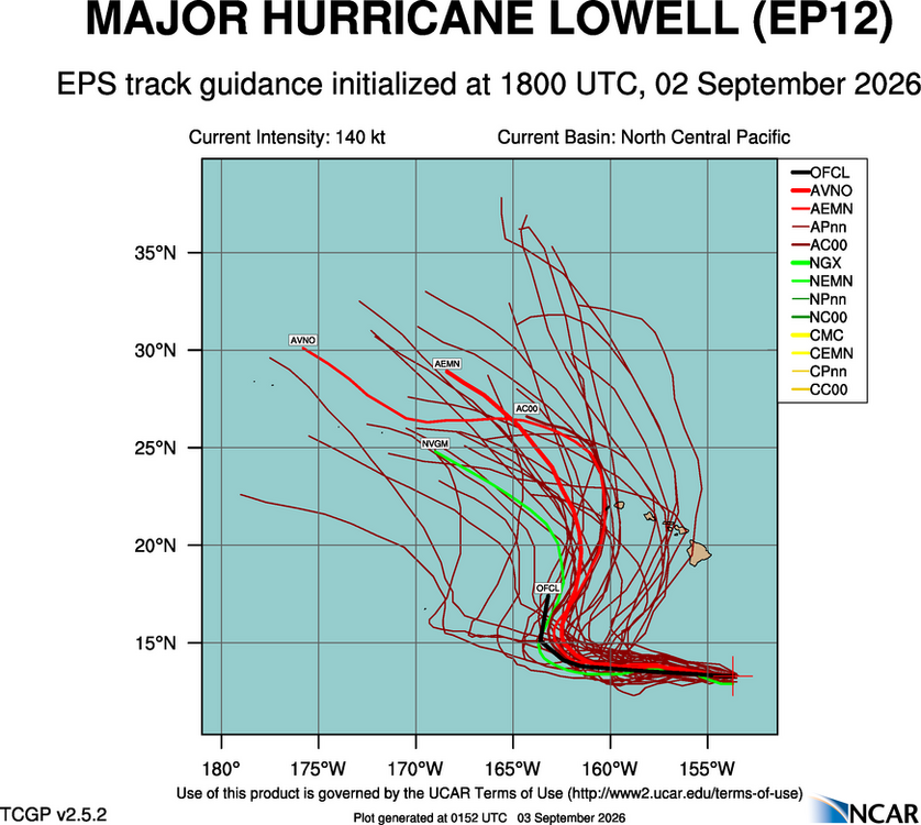
It's complex for Lowell's track. Karina moving into to area N of the islands will likely play a role here as to how strong it may be when it get closer to the trough to the NW, and how it influences the depth and position of the main upper-level trough itself! It is quite a strong 200 mb trough that develops NNW of the islands, but it only digs so far S, and at first it is positively titled and then goes negative, but at that time, it lifting is N rapidly, and then Lowell gets left behind well NW of the islands and starts moving W again. And the ensembles reflect this w/ a recurve path NNE and then it goes back NW. Where will the inflection point be!? Given the intensity of Lowell, 200 mb flow is good to use for general steering flow in this case. This is not like Iwa in 1982 or Iniki in 1992. Those were picked up by strong troughs to the W of islands much farther S, so their tracks were more straight-shooter, acceleration N going ET fairly quickly after passing the islands. Dot's track in 1959 is not the same setup either, and the 1871 estimated Cat 3 hit the eastern side of the Big Island coming in from the, so no real good analogs here when it comes to very close passes or direct hits on HI for hurricanes. Has social media latched on to this threat yet? You know how that goes! @weatherwiz has a great post recently on the Edouard thread about wishcasting, some trying everything and anything to make Edouard to RI. It did start that process. but it ran out of time, and the finer details looking at it evolution in real time that were fascinating in itself were overlooked (not here, elsewhere). Beyond the actual meteorology, I often think about the social and economic factors/impacts. The Lowell threat to HI that is starting to ramp up now about 6 days before any sig impacts, it going to hurt travel/vacation to the state. And say the western part of the state gets hit, the hype/doom will be so intense, ppl are going to think he entire island chain was devastated, and that has huge impacts well down the road for tourism and the like.
-
Augdewst 2026: Summer's Last Stand
vortex95 replied to Prismshine Productions's topic in New England
All the quoted statements above are useless from a TC analysis perspective. I've done Dvorak analysis and classification for TCs globally for 5 years at my current job, and the details often are everything! "Tstms blossoming around the center," one must ask, "is it smooth, persistent, and banded convection or just irregular blobs pulsing up and down?" This difference is huge as to signs of organization or short-term trends. Also, it makes a difference if the convection blossoms right over the center vs. it not. The former is much better for intensification potential. At about 1230z on 9/1 we finally saw this w/ Edouard after hours of blob convection away from the center and then it started to intensify markedly. "Angle of thunderstorms" No one in tropical met field ever says that. It reminds me of what Bill Paxton said in 'Twister' -- "look at the ANGLE of the updraft!" Artistic license for the movie! "Compact storm, just needs to spin more...good sign it's strengthening" Well, thanks Captain Obvious, we know it is a compact storm, and spinning more is good thing, but how about some actual empirical observations rather than drivel speculation!? -
Augdewst 2026: Summer's Last Stand
vortex95 replied to Prismshine Productions's topic in New England
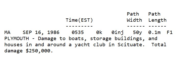
On 9/16/1986, while a spinner occurred at 635am in Scituate MA, it was snowing in NNE w/ 2" at Glen NH. I recall it well b/c during tstms in ern MA, it was so cold during them!