cptcatz
-
Posts
1,077 -
Joined
-
Last visited
Content Type
Profiles
Blogs
Forums
American Weather
Media Demo
Store
Gallery
Everything posted by cptcatz
-
2021 Atlantic Hurricane season
cptcatz replied to StormchaserChuck!'s topic in Tropical Headquarters
Euro is getting on board. You need to quit it with your quick judgements. -
2021 Atlantic Hurricane season
cptcatz replied to StormchaserChuck!'s topic in Tropical Headquarters
While the GFS curves the storm out, a bunch of the ensemble members keep it low into the islands. Definitely something to watch... -
2021 Atlantic Hurricane season
cptcatz replied to StormchaserChuck!'s topic in Tropical Headquarters
Interesting run by the icon... -
2021 Atlantic Hurricane season
cptcatz replied to StormchaserChuck!'s topic in Tropical Headquarters
Lol you must have not been following how accurate the models are for the past couple years. -
2021 Atlantic Hurricane season
cptcatz replied to StormchaserChuck!'s topic in Tropical Headquarters
The models can't seem to figure out where this thing is going to form. Going to be interesting to see where it does finally form and how the models alter their runs based on that. Seems we can't actually get anything from the models until that happens. -
2021 Atlantic Hurricane season
cptcatz replied to StormchaserChuck!'s topic in Tropical Headquarters
and the Florida peninsula shield holds! -
2021 Atlantic Hurricane season
cptcatz replied to StormchaserChuck!'s topic in Tropical Headquarters
If you don't want a generator, this is a great backup. It's great for any other uses when you need high power in remote areas, but it's also nice to have in a power outage. If you're sitting in your car charging your phone, you can pop the hood and attach this to your battery for an outlet with 1000 watts which should be able to power a small fridge/freezer. I use it quite often as I often need to power some power tools where I don't have an outlet and much easier than lugging around a portable generator. https://www.homedepot.com/p/DEWALT-1000-Watt-Portable-Car-Power-Inverter-with-Triple-USB-Ports-DXAEPI1000/301887060?MERCH=REC-_-searchViewed-_-NA-_-301887060-_-N -
2021 Atlantic Hurricane season
cptcatz replied to StormchaserChuck!'s topic in Tropical Headquarters
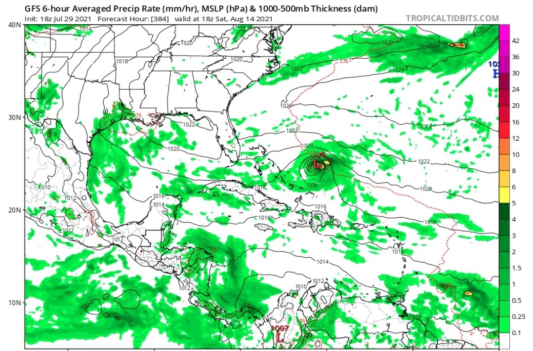
Looks like GFS and Euro are in good agreement that the wave that rolls off Africa this Thursday will try to develop. Of course euro has it staying at TD/TS through the MDR while GFS has it getting to 952 mb. Looks like the ensembles have the stronger storms curving further north with the weaker tracks heading towards the Caribbean. Should be a good one to watch. -
2021 Atlantic Hurricane season
cptcatz replied to StormchaserChuck!'s topic in Tropical Headquarters
Signal is getting better...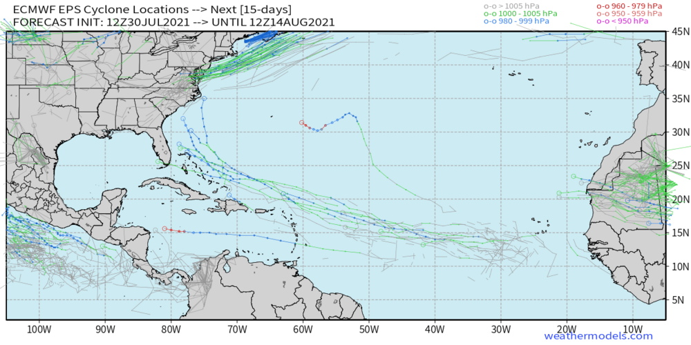
-
2021 Atlantic Hurricane season
cptcatz replied to StormchaserChuck!'s topic in Tropical Headquarters
18z GFS is the most bullish yet with a long tracking (albeit weak) MDR storm heading towards Florida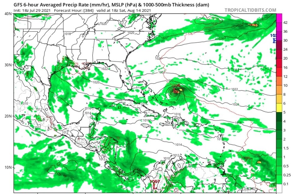
-
2021 Atlantic Hurricane season
cptcatz replied to StormchaserChuck!'s topic in Tropical Headquarters
GFS coming in with the exact same thinking as euro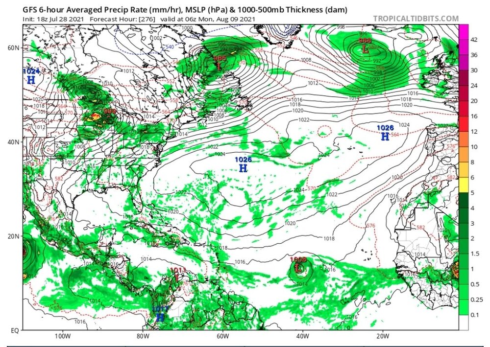
-
2021 Atlantic Hurricane season
cptcatz replied to StormchaserChuck!'s topic in Tropical Headquarters
First signs of a signal coming from euro...
-
2021 Atlantic Hurricane season
cptcatz replied to StormchaserChuck!'s topic in Tropical Headquarters
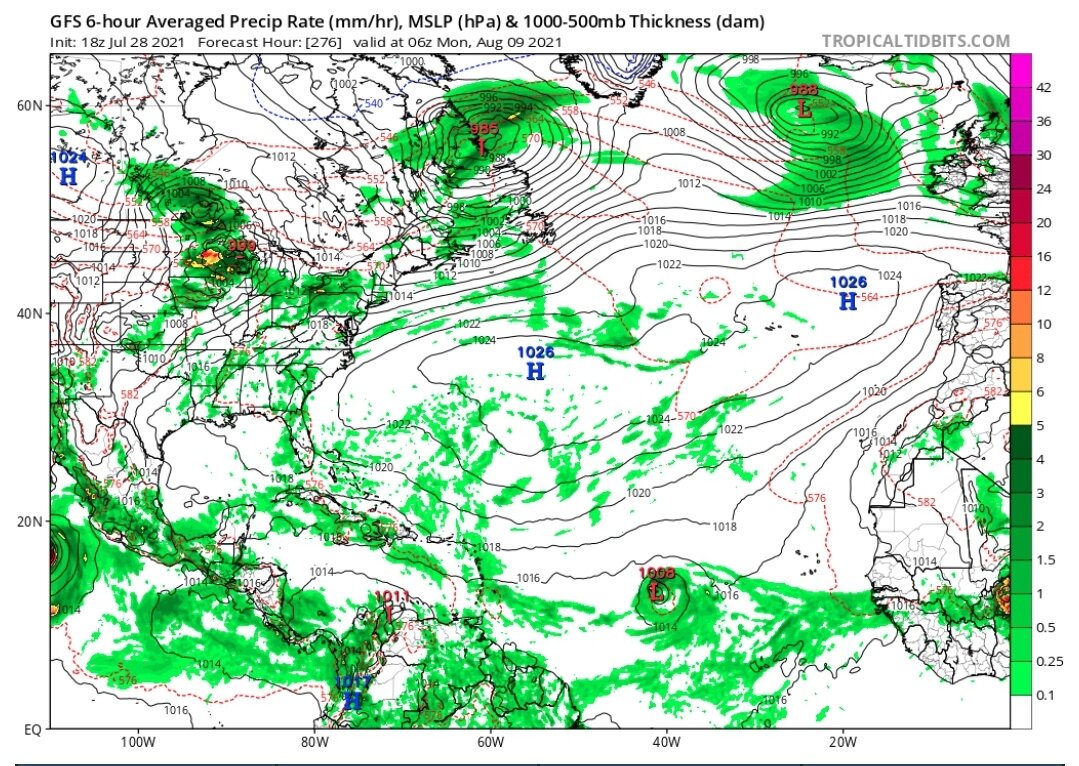
The long rage GEFS continues to show activity signals the second week of August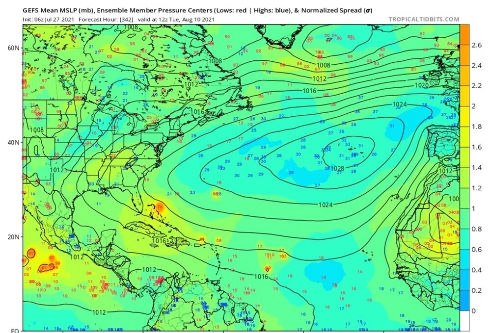
-
2021 Atlantic Hurricane season
cptcatz replied to StormchaserChuck!'s topic in Tropical Headquarters
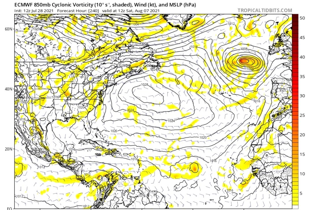
Some very faint signals on the GFS, GEFS, and Euro for something to form in the MDR around August 4-7. Not much but more than what we've seen in the past few weeks.
-
2021 Atlantic Hurricane season
cptcatz replied to StormchaserChuck!'s topic in Tropical Headquarters
90L has fizzled but there's an impressive burst of convection north of Hispaniola.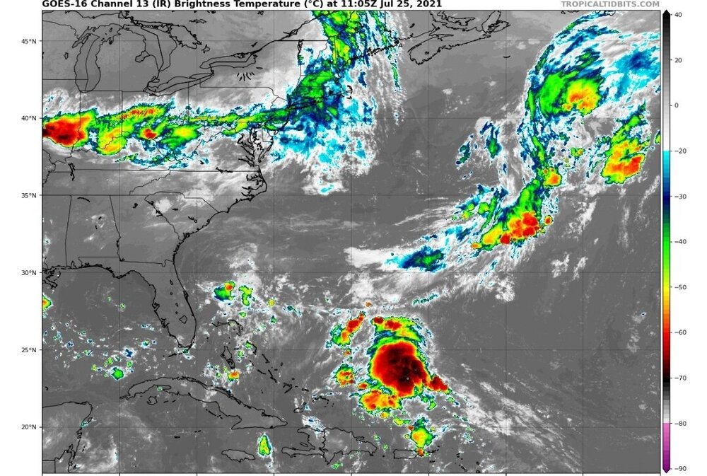
-
2021 Atlantic Hurricane season
cptcatz replied to StormchaserChuck!'s topic in Tropical Headquarters
Recon found a definite center with a small pressure drop right in the middle, but without convection overhead it's not gonna be named. -
A severe storm just rolled through Boca Raton. Got a severe thunderstorm warning with a mention of a tornado threat but no specific tornado warning/watch. Even so, I just recorded these videos over my house of cloud rotation.
-
2021 Atlantic Hurricane season
cptcatz replied to StormchaserChuck!'s topic in Tropical Headquarters
Looks like a pretty solid structure, better than TD's and TS's I've seen. Definitely a nowcasting situation since this is way ahead of any of the models. -
2021 Atlantic Hurricane season
cptcatz replied to StormchaserChuck!'s topic in Tropical Headquarters
90L has been designated and it's looking pretty juicy -
2021 Atlantic Hurricane season
cptcatz replied to StormchaserChuck!'s topic in Tropical Headquarters
Doesn't look like anything will come of this, and even if it does it will probably mean a rainy day for Bermuda. -
2021 Atlantic Hurricane season
cptcatz replied to StormchaserChuck!'s topic in Tropical Headquarters
Who cares about what they're x'ing? All it means is that they're keeping an eye on it and no one even knows except for the hardcore weather nerds who keep track of these things. -
2021 Atlantic Hurricane season
cptcatz replied to StormchaserChuck!'s topic in Tropical Headquarters
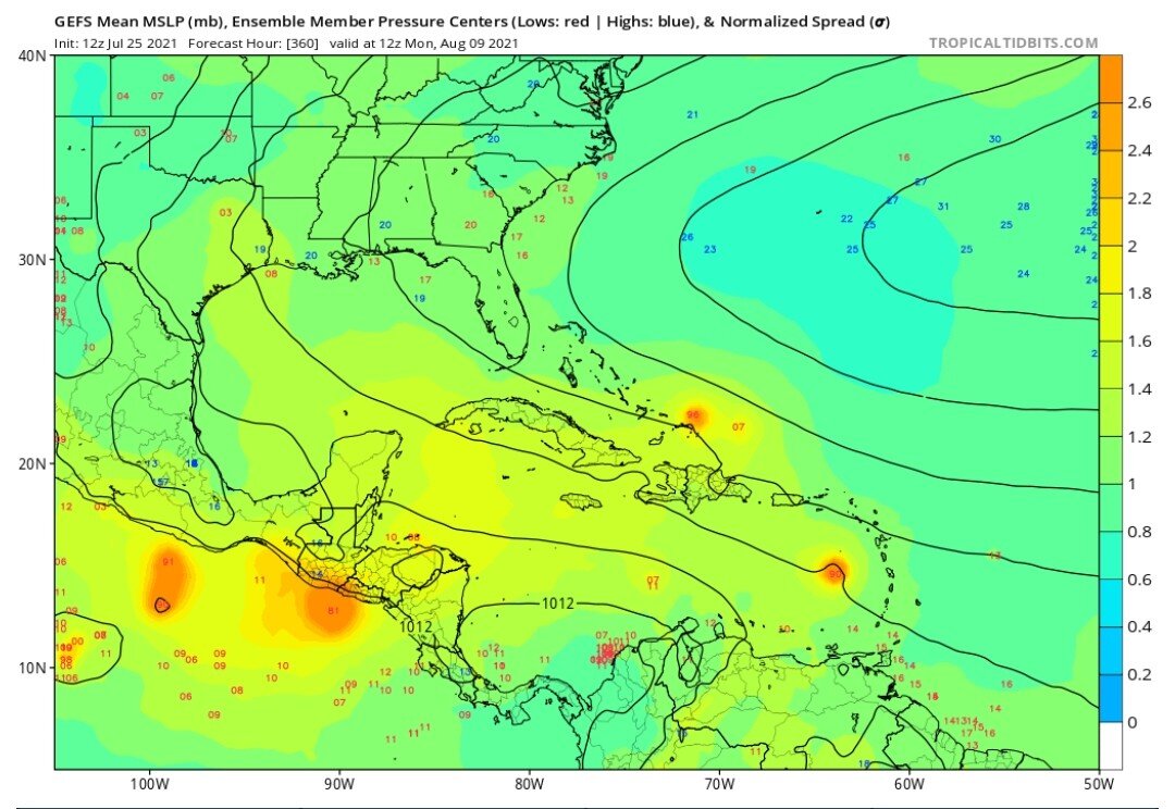
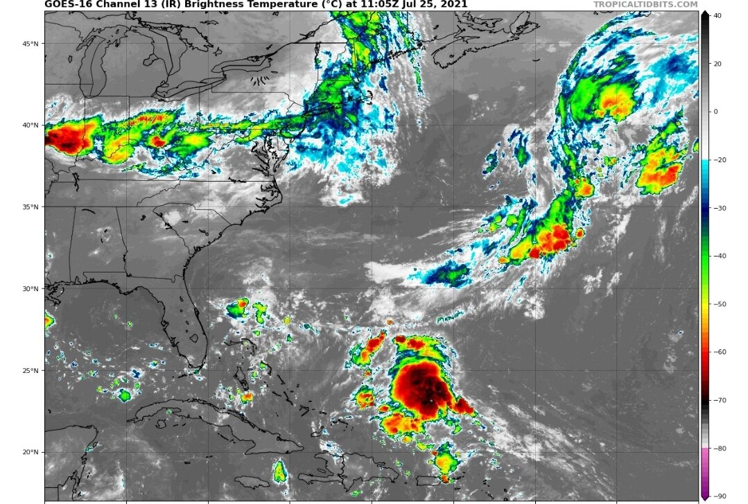
Can you explain the implications of this picture? -
Yep. I was supposed to move here to Boca Raton on the day Irma hit. Luckily I was able to delay the move a week so I missed the storm but saw the damage which was pretty significant but nothing compared to what the models were showing a couple days prior having it move up the east coast instead of the west coast. Since then, we got nothing in 2018, then had the strongest hurricane on record in the Atlantic basin barreling down at us coming to a screeching halt and turning right before hitting us. 2020, the most active season on record (which the local media made sure we knew), gave us a hurricane warning from Isaias which ended up causing a brisk breeze, and big scary Eta which gave us a good soaking of some moderately flooding rain. I'm well aware of the balls we're dodging being I love to track hurricanes, but there are so many new people in Florida that have moved down in the past year or two who went through the false alarms of Dorian and 2020 and are not prepared for a real hurricane strike. Of course the old timers, especially those who have been here since 2004, let alone 1992, know what to do, but it'll be interesting to see complacent the newcomers are when something finally hits us.
-
2021 Atlantic Hurricane season
cptcatz replied to StormchaserChuck!'s topic in Tropical Headquarters
We had the same thing happen in last year's thread, and then it started quick and didn't end... -
2021 Atlantic Hurricane season
cptcatz replied to StormchaserChuck!'s topic in Tropical Headquarters
Elsa was moving at 30 mph so those 75 mph observed winds would have been 50 mph if the storm was moving at 5 mph. Regardless, 75 mph sustained winds in a cyclone equals a hurricane.