cptcatz
-
Posts
1,078 -
Joined
-
Last visited
Content Type
Profiles
Blogs
Forums
American Weather
Media Demo
Store
Gallery
Everything posted by cptcatz
-
Oh man that's a bummer at this point. Also looks like the NOAA plane is finished after only two center fixes. That's strange as the storm isn't far at all from Lakeland so they should have plenty of fuel.
-
Seriously. Imagine the outrage if it came to light that "the authorities" faked numbers in order to encourage people to do something which the authorities believed was best for the people but the people may not have agreed.
-
I don't mean to downplay the potential surge from Ida, but at this point in the gulf Katrina was an enormous 902 mb cat 5 monster which was pushing much more water than Ida is now or probably will ever. We'll probably never see anything match Katrina's surge.
-
"Biggest storm since Katrina" is saying that Ida will not be as big as Katrina but will be bigger than every storm that has come between Katrina and now. Would you disagree that this will be the biggest storm since Katrina that New Orleans has faced?
-
2021 Atlantic Hurricane season
cptcatz replied to StormchaserChuck!'s topic in Tropical Headquarters
CMC's forecast for Labor Day...
-
Lol. I've always been interested in how ancient people experienced natural disasters for the first time. Imagine being a European colonist just settling in some tropical paradise in the Caribbean, and then you get hit by an eye of a major hurricane. Like that's gotta be a real "wtf is happening?!" moment.
-
I remember in the early 1500s when us colonists didn't even know what a hurricane was. Man that first one that hit us was sure a surprise!
-
Nice thing from here on out is the NOAA and AF planes will have a short trip to get to the storm. Nothing worse than a plane taking off and thinking ok it will be in the storm in 3 hours from now.
-
Since it's 2021 maybe we should just ask Ida what it/she/he/zhe/they identify as instead of us just assuming?
-
No sorry, the National Hurricane Center names hurricanes with definitive male or female name. Male named hurricanes are "he" and female named hurricanes are "she". Ida is a she.
-
First eye dropsonde launched at 9:44 measured 987 mb with 8 kts wind. Second eye dropsonde launched at 11:01 measured 986 mb with 11 kts wind. Seems like it's intensifying.
-
Having lived through it as well, it was the worst natural disaster in NYC history. Why would you expect it to not be talked about on a tropical weather forum?
-
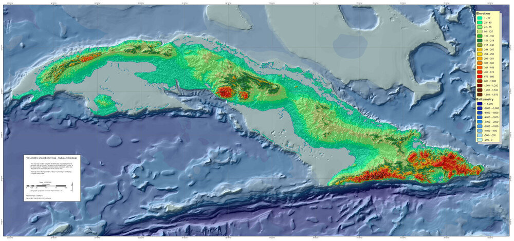
Looks like there's one slim strip of mountains it will go over. From what I can tell the highest peaks are under 2,000 feet with most of the range being less than 1,000 feet. Compare that to the 14,000 foot peaks of Hispaniola, this shouldn't do much.
-
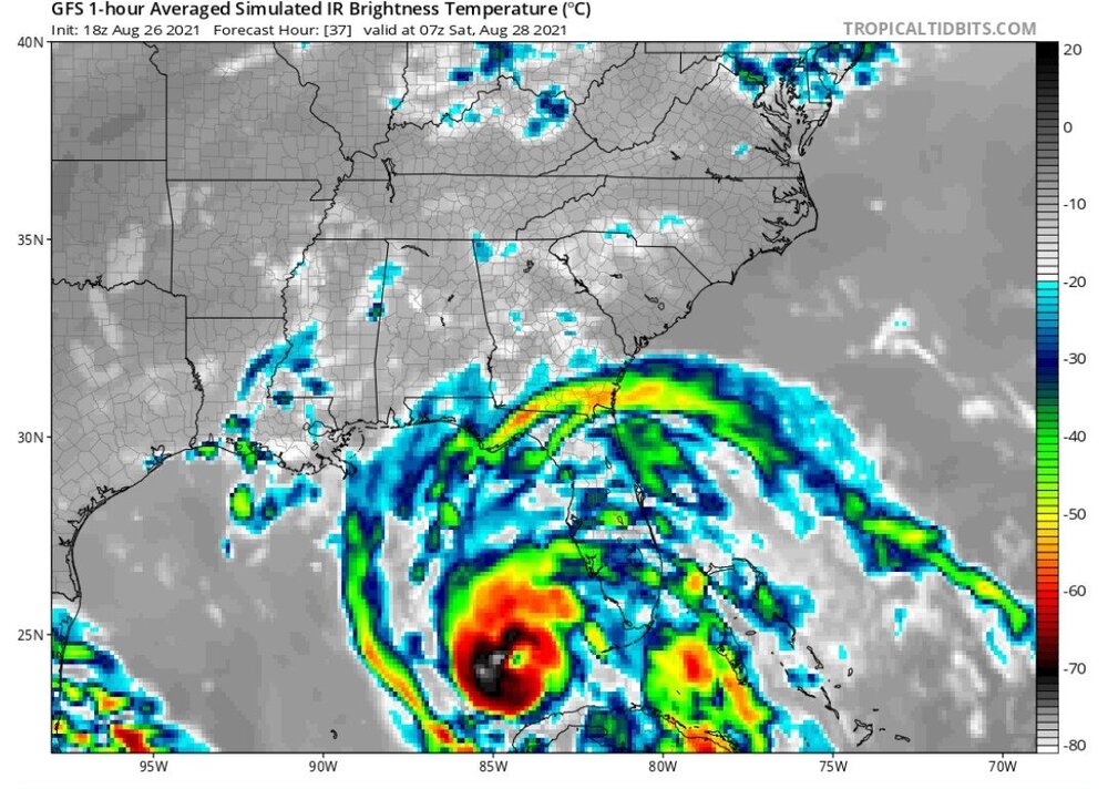
The reduced time frame will also limit storm surge.
-
With the center being so far north in the Caribbean and all the convection to the north and east of the center, it may very well brush you in Tampa Bay. GFS shows this, but I wouldn't be surprised to see it get even closer.
-
Any chance it does a Charley/Wilma turn and slam Florida?
-
Zeta's eye went right over New Orleans last year after making landfall with winds of 115 mph. Seemed like New Orleans was barely affected by Zeta though. Why were the effects minimal in Zeta but expected to be catastrophic with this?
-
The way I see it is you can hope and wish for the biggest destructive storm or you can hope and wish for sunshine all year, but at the end of the day your hoping and wishing has absolutely zero impact on what will actually happen. As long as you're not making light of someone else's actual misery, I say hope and wish for whatever you want.
-
2021 Atlantic Hurricane season
cptcatz replied to StormchaserChuck!'s topic in Tropical Headquarters
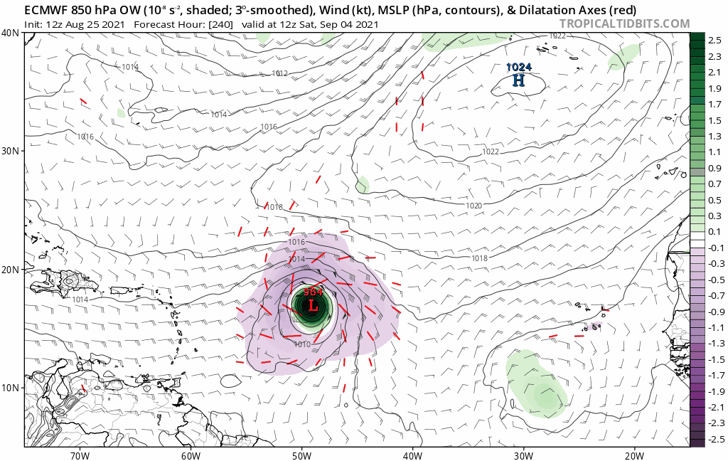
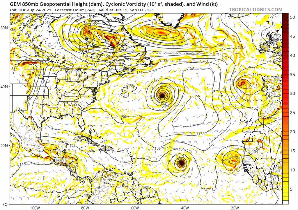
Euro going all in on this MDR storm. Would be a massive ACE maker regardless where it goes.
-
2021 Atlantic Hurricane season
cptcatz replied to StormchaserChuck!'s topic in Tropical Headquarters
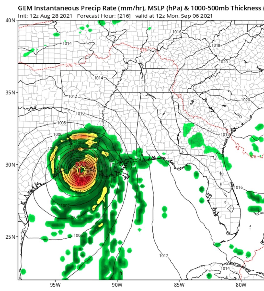
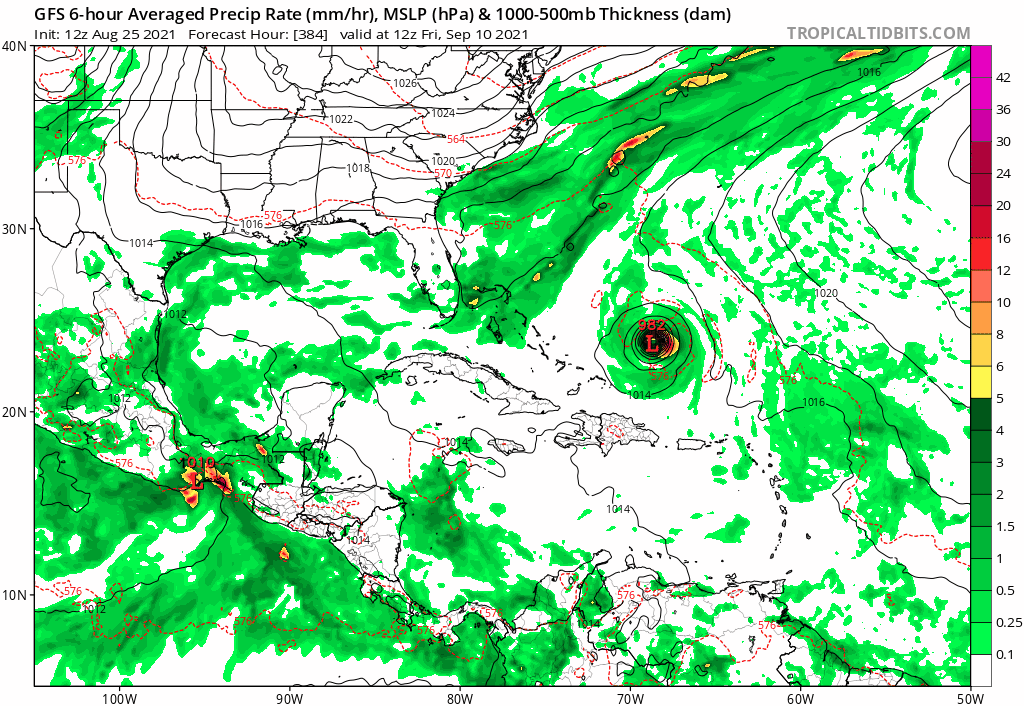
Wait, I thought you said earlier in this thread that the season was a bust and September was going to be nothing-ville? You also said Grace was gonna fall apart. Anyways, after 99L impacts the Gulf Coast, we will turn our attention to the MDR. GFS finally got on board along with CMC and Euro for a strong developing system. GFS has it approaching the Bahamas at the end of the run.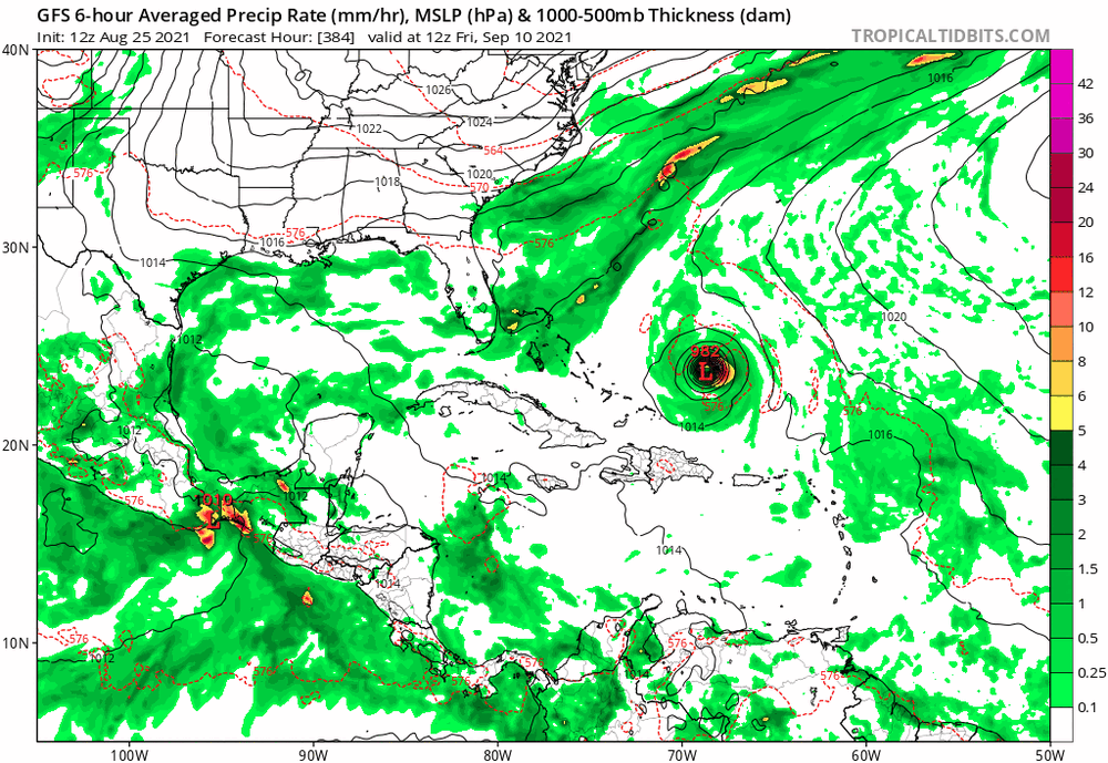
-
Not sure I've ever seen NHC talk about potential dangerous hurricane impacts from a wave during a TWO: 1. A broad area of low pressure is expected to form over the southwestern Caribbean Sea during the next day or so from a tropical wave currently located north of Colombia. Environmental conditions are forecast to be conducive for development, and a tropical depression or tropical storm is likely to form late this week or over the weekend. The system is expected to move northwestward over the northwestern Caribbean Sea and near or across the Yucatan Peninsula of Mexico on Friday and into the Gulf of Mexico this weekend where conditions are expected to be favorable for additional development. Regardless of development, heavy rainfall and flooding will be possible through the weekend in portions of Nicaragua, Honduras, Guatemala, Belize, and the Yucatan Peninsula. In addition, this system could bring dangerous impacts from storm surge, wind, and heavy rainfall to portions of the coasts of Louisiana, Texas, and the Mexican state of Tamaulipas late this weekend and early next week. However, uncertainty remains large since the system has yet to form. Interests in these areas should closely monitor the progress of this system and ensure they have their hurricane plan in place. An Air Force Reserve reconnaissance aircraft is scheduled to investigate the system Thursday afternoon, if necessary. * Formation chance through 48 hours...medium...50 percent. * Formation chance through 5 days...high...80 percent.
-
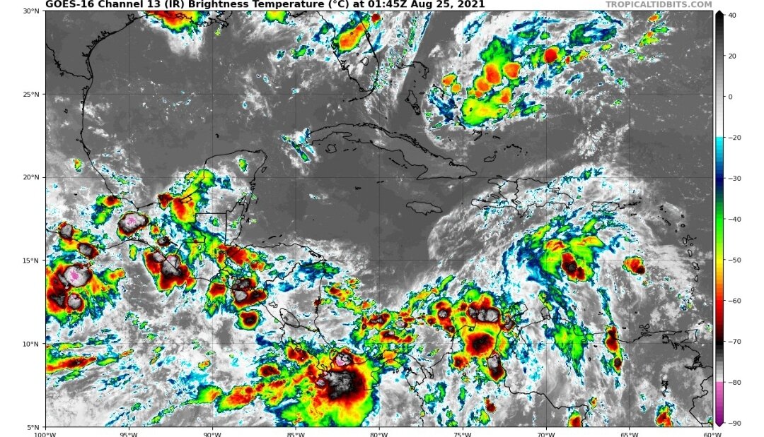
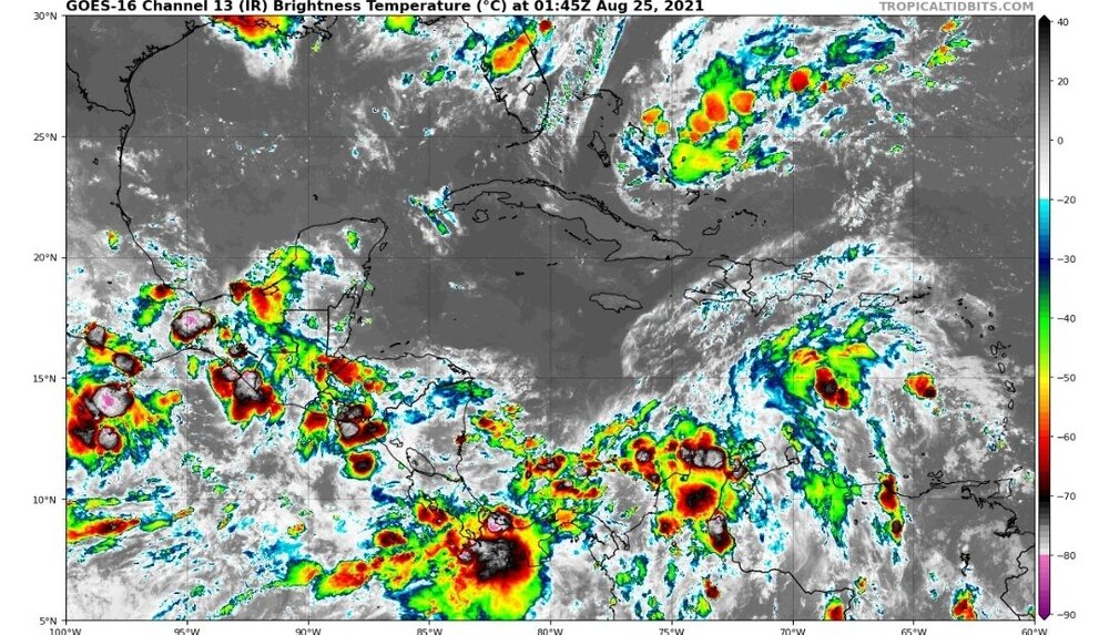
Ridiculous amount of convection over Central America. I suppose the invest is in there somewhere?
-
2021 Atlantic Hurricane season
cptcatz replied to StormchaserChuck!'s topic in Tropical Headquarters
Euro and CMC almost exactly the same with a nice sized MDR storm with a developing wave trailing right behind. Both models have been bullish on this for a number of runs, GFS still not sure.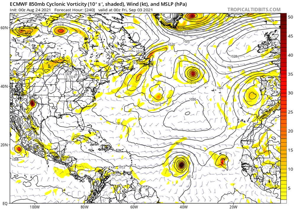

-
2021 Atlantic Hurricane season
cptcatz replied to StormchaserChuck!'s topic in Tropical Headquarters
Hard to tell but looks like that may be the wave that makes it into the Caribbean which the GFS has been trying to develop next week. After that, Euro, GFS, and CMC are all pointing to a long tracker MDR storm moving off Africa next week. -
I saw him at Sunbelt Rentals getting some industrial sized fans.