cptcatz
-
Posts
1,077 -
Joined
-
Last visited
Content Type
Profiles
Blogs
Forums
American Weather
Media Demo
Store
Gallery
Everything posted by cptcatz
-
2021 Atlantic Hurricane season
cptcatz replied to StormchaserChuck!'s topic in Tropical Headquarters
After Sam, it looks like there will be two areas to watch over the next couple weeks. Most models show the next wave (currently at 50% by NHC) curving OTS but a number of ensemble members have it continuing west maybe into the Caribbean/Antilles. Then the GFS/GEFS has been hinting at a CAG type system forming in the Caribbean, maybe something similar to a Wilma/Matthew/Michael track which climo would favor. Looks like we will likely hit the next list of names...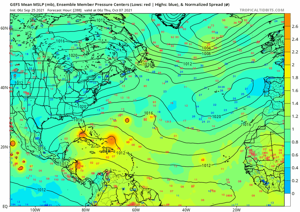
-
Anyone know when recon plans to fly in?
-
Looks like the only land at risk is Bermuda. I'd watch that next wave to see if it can sneak into the Caribbean.
-
Exactly. Like a landfall is definitely gonna happen as long as everything that every model plays out in the exact opposite way they are forecasting. I've only been tracking weather for a handful of years. Has there been another time recently when the models would be this wrong?
-
I don't think enough wishcasting will get this to the east coast. Only the weakest tracks get it close and seeing how it's already strengthening and with the NHC forecasting a major, seems to be a pretty sure thing it will curve out.
-
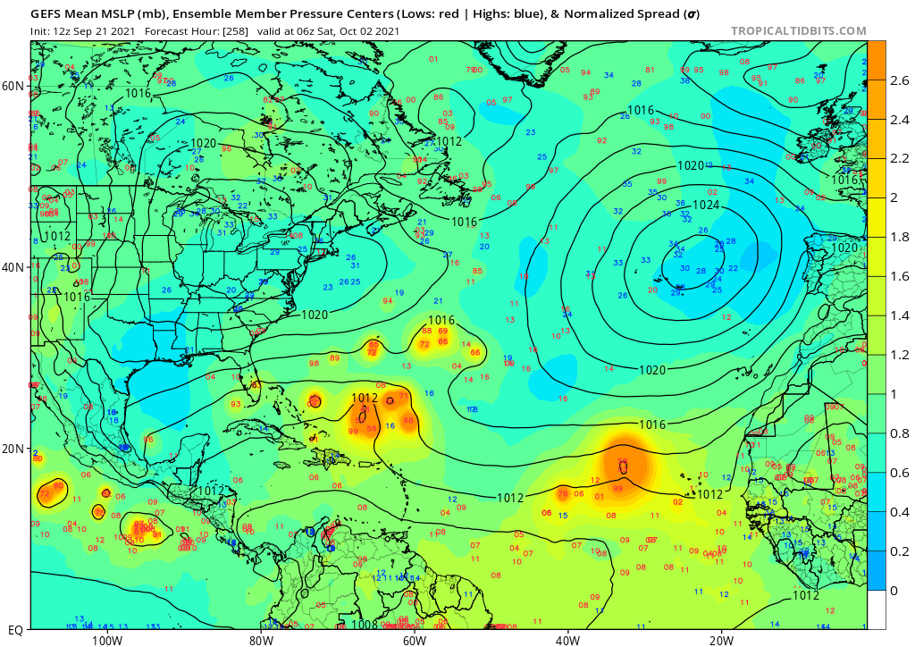
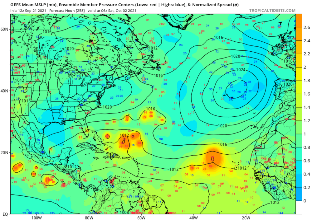
Majority of the 06z EPS members still keeping it quite low...
-
2021 Atlantic Hurricane season
cptcatz replied to StormchaserChuck!'s topic in Tropical Headquarters
The last three GFS runs all show this system that looks like it breaks off of Sam as it passes the Bahamas, which then moves west over Florida, intensifies in the gulf, then moves back east over Florida again. The 00z run drops it down to 978 mb. -
Looks like that's that for this one. Models showing yet another wave developing behind this one though...
-
18z GFS is trending significantly south and west...
-
Getting some Irma vibes here...
-
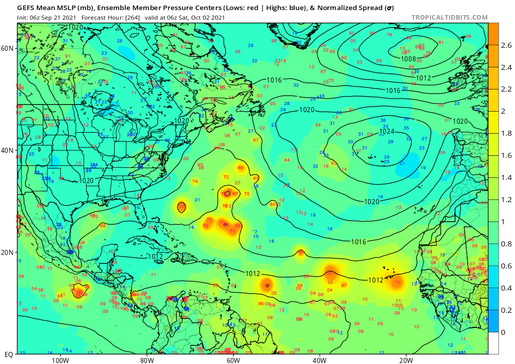
GEFS 06z compared to 12z...

-
The bulk of the 06z Euro ensembles are still keeping it southward on a track into the islands. Euro still seems to be the outlier on the southern track though. Euro also seems to not have been doing well with these MDR storms prior to development.
-
2021 Atlantic Hurricane season
cptcatz replied to StormchaserChuck!'s topic in Tropical Headquarters
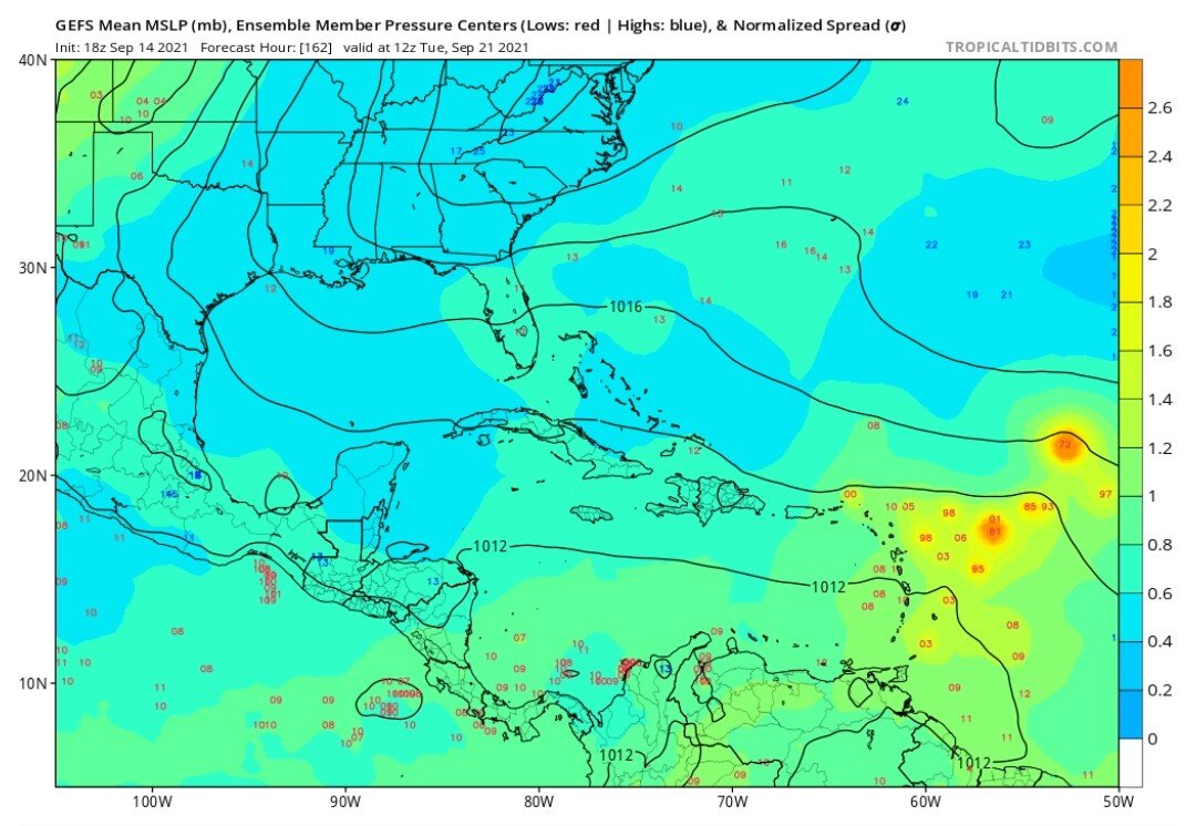
CMC is still showing 95L developing near the Bahamas. If it can somehow find low shear in that area then it's still on the table. Still over a week out so lots could change. -
2021 Atlantic Hurricane season
cptcatz replied to StormchaserChuck!'s topic in Tropical Headquarters
I think it's time to strip the central Atlantic of the MDR name and give it to the western Caribbean/southern Gulf. That's the new Main Development Region. -
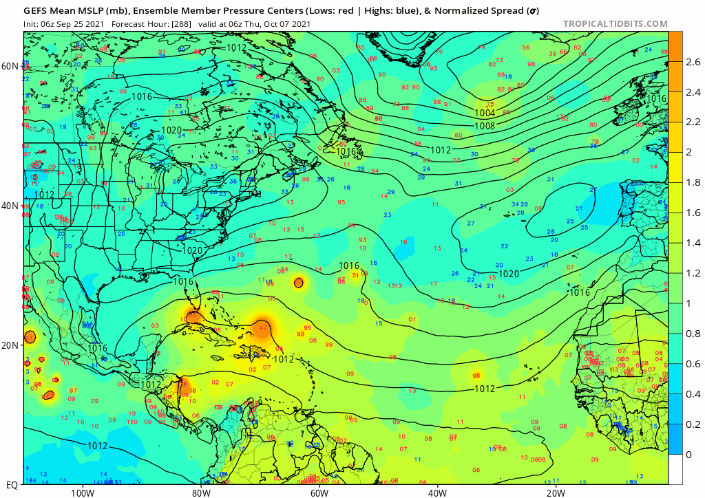
GEFS now showing a lot of members bringing into the Caribbean or just north of the islands. WAY too early to call this a fish storm.

-
I think the worst case scenario would be for it to stay weak through the Atlantic which means it treks due west and then gets to the Bahamas/Florida Straits area where it then rapidly intensifies. Something along the lines of Dorian, Andrew, or 1935 Labor Day...
-
2021 Atlantic Hurricane season
cptcatz replied to StormchaserChuck!'s topic in Tropical Headquarters
It'll be interesting to see how the back half compares to last season. Last season had FIVE major hurricanes form AFTER October 1, three of them making landfall as a major, and a fourth making landfall just shy of a major. That would be crazy active for an entire season, let alone just October and November. -
2021 Atlantic Hurricane season
cptcatz replied to StormchaserChuck!'s topic in Tropical Headquarters
Yeah I wouldn't give up on 95L. The models showing a weak storm now may be bad in the long term. Instead of intensifying in the eastern Atlantic and turning out to sea, the weak wave may now move towards the Caribbean or Bahamas. The Bahamas/Florida Straits area has a long history of blowing up storms very quickly... -
2021 Atlantic Hurricane season
cptcatz replied to StormchaserChuck!'s topic in Tropical Headquarters
Yeah go back and look at the 2017 thread. He said Harvey was a bust after it degenerated into an open wave and then said the rest of the season was going to be inactive... -
2021 Atlantic Hurricane season
cptcatz replied to StormchaserChuck!'s topic in Tropical Headquarters
Not to mention with the usually bearish NHC forecasting 65mph which means we could easily see a hurricane landfall as long as the center stays east. -
2021 Atlantic Hurricane season
cptcatz replied to StormchaserChuck!'s topic in Tropical Headquarters
No it's not. Not sure why you have that feeling. We had a long tracking Elsa in early July, a typical lull in later July, and then pretty much non stop activity since early August including three majors and two landfalling majors. How much more could you ask for by the season midpoint? -
2021 Atlantic Hurricane season
cptcatz replied to StormchaserChuck!'s topic in Tropical Headquarters
Looks like Euro wants to recurve this wave -
2021 Atlantic Hurricane season
cptcatz replied to StormchaserChuck!'s topic in Tropical Headquarters
- 967 replies
-
- 11
-

-

-
2021 Atlantic Hurricane season
cptcatz replied to StormchaserChuck!'s topic in Tropical Headquarters
Meh. Not the greatest signal for peak season... -
2021 Atlantic Hurricane season
cptcatz replied to StormchaserChuck!'s topic in Tropical Headquarters
No. Hence the Sandy impacts in the northeast were attributed to Sandy and the Ida impacts will be attributed to Ida.